

Enthusiast II
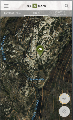
I searched for Onx Maps on the site, but didn't find any reference to it. One of the big challenges is planning off-road or back road trips in the open spaces. A lot of these areas are owned by ranchers and farmers that don't want you on their property. And you can't really blame them when someone cuts their fences, leaves gates open, or camps on their property leaving refuse and fire rings. One of the best mapping and planning tools I use is On-x Maps (http://www.onxmaps.com). This tool works on your computer, phone, and GPS. There are different layers that can be activated for private and public lands, forest service roads, and other layers oriented toward the hunting community that is their customer base.
I put a 7" Android based system in my 2011 Jeep JK Rubicon and installed this app. Using the on-board GPS, I was able to navigate back roads, trails, and cut my own trails in the mountains and deserts in Nevada. The App has both satellite views and topo maps. You can use the app on your phone, out of cell coverage, by downloading the maps you want to use.
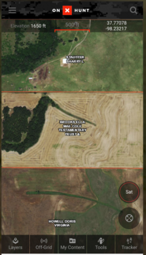
As a planning tool, it is invaluable. One of the big issues is with fenced and gated properties. You can identify ownership of private property, contact them, and get permission to cross their land. Or plan your route around denied properties without wasting your time on the trail.
I recommend everyone take a look at the app on their website.
I put a 7" Android based system in my 2011 Jeep JK Rubicon and installed this app. Using the on-board GPS, I was able to navigate back roads, trails, and cut my own trails in the mountains and deserts in Nevada. The App has both satellite views and topo maps. You can use the app on your phone, out of cell coverage, by downloading the maps you want to use.
As a planning tool, it is invaluable. One of the big issues is with fenced and gated properties. You can identify ownership of private property, contact them, and get permission to cross their land. Or plan your route around denied properties without wasting your time on the trail.
I recommend everyone take a look at the app on their website.
