
I drove a very small portion early yesterday morning from Lawrenceville to Lambertville. Definitely like using Gaia GPS on Android. Very accurate and worked well for me. Looking forward to doing more of this.
The OFFICIAL Trans NJ Trail Thread
- Thread starter Xplorr313
- Start date
You are using an out of date browser. It may not display this or other websites correctly.
You should upgrade or use an alternative browser.
You should upgrade or use an alternative browser.


I'm mostly a motorcyclist, but I do have a buddy with a Jeep Renegade. I stumbled across this thread while looking for places to off-road in NJ. Unfortunately, I don't have any iOS devices to run the app in, but this thread motivated me to construct a similar route on my favorite app called Calimoto. Importing the file was a bit of a battle, as Calimoto only knows about paved roads. A lot of the off-road stuff was lost in the process. Undeterred, I took it on as a project to add the off-road parts manually and I hope, like you, to some day share with my like-minded motorcycle enthusiasts. To that end, if anybody cares to share their favorite off-road portions with me, I would be very grateful. Preferably with a directions and/or a screen shot of the route.
BTW, the route runs right through my town in Hunterdon County. LOL.
BTW, the route runs right through my town in Hunterdon County. LOL.

Many thanks to @Xplorr313 for the hard work required to put together this amazing resource. I got a chance to do a small portion of it today in my stock 2020 Subaru Forester. Had fun at Reed Rd (Poor Man's Safari).
Is there a way to send a contribution?
Is there a way to send a contribution?

Enthusiast III
Do you have a smartphone of sorts that can download Gaia? If so it can be loaded into that or you could unzip the file and load it into Google maps as well.I'm mostly a motorcyclist, but I do have a buddy with a Jeep Renegade. I stumbled across this thread while looking for places to off-road in NJ. Unfortunately, I don't have any iOS devices to run the app in, but this thread motivated me to construct a similar route on my favorite app called Calimoto. Importing the file was a bit of a battle, as Calimoto only knows about paved roads. A lot of the off-road stuff was lost in the process. Undeterred, I took it on as a project to add the off-road parts manually and I hope, like you, to some day share with my like-minded motorcycle enthusiasts. To that end, if anybody cares to share their favorite off-road portions with me, I would be very grateful. Preferably with a directions and/or a screen shot of the route.
BTW, the route runs right through my town in Hunterdon County. LOL.
I really love Calimoto. It's made for just for motorcycling. However, as I just read today, when you import G
I really love Calimoto. It's made for just for motorcycling. However, as I just read today, when you import G
I really love Calimoto. It's made for just for motorcycling. However, as I just read today, when you import GPX file that has off-road waypoints, it either fails or moves the points to the nearest roadway. Looks like will need 2 apps after all. I will check out Gaia. Thanks.
Do you have a smartphone of sorts that can download Gaia? If so it can be loaded into that or you could unzip the file and load it into Google maps as well.
I really love Calimoto. It's made for just for motorcycling. However, as I just read today, when you import G
Do you have a smartphone of sorts that can download Gaia? If so it can be loaded into that or you could unzip the file and load it into Google maps as well.
I really love Calimoto. It's made for just for motorcycling. However, as I just read today, when you import GPX file that has off-road waypoints, it either fails or moves the points to the nearest roadway. Looks like will need 2 apps after all. I will check out Gaia. Thanks.
Hmm. I was able to import the GPX file into Gaia. However, the app itself is lacking 2 important features essential for navigating while riding a motorcycle. 1. Voice navigation and 2. Automatic map rotation. Looks like my hunt for a suitable off-road navigation app continues.
chipping away at the trail call sections at a time with the family. The kids, especially my daughter loves it. Previously we had done from Chester to Lambertville is three different outings. This past Saturday we did from Lambertville to Fort Dix. Most was kind of boring - as expected as it navigated around Princeton/Rt 1 and all of the congestion and highways. The later part brought some excitement for the kids with Collier Mills, the poor man's safari and some other fire roads. Though, the wife likes the backroads thru the historic homes more...lol. Love the work put into mapping out this trail which has a little bit of everything for everyone and really shows off the great state of NJ! Looking forward to chipping away at the rest of the trail. Even have some friends and family looking to go out with us on our adventures
Hmm. I was able to import the GPX file into Gaia. However, the app itself is lacking 2 important features essential for navigating while riding a motorcycle. 1. Voice navigation and 2. Automatic map rotation. Looks like my hunt for a suitable off-road navigation app continues.
I found it! The perfect Android app for both on and off road. It has map rotation and voice navigation and it imported the TNJT GPX file without a hitch!
And the winner is..... Locus Map Locus Map - mobile outdoor navigation app Check it out

You picked a good app! Thanks for the recommendation. I can import the tnjt map but it seems like you have to re load it after you exit the app. Any suggestions?
You picked a good app! Thanks for the recommendation. I can import the tnjt map but it seems like you have to re load it after you exit the app. Any suggestions?
I don't have that issue. Post a question or their help desk board. help.locusmap.eu

How feasible would this be on a Honda Trail 125? My concern would be on road speed limits, I would have to keep it to 50 mph or less. The southern sandy portions I know will be a pain but how about from Jackson to High Point?
I haven’t done it all but from jackson up to route 80 is all back roads. If you are on a main road, it is very quick and under 50, you will be fine.
I’m having trouble getting the file to read on LeadNav. I’m a complete noob and just bought the app and can’t figure it out. I’m able to download it but got an error trying to open it in the app.
I’m having trouble getting the file to read on LeadNav. I’m a complete noob and just bought the app and can’t figure it out. I’m able to download it but got an error trying to open it in the app.
False alarm everyone. I finally figured it out and I’m so thankful for this tool and excited to get out there.
Hey everyone, I’m new to overlanding but not to 4x4ing and camping. With that being said, I plan on tackling the TNJT with a buddy in his truck (also new) and my kids with me in mine starting on April 30. We will be leaving from the Williamstown area in south Jersey heading to High Point, camping out overnight then hitting the route. Anyone have any pointers on reserving camp site as far as where to make the next nights reservation, like how far through the route you make it per day, if that makes sense lol Thanks in advance for any tips/suggestions, and if anyone wants to tag along let me know!
Attachments

Pioneer II
- 6,020
- First Name
- Dustin
- Last Name
- Helms
- Member #
24720
- Ham/GMRS Callsign
- KD2UNH
- Service Branch
- USAF
Hey everyone, I’m new to overlanding but not to 4x4ing and camping. With that being said, I plan on tackling the TNJT with a buddy in his truck (also new) and my kids with me in mine starting on April 30. We will be leaving from the Williamstown area in south Jersey heading to High Point, camping out overnight then hitting the route. Anyone have any pointers on reserving camp site as far as where to make the next nights reservation, like how far through the route you make it per day, if that makes sense lol Thanks in advance for any tips/suggestions, and if anyone wants to tag along let me know!
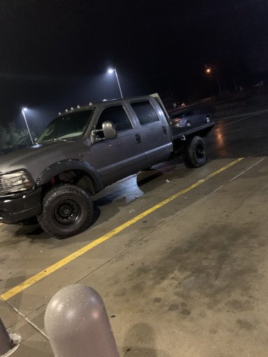
That’s a cool truck!
@Xplorr313 , OK4WD, and others have made YouTube videos of them doing the entire route. I recommend checking those out, but it seems like the fastest reasonable time to do the entire thing is 3 days. Looks like I would get a camp site in Wharton and around High Point.
Hey everyone, I’m new to overlanding but not to 4x4ing and camping. With that being said, I plan on tackling the TNJT with a buddy in his truck (also new) and my kids with me in mine starting on April 30. We will be leaving from the Williamstown area in south Jersey heading to High Point, camping out overnight then hitting the route. Anyone have any pointers on reserving camp site as far as where to make the next nights reservation, like how far through the route you make it per day, if that makes sense lol Thanks in advance for any tips/suggestions, and if anyone wants to tag along let me know!
That’s a cool truck!
@Xplorr313 , OK4WD, and others have made YouTube videos of them doing the entire route. I recommend checking those out, but it seems like the fastest reasonable time to do the entire thing is 3 days. Looks like I would get a camp site in Wharton and around High Point.
I’ve watched them and I was thinking around those areas too. Just wanted to see if there was any other opinions thank you
Pioneer II
- 6,020
- First Name
- Dustin
- Last Name
- Helms
- Member #
24720
- Ham/GMRS Callsign
- KD2UNH
- Service Branch
- USAF
Hey everyone, I’m new to overlanding but not to 4x4ing and camping. With that being said, I plan on tackling the TNJT with a buddy in his truck (also new) and my kids with me in mine starting on April 30. We will be leaving from the Williamstown area in south Jersey heading to High Point, camping out overnight then hitting the route. Anyone have any pointers on reserving camp site as far as where to make the next nights reservation, like how far through the route you make it per day, if that makes sense lol Thanks in advance for any tips/suggestions, and if anyone wants to tag along let me know!
That’s a cool truck!
@Xplorr313 , OK4WD, and others have made YouTube videos of them doing the entire route. I recommend checking those out, but it seems like the fastest reasonable time to do the entire thing is 3 days. Looks like I would get a camp site in Wharton and around High Point.
I’ve watched them and I was thinking around those areas too. Just wanted to see if there was any other opinions thank you
I stayed at camp Taylor last summer, it was pretty coo if you check out the wolves and stuff. Bears are real there btw, but it’s an alternative camp spot. I also made he mistake of camping at wading pines in Wharton (next to Godfrey bridge), I DEFINITELY don’t recommend that spot. In Wharton Bodine, Hawkins and Godfrey seem like cool camp spots. I would just call ahead and have your sites booked and squared away before you roll out on your trip

Member III
I believe the boondock camping areas of NJ's State Forests are STILL closed due to Covid. (Bodine, Hawkins, Godfrey). Camp Taylor is a cool spot. Turtle Run in the Pine Barrens is a commercial campground & a much quieter alternative to Wading Pines.
Pioneer II
- 6,020
- First Name
- Dustin
- Last Name
- Helms
- Member #
24720
- Ham/GMRS Callsign
- KD2UNH
- Service Branch
- USAF
I believe the boondock camping areas of NJ's State Forests are STILL closed due to Covid. (Bodine, Hawkins, Godfrey). Camp Taylor is a cool spot. Turtle Run in the Pine Barrens is a commercial campground & a much quieter alternative to Wading Pines.
Wow, still!? ...
I might end up checking out turtle run later this year then
