How do you find places to camp?

  • HTML tutorial

BogdanYZ

Rank I
Launch Member

Traveler I

233
San Francisco
Member #

10291

Hey everyone,
I'm pretty new to the community, but just bought my 98 4Runner and I want to take it out for some dispersed camping. I've been trying to figure out how to find places to camp near Point Reyes, CA but can't find any information on places to camp without a permit that aren't at a campground.

How do you go about finding a place to camp without just driving around looking for fire roads?

Does anyone have a recommendation on good places to camp near Point Reyes without a permit?

Thanks for your help!
Bogdan
 

Ripley1046

Rank VI
Launch Member

Influencer II

3,671
Manitowoc, WI
First Name
Cory
Last Name
Ripley
Member #

10046

Ham/GMRS Callsign
KD9VKY
I'm also curious about this in other regions. My family has been camping in state parks and forests in Wisconsin for a few years, but we want to get a little more backwoods and spontaneous.

Welcome Bogdan! I'm still pretty new here, and to overlanding, but there seems to be a lot of people here in CA, so I'm sure someone will have some great spots for you.
 

Sidetrekked Overland

Rank V
Launch Member

Traveler III

1,922
Possum Kingdom Lake, Texas
First Name
David and Dayna
Last Name
Coston
Member #

6520

Ham/GMRS Callsign
KI5NXU GMRS:WROE726
Service Branch
USMC
Ioverlander.com i plan on using this on my two week trip to colorado and nm in march. It looks very helpful.
 

VCeXpedition

Rank V
Launch Member

Off-Road Ranger I

2,932
Torrance, L.A., Cal., Earth
First Name
Dan
Last Name
Rich
Member #

0582

Ham/GMRS Callsign
K6DHR
@BogdanYZ welcome. That's kind of the fun part for me, but I live down south where there's more open desert for that kind of thing.

I've become very familiar with Google Earth and Google maps to find places, roads that exist with open spaces, look for places that have room, then go explore.
You have to allow some room for error or a plan-B, but I've been nearly 100% successful in finding places to lay up for a night or two.
Some have been awesome, some just a wide spot in the road, but so far so good.

Set your expectations accordingly, you won't always find that spectacular view to wake up to, but getting out and finding, exploring, making notes for future trips to return, that's all the fun part for me.
I've got notes and my mapping program full of waypoints and marks where there's a camping spot that has potential.

I also love paper maps for that sort of thing, I have too many. It's sort of a bad habit with me that I have to buy the map wherever I am. It's a sub-hobby!

Main point is to get out there and take a calculated risk to see what you can see. Enjoy!

Dan.
 

1Louder

Rank VI
Launch Member

Member II

4,187
AZ
First Name
Chris
Last Name
K
Member #

1437

Ham/GMRS Callsign
K1LDR
Ultimate CG is a good app. Shows dispersed camping and campgrounds all across the US.
 
  • Like
Reactions: CanyonMULE

Ripley1046

Rank VI
Launch Member

Influencer II

3,671
Manitowoc, WI
First Name
Cory
Last Name
Ripley
Member #

10046

Ham/GMRS Callsign
KD9VKY
@1Louder (love the name by the way) I just searched for that, I'm assuming it's the Ultimate US Public Campgrounds that's $4? Has UC, an RV and a flag in the app icon? Wouldn't be the first time I bought the wrong app...
 

CanyonMULE

Rank II
Launch Member

Enthusiast I

404
Loveland, Colorado
First Name
Jon
Last Name
Rudolph
Member #

10601

I've been following this thread intently. Planning a trip to Yosemite NP with one of my sons. Of course NP camp sites are already reserved (even pre-season) or closed for the season.

http://www.ultimatecampgrounds.com looks like a great app with a lot of options for us already.

http://ioverlander.com/ looks like a good app too, especially for boondocking sites.

Best part of the situation is now it will be more of an overlanding adventure as we will wing it without a guaranteed camp site and more likely not be in a campsite with people on top of people.

Thank you @1Louder and @TOTA for a solution and @BogdanYZ for initiating the question.

#SummitLifeNow
 
Last edited:

1Louder

Rank VI
Launch Member

Member II

4,187
AZ
First Name
Chris
Last Name
K
Member #

1437

Ham/GMRS Callsign
K1LDR
  • Like
Reactions: Ripley1046

BogdanYZ

Rank I
Launch Member

Traveler I

233
San Francisco
Member #

10291

Thanks for all your replies! I like the idea of using google earth and just exploring. Since I live in California though where the pretty parts are a lot more crowded and I'm sure there are more restrictions its helpful to know there are some apps out there too. I also saw Michael's latest video on youtube where he said they're working on integrating more events and camp spots into the forum map.

Do you guys have a preference between iOverlander, Gaia, and Ultimate Campgrounds? Which one is most dependable and complete?
 

1Louder

Rank VI
Launch Member

Member II

4,187
AZ
First Name
Chris
Last Name
K
Member #

1437

Ham/GMRS Callsign
K1LDR
Do you guys have a preference between iOverlander, Gaia, and Ultimate Campgrounds? Which one is most dependable and complete?
They are all very different tools. Gaia is not really meant to be a search tool for POI's. They are improving this part of the app but that is not its core strength.

iOverlander I don't have enough experience with although I think the site is better than the app.

Ultimate Campgrounds is really good at what it does. Find free or cheap camping (NOT including KOA's etc) If you have a make they have an app called Road Trip Planner that I think works fairly well.
 
  • Like
Reactions: Kevin108

MOAK

Rank V
Launch Member

Off-Road Ranger I

2,865
Wernersville Public Library, North Reber Street, Wernersville, PA, USA
First Name
Donald
Last Name
Diehl
Member #

0745

Ham/GMRS Callsign
WRPN 506
OK, this is an interesting topic as everyone has their own successful or unsuccessful methods of finding just the right place... We have had great luck with the series of topo maps available from National Geographic and is always $10 well spent.
https://shop.nationalgeographic.com/category/maps/trail-maps
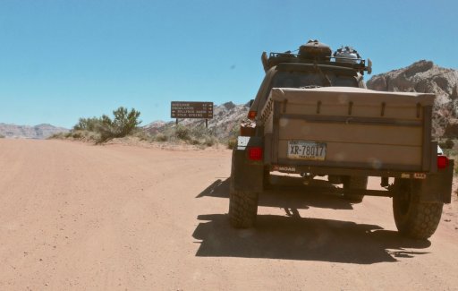
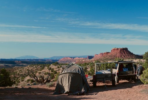
After all, why go at all if every detail is pre-planned? It doesn't get much better than stumbling unto that perfect campsite with no more than a good map and a bit of seat-of-the-pants dead reckoning getting you there. I love the old saying, " we came to a fork in the road and took it" (Yogi Berra) That day, this was our fork in the road, we took it and ended up here. I understand time constraints but full on wandering is good for the soul. DSC00348.jpg DSC00380.jpg
 

Ripley1046

Rank VI
Launch Member

Influencer II

3,671
Manitowoc, WI
First Name
Cory
Last Name
Ripley
Member #

10046

Ham/GMRS Callsign
KD9VKY
Bought Ultimate Campgrounds, and already used it to book a site for our trip in June.

As much as I'd love to just hit the road and find a site, in Wisconsin that's not an easy feat. I'd like to get out west and be able to just roam where the wind takes us, but for now I'll take what I can get. As far as I know there isn't much here for stop and camp spots that aren't just wide spots in fire lanes.

Thanks again to @1Louder for the recommendation.
 
  • Like
Reactions: Gregory Youngblood

JersT4R

Rank V
Member
Investor

Traveler III

2,352
Norfolk, VA
First Name
Jeremy
Last Name
Bailey
Member #

8880

I haven't bought Ultimate GC yet, figured I'd use Google Earth and iOverlander to find a site for my upcoming trip. Thanks for sharing the information!
 

Kent R

Executive Director
Staff member
Mod Team
Moderator
Member

Pathfinder III

5,200
El Dorado, Ca
First Name
Kent
Last Name
Reynolds
Member #

1632

Ham/GMRS Callsign
K6KNT
Service Branch
Retired Firefighter
Google earth and Gaia Pro work for me. Google to check out the satellite view and Gaia for land ownership, public / private. I dont think there is a perfect solution I try to adapt to each situation and hope for the best.
 
  • Like
Reactions: AZ WANDERING BEAR

BogdanYZ

Rank I
Launch Member

Traveler I

233
San Francisco
Member #

10291

A lot of dispersed camping in California. Google , ask here, social media. I live in the bay area and try to do 10 trips a year.

Sent from my SM-G930T using OB Talk mobile app
I'm also from the bay area which presents a problem since it's so crowded everywhere. How do you go about finding fire roads? Is there a filter on google maps I'm missing? I've been browsing google maps like crazy and I can't tell what's a fire road and what's just a wide hiking path.