+1 for the Trails Illustrated maps. They have an incredible amount of detail! As best I can tell, if you go to https://gaiagps.com and create an account, you can look at the map for free, with Trails Illustrated being one of the layers you can select. It's also available in the app.We have had great luck with the series of topo maps available from National Geographic and is always $10 well spent. https://shop.nationalgeographic.com/category/maps/trail-maps
How do you find places to camp?
- Thread starter BogdanYZ
- Start date
You are using an out of date browser. It may not display this or other websites correctly.
You should upgrade or use an alternative browser.
You should upgrade or use an alternative browser.

Off-Road Ranger I
- 2,865
- First Name
- Donald
- Last Name
- Diehl
- Member #
0745
- Ham/GMRS Callsign
- WRPN 506
Good info for the techno geeks out there. Once off the grid however, I trust my good old fashioned paper maps and a compass.+1 for the Trails Illustrated maps. They have an incredible amount of detail! As best I can tell, if you go to https://gaiagps.com and create an account, you can look at the map for free, with Trails Illustrated being one of the layers you can select. It's also available in the app.


Enthusiast III
In CNY (Central New York) finding places is challenging. Don't get me wrong, finding places where everybody else goes is easy. Finding places off the beaten path is hard. So I spend the winter on Google maps (satellite view) researching various state lands, their roads, and then cross-referencing those areas against state websites with usage rules/restrictions. Some of those turn into winter/off-season adventure drives where I and some OB friends scout the areas out. Some of those turn into winners. Some not. Winter is especially complicated here because many public forest access roads become snowmobile-only during the winter.

Member I
I like to Google disperse camping in what ever state I want to go. https://freecampsites.net/#!Arkansas&query=region
I searched Arkansas my home state. Next week the wife & I are headed to Morgan Deer Camp in the Redding Rec. Area, Arkansas.
I searched Arkansas my home state. Next week the wife & I are headed to Morgan Deer Camp in the Redding Rec. Area, Arkansas.

Advocate III
Good info for the techno geeks out there. Once off the grid however, I trust my good old fashioned paper maps and a compass.
I love my tech and mobile gear, but we ought to get a few of us that have been doing this since wayyy before tech and mobile devices to lead orienteering workshops for those interested in learning more about paper maps and compass.
If you have the app and a subscription, the maps are downloadable to your device. Still, I always travel with a printed material as well. Our local Bass Pro has a rack of the Trails Illustrated maps for about $12 per area. I also have an Delorme VA Road Atlas that I've had for 10 years or better.Good info for the techno geeks out there. Once off the grid however, I trust my good old fashioned paper maps and a compass.

Pathfinder I
I use the Backroadmapbooks for here in Canada. I also search for camping on crown lands on the internet. I also talk to people in parking lots that have a rig that looks like they might have some good ideas.
Usually with paper maps and landmarks to get around.
Usually with paper maps and landmarks to get around.
Advocate III
I use the Backroadmapbooks for here in Canada. I also search for camping on crown lands on the internet. I also talk to people in parking lots that have a rig that looks like they might have some good ideas.
Usually with paper maps and landmarks to get around.
I got three of the Backroad Mapbooks couple weeks ago; New Brunswick, Nova Scotia/PEI, and Newfoundland/Labrador and have to say these are terrific mapbooks. Two of them say on the cover "Includes Crown Land" and the other doesn't, for some reason, though I haven't yet checked to see if it actually does. These are very nicely done mapbooks, with a lot of accompanying info on various adventure spots. I'm sure I'll get more for the rest of Canada as I wander other provinces.
TIP: I found out after I ordered and paid mine that they are less expensive through Amazon--Backroad Mapbooks for Canada--especially if you're a Prime member, as shipping is less expensive. I paid $30 ($23.78 USD) for shipping to the states, and that was the least expensive option they had. Still a deal really, to purchase from them, as the US dollar is strong against the Canadian dollar right now, so the price ends up quite a bit less than is listed on their site even when you include approx $8USD shipping per book.

I like to watch youtube videos of other peoples trip in the area we are going, be surprised what info you can pick up that way
Enthusiast III
I like to watch youtube videos of other peoples trip in the area we are going, be surprised what info you can pick up that way
Very true. I do a lot of this during the winter. There happened to be a guy on youtube that filmed all of these tiny state forests in my region, with descriptions, and routes, and warnings. With an emphasis on free camping areas. I made sure to send a big thanks to him, his work introduced me to at least 3-4 new areas I wasn't aware of.
Off-Road Ranger I
- 1,009
- First Name
- David
- Last Name
- Partridge
- Member #
13381
- Ham/GMRS Callsign
- KN6GRX
+1 on those who use https://freecampsites.net/ to find free or inexpensive campsites in any area.
I use Gaia GPS: Navigate, Track, and Explore to find my routes for dirt tracks.
And search YouTube videos for ideas at a specific location.
I use Gaia GPS: Navigate, Track, and Explore to find my routes for dirt tracks.
And search YouTube videos for ideas at a specific location.
Why not just get the permit ??Does anyone have a recommendation on good places to camp near Point Reyes without a permit?
Advocate III
- 5,584
- First Name
- Michael
- Last Name
- Rose
- Member #
20990
- Ham/GMRS Callsign
- W7FSB
- Service Branch
- US ARMY Retired
Go to your locap outdoor outfitter store and ask any one in there where they go, what they do when the get there, and so forth. once you get an idea wheremothersmare going, make a plan to use that as a backup. Then head out early in the morning tomgive yourself time to explore.
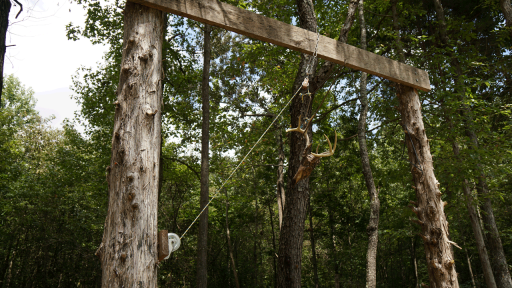
When you are out day tripping be on the lookout for meat poles hanging in the trees... usually this means that you can camp for free here.
When you are out day tripping be on the lookout for meat poles hanging in the trees... usually this means that you can camp for free here.