
@irvinemike Irvine isn't too far from SD and im sure there are otehr members located in SoCal. Maybe we get an Off The Grid Rally type thing going down out neck of the woods. Like @SLO Robert said, would be a great way to know your rig and it's capabilities.
First trip advice for a noob near Orange County, California
- Thread starter irvinemike
- Start date
You are using an out of date browser. It may not display this or other websites correctly.
You should upgrade or use an alternative browser.
You should upgrade or use an alternative browser.


Pathfinder III
@irvinemike Irvine isn't too far from SD and im sure there are otehr members located in SoCal. Maybe we get an Off The Grid Rally type thing going down out neck of the woods. Like @SLO Robert said, would be a great way to know your rig and it's capabilities.
Joshua Tree is in the middle of you guys and would be a great meet up spot. Also, near San Diego, Anza Borrego looks really fun, though I haven't been. It's on the list because I've also wanted to go out to the Salton Sea and that's near there... Youtube it, there's tons of video.

Off-Road Ranger I
@dmurph1996 & @irvinemike
For you SoCal folks, there is Anza Borrego and surrounding BLM land, Ocotillo Wells (lots of geological tourism there) and Truckhaven, Oriflamme Canyon. Coyote Canyon to camping in Collins Valley at Anza Borrego is a very nice location. If anyone of these look interesting let me know, I will tell you what I know about them.
I really recommend Gaia Gps for the Android/Apple users. A free account gets you access to downloadable USGS Topo and USFS maps.

Benefactor
- 15,584
- First Name
- Michael
- Last Name
- Murguia
- Member #
0000
- Ham/GMRS Callsign
- KM6YSL
Yes there is! It's growing. They are all in CA right now, but you can download the files for Google Earth or GPS units. You can find it on the main page!@dmurph1996 if you dont have a delorme unit, i have had great success with using Backcountry Navigator on my android devices. You have several different maps available for free, including some US forestry maps. Download them onto you device for when you dont have any cell reception (gps on tablets and phones are independent of cell coverage) and you can import your gps files into it. You can also track and record the route you take that way you can share it with the rest of us :)
If you have a Apple products, i have heard many good things about GAIA maps. Either way, having a good nav system with topography available can do you wonders.
@administrator isnt there a section somewhere with downloadable routes for people to download and use for their own trips?

For a first good trip relatively local I'd hit up Berdoo Canyon. Its essentially the rear entrance to Joshua Tree. Very moderate trails but very scenic, also not to far away from civilization should anything go wrong. But your rig will handle it with ease. We always head out there to do shake down cruses of new gear, set ups, trailers and what not. Its a day trip for me from Lakewood, so that is within you 4 hour window. A bunch of folks shoot out there but only at the very beginning of the trail head before you actually get into the canyon. Don't let that deter you, its only open BLM land for a few miles, then your into the National Park.
The trail connects to the Geology Trail Tour inside Joshua Tree, so if you head out and follow the trail into the park, you could either turn around and head back or pick up the paved road and head out of the park that way, but you will have to pay the entry fee upon leaving.
The trail connects to the Geology Trail Tour inside Joshua Tree, so if you head out and follow the trail into the park, you could either turn around and head back or pick up the paved road and head out of the park that way, but you will have to pay the entry fee upon leaving.
Is a 4x4 required? Currently have a 2x4 but looking to get a lift for more clearanceFor a first good trip relatively local I'd hit up Berdoo Canyon. Its essentially the rear entrance to Joshua Tree. Very moderate trails but very scenic, also not to far away from civilization should anything go wrong. But your rig will handle it with ease. We always head out there to do shake down cruses of new gear, set ups, trailers and what not. Its a day trip for me from Lakewood, so that is within you 4 hour window. A bunch of folks shoot out there but only at the very beginning of the trail head before you actually get into the canyon. Don't let that deter you, its only open BLM land for a few miles, then your into the National Park.
The trail connects to the Geology Trail Tour inside Joshua Tree, so if you head out and follow the trail into the park, you could either turn around and head back or pick up the paved road and head out of the park that way, but you will have to pay the entry fee upon leaving.
I all depends on the the rain to be honest, it is a wash and it changes every year. There are a few small rock gardens and 2 very moderate climbs with switch backs. I've taken a buddy through with a stock 2nd gen 2wd 4Runner and on the dame trp a guy ran it with his stock 4wd (AWD???) Honda Ridgeline. I spotted them both and they had to take their time and watch their lines but the made it. Once you get out of the canyon in relatively high speed desert running.Is a 4x4 required? Currently have a 2x4 but looking to get a lift for more clearance
I need to do a shake down run of the new 4Runner, if some of you guys are interested I could carve out a Sunday to head out there. Anyone interested??

@irvinemike Welcome, while I'm not new to Overlanding or camping like yourself I struggled when I was starting out as well. One of the biggest things for me was www.trails.com. This site is basic, but gives you good detail on local off road trails, shares difficulty, time it takes to travel and members have shared there Picts of routes. Big Bear and the surrounding areas are a perfect place to start. Nothing is that remote that you could hike out in an emergency and there are usually a lot of folks around so your likely to see others on the trails.
I live in HB, and always happy to share what I have learned in person. Plus rig and gear chats are always a good use of free time.
Lastly I would recommend checking out a good local off road shop or overland shop. Near you Rebel Off-road in lake forest is a great shop for jeep modifications etc. they are very knowledgable and they have a rental place working out of the shop As well if your looking for a small trailer or tent. Another good resource is Goose Gear in Westminster. They have a wonderful location with lots of cool goodies to check out and plenty of things to send your money on. The staff their are extremely knowledgable and have helped me a lot.
Welcome! :)

@stringtwelve @SLO Robert @dmurph1996 @ryanpce @dmurph1996 @wesel123 @administrator
I'm late on replying to a lot of great posts, sorry all. Log-in was down for a while, busy with little ones, and work has been crazy. Thank you all for all the great advice. Its all slowly but surely starting to come together now. With every trip the confidence is building and with confidence I realize I am planning much more trips. Loving it. I had a recent trip in Mammoth with the family about 2 weeks ago, took the jeep for the first time, left the family boring SUV at home. In preparation for the trip up to June Lake, I downloaded at the last minute North American Hema Maps on my iphone 6. I didn’t see any dirt trails on my version (maybe user error) but it was the best app I have ever used for marking waypoints, it allowed me to take pictures for the waypoints, track stats, record my route, and also make notes so you can easily remember the spots. I also had the book Sierra Nevada Byways: 51 of the Sierra Nevada's Best Backcountry Drives book with me. Followed some tips to a hidden dirt trail near the lifts in Mammoth planning to take the scenic route to Devils PostPile. At the entrance of the trail, I could see the dirt trail had 50% snow coverage on it still. I probably shouldn’t have attempted it, plus I had the wife and kids and sure enough after few hundred feet into the trail, all steep downhill, I made the decision to make a U-turn as the trail starting disappearing and my direction became more of a guess. And sure enough, I got stuck trying to go back up. Steep uphill + gravity + snow was impossible to get back up. Felt that sick feeling in the pit of my stomach. I was nervous not going to lie. Mainly because when you’re responsible for your family, it’s quite a different kind of pressure than just worrying about yourself. But I kept my composure, I did have a few things on my side. A 2013 Jeep Rubicon fully outfitted for any task, a warn winch (I never used a winch before), and a lot of fake recovery know how of knowledge logged in my brain from countless hours on YouTube for a situation like this. After all failed attempts of going through the A-Z of alternative measures (air down, 4L, 4H, using more speed, trying to take a different line, etc.) I resorted to my last ditch attempt of using the winch + tree saver strap all while thoughts of having to call a forest ranger or AAA was at the back of my mind. I didn't even know the winch would work since I have never tested it before. For all I knew the battery wasn't connected right. Did I mentioned a thunder storm was on its way right about that time too. But to my pleasant surprise, the winch worked. The Warn was a beast, effortless. I got us out, kids gave me the thumbs up while sipping their juice boxes, and didn’t lose any fingers doing it. All while the wife was reading the section to me in the book about not attempting this trail if its closed or has snow. :) Later on once warm and back safe back in the cabin with a hot cup of coffee. Reflecting on the scenario I believe I could of also got out using MaxTrax. So I will be purchasing some soon. All in all a great crash course learning experience that I do not regret. I still have a lot to learn, a lot of what if scenario questions that I have no answers to. All very overwhelming but I also know if I don't just get out there and just do it, it will never happen. I have to say, being able to fish, camp, site see, share the experience with my family, and ride some trails was by far the best Mammoth trip I have had to date. Being deep into the woods far from the hwy and busy population. Seeing views at 6,000 feet 99% of everyone else there would never get to see, the feeling of beautiful solitude and freedom really made for a different kind of overall experience that's hard to explain. It was the cherry on top of the trip for me to wrap up an awesome week! Next on my purchase list is a rooftop tent, fridge, and drawer system. This is an expensive hobby, are all overlanders rich? :)
I'm late on replying to a lot of great posts, sorry all. Log-in was down for a while, busy with little ones, and work has been crazy. Thank you all for all the great advice. Its all slowly but surely starting to come together now. With every trip the confidence is building and with confidence I realize I am planning much more trips. Loving it. I had a recent trip in Mammoth with the family about 2 weeks ago, took the jeep for the first time, left the family boring SUV at home. In preparation for the trip up to June Lake, I downloaded at the last minute North American Hema Maps on my iphone 6. I didn’t see any dirt trails on my version (maybe user error) but it was the best app I have ever used for marking waypoints, it allowed me to take pictures for the waypoints, track stats, record my route, and also make notes so you can easily remember the spots. I also had the book Sierra Nevada Byways: 51 of the Sierra Nevada's Best Backcountry Drives book with me. Followed some tips to a hidden dirt trail near the lifts in Mammoth planning to take the scenic route to Devils PostPile. At the entrance of the trail, I could see the dirt trail had 50% snow coverage on it still. I probably shouldn’t have attempted it, plus I had the wife and kids and sure enough after few hundred feet into the trail, all steep downhill, I made the decision to make a U-turn as the trail starting disappearing and my direction became more of a guess. And sure enough, I got stuck trying to go back up. Steep uphill + gravity + snow was impossible to get back up. Felt that sick feeling in the pit of my stomach. I was nervous not going to lie. Mainly because when you’re responsible for your family, it’s quite a different kind of pressure than just worrying about yourself. But I kept my composure, I did have a few things on my side. A 2013 Jeep Rubicon fully outfitted for any task, a warn winch (I never used a winch before), and a lot of fake recovery know how of knowledge logged in my brain from countless hours on YouTube for a situation like this. After all failed attempts of going through the A-Z of alternative measures (air down, 4L, 4H, using more speed, trying to take a different line, etc.) I resorted to my last ditch attempt of using the winch + tree saver strap all while thoughts of having to call a forest ranger or AAA was at the back of my mind. I didn't even know the winch would work since I have never tested it before. For all I knew the battery wasn't connected right. Did I mentioned a thunder storm was on its way right about that time too. But to my pleasant surprise, the winch worked. The Warn was a beast, effortless. I got us out, kids gave me the thumbs up while sipping their juice boxes, and didn’t lose any fingers doing it. All while the wife was reading the section to me in the book about not attempting this trail if its closed or has snow. :) Later on once warm and back safe back in the cabin with a hot cup of coffee. Reflecting on the scenario I believe I could of also got out using MaxTrax. So I will be purchasing some soon. All in all a great crash course learning experience that I do not regret. I still have a lot to learn, a lot of what if scenario questions that I have no answers to. All very overwhelming but I also know if I don't just get out there and just do it, it will never happen. I have to say, being able to fish, camp, site see, share the experience with my family, and ride some trails was by far the best Mammoth trip I have had to date. Being deep into the woods far from the hwy and busy population. Seeing views at 6,000 feet 99% of everyone else there would never get to see, the feeling of beautiful solitude and freedom really made for a different kind of overall experience that's hard to explain. It was the cherry on top of the trip for me to wrap up an awesome week! Next on my purchase list is a rooftop tent, fridge, and drawer system. This is an expensive hobby, are all overlanders rich? :)

Dude where do I get this Bible?buy this book and have at it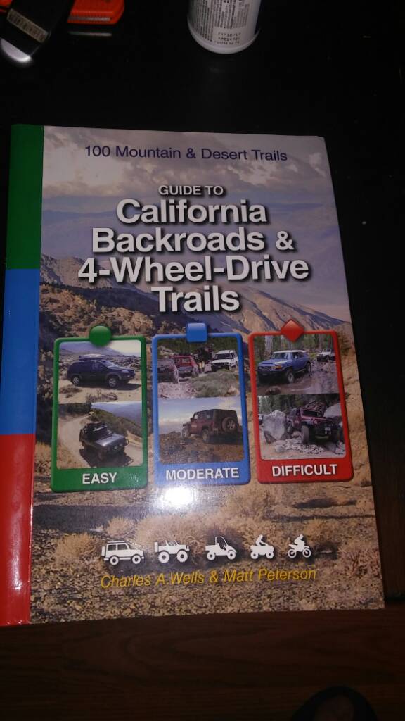
Off-Road Ranger I
- 1,710
- First Name
- Robert
- Last Name
- Niederhauser
- Member #
1519
- Ham/GMRS Callsign
- KM6ULA

A new site committed to keep trail information up to date is TrailsOffroad.com you can search by state, level of difficulty, and a few other parameters. With close to 100 writers the catalog of trails keeps growing. Detailed instructions, highlight video and GPX track files are available for download.
The FunTrek books are excellent but trails close and open all the time so try to back that information up with MVUM maps if available and message forums posts.
The FunTrek books are excellent but trails close and open all the time so try to back that information up with MVUM maps if available and message forums posts.
