7 Hour Plane Crash Trail

  • HTML tutorial

laufer

Rank I

Contributor III

184
Chicago, IL, USA
First Name
Konstantin
Last Name
Läufer
Ham/GMRS Callsign
KD9IOJ
The entire trail is 100% legal. Including the North of Calumet. It's mostly on Hwy 41 to Mandan Rd.
Have fun you all! I ran the trail last weekend. It was dry and beautiful!!!
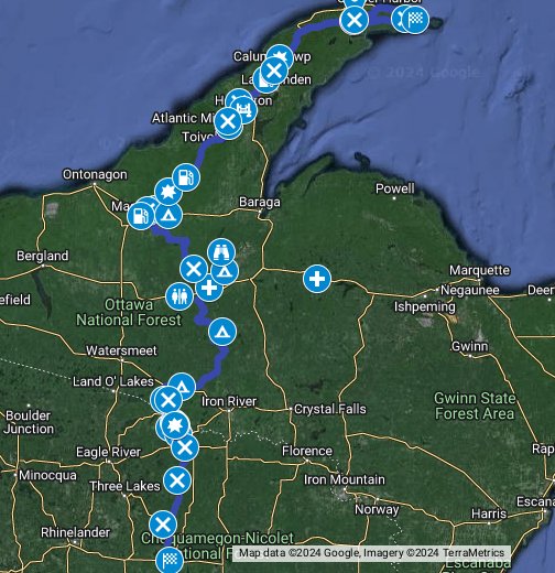
I believe @Wanderlost are correct after all. I double-checked the 7h route against the Michigan DNR ORV routes and trails dataset. All of the ORV routes north of Calumet are restricted to proper ORVs less than 65" wide. The two specific problem spots are Calumet to Ahmeek and the southern leg close to the tip, both easy to avoid. This screenshot shows the 7h route in brown, restricted ORV routes in red, unrestricted ORV routes in orange, and MI DNR roads in gray (near the tip).

Screenshot 2020-07-20 at 10.52.29.png
 
  • Like
Reactions: Scout

laufer

Rank I

Contributor III

184
Chicago, IL, USA
First Name
Konstantin
Last Name
Läufer
Ham/GMRS Callsign
KD9IOJ
I believe @Wanderlost are correct after all. I double-checked the 7h route against the Michigan DNR ORV routes and trails dataset. All of the ORV routes north of Calumet are restricted to proper ORVs less than 65" wide. The two specific problem spots are Calumet to Ahmeek and the southern leg close to the tip, both easy to avoid. This screenshot shows the 7h route in brown, restricted ORV routes in red, unrestricted ORV routes in orange, and MI DNR roads in gray (near the tip).
Attached is a new version of this route that avoids these problem spots by going onto US-41 right after Calumet and avoiding the southern leg of Mandan Road. I hope it's useful.

Disclaimer: You are solely responsible for the legal use of the attached location data.

Screenshot from 2020-07-20 15-14-52.png

GPX viewer
 

Attachments

  • Like
Reactions: GrumpyOldMan

GrumpyOldMan

Rank I

Enthusiast I

261
Lake Villa, IL, USA
First Name
Todd
Last Name
Dessain
Ham/GMRS Callsign
K9HNK
Friends,

As there has been discussion about the difficulty of the trail, I wanted to comment. My wife and I drove Segment 1 from Crandon to Highway 70. I was in my Raptor and she was in her stock 2015 Explorer. The route out of Crandon is paved and moves to gravel in a couple miles. There is a section of dirt where they were actively logging. Then the route goes back to gravel. Honestly anything more capable than a lowered sports car could do this first section.

So my 2 cents, if you have a vehicle, go drive! Have fun! Bring a friend in case something goes wrong, but you can do the first stage for sure.

Our local Raptor group may be doing more of this in a few weeks which is why I pre-ran some of it.
 

Wanderlost

Rank VI
Launch Member

Member III

3,316
Caledonia, Illinois
Member #

8490

Yeah, yeah, it's me again. A bunch of us are going to drive this North to South August 22nd if anyone is around and would like to join.
We're likely going to be doing the trail the same time. Maybe we'll see you along the way!

What's your itinerary look like?

We were thinking about starting at the south end on Friday and working our way north. Camping around the Bob's Lake area Friday night.
 
  • Like
Reactions: TD Bauer

GrumpyOldMan

Rank I

Enthusiast I

261
Lake Villa, IL, USA
First Name
Todd
Last Name
Dessain
Ham/GMRS Callsign
K9HNK
We're likely going to be doing the trail the same time. Maybe we'll see you along the way!

What's your itinerary look like?

We were thinking about starting at the south end on Friday and working our way north. Camping around the Bob's Lake area Friday night.
So we're going to get up early Saturday morning and haul butt up to CH and then run the route in reverse. The idea being if it takes too long, we can peel off and take highway home. I have a place in Rhinelander so a bunch of guys are gonna stay with me and others will stay at local hotels.

What do you use for radio? We use MURS so if you do as well, you'll likely be able to hear us before you see us.
 

Wanderlost

Rank VI
Launch Member

Member III

3,316
Caledonia, Illinois
Member #

8490

So we're going to get up early Saturday morning and haul butt up to CH and then run the route in reverse. The idea being if it takes too long, we can peel off and take highway home. I have a place in Rhinelander so a bunch of guys are gonna stay with me and others will stay at local hotels.

What do you use for radio? We use MURS so if you do as well, you'll likely be able to hear us before you see us.
We'll probably pass by you near the north end Saturday morning then. Then hopefully we'll find a quiet spot along the shore to camp. We have a product review video to shoot while we're out too.
We us GMRS and CB. Usually channel 16 on both. On the highway the CB goes to 19 for traffic and delay news.
Hopefully we'll see you up there!

Here's how you'll recognize us:DSC_0339.JPG
 

GrumpyOldMan

Rank I

Enthusiast I

261
Lake Villa, IL, USA
First Name
Todd
Last Name
Dessain
Ham/GMRS Callsign
K9HNK
We'll probably pass by you near the north end Saturday morning then. Then hopefully we'll find a quiet spot along the shore to camp. We have a product review video to shoot while we're out too.
We us GMRS and CB. Usually channel 16 on both. On the highway the CB goes to 19 for traffic and delay news.
Hopefully we'll see you up there!
Sounds good. I'm assuming GMRS channel is 462.5750 MHz. Are you using a security channel as well? I'll set my radio to include that freq in my scan so hopefully I'll hear you if you transmit.

Look for a string of Ford Raptors. That'll be us!
 

GrumpyOldMan

Rank I

Enthusiast I

261
Lake Villa, IL, USA
First Name
Todd
Last Name
Dessain
Ham/GMRS Callsign
K9HNK
Guys and gals,

So we had a blast on this route last saturday. We left Rhinelander at 0700 and tore up to CH. We blew through and up to the end of the peninsula. The road started as gravel and quickly turned into a rocky, wooded, undulating route. It was amazing how many vehicles were trying to get to the end. Yeah there were trucks and SUVs, Subarus and Jeeps, but there was also a fair share of minivans, sedans and so on. Most pulled over for us since 16 Raptors and 2 FJ's must have looked intimidating. We moved pretty good over the terrain since frankly the Raptors are designed to go fast off road.

We had a guy break an aftermarket tie rod end, so he got that fixed and went back to Rhinelander not wanting to tempt fate.

We then headed south. Some areas were closed so we had to detour. The gravel roads were awesome. We were able to go real fast on the long straights (I hit 85, some hit triple digits) and as things got dark, it got easier since oncoming lights were visible. Most of use have LOTS of aux lighting, so fast and dark is no big deal.

The water fording was awesome. I got to lead that. Some mud on the ground made me slide laterally, but everyone else had good traction. I don't know how deep it was as I was concentrating, but I bet it was towards the top of my tires (35"). If someone has photos and we can tell better I'll update.

All in all it too us 9 hours. We spent time setting up for photos, chit chatting, peeing, hydrating and so on. It was a LONG day with our early start, so my preference would be to camp in CH or at the peninsula and then drive south.

I am continuously amazed at how well the Raptor does. It does produce a false sense of talent, and sure guys run out of talent before they run out of truck or trail, but if you can mitigate that, it's amazing. I've had my 2011 for 8 years now and I still love her and all her rust!
 
  • Like
Reactions: DanW and GPG3

bschultz

Rank 0

Contributor I

30
Madison, WI, USA
First Name
Brittany
Last Name
Schultz
After looking at the map I am not entirely sure if this is doable, but does anyone know if you can get on the trail from various different points? We had plans to hike Porcupine Mountain and then hop on this trail in the Twin Lakes area up to Houghton. Then we wanted to get off the trail to Mountain Bike in Houghton. Then we would get back on in the Mohawk/Fulton area to find a camping spot for the night and then continue to end at High Rock Bay for camping. Will these stops work with how the trail is laid out and flows? Does anyone have a better idea for these detours we wanted to make along the way?

Broken down:
Can you start the trail in Twin Lakes and get off of it in Houghton?
Can you get back on the trail in the Mohawk/Fulton area?
Is there a close camping spot on the trail near Mohawk/Fulton? (we wouldn't want to drive too much in the dark looking for a spot to camp after mountain biking)
Are Toyota Tundra's too large of vehicles for this trail?

* I am assuming this should work as both starting points we want are fuel stations, but I just wanted to confirm before locking in the plan!
 

GrumpyOldMan

Rank I

Enthusiast I

261
Lake Villa, IL, USA
First Name
Todd
Last Name
Dessain
Ham/GMRS Callsign
K9HNK
After looking at the map I am not entirely sure if this is doable, but does anyone know if you can get on the trail from various different points? We had plans to hike Porcupine Mountain and then hop on this trail in the Twin Lakes area up to Houghton. Then we wanted to get off the trail to Mountain Bike in Houghton. Then we would get back on in the Mohawk/Fulton area to find a camping spot for the night and then continue to end at High Rock Bay for camping. Will these stops work with how the trail is laid out and flows? Does anyone have a better idea for these detours we wanted to make along the way?

Broken down:
Can you start the trail in Twin Lakes and get off of it in Houghton?
Can you get back on the trail in the Mohawk/Fulton area?
Is there a close camping spot on the trail near Mohawk/Fulton? (we wouldn't want to drive too much in the dark looking for a spot to camp after mountain biking)
Are Toyota Tundra's too large of vehicles for this trail?

* I am assuming this should work as both starting points we want are fuel stations, but I just wanted to confirm before locking in the plan!
Brittany,

You can totally get on and off anywhere. That section, if memory serves, was old train track ORV route that mirrored highway 26. There were sections that were closed if I'm thinking about the right area.

So yeah you can get on in Fulton, but I'm not aware of camping there. When I was doing a UP motorcycle ride the weekend before I did this, camping was tough to come by. All campgrounds were only booking 50% of their spots due to COVID, so space was limited.

We did the trail in Ford Raptors which are 7" wider than a stock F150, so your Tundra should be fine.

If you wanted to chat, PM me a number and we can touch base. Happy to help out a fellow off roader!


Todd
 

bschultz

Rank 0

Contributor I

30
Madison, WI, USA
First Name
Brittany
Last Name
Schultz
Brittany,

You can totally get on and off anywhere. That section, if memory serves, was old train track ORV route that mirrored highway 26. There were sections that were closed if I'm thinking about the right area.

So yeah you can get on in Fulton, but I'm not aware of camping there. When I was doing a UP motorcycle ride the weekend before I did this, camping was tough to come by. All campgrounds were only booking 50% of their spots due to COVID, so space was limited.

We did the trail in Ford Raptors which are 7" wider than a stock F150, so your Tundra should be fine.

If you wanted to chat, PM me a number and we can touch base. Happy to help out a fellow off roader!


Todd
Thank you Todd! If I have any other questions that come up while planning our trip, I will definitely reach out.
 

Hayseed_OL

Rank 0

Contributor I

30
Midwest
First Name
P
Last Name
M
Does the trail extend any further south towards Milwaukee/Chicago and such. If we drive up there, want to do more than the 7hr drive.
 

SCT21

Rank II

Member I

404
Zeeland, MI
First Name
Patrick
Last Name
McKenney
Member #

42459

Hi Everyone,

Few weeks back came across the video @Wanderlost did and it's inspired our first true Overlanding trip. So my Dad and I will be setting out from lower Michigan on Sept. 26th, spending the night in Iron River and then the morning of the 27th heading down to Crandon to do the full route. I'm working on a route as well that will include the drive up to Point Abbaye, and then take us into the Huron Mountains and stopping at Mt. Arvon (Michigan's highest point) and then moving us west towards Marquette.

If anyone is going to be on the route Sept. 27th - 29th let me know.
 
  • Like
Reactions: Wanderlost
T

TD Bauer

Guest
This trail looks like a lot of fun. I wonder if my little Jeep Renegade Trailhawk could handle it...no upgrades other than the Toyo A/Ts I put on it. I must tempt fate and give it a whirl next week if I can sneak away from work.

Any who have run the trail known of obvious places I should avoid, do let me know. :-)
 

SCT21

Rank II

Member I

404
Zeeland, MI
First Name
Patrick
Last Name
McKenney
Member #

42459

This trail looks like a lot of fun. I wonder if my little Jeep Renegade Trailhawk could handle it...no upgrades other than the Toyo A/Ts I put on it. I must tempt fate and give it a whirl next week if I can sneak away from work.

Any who have run the trail known of obvious places I should avoid, do let me know. :-)
You'll be fine, I just completed it earlier this week in my Subaru Crosstrek and it was a blast. There is one section that is very wet, and form what I've seen it's more than even a stream crossing, but more like the stream and trail combine for a period of time:

1601650635174.png
The lake there is Kaine Lake, and the coordinates on the first waypoint 'Enter Trail' are 46.04250, -88.90656. It's pretty obvious when you get to it as it's a turn off down a short gravel road. When we arrived there was water flowing down the two track ruts. So we didn't even attempt to go down it, we were doing it alone in my Subaru and not tempting fate. Had I been with a second vehicle to help even with a simple pull I might have at least gone down and checked it out. The Dark blue was my avoidance, only added a few miles of pavement, wasn't a big deal.

It was absolutely gorgeous, so if you can get out soon when color is still peaking in that area do it, the Keweenaw was a little behind in color. So I would imagine up there you'd have a few more days to get to it and get good color up there. The other note I will share is the original route doesn't cover much of the Bill Nicholls Trail, and instead jumps up onto M-26 in Mass City. Instead of that route, jump onto the Bill Nicholls at McKeever (which is just a spot on the map) and take the trail, you don't want to miss the 3 bridges here: 46.78452, -89.01201 (my camera waypoint).
1601651346028.png

Otherwise, get out there on it. It's a great route. IMG_20200927_144051.jpg
 
  • Like
Reactions: TD Bauer
T

TD Bauer

Guest
You'll be fine, I just completed it earlier this week in my Subaru Crosstrek and it was a blast. There is one section that is very wet, and form what I've seen it's more than even a stream crossing, but more like the stream and trail combine for a period of time:

The lake there is Kaine Lake, and the coordinates on the first waypoint 'Enter Trail' are 46.04250, -88.90656. It's pretty obvious when you get to it as it's a turn off down a short gravel road. When we arrived there was water flowing down the two track ruts. So we didn't even attempt to go down it, we were doing it alone in my Subaru and not tempting fate. Had I been with a second vehicle to help even with a simple pull I might have at least gone down and checked it out. The Dark blue was my avoidance, only added a few miles of pavement, wasn't a big deal.

It was absolutely gorgeous, so if you can get out soon when color is still peaking in that area do it, the Keweenaw was a little behind in color. So I would imagine up there you'd have a few more days to get to it and get good color up there. The other note I will share is the original route doesn't cover much of the Bill Nicholls Trail, and instead jumps up onto M-26 in Mass City. Instead of that route, jump onto the Bill Nicholls at McKeever (which is just a spot on the map) and take the trail, you don't want to miss the 3 bridges here: 46.78452, -89.01201 (my camera waypoint).


Otherwise, get out there on it. It's a great route.
Nice! Thanks for the excellent information! Will for sure hit the Bill Nicholas Trail.

Looks like you hit some peak colors on your run! Autumn is such a great time of year.
 

GPG3

Rank II

Enthusiast III

473
Wisconsin
First Name
George
Last Name
Papageorge
Nice! Thanks for the excellent information! Will for sure hit the Bill Nicholas Trail.

Looks like you hit some peak colors on your run! Autumn is such a great time of year.
How did you all you all do on the Baja Section of the #7HourPlaneCrashTrail ?
 

SCT21

Rank II

Member I

404
Zeeland, MI
First Name
Patrick
Last Name
McKenney
Member #

42459

How did you all you all do on the Baja Section of the #7HourPlaneCrashTrail ?
Are you refering to the 'bouncey' section north of the bridges on the Bill Nicholas and south of Houghton? If so, I ended up bailing off in that section as I had a slow leak in a tire and decided to run the highway to Hankcock to get it fixed before it caused more problems. We pulled off not to many miles north of the bridge section just as it started to get bouncier.
 
  • Like
Reactions: GPG3