

I and many others are disappointed on how lame the trans Wisconsin adventure trail is.
One can use a minivan to complete it.
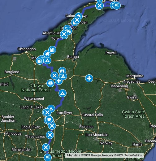
I mapped out a trail that requires an overlanding rig. It is about 90% offroad to its final beautiful campsite.
Along the way you can drift off the trail and enjoy scenic areas and waterfalls.
Link to map below....
Be safe, enjoy!
 goo.gl
One can use a minivan to complete it.
I mapped out a trail that requires an overlanding rig. It is about 90% offroad to its final beautiful campsite.
Along the way you can drift off the trail and enjoy scenic areas and waterfalls.
Link to map below....
Be safe, enjoy!
7 Hour Plane Crash Trail (CRANDON to KEWEENAW) - Google My Maps
I'm a Wisconsin native who lived out West for a little while after college. I raced stock mini class in the desert and was a member of the TOYOTA / Ivan Stewart Race Team. When I moved back, I really missed the accessibility to trails that have a Baja feel to them. Well,... I mapped out the...


