
All Going
All Not Going
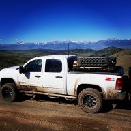
OB Central Valley: Corral Hollow / Deer Valley Trip
-
START DATE
11:30
11:30 AM Pacific Time (US & Canada)11:30 Hrs GMT -8:00 -
END DATE
Sunday, July 26, 2020
09:00 AM Pacific Time (US & Canada)09:00 Hrs GMT -8:00
 RALLY POINT EVENT
 OVERLAND BOUND REGION
US West
 EVENT TYPE
Trip
 DIFFICULTY
9 - SEVERE 2
Rally Point Event

Terrain Type
- Dirt Road
- Highway
- Mud
- Rock Crawling
- Sand

Recommended
- 4WD
- Lift
- Off Road Tires
- Sliders
- Spot Lights

Channel
- HAM 146.460
Rally Point Details:
We be leaving from the Mobil Gas Station at 1200hrs sharp on Friday (7-24-20). From there, we will be heading East on HWY 4 to the Western Corral Hollow OHV Trail. The plan to camp at the Mountain Vista, the Corral Hollow campground will be the back up site.
Satuday (7-25-20) we will finish the Corral Hollow Trail and then head further up HWY 4 to the Deer Valley OHV Trail. This day WILL be the most difficult section of the trip. Time permitting, we will have lunch at the Lower Blue Lake Dam. From there, we will head back down the trail to Deer Valley for camp.
Sunday (7-26-20) we will be finishing the back track on the Deer Valley Trail to HWY 4. Then, unfortunately, we are headed home.
Please make reference the to following waypoints:
- Corral Hollow Trail (Friday)
- West Trail Head (38.41293, -120.13654)
- Old Forest Cabin (38.47095, -120.09328)
- Corral Hollow Campsites (38.47955, -120.07413) - depending on how many rigs attend, this will be our secondary campsite.
- Mountain Vista Campsite (38.47930, -120.06392) - this will be our 1st choice for our campsite if available.
- East Trail Head (38.45693, -120.05284)
- Deer Valley Trail (Saturday)
- South Trail Head (38.53831, -119.897)
- South Water Crossing (38.571542, -119.914807) -Primary Campsite for the night
- North Water Crossing (38.591271, -119.919831) -Secondary Campsite for the night
- North Trail Head (38.60926, -119.92461) -Tertiary Campsite for the night
The ultimate goal for Saturday is to make it to the North Trail Head and have lunch at the dam and then back track to the south water crossing for camp. This would make Sunday morning a little easier.
If for some reason that does not happen due to time, we can make camp when we 1st get to the south water crossing and save the rest of the trail for Sunday morning. Then take HWY 88 home. This will obviously add miles and time to your trip home. When the time comes, we can make group decision.

 IV
IV
Telldanny
Member# 22028
 VI
VI
BettyWhiteOneSeven
Member# 16499MrTheKiller
Member# 25353 III
III
Yoye0513
Member# 14331 IV
IV
Bucket_Head_57
Member# 16431 III
III
YJ Dan
Member# 20915 III
III
Willy The Grunt
Member# 3932
 VI
VI
CTO1Mike
Member#
DurangoTom
Member# I
I
VOLENS ET POTENS
Member# 24647- Start Point: 4469 Escalon-Bellota Rd, Farmington, CA 95230, USA GPS Coordinates: 37.93084, -121.00138 Notes:
This Rally Point location and route can be downloaded if the buttons are active. The “Launch Google Earth" option will allow you to review the location in 3D. Please keep in mind, actual terrain may vary greatly. This should be used for reference only.
Save KML Save GPX PDF Launch in Google Map Launch in Google Earth
Comments