UPDATED: PREWITT RIDGE RD 2/17 -- CLOSED:Bixby/Coast Road 2/17
- Thread starter infennonlabs
- Start date
You are using an out of date browser. It may not display this or other websites correctly.
You should upgrade or use an alternative browser.
You should upgrade or use an alternative browser.


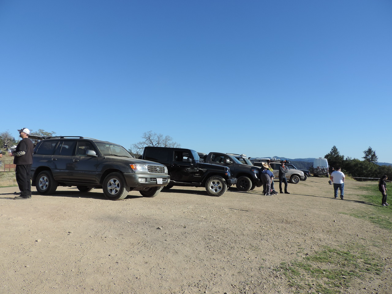
Not sure what was happening on 101; but it was a shit show from MoHill all the way to the 156 turnoff to Monterey. Didn’t want to sit in more stop and go traffic so I kept going on 101 all the way to Ft Hunter-Ligett. Currently sitting at the Subway on base eating lunch. Gonna head out for the trail in about 15 coming from the East.


Steward II
Never saw anyone from the group, but had a great time, thanks for the giaa directions
Sent from my SAMSUNG-SM-G891A using Tapatalk

Off-Road Ranger I
- 1,503
- First Name
- Patrick
- Last Name
- Hung
- Member #
9818
- Ham/GMRS Callsign
- W6AJR
I guess that we all arrived at different times. I arrived at Chevron at 11:15 or so, and left for Kirk Creek at 11:45 as I didn't think any of you were at the gas station. Arrived at Kirk Creek at about 12:40, and waited till 12:55 before deciding to hit the trail and wait for you all on Prewitt Ridge. After Prewitt Ridge, I did head south on the trail to see if I could complete the loop as per Gaia's route, but came to a locked gate a few miles down which forced me to turn around and take the same way out to SR1. I did see a tan Taco coming up the dirt trail toward Prewitt Ridge - was that you, Scorpio VI? It was probably a bit after 3 PM.
Here's my recorded Gaia track of the trail run today (the locked gate is next to Silver Peak Wilderness, where I had to turn around, and track ends):
https://www.gaiagps.com/public/c8JLZVkcihNBElQW0Dy8t4V6
Here's my recorded Gaia track of the trail run today (the locked gate is next to Silver Peak Wilderness, where I had to turn around, and track ends):
https://www.gaiagps.com/public/c8JLZVkcihNBElQW0Dy8t4V6
Last edited:

Traffic was horrible, but overall a great time meeting up with @ScorpioVI, @2003DiscoII, @JeepWave, and @SuperLuke!

Enthusiast III
I encountered the same locked gate when I tried to complete the loop. That was around 4:45pm. Had to turn around, but at least I saw a beautiful sunset from one of the turnoffs.I guess that we all arrived at different times. ... After Prewitt Ridge, I did head south on the trail to see if I could complete the loop as per Gaia's route, but came to a locked gate a few miles down which forced me to turn around and take the same way out to SR1. I did see a tan Taco coming up the dirt trail toward Prewitt Ridge - was that you, Scorpio VI? It was probably a bit after 3 PM.
It was fun to meet up with @willnicks, @ScorpioVI, @2003DiscoII, and @SuperLuke! Sorry I missed some of you—we’ll have to meet another time!
I did see a tan Taco coming up the dirt trail toward Prewitt Ridge - was that you, Scorpio VI? It was probably a bit after 3 PM.
Yea you pulled over for me right? Pretty sure I saw that rig in your avatar.
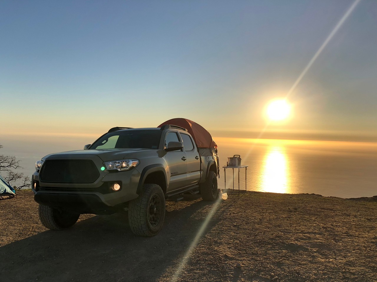
Sorry I didn't get to wheel and hang with you guys for long. I did end up spending the night at the ridge and was treated to a spectacular sunset and sunrise, but I definitely picked the wrong weekend to be up there. My next door neighbors were pretty chill but the others up there could use a refresher on wilderness etiquette.
Anyways, here some pics:


Easter weekend (3/30 Friday to 4/1 Sunday) I was planning on going up to Mendocino National Forest and camp at Lake Pillsbury and try for Hull Mountain. Going up the Ukiah side and staying on that side for the weekend. Lemme know if anyone is interested. Will probably post a real thread when I finalize route etc.
Sent from my Pixel 2 using OB Talk mobile app
Sent from my Pixel 2 using OB Talk mobile app
2003DiscoII
Rank II
Enthusiast III
It was nice to meet everyone. I’m going to be doing a pismo beach trip at the end of March- beginning of April if anyone would like to join
Sent from my iPhone using OB Talk
Sent from my iPhone using OB Talk
Enthusiast III
Shared route
From n39 05.457 w120 57.039 to Knee Deep Brewing Company via Iowa Hill Rd.
1 hr 44 min (38 mi)
1 hr 44 min in current traffic
1. Head southeast on Iowa Hill Rd toward Fowler Ave
2. Turn right to stay on Iowa Hill Rd
3. Turn left to stay on Iowa Hill Rd
4. Sharp right to stay on Iowa Hill Rd
5. Arrive at location: 27300 Big Dipper Rd
6. Head southeast on Big Dipper Rd toward Adelia Hill Rd
7. Turn right onto Shirt Tail Canyon Rd
8. Arrive at location: 2680 Kings Hill Rd
9. Head west on Kings Hill Rd toward Shirt Tail Canyon Rd
10. Turn left onto Shirt Tail Canyon Rd
11. Turn right to stay on Shirt Tail Canyon Rd
12. Arrive at location: Shirt Tail Canyon Rd
13. Head southeast on Shirt Tail Canyon Rd toward Yankee Jims Rd
14. Turn right onto Yankee Jims Rd
15. Arrive at location: Yankee Jims Rd
16. Head southwest on Yankee Jims Rd toward Gillis Hill Rd
17. Arrive at location: 402-498 Yankee Jims Rd
18. Head west on Yankee Jims Rd toward Canyon Way
19. Slight right onto Canyon Way
20. Turn left toward S Auburn St
21. Turn left onto S Auburn St
22. Turn left onto the I-80 W ramp
23. Merge onto I-80 W
24. Take exit 123 for Bell Rd
25. Turn right onto Bell Rd
26. Turn right onto New Airport Rd
27. Turn left
28. Turn right
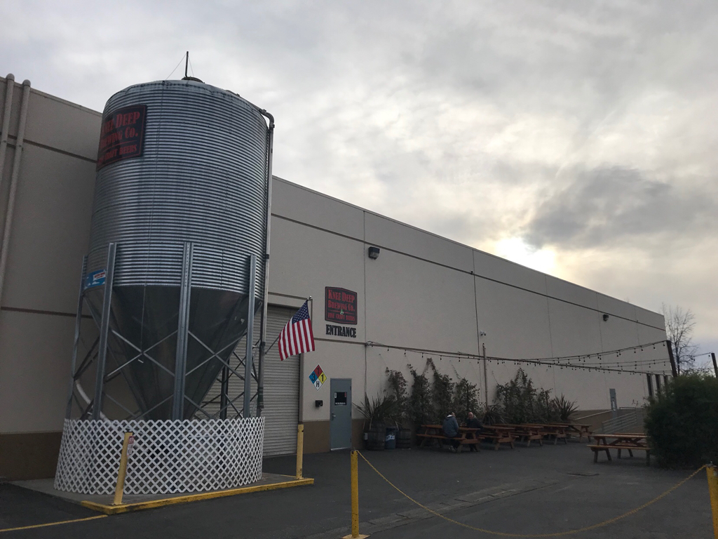
29. Arrive at location: Knee Deep Brewing Company (wet the whistle)
For the best route in current traffic visit https://goo.gl/maps/BViY3tzRgMM2
Sent from my Nexus 9 using OB Talk mobile app
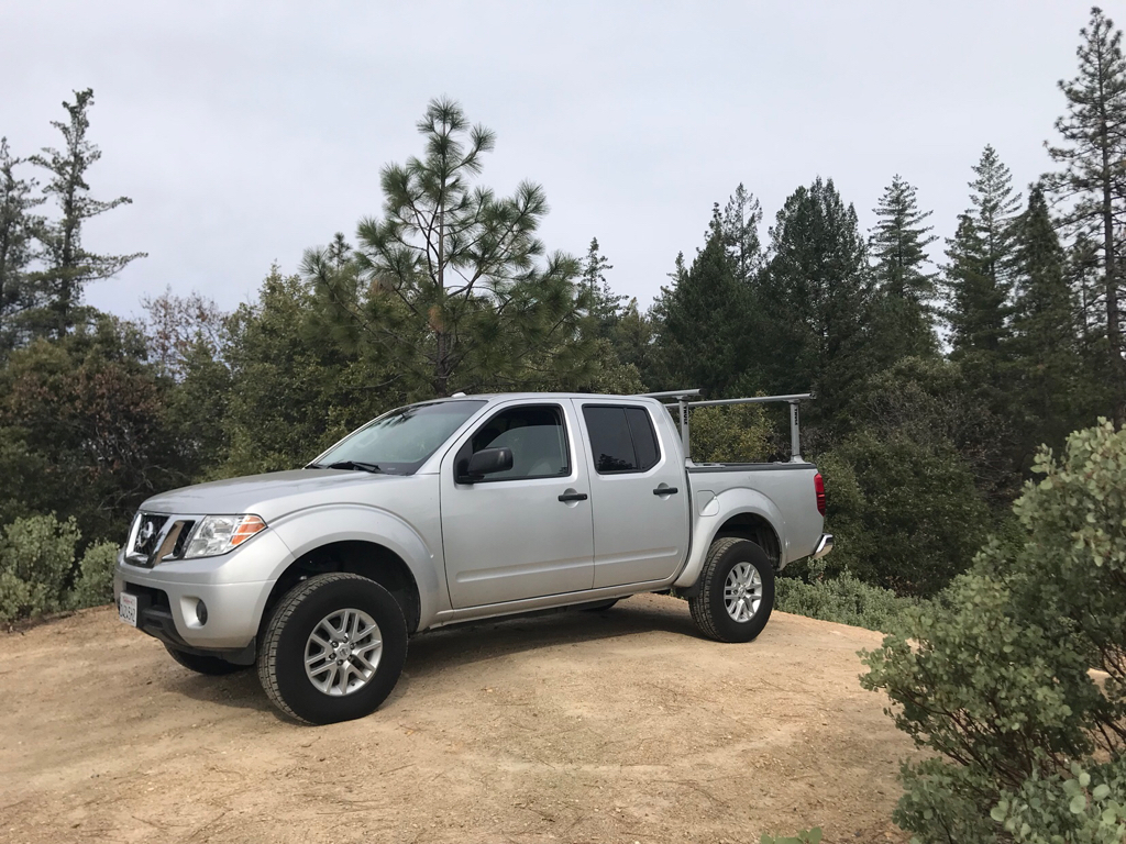
Went on your shared route today. Been there a few times before but had never been to Knee Deep. Thanks for sharing, hope my pictures will inspire someone else to go. For anyone thinking about going this trip is super easy, 75% paved and 25% maintained gravel roads. Any stock rig can handle this, might be a different story on a really wet year.


Sent from my iPhone using Tapatalk
Nice photos. I'm jealous. I didn't get to make it out on Sunday like I planned. Was it cold?Went on your shared route today. Been there a few times before but had never been to Knee Deep. Thanks for sharing, hope my pictures will inspire someone else to go. For anyone thinking about going this trip is super easy, 75% paved and 25% maintained gravel roads. Any stock rig can handle this, might be a different story on a really wet year.
Sent from my iPhone using Tapatalk
Sent from my Pixel 2 using OB Talk mobile app
Enthusiast III
Nice photos. I'm jealous. I didn't get to make it out on Sunday like I planned. Was it cold?
Sent from my Pixel 2 using OB Talk mobile app
Yeah, you definitely have to get out there. I started at Colfax at 1pm and was at the brewery by 4:05. That’s also with me stopping to take pictures. You could definitely sleep in and still have time to go out there. Temp was probably high 40’s low 50’s, nothing too crazy. Surprisingly my 2016 Frontier doesn’t have a temp display or else I would have known exact temps.
Sent from my iPhone using Tapatalk
Figured it would have been colder with snow coming down in TahoeYeah, you definitely have to get out there. I started at Colfax at 1pm and was at the brewery by 4:05. That’s also with me stopping to take pictures. You could definitely sleep in and still have time to go out there. Temp was probably high 40’s low 50’s, nothing too crazy. Surprisingly my 2016 Frontier doesn’t have a temp display or else I would have known exact temps.
Sent from my iPhone using Tapatalk
Sent from my Pixel 2 using OB Talk mobile app
Enthusiast III
Figured it would have been colder with snow coming down in Tahoe
Sent from my Pixel 2 using OB Talk mobile app
Message me if you have any other routes you’re willing to share. Don’t know any out here, would like to get out and explore some more. Thanks again!
Sent from my iPhone using Tapatalk
It was nice to meet everyone. I’m going to be doing a pismo beach trip at the end of March- beginning of April if anyone would like to join
I'd be down for Pismo, never been. Post a thread.
Off-Road Ranger I
- 1,503
- First Name
- Patrick
- Last Name
- Hung
- Member #
9818
- Ham/GMRS Callsign
- W6AJR
Hey ScorpioVI, I guess that we did meet each other on the trail to Prewitt, just in passing; yes, that was me. We'll meet again soon, I'm sure. Awesome photos, by the way.
So we have two proposed trips on Easter weekend (Mendo and Pismo)? Unfortunately I can't do those as I'm heading down to Death Valley for three days on the following Monday with the family (my first time!). I'm hoping to learn the area so as to organize a trip in the autumn or spring of next year.
In the meantime, how about a day trip to Hollister Hills? Saturday March 17th would be a good day for me; if there's some interest, I'll start a new thread. I've been to HH a few times with the Nissan club, and it has always been fun. Attached is a photo of me being too ambitious, and having to back out of a boggy mess (note the Jeep gloating after having made it across successfully). That pit is probably bone-dry right now.


And a couple more, going up the "steps":


So we have two proposed trips on Easter weekend (Mendo and Pismo)? Unfortunately I can't do those as I'm heading down to Death Valley for three days on the following Monday with the family (my first time!). I'm hoping to learn the area so as to organize a trip in the autumn or spring of next year.
In the meantime, how about a day trip to Hollister Hills? Saturday March 17th would be a good day for me; if there's some interest, I'll start a new thread. I've been to HH a few times with the Nissan club, and it has always been fun. Attached is a photo of me being too ambitious, and having to back out of a boggy mess (note the Jeep gloating after having made it across successfully). That pit is probably bone-dry right now.
And a couple more, going up the "steps":

Pathfinder III
I live near Pismo. Start a thread and holler if I can be of any help if you haven't been. Glad some of you got to Prewitt. It's quite a view!
