Just got back from running the byway and you guys will have a great time. The Byway is everything described in the guides. Callie's is a great launching spot and a group friendly campground. If they are cooking ribs and chicken Friday or Saturday night ---- highly recommend the dinner!
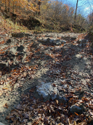
As far as the route.... Spaas Creek and Pumpkin Hollow required us to spot through many rocky and rutted areas but overall we made it through without any issues. We ran into THE muddy, rutted area on Pilot Furnace road past the sensitive landowner note and ultimately ended up using the winch to just pull us over one rock ledge where we just couldn't get enough grab. Drier conditions and it may not have been an issue at all.
The water crossing before Old Fincastle road was deep... probably at least 24-30 inches but the bottom of the creek was solid and straight forward ----allowing us to move quickly though without issue. Make sure to check the depth before this crossing... all the others were lower levels and solid bottoms as well.
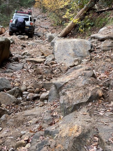
THE ROCK obstacle on Old Fincastle is a serious undertaking..... From the video's I watched I knew the line was to stay as high on the passenger side to get the rear driver up on the center of the big rock before.coming down.. at my skill level and as luck would have it---- didn't remain high enough for long enough and got hung up on the driver rock rail. Simple pull with the winch for about 2 feet and over the obstacle we went safely. This is a real test but with a good spotter it can be done as seen on You Tube----usual disclaimer to use caution for sure. But there are alternative routes around this area so no reason to damage your vehicle if any doubt is in play. Still need to drive our loves home !!!
My FJ is lifted about 2.5 inches from stock, equipped with rock rails and skids plate with almost 33inch tires. Have a winch and traction boards. I can honestly say that I used all this equipment at one point or the other on the byway so I was happy to have them along.
It is muddy and slippery where noted so come prepared to get your shoes dirty !!!
Only place we got turned around a bit was at David's Big Boulder beach.... if running counterclockwise ---- the DBBB exits this area to the south (once across the first creek crossing exit to the right back across the creek.) There is a road that goes East ( left ) and not sure where it would have taken us as it got tighter and tighter before we realized our mistake.
We took three days to do the loop but with EARLIER starts it can be done in two if you move along at this time of the year. The Carto Tracks map ( along with the Advenza app ) was spot on for keeping us on route and for the most part the GAIA download was accurate as well. Twice GAIA seemed to lose us deep in the hollows but found us once we got back higher-----overall both worked There are signs along the way but not at all the intersection so we used the maps constantly.
I'll try to attach some pictures next.

First pix was on the Pilot Furnace road.... looked fairly straight forward but mud and loose rock caused us a few headaches before just using the winch to climb 12 inches ---- lol

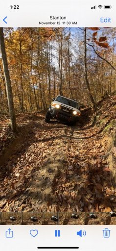
second pix --- just some of the fun angles you can get on there

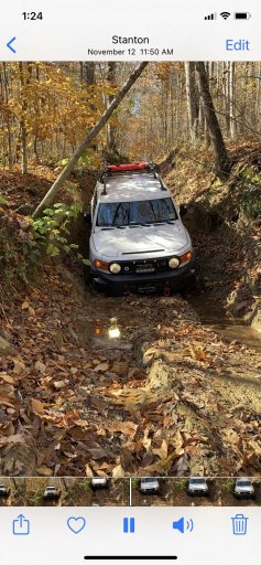
third pix.... just have to let the ruts dictate where you can go

fourth pic....--- this the view of the rock obstacle on old fincastle....ironically the hardest part was getting over the first ledge you see in the foreground before tackling the big sloping rock in the middle. But you can see we made it......
Happy Thanksgiving everyone and have a blast out there this weekend.
Bart