
Pathfinder III
TAT Day 1 – Starting the Trail!: Marlinton, WV to Covington VA
We started our day out with a fantastic breakfast at the restaurant at the Marlinton Inn, did some final checks of the maps and GPS and then went next door to the Marathon station for a final fill up of the tank and the gas cans.
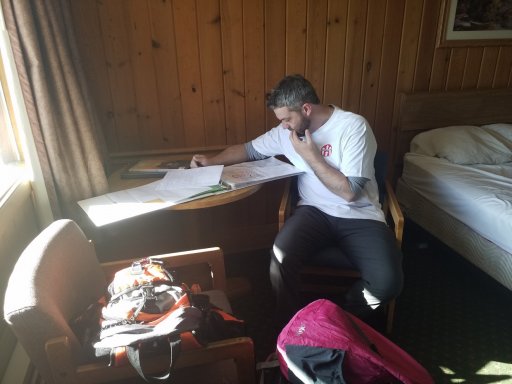
Going over the maps one last time.
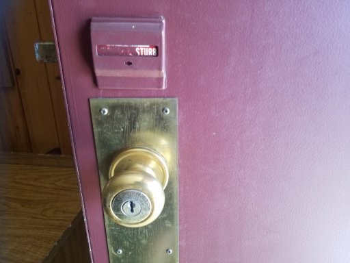
The options on our room were "do not disturb" and "sturb" so... yeah.
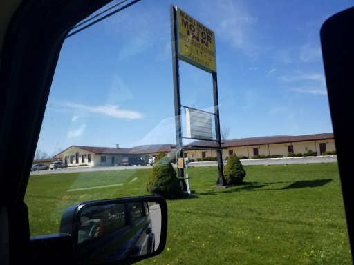
We were pretty much the only people at the Marlinton Inn, there was I think two other cars in various places around the motel.
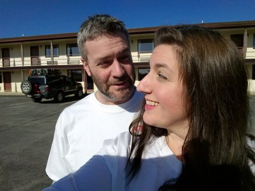
Ready to go? Are YOU ready to go?
The Virginia section of the TAT starts right in front of the Marlinton Inn which makes it a great place to stay to start your trip.
The first 17 miles of the trail are all paved and wind through Marlinton and then follow the river till you hit a forest road where the dirt starts. We pulled over, took a few pics, aired down and set off on the trail. This section of trail is not particularly difficult, but very pretty, and we kept slowing down just to look off in the distance at the mountains.
This is what most of this section of the trail looked like.
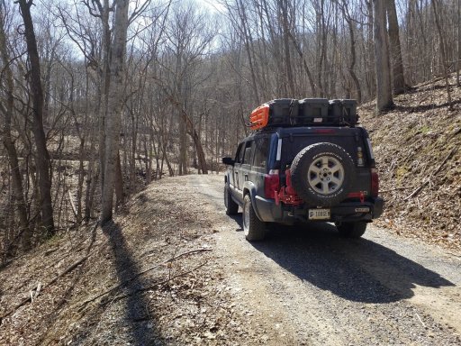
There were several signs for controlled burns when we went through and we could see and most definitely smell some of them in the distance. The further we got up the trail we started to see evidence of the burn areas where some of the forest floor was freshly burned and still black and covered in soot. Continuing our climb up the mountains there were lots of blind switchbacks that were a little sketchy as we had just seen a truck coming out of the trail the oncoming way and there was nowhere to pull over if there was someone coming the other way. The trail soon switched back to paved roads for a quick drive through some beautiful farm fields and rolling hills. Hopping back on the dirt sections this part was a little more interesting as there were some sharp pointy tire popping rocks to avoid, more switch backs, lots of ups and downs, several small waterfalls, and two small water crossings. We actually stopped to take some pictures at one point and since we hadn’t seen anyone on the trails all morning I didn’t even pull over, so I was stopped in the middle of the trail. We hadn’t been out of the jeep long and I looked up and saw another Jeep (a TJ I think) coming from the opposite direction and I was blocking the road. I ran back and tried to move over enough for them to get by and as they passed were pretty sure the two guys in the jeep were wearing Overlandbound shirts so, if you guys see this, hi!
Lots of streams and small little water falls like this are along the trail. Just pretty to stop and take a look at.
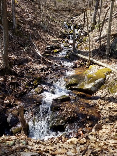 We continued down the trail and popped out on a few short sections of pavement before hitting another dirt section. This was a road that was being heavily used by logging and there were lots of big logging vehicles all parked alongside the road. About halfway through this section it intersected several paved roads and in one case on a particularly easy gravel section, we actually got cut off by a Honda Odyssey minivan that pulled around us when we stopped to check the GPS. Yeah… a minivan. This should also give you an idea of how difficult the section of trail through here was. Not smooth by any means as we watched this poor thing repeatedly bounce and bottom out going through dips and bumps, the whole time thinking… why? Honestly, I think maybe these poor guys were lost. We wound up following these guys for a little over 30 minutes and this is where we discovered we had a problem. About 10 minutes into following the van the Jeep starts to get hot. Not overheating yet but well above the 50% mark on the dial. At first, I thought it was just because we were having to drive so slow following this minivan, and all the dust it was kicking up that maybe we just weren’t getting enough air through the radiator. Then I started to smell coolant and I knew we had a big problem. We continued, knowing we were coming to our camp spot for the night and I’d look at it then. As we are coming up to our planned campsite suddenly this van turns in and takes the last spot. So, I guess maybe they weren’t lost? Either way, this was the last spot to camp on this mountain. We knew we’d have to continue towards Covington and find an alternate campsite. As we drove on the overheating got worse. We still had about a 30 some minute drive just to get down off the mountain then another 15-20 minutes to the town so I was getting worried. We made it to Covington and stopped at a gas station and I noticed there was a stead stream of coolant spraying out of the front of the radiator…. The center tooth on the grill was missing and there was a dent right in one of the veins of the radiator and that’s where it was spraying coolant….
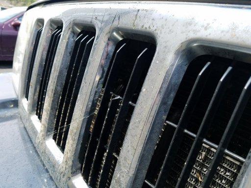
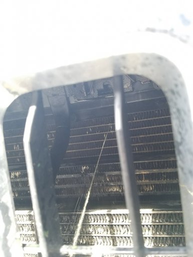
This was not a good feeling. We made it to our campsite for the night and I tried to figure out what to do with the Jeep… We wound up camping at a fairly crowded but nice campground as it was getting late and we were running out of options. We slept well but I knew tomorrow was going to be a rough day dealing with the radiator.
We started our day out with a fantastic breakfast at the restaurant at the Marlinton Inn, did some final checks of the maps and GPS and then went next door to the Marathon station for a final fill up of the tank and the gas cans.
Going over the maps one last time.

The options on our room were "do not disturb" and "sturb" so... yeah.

We were pretty much the only people at the Marlinton Inn, there was I think two other cars in various places around the motel.
Ready to go? Are YOU ready to go?

The Virginia section of the TAT starts right in front of the Marlinton Inn which makes it a great place to stay to start your trip.

The first 17 miles of the trail are all paved and wind through Marlinton and then follow the river till you hit a forest road where the dirt starts. We pulled over, took a few pics, aired down and set off on the trail. This section of trail is not particularly difficult, but very pretty, and we kept slowing down just to look off in the distance at the mountains.
This is what most of this section of the trail looked like.

There were several signs for controlled burns when we went through and we could see and most definitely smell some of them in the distance. The further we got up the trail we started to see evidence of the burn areas where some of the forest floor was freshly burned and still black and covered in soot. Continuing our climb up the mountains there were lots of blind switchbacks that were a little sketchy as we had just seen a truck coming out of the trail the oncoming way and there was nowhere to pull over if there was someone coming the other way. The trail soon switched back to paved roads for a quick drive through some beautiful farm fields and rolling hills. Hopping back on the dirt sections this part was a little more interesting as there were some sharp pointy tire popping rocks to avoid, more switch backs, lots of ups and downs, several small waterfalls, and two small water crossings. We actually stopped to take some pictures at one point and since we hadn’t seen anyone on the trails all morning I didn’t even pull over, so I was stopped in the middle of the trail. We hadn’t been out of the jeep long and I looked up and saw another Jeep (a TJ I think) coming from the opposite direction and I was blocking the road. I ran back and tried to move over enough for them to get by and as they passed were pretty sure the two guys in the jeep were wearing Overlandbound shirts so, if you guys see this, hi!
Lots of streams and small little water falls like this are along the trail. Just pretty to stop and take a look at.
 We continued down the trail and popped out on a few short sections of pavement before hitting another dirt section. This was a road that was being heavily used by logging and there were lots of big logging vehicles all parked alongside the road. About halfway through this section it intersected several paved roads and in one case on a particularly easy gravel section, we actually got cut off by a Honda Odyssey minivan that pulled around us when we stopped to check the GPS. Yeah… a minivan. This should also give you an idea of how difficult the section of trail through here was. Not smooth by any means as we watched this poor thing repeatedly bounce and bottom out going through dips and bumps, the whole time thinking… why? Honestly, I think maybe these poor guys were lost. We wound up following these guys for a little over 30 minutes and this is where we discovered we had a problem. About 10 minutes into following the van the Jeep starts to get hot. Not overheating yet but well above the 50% mark on the dial. At first, I thought it was just because we were having to drive so slow following this minivan, and all the dust it was kicking up that maybe we just weren’t getting enough air through the radiator. Then I started to smell coolant and I knew we had a big problem. We continued, knowing we were coming to our camp spot for the night and I’d look at it then. As we are coming up to our planned campsite suddenly this van turns in and takes the last spot. So, I guess maybe they weren’t lost? Either way, this was the last spot to camp on this mountain. We knew we’d have to continue towards Covington and find an alternate campsite. As we drove on the overheating got worse. We still had about a 30 some minute drive just to get down off the mountain then another 15-20 minutes to the town so I was getting worried. We made it to Covington and stopped at a gas station and I noticed there was a stead stream of coolant spraying out of the front of the radiator…. The center tooth on the grill was missing and there was a dent right in one of the veins of the radiator and that’s where it was spraying coolant….

This was not a good feeling. We made it to our campsite for the night and I tried to figure out what to do with the Jeep… We wound up camping at a fairly crowded but nice campground as it was getting late and we were running out of options. We slept well but I knew tomorrow was going to be a rough day dealing with the radiator.

