The OFFICIAL Trans NJ Trail Thread

  • HTML tutorial

Cooter545

Rank II
Member

Contributor II

327
Hanover, PA, USA
First Name
David
Last Name
Johnson
Member #

26930

Service Branch
US Navy Veteran
Thank you for creating this file. Can anyone tell me how in open the GPX file in the LeadNav app?
I am planning to do the trail Labor Day weekend, 4 days available. I do not see a way to download your map. Would you be able to send it to my email address? projectsurvive545@gmail.com. I would appreciate it. I confess I am not a computer wizard.
 

MuckSavage

Rank V
Launch Member

Member III

2,268
South Jersey, NJ, USA
First Name
Tim
Last Name
McG
Member #

15570

@bradwesley I'm sorry I might be late in my response but there was another fire in the Batsto area. I think Bulltown Rd was closed for a while as was Buttonwood Hill camp. NJFFS reported the fire 100% contained yesterday.
 
  • Like
Reactions: Dusther210

pa10spro

Rank II
Launch Member

Enthusiast I

404
PA
First Name
Mark
Last Name
Townsend
Member #

21073

Running this route starting Monday July 18- 21 with two trucks.....msg me if your heading out or interested in joining us
 
  • Like
Reactions: Dusther210

Cooter545

Rank II
Member

Contributor II

327
Hanover, PA, USA
First Name
David
Last Name
Johnson
Member #

26930

Service Branch
US Navy Veteran
@Cooter545 The file is in the first post of the first page of this thread. You can unzip it & download it from there. I think the file is too large to email.
The file is to large for my lap top. I will have to figure out the trail on my own. I am not even sure where to start. Thanks anyway.
 

Canyonz

Rank I

Contributor III

154
Sparta, Sussex County, New Jersey, United States
First Name
Norman
Last Name
Bruffy
Hey guys, and gals, I decided to create an “official” Trans New Jersey Trail thread. This is where you can find the “official” route and any route info you need to know. Also, this thread will be good for those to post info about the route; like road closures, detours, dangers, trees down, and anything else that may restrict access to the trail.

If anyone wants a copy of the route, it is FREE and available at the bottom of this post. I will accept donations if you feel inclined to donate to the beer fund. The donations can be sent to xplorr313@gmail.com. The donations are not required though!

Previously I charged for the route due to keeping the route out of the hands of those who were only looking to “off-road” or “wheel” illegally on state land. I received a lot of backlash from the off-roading / Overlanding community for charging for the route. I put over 2 years of my life into making this route, please stay on the path and DO NOT “off-road” or “wheel” off of the path. This could cause closures and could also land you in major trouble with the state, for example: a hefty fine or even vehicle impoundment. I’ve seen and heard about it happening. Do not think it won’t happen to you. The state does have trail cameras along some of the more “prone to off-roading” spots. You will get caught.

The route is current and up to date as of 1-16-2020. The most recent revision of the route was done on 1-16-2020. If you have any version older than 1-16-2020 please reach out to me for an updated version. I will keep this post updated with the most recent version of the route.

I HIGHLY RECOMMEND THE LEADNAV APP FOR THE BEST EXPERIENCE. LeadNav is only for iPhones and iPads. The route can be used on other devices, but the route was made with and for LeadNav.

For those of you who are just learning about the Trans New Jersey Trail, the trail is a 450+ mile route that spans from High Point, NJ to Cape May, NJ. The trail consist of asphalt, gravel, sand, dirt, and some mud. The trail is 100% legal for all street legal vehicles. This means you must be registered, insured, and compliant with all DOT regulations (headlights, taillights, seat belts, turn signals, and so on).

The TNJT can be completed in a Subaru as long as the driver is experienced. There is NOTHING complicated on this route. There ARE bypasses for those who do not have a snorkel or the ability to traverse deep mud holes. The bypasses are clearly marked as separate routes. The Zillon Bypass is recommended for those who do not wish to traverse down an extremely tight trail and do not want to risk the couple extremely sloppy mud holes along that part of the TNJT. The Zillon Bypass is 100% asphalt that bypasses the tight trail and sloppy mud holes.

The whole route CAN be done in 3 days. I completed the route in 4 days when I ran it start to end non stop in 2017. My 4th day on the trail only consisted of 50 miles and I could have just finished it on day 3.

The trail has 3 sections North, Central, and South. I consider the North section to go from High Point, NJ to Round Valley Reservoir (Spruce Run Recreation Area [campground]). The Central section to go from Round Valley Reservoir to Brendan T. Byrne State Forest (camping is available in Brendan T. Byrne State Forest). The South section to go from Brendan T. Byrne State Forest to Cape May, NJ. If you feel inclined to turn it into a 4 day trip, I recommend stopping at Belleplain State Forest for an overnight stay.

I do plan to offer 4 versions of the TNJT. A full length version, which is what I have been passing out to everyone, and the three sections. This will allow daytrippers to do the route one section at a time. I will post when the 4 versions are available. Right now just the whole route is available.

Anyone have any questions, please reach out to me by email or ask here!
 

MuckSavage

Rank V
Launch Member

Member III

2,268
South Jersey, NJ, USA
First Name
Tim
Last Name
McG
Member #

15570

Seems that OK4WD in Stewartsville, NJ is having an event on Oct 22, 2022. They're not far from the Spruce Run area. If anyone is thinking about traveling parts of the TNJT, this could be a two-fer.....ride the trail & hang out at OK4WD! I may drive up, camp at Spruce run, break camp Sat morning then shoot over to OK4WD, hang out for awhile then travel part of TNJT back south. Here's some info;

"Well folks the summer is over, the temps are dropping, and it's time to get together for another Trucks and Coffee. We'll be hosting our third Trucks and Coffee at our shop on Saturday, October 22, from 9am to 12. Free coffee supplied by @thestonebean is being served by the Franklin Township Volunteer Fire Department.
.
We'll be having our Door Prize raffle at the end of the event, each driver will receive one raffle ticket when they enter the show. More tickets will be available at the coffee stand. All donations go towards the Franklin Township Fire Department and Warren County Habitat for Humanity. The prizes are still rolling in! So far on the list we have AEV, NORA Off-road School, TreadLightly, ARB, and Extang Bed Covers. We'll keep you posted as more are being added!
.
All vehicles are welcome! Pets definitely, hot rods, bikes, bring them all! Free entry, no registration required. "
 

tarbal255

Rank I

Contributor III

184
New Jersey, USA
First Name
Daniel
Last Name
Tseng
Ham/GMRS Callsign
Ham
Seems that OK4WD in Stewartsville, NJ is having an event on Oct 22, 2022. They're not far from the Spruce Run area. If anyone is thinking about traveling parts of the TNJT, this could be a two-fer.....ride the trail & hang out at OK4WD! I may drive up, camp at Spruce run, break camp Sat morning then shoot over to OK4WD, hang out for awhile then travel part of TNJT back south. Here's some info;

"Well folks the summer is over, the temps are dropping, and it's time to get together for another Trucks and Coffee. We'll be hosting our third Trucks and Coffee at our shop on Saturday, October 22, from 9am to 12. Free coffee supplied by @thestonebean is being served by the Franklin Township Volunteer Fire Department.
.
We'll be having our Door Prize raffle at the end of the event, each driver will receive one raffle ticket when they enter the show. More tickets will be available at the coffee stand. All donations go towards the Franklin Township Fire Department and Warren County Habitat for Humanity. The prizes are still rolling in! So far on the list we have AEV, NORA Off-road School, TreadLightly, ARB, and Extang Bed Covers. We'll keep you posted as more are being added!
.
All vehicles are welcome! Pets definitely, hot rods, bikes, bring them all! Free entry, no registration required. "
Are there any trails or fire roads to go on in the area?
 

S4NM4N

Rank IV
Member

Enthusiast II

979
New Jersey
First Name
J
Last Name
S
Member #

29011

Seems that OK4WD in Stewartsville, NJ is having an event on Oct 22, 2022. They're not far from the Spruce Run area. If anyone is thinking about traveling parts of the TNJT, this could be a two-fer.....ride the trail & hang out at OK4WD! I may drive up, camp at Spruce run, break camp Sat morning then shoot over to OK4WD, hang out for awhile then travel part of TNJT back south. Here's some info;

"Well folks the summer is over, the temps are dropping, and it's time to get together for another Trucks and Coffee. We'll be hosting our third Trucks and Coffee at our shop on Saturday, October 22, from 9am to 12. Free coffee supplied by @thestonebean is being served by the Franklin Township Volunteer Fire Department.
.
We'll be having our Door Prize raffle at the end of the event, each driver will receive one raffle ticket when they enter the show. More tickets will be available at the coffee stand. All donations go towards the Franklin Township Fire Department and Warren County Habitat for Humanity. The prizes are still rolling in! So far on the list we have AEV, NORA Off-road School, TreadLightly, ARB, and Extang Bed Covers. We'll keep you posted as more are being added!
.
All vehicles are welcome! Pets definitely, hot rods, bikes, bring them all! Free entry, no registration required. "
Thanks for the heads up. This place is 15mins from me and I had no idea. We just moved up here just under a year ago and still don't know all this area has to offer. I'll def make the trip over.
 
  • Like
Reactions: MuckSavage

MuckSavage

Rank V
Launch Member

Member III

2,268
South Jersey, NJ, USA
First Name
Tim
Last Name
McG
Member #

15570

Thanks for the heads up. This place is 15mins from me and I had no idea. We just moved up here just under a year ago and still don't know all this area has to offer. I'll def make the trip over.
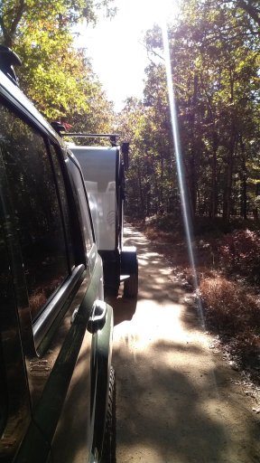
Cool, perhaps I'll see you. Green Commander, possibly towing a Flyer Explore trailer.
 

Canyonz

Rank I

Contributor III

154
Sparta, Sussex County, New Jersey, United States
First Name
Norman
Last Name
Bruffy
Hey guys, and gals, I decided to create an “official” Trans New Jersey Trail thread. This is where you can find the “official” route and any route info you need to know. Also, this thread will be good for those to post info about the route; like road closures, detours, dangers, trees down, and anything else that may restrict access to the trail.

If anyone wants a copy of the route, it is FREE and available at the bottom of this post. I will accept donations if you feel inclined to donate to the beer fund. The donations can be sent to xplorr313@gmail.com. The donations are not required though!

Previously I charged for the route due to keeping the route out of the hands of those who were only looking to “off-road” or “wheel” illegally on state land. I received a lot of backlash from the off-roading / Overlanding community for charging for the route. I put over 2 years of my life into making this route, please stay on the path and DO NOT “off-road” or “wheel” off of the path. This could cause closures and could also land you in major trouble with the state, for example: a hefty fine or even vehicle impoundment. I’ve seen and heard about it happening. Do not think it won’t happen to you. The state does have trail cameras along some of the more “prone to off-roading” spots. You will get caught.

The route is current and up to date as of 1-16-2020. The most recent revision of the route was done on 1-16-2020. If you have any version older than 1-16-2020 please reach out to me for an updated version. I will keep this post updated with the most recent version of the route.

I HIGHLY RECOMMEND THE LEADNAV APP FOR THE BEST EXPERIENCE. LeadNav is only for iPhones and iPads. The route can be used on other devices, but the route was made with and for LeadNav.

For those of you who are just learning about the Trans New Jersey Trail, the trail is a 450+ mile route that spans from High Point, NJ to Cape May, NJ. The trail consist of asphalt, gravel, sand, dirt, and some mud. The trail is 100% legal for all street legal vehicles. This means you must be registered, insured, and compliant with all DOT regulations (headlights, taillights, seat belts, turn signals, and so on).

The TNJT can be completed in a Subaru as long as the driver is experienced. There is NOTHING complicated on this route. There ARE bypasses for those who do not have a snorkel or the ability to traverse deep mud holes. The bypasses are clearly marked as separate routes. The Zillon Bypass is recommended for those who do not wish to traverse down an extremely tight trail and do not want to risk the couple extremely sloppy mud holes along that part of the TNJT. The Zillon Bypass is 100% asphalt that bypasses the tight trail and sloppy mud holes.

The whole route CAN be done in 3 days. I completed the route in 4 days when I ran it start to end non stop in 2017. My 4th day on the trail only consisted of 50 miles and I could have just finished it on day 3.

The trail has 3 sections North, Central, and South. I consider the North section to go from High Point, NJ to Round Valley Reservoir (Spruce Run Recreation Area [campground]). The Central section to go from Round Valley Reservoir to Brendan T. Byrne State Forest (camping is available in Brendan T. Byrne State Forest). The South section to go from Brendan T. Byrne State Forest to Cape May, NJ. If you feel inclined to turn it into a 4 day trip, I recommend stopping at Belleplain State Forest for an overnight stay.

I do plan to offer 4 versions of the TNJT. A full length version, which is what I have been passing out to everyone, and the three sections. This will allow daytrippers to do the route one section at a time. I will post when the 4 versions are available. Right now just the whole route is available.

Anyone have any questions, please reach out to me by email or ask here!
 

atc250r

Rank I

Contributor I

145
Orange County, NY
First Name
John
Last Name
Ried
Stumbled across this via Google after hearing about this trail on the Tacoma forum. Hard to believe I lived right off of it in the Flemington area for 20 years and never had a clue. Now I'm living in NY near the northern end of it and hope to do the northern 1/3 this spring as a day trip with my wife in our 2022 Tacoma SR5. Hoping to at least have some more aggressive tires on by then and maybe a 2" lift.