The OFFICIAL Trans NJ Trail Thread

  • HTML tutorial

MuckSavage

Rank V
Launch Member

Member III

2,268
South Jersey, NJ, USA
First Name
Tim
Last Name
McG
Member #

15570

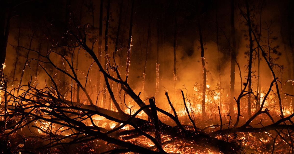
Prescribed Burning Advisory: The Batona Trail
The Batona Trail between Evans Bridge and Bulltown Road will be closed from March 1 through approximately March 7 due to prescribed burning. Please avoid this area during this time.
If you need assistance finding a different hike, please call the Batsto office at 609-561-0024.
 
  • Like
Reactions: Dusther210

MuckSavage

Rank V
Launch Member

Member III

2,268
South Jersey, NJ, USA
First Name
Tim
Last Name
McG
Member #

15570

This sounds like a great Trail, we live near Lewes, De, the other side of Delaware Bay. If we could get a hold your map file, we could add the ferry ride and run south to north. If you are willing, my family and I would love to check it out. Thanks
The file is the bottom of the 1st post of this thread. You can download it from there.
 
  • Like
Reactions: Dusther210

RoverDude109

Rank I

Contributor III

154
PA
First Name
Robert
Last Name
Palmer
So I'll be heading to Wharton next month, basing out of Atsion - our plan was to head a couple of hours north on the trail, and maybe a couple of hours south. Taking it pretty easy (looking for more of a nice trail ride vs getting bumper deep in water/mud). Any areas to be wary of?
 

jbrandvt

Rank 0

Contributor II

38
Vermont, USA
First Name
Jeff
Last Name
Brand
Planning to run in the same area (Northern 3rd), wondering the same thing. I also wonder what we can realistically cover in one day starting from the northern end of the trail. I was thinking that if we could get down to I-78/287 there are options for both campgrounds and hotels.

Does anyone have a favorite campground on the trail?
 
  • Like
Reactions: Dusther210

El Viking

Rank IV
Member

Enthusiast II

1,249
New York, NY, USA
First Name
Nathan
Last Name
Christopherson
Member #

30340

Ham/GMRS Callsign
NA2MC
Service Branch
Army
Hey guys, and gals, I decided to create an “official” Trans New Jersey Trail thread. This is where you can find the “official” route and any route info you need to know. Also, this thread will be good for those to post info about the route; like road closures, detours, dangers, trees down, and anything else that may restrict access to the trail.

If anyone wants a copy of the route, it is FREE and available at the bottom of this post. I will accept donations if you feel inclined to donate to the beer fund. The donations can be sent to xplorr313@gmail.com. The donations are not required though!

Previously I charged for the route due to keeping the route out of the hands of those who were only looking to “off-road” or “wheel” illegally on state land. I received a lot of backlash from the off-roading / Overlanding community for charging for the route. I put over 2 years of my life into making this route, please stay on the path and DO NOT “off-road” or “wheel” off of the path. This could cause closures and could also land you in major trouble with the state, for example: a hefty fine or even vehicle impoundment. I’ve seen and heard about it happening. Do not think it won’t happen to you. The state does have trail cameras along some of the more “prone to off-roading” spots. You will get caught.

The route is current and up to date as of 1-16-2020. The most recent revision of the route was done on 1-16-2020. If you have any version older than 1-16-2020 please reach out to me for an updated version. I will keep this post updated with the most recent version of the route.

I HIGHLY RECOMMEND THE LEADNAV APP FOR THE BEST EXPERIENCE. LeadNav is only for iPhones and iPads. The route can be used on other devices, but the route was made with and for LeadNav.

For those of you who are just learning about the Trans New Jersey Trail, the trail is a 450+ mile route that spans from High Point, NJ to Cape May, NJ. The trail consist of asphalt, gravel, sand, dirt, and some mud. The trail is 100% legal for all street legal vehicles. This means you must be registered, insured, and compliant with all DOT regulations (headlights, taillights, seat belts, turn signals, and so on).

The TNJT can be completed in a Subaru as long as the driver is experienced. There is NOTHING complicated on this route. There ARE bypasses for those who do not have a snorkel or the ability to traverse deep mud holes. The bypasses are clearly marked as separate routes. The Zillon Bypass is recommended for those who do not wish to traverse down an extremely tight trail and do not want to risk the couple extremely sloppy mud holes along that part of the TNJT. The Zillon Bypass is 100% asphalt that bypasses the tight trail and sloppy mud holes.

The whole route CAN be done in 3 days. I completed the route in 4 days when I ran it start to end non stop in 2017. My 4th day on the trail only consisted of 50 miles and I could have just finished it on day 3.

The trail has 3 sections North, Central, and South. I consider the North section to go from High Point, NJ to Round Valley Reservoir (Spruce Run Recreation Area [campground]). The Central section to go from Round Valley Reservoir to Brendan T. Byrne State Forest (camping is available in Brendan T. Byrne State Forest). The South section to go from Brendan T. Byrne State Forest to Cape May, NJ. If you feel inclined to turn it into a 4 day trip, I recommend stopping at Belleplain State Forest for an overnight stay.

I do plan to offer 4 versions of the TNJT. A full length version, which is what I have been passing out to everyone, and the three sections. This will allow daytrippers to do the route one section at a time. I will post when the 4 versions are available. Right now just the whole route is available.

Anyone have any questions, please reach out to me by email or ask here!
Thank you for creating this file. Can anyone tell me how in open the GPX file in the LeadNav app?
 

Contributor III

404
Gardiner, NY, USA
First Name
Richard
Last Name
Brody
Member #

31316

I just ran the TNJT The weekend of 4/1/22 , just two vehicles and the GPX file was dead on , only had one hiccup ( bridge work ) the question I have is on many of the trails we saw blue paint markers on the trails but the GPX route didn't always follow them , does anyone know who painted them and is there a map or file on them ?
 

MuckSavage

Rank V
Launch Member

Member III

2,268
South Jersey, NJ, USA
First Name
Tim
Last Name
McG
Member #

15570

@vagabonds overland Congratulations on completing the trail! The TNJT is not physically marked with any paint blazes. I've seen the blue blazes in the Pine Barrens but nowhere near any of the officially marked/published trails by the Forest Service. A little googling found a hint that there's possibly a new long trail in NJ marked in blue. (Similar to the Batona Trail, marked in pink)
Again, I congratulate you & your travel partners. Will you be posting any kind of trip report?
 
  • Like
Reactions: Dusther210

El Viking

Rank IV
Member

Enthusiast II

1,249
New York, NY, USA
First Name
Nathan
Last Name
Christopherson
Member #

30340

Ham/GMRS Callsign
NA2MC
Service Branch
Army
I ran the trail with Vagabonds, as mentioned we had a great time and completed the trip in 2.5 days.
Day 1 - beginning of the trail is mostly paved roads, very scenic and had no issues. There were two spots, Boat Road and I forget the name of the other where it was off-roading. I was pulling a Patriot X1 with a 2018 Rubicon JKU and had no issues on the technical portion, was able to complete the rock climb in two wheel drive.
There are a couple County Park roads that are still closed for the season, I don't expect they will open until mid to late April.
Once in the pine barrens region the route was in good condition. The deep water hazard is currently passable although I would not recommend with a stock vehicle as it is about three foot deep. The third water hazard, bottom is very soft mud and with the trailer I did get stuck. We easily pulled out with other vehicle. The right embankment of the third deep water hole is packed sand and if you stay to the right you should not have any issues.
All of the private campgrounds along the trial are not currently open for camping. State parks are open and you need to obtain a permit online at least 24 hrs prior to your intended stay.
Rich was taking notes and he will know which roads were closed along with which bridge was closed on the route.
 

MuckSavage

Rank V
Launch Member

Member III

2,268
South Jersey, NJ, USA
First Name
Tim
Last Name
McG
Member #

15570

@El Viking Great to hear & Thank you for sharing your experiences! you towed a trailer.....Nice!. I thought of dragging my Intech Flyer Explore along the route but it may be a lil too much. I often run/maintain the southern portion of the trail (Byrne S.F. to Cape May). I'm glad it's good after the winter.
 
Last edited:

El Viking

Rank IV
Member

Enthusiast II

1,249
New York, NY, USA
First Name
Nathan
Last Name
Christopherson
Member #

30340

Ham/GMRS Callsign
NA2MC
Service Branch
Army
@El Viking Great to hear & Thank you for sharing your experiences! you towed a trailer.....Nice!. I thought of dragging my Intech Flyer Explore along the route but it ma be a lil too much. I often run/maintain the southern portion of the trail (Byrne S.F. to Came May). I'm glad it's good after the winter.
I will have to look into the Batona Trail, saw the pink markings along the route.
 

RobDiablo44

Rank 0

Contributor I

68
Somerset/Hunterdon County NJ
First Name
Rob
Last Name
Tillisch
I just discovered this forum and this specific trail this week. I downloaded the map and the LeadNav app to my phone and drove my stock Dodge Ram to the nearest entry spot to me last night, just 3 miles South off of Rt 202 in Flemington. Took a two hour drive from Flemington to Stockton on roads I'd never been on before. About a third of it was gravel roads, covered bridge at one spot. I finally quit at dusk and got on rt 29 in Stockton, and I was just 30 minutes from home. From reading the thread, it sounds like the very small section I was on is fairly tranquil and easygoing by the standards of this trail.

I really can't thank you enough for creating this and for the updates. I'm planning to explore more of it this year. I read this whole thread and I wanted to see if this assumption is correct: Do the bypasses avoid pretty much all of the more challenging off-road portions? I don't really go in for any technical 4 wheel stuff, and I'd probably avoid anything beyond a bumpy backroad/trail and some splashes in puddles. It sounds like from High Point to Six Flags would be about my speed using the bypasses, but not sure about the portion from Six Flags to Cape May. Any other "bunny slope" guidance is appreciated.
 

MuckSavage

Rank V
Launch Member

Member III

2,268
South Jersey, NJ, USA
First Name
Tim
Last Name
McG
Member #

15570

@RobDiablo44 The by-passes are for your & your vehicles safety/well-being. They are of course seasonal. For instance, where the "Mt Misery Water Crossing" bypasses. I've saw the water levels in May approximately 3'+ deep. I've traversed it in September, I've driven thru it and the water was approximately 15" deep. In my opinion, taking a bypass doesn't take away from the spirit of the route. When @Xplorr313 laid out the route & realized the need for bypasses, he laid them out to be a nice ride, not just "get back to the trail asap"
 

Tacoverland OCMD

Rank III

Contributor III

699
Berlin, MD, USA
First Name
Jarrett
Last Name
Humphress
Member #

30230

Going to be doing this trail at the end of June. Lots of great info regarding the roads and trails, however not much info on the camping, Anyone who's familiar with the area and/or done the route, could you possibly give some more insight into the camping aspect of the trail? Going to be bringing my DIY overland trailer pulled behing my tacoma! Looking forward to the trail!
 
  • Like
Reactions: Carnage_95YJ

JMY217

Rank I

Contributor II

124
Bergen County, NJ, USA
First Name
Joe
Last Name
Yannotti
I ran a bit of the northern part of the trail this past weekend. Buttermilk Falls was open up until the falls, but then beyond that it was blocked with concrete barriers.

We turned back and headed for the bypass which was closed to local traffic only. We rolled the dice and took it, but the road is completely closed about 3/4 of the way down. It looks like it has possibly been washed out or is actively under construction.

It was easy to double back with the map and find a way beyond, but Im curious as to why the second half of buttermilk falls was closed. It seems that if it was seasonal, the whole trail would have been closed.
 

Tacoverland OCMD

Rank III

Contributor III

699
Berlin, MD, USA
First Name
Jarrett
Last Name
Humphress
Member #

30230

I ran a bit of the northern part of the trail this past weekend. Buttermilk Falls was open up until the falls, but then beyond that it was blocked with concrete barriers.

We turned back and headed for the bypass which was closed to local traffic only. We rolled the dice and took it, but the road is completely closed about 3/4 of the way down. It looks like it has possibly been washed out or is actively under construction.

It was easy to double back with the map and find a way beyond, but Im curious as to why the second half of buttermilk falls was closed. It seems that if it was seasonal, the whole trail would have been closed.
thanks for the info i’ll keep that in mind, what’s your recommendations on camping along the trail? reserve ahead of time or just show up or what?
 

El Viking

Rank IV
Member

Enthusiast II

1,249
New York, NY, USA
First Name
Nathan
Last Name
Christopherson
Member #

30340

Ham/GMRS Callsign
NA2MC
Service Branch
Army
I ran the trail a few months ago and camping was an issue, majority of the campgrounds were not open and the state parks require reserving at least 24 hours in advance. We did not find any camp sites that were available as first come first serve. I would think majority of the private campgrounds are now open. I would highly recommend making reservations ahead of time.
 
  • Like
Reactions: Tacoverland OCMD

bradwesley

Rank I

Enthusiast I

231
Audubon, NJ, USA
First Name
Chris
Last Name
Braddock
Forrest fire in Wharton.
Was hoping to enter around Batsto Village tomorrow then I remembered about this.

I haven’t been that way since the fires. Would it still be okay to get on around there?