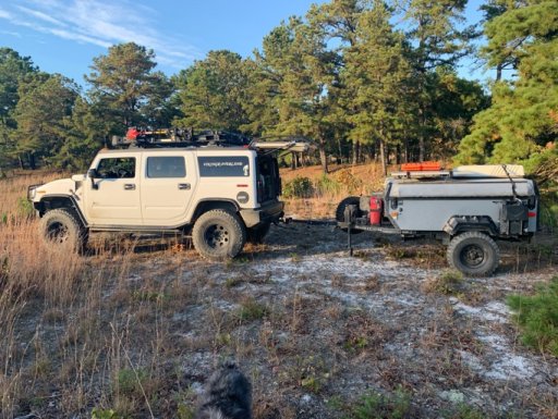
The OFFICIAL Trans NJ Trail Thread

  • HTML tutorial

Fuzion Traveler

Rank II
Launch Member

Contributor III

327
Yorktown, Virginia
First Name
Bill
Last Name
Duguay
Member #

18810

Hey guys, and gals, I decided to create an “official” Trans New Jersey Trail thread. This is where you can find the “official” route and any route info you need to know. Also, this thread will be good for those to post info about the route; like road closures, detours, dangers, trees down, and anything else that may restrict access to the trail.

If anyone wants a copy of the route, it is FREE and available at the bottom of this post. I will accept donations if you feel inclined to donate to the beer fund. The donations can be sent to xplorr313@gmail.com. The donations are not required though!

Previously I charged for the route due to keeping the route out of the hands of those who were only looking to “off-road” or “wheel” illegally on state land. I received a lot of backlash from the off-roading / Overlanding community for charging for the route. I put over 2 years of my life into making this route, please stay on the path and DO NOT “off-road” or “wheel” off of the path. This could cause closures and could also land you in major trouble with the state, for example: a hefty fine or even vehicle impoundment. I’ve seen and heard about it happening. Do not think it won’t happen to you. The state does have trail cameras along some of the more “prone to off-roading” spots. You will get caught.

The route is current and up to date as of 1-16-2020. The most recent revision of the route was done on 1-16-2020. If you have any version older than 1-16-2020 please reach out to me for an updated version. I will keep this post updated with the most recent version of the route.

I HIGHLY RECOMMEND THE LEADNAV APP FOR THE BEST EXPERIENCE. LeadNav is only for iPhones and iPads. The route can be used on other devices, but the route was made with and for LeadNav.

For those of you who are just learning about the Trans New Jersey Trail, the trail is a 450+ mile route that spans from High Point, NJ to Cape May, NJ. The trail consist of asphalt, gravel, sand, dirt, and some mud. The trail is 100% legal for all street legal vehicles. This means you must be registered, insured, and compliant with all DOT regulations (headlights, taillights, seat belts, turn signals, and so on).

The TNJT can be completed in a Subaru as long as the driver is experienced. There is NOTHING complicated on this route. There ARE bypasses for those who do not have a snorkel or the ability to traverse deep mud holes. The bypasses are clearly marked as separate routes. The Zillon Bypass is recommended for those who do not wish to traverse down an extremely tight trail and do not want to risk the couple extremely sloppy mud holes along that part of the TNJT. The Zillon Bypass is 100% asphalt that bypasses the tight trail and sloppy mud holes.

The whole route CAN be done in 3 days. I completed the route in 4 days when I ran it start to end non stop in 2017. My 4th day on the trail only consisted of 50 miles and I could have just finished it on day 3.

The trail has 3 sections North, Central, and South. I consider the North section to go from High Point, NJ to Round Valley Reservoir (Spruce Run Recreation Area [campground]). The Central section to go from Round Valley Reservoir to Brendan T. Byrne State Forest (camping is available in Brendan T. Byrne State Forest). The South section to go from Brendan T. Byrne State Forest to Cape May, NJ. If you feel inclined to turn it into a 4 day trip, I recommend stopping at Belleplain State Forest for an overnight stay.

I do plan to offer 4 versions of the TNJT. A full length version, which is what I have been passing out to everyone, and the three sections. This will allow daytrippers to do the route one section at a time. I will post when the 4 versions are available. Right now just the whole route is available.

Anyone have any questions, please reach out to me by email or ask here!
 

Boucher

Rank V
Member

Member II

2,011
Maidens, VA, USA
First Name
John
Last Name
Boucher
Member #

14789

Service Branch
Retired USN
Looking for recommendation for the area for a few days of over-landing, I'm on an off road two week trip from Va to Maine however I need to be near cape may by next sat morning and I'm looking for the best area for a few days of off road fun.
 
Last edited:

Motor Mike

Rank 0

Contributor I

60
Westchester, NY, USA
First Name
Michael
Last Name
Michaud
Hey guys, and gals, I decided to create an “official” Trans New Jersey Trail thread. This is where you can find the “official” route and any route info you need to know. Also, this thread will be good for those to post info about the route; like road closures, detours, dangers, trees down, and anything else that may restrict access to the trail.

If anyone wants a copy of the route, it is FREE and available at the bottom of this post. I will accept donations if you feel inclined to donate to the beer fund. The donations can be sent to xplorr313@gmail.com. The donations are not required though!

Previously I charged for the route due to keeping the route out of the hands of those who were only looking to “off-road” or “wheel” illegally on state land. I received a lot of backlash from the off-roading / Overlanding community for charging for the route. I put over 2 years of my life into making this route, please stay on the path and DO NOT “off-road” or “wheel” off of the path. This could cause closures and could also land you in major trouble with the state, for example: a hefty fine or even vehicle impoundment. I’ve seen and heard about it happening. Do not think it won’t happen to you. The state does have trail cameras along some of the more “prone to off-roading” spots. You will get caught.

The route is current and up to date as of 1-16-2020. The most recent revision of the route was done on 1-16-2020. If you have any version older than 1-16-2020 please reach out to me for an updated version. I will keep this post updated with the most recent version of the route.

I HIGHLY RECOMMEND THE LEADNAV APP FOR THE BEST EXPERIENCE. LeadNav is only for iPhones and iPads. The route can be used on other devices, but the route was made with and for LeadNav.

For those of you who are just learning about the Trans New Jersey Trail, the trail is a 450+ mile route that spans from High Point, NJ to Cape May, NJ. The trail consist of asphalt, gravel, sand, dirt, and some mud. The trail is 100% legal for all street legal vehicles. This means you must be registered, insured, and compliant with all DOT regulations (headlights, taillights, seat belts, turn signals, and so on).

The TNJT can be completed in a Subaru as long as the driver is experienced. There is NOTHING complicated on this route. There ARE bypasses for those who do not have a snorkel or the ability to traverse deep mud holes. The bypasses are clearly marked as separate routes. The Zillon Bypass is recommended for those who do not wish to traverse down an extremely tight trail and do not want to risk the couple extremely sloppy mud holes along that part of the TNJT. The Zillon Bypass is 100% asphalt that bypasses the tight trail and sloppy mud holes.

The whole route CAN be done in 3 days. I completed the route in 4 days when I ran it start to end non stop in 2017. My 4th day on the trail only consisted of 50 miles and I could have just finished it on day 3.

The trail has 3 sections North, Central, and South. I consider the North section to go from High Point, NJ to Round Valley Reservoir (Spruce Run Recreation Area [campground]). The Central section to go from Round Valley Reservoir to Brendan T. Byrne State Forest (camping is available in Brendan T. Byrne State Forest). The South section to go from Brendan T. Byrne State Forest to Cape May, NJ. If you feel inclined to turn it into a 4 day trip, I recommend stopping at Belleplain State Forest for an overnight stay.

I do plan to offer 4 versions of the TNJT. A full length version, which is what I have been passing out to everyone, and the three sections. This will allow daytrippers to do the route one section at a time. I will post when the 4 versions are available. Right now just the whole route is available.

Anyone have any questions, please reach out to me by email or ask here!
Trying to load file into Garmin Basecamp and getting undefined error, anyone have success with Garmin import?
 

dlsilver

Rank II
Member

Enthusiast I

404
Ewing, Mercer County, New Jersey, United States
First Name
Dina
Last Name
SilbernagelKrohne
Member #

40413

TNJT GPX converted from route to track: Route Converter on AllTrails
I was having trouble importing the original file into Basecamp too but this worked. Thank you. I'm new to working with GPX files and have a Garmin 66ST - why did converting the file with Alltrails matter if the file was GPX pre and post-conversion. Thanks again.
 

MuckSavage

Rank V
Launch Member

Member III

2,268
South Jersey, NJ, USA
First Name
Tim
Last Name
McG
Member #

15570

"Official" only for this thread. Prior to Xplorer313 making his version available on this thread in post #1, there were many mentions of TNJT in multiple threads. Here is where we tried to gather all TNJT discussion.
 
  • Like
Reactions: Dusther210

Boucher

Rank V
Member

Member II

2,011
Maidens, VA, USA
First Name
John
Last Name
Boucher
Member #

14789

Service Branch
Retired USN
I finished my two-week trek from VA to Maine and Down through NJ. I'm not the most camera enthusiastic guy to speak on video however I made a video with music of parts of the southern portion of the Trans NJ Trail from around Tom rivers down to cape May

Southern Portion Trans NJ Trail
 

Derkram19

Rank 0

Contributor I

68
Bridgewater, NJ, USA
First Name
Derrick
Last Name
Pelech
Well, the water crossings are hood deep at times. It’s best to take them slow and do not splash into them. Here’s a photo of the Mt Misery Water Crossing. You will be going the opposite direction than the direction these guys were going.

As for the sloppy mud, there are a few sections where you can sink a vehicle on 37s there. But luckily those sections have go arounds.

The Zillon Bypass will by pass a section of deep sloppy mud that has no go arounds. You are forced to go through those holes. One of them being a deep hole where I almost got my 4Runner on 33s stuck (bottomed out) and the other being where I got my FJ Cruiser on 34s stuck down to the doors. The spot where I got the FJ stuck, I highly recommend to go to the right and DO NOT go through the center hole unless you have a winch. Maxtrax and treds will not help you in this situation. If you go to the right, it is sloppy mud but it is not deep. Only issue with going to the right is that it’s VERY tight. You have to wiggle your Way between the trees. If I can squeeze a 5th gen 4Runner through there then anyone should be fine as long as they’re not a 4 door long wheel base truck lol.View attachment 68661
intersting anyone going out running these trails any time soon?
 

njhiker43

Rank I

Enthusiast I

231
New Jersey, USA
First Name
Kevin
Last Name
Duffy
I agree with Marvaz, this section of the trail was more technical and required 4 wheel drive with high clearance but doable. My wife and I did the northern section (High Point to Clinton) yesterday. Had a great time and very scenic trail. Had one issue on the road to Buttermilk Falls ( 41° 8'12.41"N, 74°53'20.61"W), the road was blocked with a pipe. There was no signs stating that you couldn't drive down the road, so we moved the pipe out of the way and continued on our way. Got a lot of dirty looks from people, one old woman verbally expressed her distain for us for driving down her road. Drove until we encountered another pipe across the road, again we moved the pipe and continued until we could see the paved road where we encountered the last pipe across the road...this one had a lock on it! So we got to do the ride of shame all the way back for the detour around. Other than that the northern section was pretty much passible.
agree with this section but when I did this over the summer my stock JL handed it fine in 4H and a good line without any issue. Really the only portion on the north half with any need for 4wd.
 

stebbc1138

Rank III

Contributor III

797
Royal Oak, Maryland, United States
First Name
Colin
Last Name
Stebbins
Member #

28911

Hey guys, and gals, I decided to create an “official” Trans New Jersey Trail thread. This is where you can find the “official” route and any route info you need to know. Also, this thread will be good for those to post info about the route; like road closures, detours, dangers, trees down, and anything else that may restrict access to the trail.

If anyone wants a copy of the route, it is FREE and available at the bottom of this post. I will accept donations if you feel inclined to donate to the beer fund. The donations can be sent to xplorr313@gmail.com. The donations are not required though!

Previously I charged for the route due to keeping the route out of the hands of those who were only looking to “off-road” or “wheel” illegally on state land. I received a lot of backlash from the off-roading / Overlanding community for charging for the route. I put over 2 years of my life into making this route, please stay on the path and DO NOT “off-road” or “wheel” off of the path. This could cause closures and could also land you in major trouble with the state, for example: a hefty fine or even vehicle impoundment. I’ve seen and heard about it happening. Do not think it won’t happen to you. The state does have trail cameras along some of the more “prone to off-roading” spots. You will get caught.

The route is current and up to date as of 1-16-2020. The most recent revision of the route was done on 1-16-2020. If you have any version older than 1-16-2020 please reach out to me for an updated version. I will keep this post updated with the most recent version of the route.

I HIGHLY RECOMMEND THE LEADNAV APP FOR THE BEST EXPERIENCE. LeadNav is only for iPhones and iPads. The route can be used on other devices, but the route was made with and for LeadNav.

For those of you who are just learning about the Trans New Jersey Trail, the trail is a 450+ mile route that spans from High Point, NJ to Cape May, NJ. The trail consist of asphalt, gravel, sand, dirt, and some mud. The trail is 100% legal for all street legal vehicles. This means you must be registered, insured, and compliant with all DOT regulations (headlights, taillights, seat belts, turn signals, and so on).

The TNJT can be completed in a Subaru as long as the driver is experienced. There is NOTHING complicated on this route. There ARE bypasses for those who do not have a snorkel or the ability to traverse deep mud holes. The bypasses are clearly marked as separate routes. The Zillon Bypass is recommended for those who do not wish to traverse down an extremely tight trail and do not want to risk the couple extremely sloppy mud holes along that part of the TNJT. The Zillon Bypass is 100% asphalt that bypasses the tight trail and sloppy mud holes.

The whole route CAN be done in 3 days. I completed the route in 4 days when I ran it start to end non stop in 2017. My 4th day on the trail only consisted of 50 miles and I could have just finished it on day 3.

The trail has 3 sections North, Central, and South. I consider the North section to go from High Point, NJ to Round Valley Reservoir (Spruce Run Recreation Area [campground]). The Central section to go from Round Valley Reservoir to Brendan T. Byrne State Forest (camping is available in Brendan T. Byrne State Forest). The South section to go from Brendan T. Byrne State Forest to Cape May, NJ. If you feel inclined to turn it into a 4 day trip, I recommend stopping at Belleplain State Forest for an overnight stay.

I do plan to offer 4 versions of the TNJT. A full length version, which is what I have been passing out to everyone, and the three sections. This will allow daytrippers to do the route one section at a time. I will post when the 4 versions are available. Right now just the whole route is available.

Anyone have any questions, please reach out to me by email or ask here!
This sounds like a great Trail, we live near Lewes, De, the other side of Delaware Bay. If we could get a hold your map file, we could add the ferry ride and run south to north. If you are willing, my family and I would love to check it out. Thanks
 

MuckSavage

Rank V
Launch Member

Member III

2,268
South Jersey, NJ, USA
First Name
Tim
Last Name
McG
Member #

15570

FYI, The state is conducting controlled burns in areas the TNJT traverses. Byrne, Wharton & Peaslee WMA to name a few.