Expedition Master III
- 5,643
- First Name
- Mac
- Last Name
- Raslan
- Member #
4788
- Ham/GMRS Callsign
- KJ7TLH or GMRS WRBM678
- Service Branch
- Sweet District II
I think I get it lolYes.
Enter at your own risk.
Sent from my SAMSUNG-SM-T337A using Tapatalk
Expedition Master III
4788
I think I get it lolYes.
I think I get it lol
Enter at your own risk.

Enthusiast III

Contributor I
Enthusiast III


Off-Road Ranger I
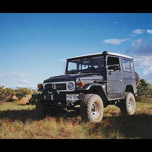
View attachment 19937
When I see rigs like this, I just drool... Love the front end!
I'm the kind of guy that would drive that to the office and park in reserved parking just to see everyone else's reactions. That Toyota looks sick!!View attachment 19937
When I see rigs like this, I just drool... Love the front end!

Influencer I
Dang!View attachment 19937
When I see rigs like this, I just drool... Love the front end!

that reminds me of some of my favourite places out in the channel country in western Queensland AustraliaComing home from a recent trip - Eastern OregonView attachment 20036