
badelf? never heard of this before. what is the benefit to this brand over others?I use paper and electronics maps. When planning a trip I use GAIA on my laptop which transfers to my iPhone and iPad. I plan the route and then I also down load the areas around the route. After that I get out my paper maps and look at the route on them to be sure they are there. I carry the maps for the states I am going to.
While traveling off road, I hook my iPhone or iPad up to my BadElf GPS and then I will know just where I am. This system has worked everyplace I have gone, even up to the Arctic Ocean.
Paper maps? still a thing or no?
- Thread starter beachdude93
- Start date
You are using an out of date browser. It may not display this or other websites correctly.
You should upgrade or use an alternative browser.
You should upgrade or use an alternative browser.
FlJeep
Rank 0

Contributor I

Pioneer II
- 6,020
- First Name
- Dustin
- Last Name
- Helms
- Member #
24720
- Ham/GMRS Callsign
- KD2UNH
- Service Branch
- USAF
I use my Gaia and google maps for primary mobile navigation and my garmin foretrex 401 and tacnav on foot. So I’m always lugging a phone charger and batteries.
However I always make sure I have a waterproof paper map of the area I will be in. A lensatic compass and practice makes the paper maps pretty useful. And neither takes up much space or weighs much.
However I always make sure I have a waterproof paper map of the area I will be in. A lensatic compass and practice makes the paper maps pretty useful. And neither takes up much space or weighs much.
Pioneer II
- 5,737
- First Name
- Kent
- Last Name
- Reynolds
- Member #
1632
- Ham/GMRS Callsign
- K6KNT
- Service Branch
- Retired Firefighter
My main maps are USFS, Tom Harrison & Nat GeoSo i recently found this Battle Board on an ad on instagram
and because im a delusional hopeless consumer I was thinking about traditional paper maps. What are your guys opinions on paper maps? Are they still heavily in use (in the US) or has GPS all but pretty much replaced the maps?
Are there map brands off roaders trust more than others?
I believe in redundancy, so I always have the local Forest or NP map, DeLorme Atlas&Gazetter for the state, GPS, Ipad with mapping, spare emergency GPS and InReach.

Off-Road Ranger I
Electronic gizmos only work so far, as long as the paper map is updated i use one when the electronics stuff kaputs!


Advocate III
.We carry an old Silva compass and it works very well after a couple of decades.
...
You have to have it for a couple decades before it works well?

Just kidding; couldn't resist. I have an old Silva, too.
.

Advocate I
Nat Geo=National Geographic-----------; National Geographic MapsYa i dont want to load myself down with maps. So the gazzeteer looks good for my state and the 3 states around me.
Whats the nat geo trails maps? are they different than the gazzetteer?
As some one else posted the Tom Harrison maps are great too.

I find it interesting that there are several references to electronic equipment's failing. While obviously it's necessary to keep items charged, I've never had a problem with this - I tend to be over-careful I suppose but the combination of charging in the vehicle and charging from solar chargers has worked so far. In terms of outright failure of items, I've never had a failure of my GPS units (since 1999), or my iPhones or iPads (since they came out). We had a problem with a laptop once - running it for weeks at altitudes higher than the specification - even then the CPU continued to work, it was simply that the battery needed to be replaced.
Luck?
Luck?
Pioneer II
- 6,020
- First Name
- Dustin
- Last Name
- Helms
- Member #
24720
- Ham/GMRS Callsign
- KD2UNH
- Service Branch
- USAF
I find it interesting that there are several references to electronic equipment's failing. While obviously it's necessary to keep items charged, I've never had a problem with this - I tend to be over-careful I suppose but the combination of charging in the vehicle and charging from solar chargers has worked so far. In terms of outright failure of items, I've never had a failure of my GPS units (since 1999), or my iPhones or iPads (since they came out). We had a problem with a laptop once - running it for weeks at altitudes higher than the specification - even then the CPU continued to work, it was simply that the battery needed to be replaced.
Luck?
I’m the type of person that has the opposite luck of you lol.
I just had to replace the battery in my goal zero guide 10, which has solar panels I used in Afghanistan in 2013 (they’re not operating at 100%), my goal zero switch no longer holds a charge (quit on me mid trip), AAA batteries in my Garmin don’t last forever, my iPhone SE battery doesn’t hold a charge like it used to but it gets to stay on a charger 90% of the time anyway and I refuse to downgrade to a new phone. Charging batteries for headlamps, cameras, flashlights and LED lanterns in addition to the previously mentioned items sometimes batteries die in something. I basically always got things charging while driving but for various reasons sometimes things don’t charge or the charge doesn’t last long enough (like because it’s winter and cold outside).
So just in case I have map and compass. So far I haven’t had my life depend on it
TheBison
Rank V

Creator III
- 2,028
- First Name
- Brian
- Last Name
- Foltz
- Member #
27816
- Ham/GMRS Callsign
- AA0BF / WRMI426
- Service Branch
- U.S. Army
Gazetteer is great for high-level views, but if you want real detail and relatively current information these are the way to go, at least in my area. Plus, Trails Illustrated is a layer on Gaia as well :).Ya i dont want to load myself down with maps. So the gazzeteer looks good for my state and the 3 states around me.
Whats the nat geo trails maps? are they different than the gazzetteer?
Clearly we need to travel in convoy one day! On average we'll get by...I’m the type of person that has the opposite luck of you lol.
I just had to replace the battery in my goal zero guide 10, which has solar panels I used in Afghanistan in 2013 (they’re not operating at 100%), my goal zero switch no longer holds a charge (quit on me mid trip), AAA batteries in my Garmin don’t last forever, my iPhone SE battery doesn’t hold a charge like it used to but it gets to stay on a charger 90% of the time anyway and I refuse to downgrade to a new phone. Charging batteries for headlamps, cameras, flashlights and LED lanterns in addition to the previously mentioned items sometimes batteries die in something. I basically always got things charging while driving but for various reasons sometimes things don’t charge or the charge doesn’t last long enough (like because it’s winter and cold outside).
So just in case I have map and compass. So far I haven’t had my life depend on it
Pioneer II
- 6,020
- First Name
- Dustin
- Last Name
- Helms
- Member #
24720
- Ham/GMRS Callsign
- KD2UNH
- Service Branch
- USAF
Clearly we need to travel in convoy one day! On average we'll get by...I’m the type of person that has the opposite luck of you lol.
I just had to replace the battery in my goal zero guide 10, which has solar panels I used in Afghanistan in 2013 (they’re not operating at 100%), my goal zero switch no longer holds a charge (quit on me mid trip), AAA batteries in my Garmin don’t last forever, my iPhone SE battery doesn’t hold a charge like it used to but it gets to stay on a charger 90% of the time anyway and I refuse to downgrade to a new phone. Charging batteries for headlamps, cameras, flashlights and LED lanterns in addition to the previously mentioned items sometimes batteries die in something. I basically always got things charging while driving but for various reasons sometimes things don’t charge or the charge doesn’t last long enough (like because it’s winter and cold outside).
So just in case I have map and compass. So far I haven’t had my life depend on it
Deal lol
You don't need battle board. Just ; DeLorme Atlas & Gazetteer | Garmin or the other brand I can't think of right now to take with you and research on GooooooooooooooogleEarth and your gazetteer.
You can get Topo maps from USGS if you need that or for some places like Death Valley, Nat Geo makes good maps.
Interesting to see the first 3 responses are from Land Rover Owners..............
They get lost a lot. Land Rovers don't stay running long enough for their owners to get good at navigating anywhere.
I'll second the Delorme atlas. It's handy when your GPS get pissed that you're ignoring it's routing, and locks up in blue screen. And it's laminated so your copilot can't ruin it with make up, tooth paste, potato salad, sun tan lotion, fingernail polish, hatred of your mother, coffee, toy dog drool, sour creme, fish bowl drinks, overland tea, etc.

Good thread, in Baja I use both the Baja Atlas (paper) my Garmin, and Google maps. I do like a paper map, they have never failed me. I have had to wait for one or another farkel to charge. Rig has a flat compass in the glovebox.
Last edited:
NMBruce
Rank V

Advocate II
- 1,808
- First Name
- Bruce
- Last Name
- Cooper
- Member #
27527
- Ham/GMRS Callsign
- KE0NBD
- Service Branch
- U.S. Air Force
badelf? never heard of this before. what is the benefit to this brand over others?
I have had this for long time. A friend who spends a lot of time off the grid told me about and I know a few hikers who use it.
Since I have had this for a while and it has worked perfectly for me, I haven’t looked into and I don’t know anything about the other stuff that people are using
I have the Pro. Bad Elf GPS Pro

I swear by paper maps. They are always on, they never crash, there is no subscription. One thing I know, the anything electronic will fail when you need it most. Paper never fails. On the information, detail supplied, ya sure electronoc maps look very cool but do you ever wonder about the accuracy of that data. Like is it possible some of the electronic enhancements are pure marketing spin? Like how many buyers even test, need, rely on that spin.
I use paper only. I fing Map Books gives all the detail I need. Even without elevation contours, If it shows a creek on the left, mountain on the right is it not obvious which way is downhill. If it shows multiple swithchbacks is it not obvious you are gaining or losing wlevation?
I like the challenge of figuring it out, no need to be spoon fed.
ps, on the electronic thing, other than google earth at home planning a trip, I never need it and it is purely a convenience. The actual trip is planned on paper.
Here...
DeLorme Atlas & Gazetteer | Garmin
buy.garmin.com
They can be purchased just about anywhere.
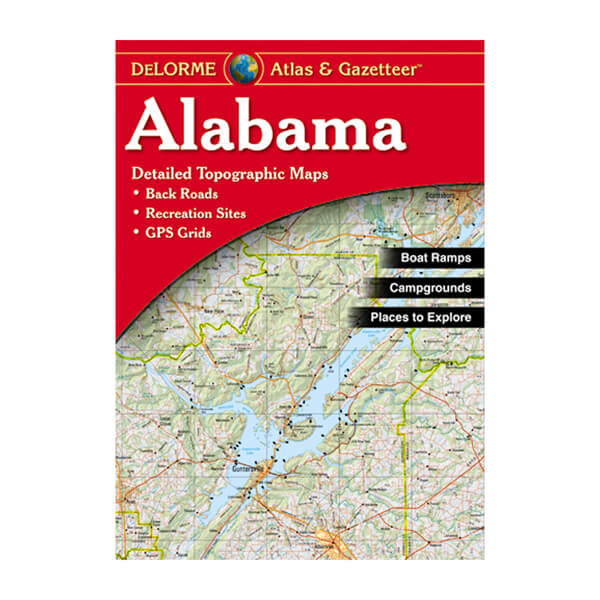
These are the ones I have for my state and the surrounding ones. Boat ramps, fishing, camping, hunting, hiking trails and more. Good stuff.
These are the ones I have for my state and the surrounding ones. Boat ramps, fishing, camping, hunting, hiking trails and more. Good stuff.
Yup... back when I first got some I was told that even well established cow paths and walking trails could be found on them. A few years back I was able to test this. We were traveling through eastern Kansas and SWMBO was on her phone looking to see if there were any interesting, but out of the way and obscure things to see.
Turns out there was a hidden spring that the early wagon trains used. It was the only one in the area and if you missed it chances are you'd run out of water a few days before finding the next one. It was found in the 1850s by a wagon train that was in desperate need of water. It's a bit more south of Alcove Springs - the one the Donner Party used.
The GPS got us in the general area but not even close, there was no mention of the spring. Fortunately I had the Kansas gazetteer in the trunk. Got it out and had a look - sure enough, the spring was there, and noted, as was a very primitive visitor center (a fence post with a map and sign). We were on the far side of the property but the map showed a backdoor hiking trail that went right to the spring.
Advocate III
These are the ones I have for my state and the surrounding ones. Boat ramps, fishing, camping, hunting, hiking trails and more. Good stuff.
.Yup... back when I first got some I was told that even well established cow paths and walking trails could be found on them. A few years back I was able to test this. We were traveling through eastern Kansas and SWMBO was on her phone looking to see if there were any interesting, but out of the way and obscure things to see.
Turns out there was a hidden spring that the early wagon trains used. It was the only one in the area and if you missed it chances are you'd run out of water a few days before finding the next one. It was found in the 1850s by a wagon train that was in desperate need of water. It's a bit more south of Alcove Springs - the one the Donner Party used.
The GPS got us in the general area but not even close, there was no mention of the spring. Fortunately I had the Kansas gazetteer in the trunk. Got it out and had a look - sure enough, the spring was there, and noted, as was a very primitive visitor center (a fence post with a map and sign). We were on the far side of the property but the map showed a backdoor hiking trail that went right to the spring.
The Delorme Gazetteers are wonderful resources. I remember when they first started, here in Maine, and all they had was the Maine Atlas & Gazetteer. They still print it with the old blue cover:
 ....
....
...
There used to be a great retail shop at the Delorme HQ in Freeport that had everything they publish. I don't think you can go in and buy anything anymore, though, since Garmin bought them out. Though you can still go in and visit Eartha, the world's largest earth model, which is 44' in diameter and rotates:

.
Last edited:
