• Guest, UPDATE We went through the site migration runbook and completed all steps. We will need to complete the migration next week, but will leave the forums up for the weekend. A few days after maintenance, a major upgrade revision to the forum site will occur.
  • HTML tutorial

Paper maps? still a thing or no?

ChadHahn

Rank III

Advocate I

I carry one of these in my glovebox:
I don't think Benchmark makes them anymore and I don't know if they made them for other states but I have all 4 quadrants of AZ. Some are on plain paper and some are on coated paper. They take up a lot less space than the gazetteer (which I also have) but have tremendous detail.
 

ThundahBeagle

Rank V

Advocate I

.
The Delorme Gazetteers are wonderful resources. I remember when they first started, here in Maine, and all they had was the Maine Atlas & Gazetteer. They still print it with the old blue cover:

View attachment 195009....View attachment 195010
...

There used to be a great retail shop at the Delorme HQ in Freeport that had everything they publish. I don't think you can go in and buy anything anymore, though, since Garmin bought them out. Though you can still go in and visit Eartha, the world's largest earth model, which is 44' in diameter and rotates:

View attachment 195012

.
I've got Mass, NH and VT. Thought I had a Maine one around here too. Didnt realize it was blue in tribute. Cool
 

Anak

Rank V
Launch Member

Member III

I find it interesting that there are several references to electronic equipment's failing. While obviously it's necessary to keep items charged, I've never had a problem with this - I tend to be over-careful I suppose but the combination of charging in the vehicle and charging from solar chargers has worked so far. In terms of outright failure of items, I've never had a failure of my GPS units (since 1999), or my iPhones or iPads (since they came out). We had a problem with a laptop once - running it for weeks at altitudes higher than the specification - even then the CPU continued to work, it was simply that the battery needed to be replaced.

Luck?
GPS is satellite dependent.

There are some really cool places you can go where there isn't enough sky for GPS.
 

ThundahBeagle

Rank V

Advocate I

.
A very interesting state!
We will be driving through there en route to see my nephew out in Montana. I've been to Cleveland, I've been to Chicago. So according to my research, the coolest stuff on this drive will be between Sioux Falls and Big Sky, inclusive. Want to be ready for some outdoors fun
 

egilbe

Rank IV
Launch Member

Enthusiast III

.
The Delorme Gazetteers are wonderful resources. I remember when they first started, here in Maine, and all they had was the Maine Atlas & Gazetteer. They still print it with the old blue cover:

View attachment 195009....View attachment 195010
...

There used to be a great retail shop at the Delorme HQ in Freeport that had everything they publish. I don't think you can go in and buy anything anymore, though, since Garmin bought them out. Though you can still go in and visit Eartha, the world's largest earth model, which is 44' in diameter and rotates:

View attachment 195012

.
Hasn't changed much from the '80's when I was using them to ride around all the logging roads that criss-cross Maine. Invaluable tool. Funny, back then we called it "touring" as, we were "on tour". Put a lot of offroad miles on a '78 toyota Corolla and an '87 two-wheel drive Ford Ranger. Friends had an assortment of Jeep CJ5, real all wheel drive IH Scout, and 4WD toyota pickups or Ford F150's. Drank a lot of beer riding those dirt roads. Now, I pay it back by picking up all the trash I find out on the trails to make up for the litter I created in my misspent youth.

Another good resource I haven't seen mentioned is Caltopo. I use it to print maps of hiking trails to give to friends I take hiking in some pretty remote areas in NH and Maine. Electronics fail. GPS doesn't work around Baxter State Park for some reason. The cold drains cell phone batteries as evidenced by all the ding-dongs needing "rescue" n the White Mountains who are depending on All Trails to get them back to their car. They call SAR and the state of NH sends them a tuition bill for their lesson on self-reliance. National Guard Helicopter flights aren't cheap to rescue their dumb ass off a mountain peak where they had no business being in the first place.
 
Last edited:

Alanymarce

Rank IV

Trail Mechanic III

GPS is satellite dependent.

There are some really cool places you can go where there isn't enough sky for GPS.
I'm guessing you mean narrow canyons(?). Yes that's true, however you'll start somewhere where there is a signal.

To be clear, we don't use the GPS for "turn-by-turn" navigation - simply to know where we are. An example - Misiones Province, Argentina : we know there's a "road" (Ruta 21) which crosses the forest biosphere reserve to get to the Saltos de Moconá. We use the map on the iPad to find the route, navigate to the start, and we track our progress on the GPS. When we can see the river, on the GPS 11 Km away (a long story of how we got to that point) we know how far we are from the river and our altitude, so we know that (barring further challenges) we'll get there before long.
 

Contributor II

So i recently found this Battle Board on an ad on instagram

and because im a delusional hopeless consumer I was thinking about traditional paper maps. What are your guys opinions on paper maps? Are they still heavily in use (in the US) or has GPS all but pretty much replaced the maps?

Are there map brands off roaders trust more than others?
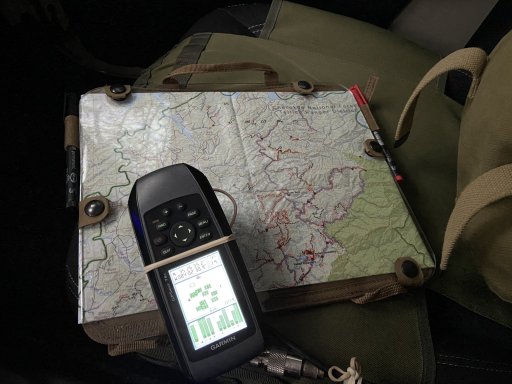
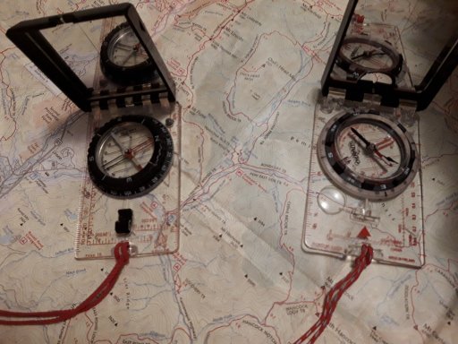
First: Congratulations! Your post is what put me over the edge for joining OB. To specifically answer both questions 1) I have a battle board. I use it every time I'm out on the trail. Depending on which one you get, it can be fairly large. However, mine is set up to hold a map on each side, plus a bunch of mapping stuff like pens, compass, protractors and the like. I now call it my "Mapper Keeper!"

2) Yes, maps are still in heavy use. How do I know this? I am a professional cartographer/ map maker. My experience goes way back into the 90s and I earned a BA in Geography with a concentration in GIS/GPS/ and Cartography. At the risk of sounding spammy, I am currently a self employed cartographer that makes maps for two primary customers: Ham radio operators and Overlanders/car campers/off roaders. I started this back in January 2015. In this day in age of GPS everywhere, people still enjoy having a map laid out across their hood. Plus, it's easier to look at your starting point and your ending point without scrolling around. Only downside is that maps have "end" at the edge of the paper. As much as I use GPS (since 1996), I still don't hit the trails without a map. I do use what I make.

And I bet you have not heard of me. It's not you, it's me. I make good maps, but I am a general disappointment when it comes to advertising and marketing, haha.

And here is a pic I took of half of my Battle Board in action while we were scouting a location in the Tellico Ranger District of the Cherokee National Forest a a few months ago.

IMG_3344.JPG
 

BigH2OChief

Rank V
Member

Enthusiast III

First: Congratulations! Your post is what put me over the edge for joining OB. To specifically answer both questions 1) I have a battle board. I use it every time I'm out on the trail. Depending on which one you get, it can be fairly large. However, mine is set up to hold a map on each side, plus a bunch of mapping stuff like pens, compass, protractors and the like. I now call it my "Mapper Keeper!"

2) Yes, maps are still in heavy use. How do I know this? I am a professional cartographer/ map maker. My experience goes way back into the 90s and I earned a BA in Geography with a concentration in GIS/GPS/ and Cartography. At the risk of sounding spammy, I am currently a self employed cartographer that makes maps for two primary customers: Ham radio operators and Overlanders/car campers/off roaders. I started this back in January 2015. In this day in age of GPS everywhere, people still enjoy having a map laid out across their hood. Plus, it's easier to look at your starting point and your ending point without scrolling around. Only downside is that maps have "end" at the edge of the paper. As much as I use GPS (since 1996), I still don't hit the trails without a map. I do use what I make.

And I bet you have not heard of me. It's not you, it's me. I make good maps, but I am a general disappointment when it comes to advertising and marketing, haha.

And here is a pic I took of half of my Battle Board in action while we were scouting a location in the Tellico Ranger District of the Cherokee National Forest a a few months ago.

View attachment 196473
Nice points. My glovebox is my Map File Drawer. Has charts, maps, notes, grease pens, protractors and there's a lensatic compass in all four door panels. If I ever got myself lost, I'd never be able to live down the embarrassment. Ha-ha!
 

Wellspring

Rank II

Enthusiast III

Electronic gadgets are fine, but I learned to use a map and compass when I was a young kid, and still use maps to this day either on the trail hiking, or overland traveling. Yes, I too use my electronic "toys" but I always travel with a paper map or map book.
 

BigH2OChief

Rank V
Member

Enthusiast III

Electronic gadgets are fine, but I learned to use a map and compass when I was a young kid, and still use maps to this day either on the trail hiking, or overland traveling. Yes, I too use my electronic "toys" but I always travel with a paper map or map book.
Absolutely right. Technology will always fail (Murphy's Law). Basic navigation is a must in my family. As example, for all my kids' and grandkids' on their 10th Birthday they all got/get the same thing from me... A Compass, Protractor, and an extended backpacking trip where they learn basic land navigation and put on a solo Land Nav course at the end of the trip. I haven't lost one of them yet and the older kids pump up 'the right of passage' to the up and comers. Next victim is in two months with a Grandson.
 

Correus

Rank V
Launch Member

Member III

Absolutely right. Technology will always fail (Murphy's Law). Basic navigation is a must in my family. As example, for all my kids' and grandkids' on their 10th Birthday they all got/get the same thing from me... A Compass, Protractor, and an extended backpacking trip where they learn basic land navigation and put on a solo Land Nav course at the end of the trip. I haven't lost one of them yet and the older kids pump up 'the right of passage' to the up and comers. Next victim is in two months with a Grandson.
I've been through several land nav courses through the years, starting with Scouts and ending with the Army. Even with all of them my sense of direction sucks, it's a rolling joke amongst friends and family.

I can honestly state that the most nerve wracking land nav course I've ever had to pass as at Ft. Knox. It was a timed course with 8 stops; it lasted from sunset to sunrise. And yes, I passed.
 

Contributor II

Nice points. My glovebox is my Map File Drawer. Has charts, maps, notes, grease pens, protractors and there's a lensatic compass in all four door panels. If I ever got myself lost, I'd never be able to live down the embarrassment. Ha-ha!
Dude...I get lost so much my trail name is Backtrack! It's a running joke among my friends, "I'm make the maps, I don't follow them!" haha.
 

NWFreeman

Rank 0

Contributor I

Another source of maps is the website: https://caltopo.com/

You can do topographic layers, aerial photo overlays, GIS overlays, look at sun exposure, measure and plot, see pretty much any feature you want to see. A wide variety of base formats that are customizable. Extremely useful and powerful program. Of course, you'll have to print them but you get to choose the scale and size depending upon how much detail you desire.
 

leeloo

Rank V
Launch Member

Advocate I

So between me, my wife and the kid we have about 3 phones, 2 tablets and 3 laptops, all with all the maps and apps for off line navigation.
The probability that all of them are out of power(I have an aux 100 ah with a solar panel, an that has the possibility to charge directly via USB as well ) or some other kind of technical failure is about the same as me experiencing a nuclear explosion EM pulse, and by than I think I have bigger problems than not having a paper map.
For planning is nice to have huge paper map, but connecting the laptop/tablet to a 100+ inch tv does the trick as well.
 
Top