Old Nipissing Road - Ontario

  • HTML tutorial

Ontario Overland

Rank V
Launch Member

Pathfinder I

2,268
Hanover,Ontario, Canada
First Name
Mike
Last Name
Cerutti
Member #

0939

Old Nipissing Road Trip Report

7F294396-8DF7-485B-9E27-5E458DF7E93E.jpg

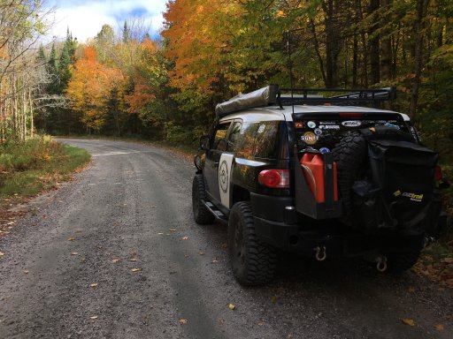
over thanksgiving weekend I ran the old nipissing road/forgotten trails from Orville to Commanda. I did this over 2days staying overnight in magnetawan, it can easily be done in one day but spreading it out gave me the chance to explore a few offshoots and stop at the ghost towns and graveyards.

Great map and trip planning resource.
http://www.thenipissingroad.com/

Here's a few historical/useful links.
http://www.nipissingroad.ca/
http://www.northernontario.travel/atving/old-nipissing-road-ghost-town-atv-trip-pt-1
http://www.overlandcanada.com/forum/showthread.php?1587-Nipissing-Road-planning


Day1
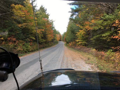
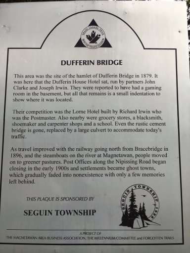
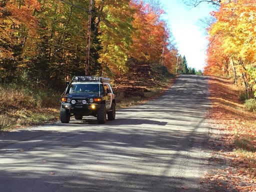
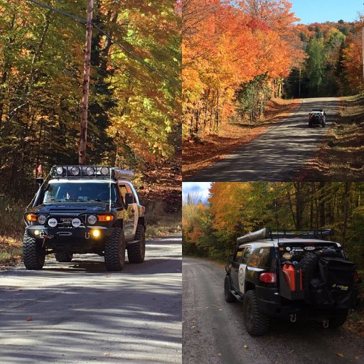
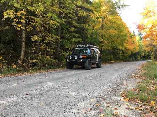
I started my journey by heading north on old Nipissing Rd off of Hwy552. This section is nice 50km of smooth winding gravel road through the woods. There's a few ghost towns and graveyards along this part, most noteable is duffern bridge. When I reached the town of magnetawan I had a great meal of fresh pickerel at the magnetawan hotel and bar and called it a day.
IMG_0349.JPG
IMG_0347.JPG
IMG_0350.JPG
IMG_0346.JPG
IMG_0348.JPG

Day2
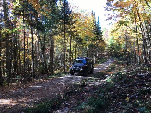
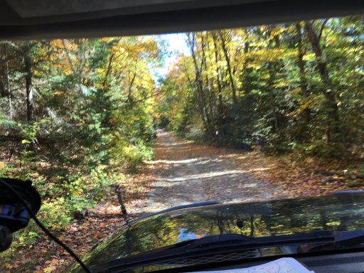
I continued along the old nipissing road by leaving magnetawan and crossing over Hwy124. This section was completely foreign to me. It didn't take line for the nicely groomed gravel roads to end and the single track atv/sled trails to start.
IMG_0357.JPG
IMG_0354.JPG

Once I left the forgotten trails and found myself back on some more well used gravel roads. I was then greeted with the fall colours of northern Ontario in their full glory.
IMG_0358.JPG
IMG_0360.JPG

Continued....
 
Last edited:

Ontario Overland

Rank V
Launch Member

Pathfinder I

2,268
Hanover,Ontario, Canada
First Name
Mike
Last Name
Cerutti
Member #

0939

....

Shortly down the road I came to the turn off to RYE RD, for about 100meters there were signs warning of "no exit" , "bridge out" and "turn around now!" Now, I had heard conflicting reports about the roads "passibility" so I decided to ignore all that and pushed forward. Quickly you could tell the road became significantly less traveled.

IMG_0364.JPG

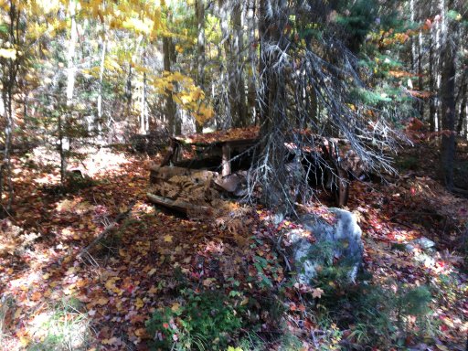
...I wonder how long this poor soul has been here....
IMG_0365.JPG

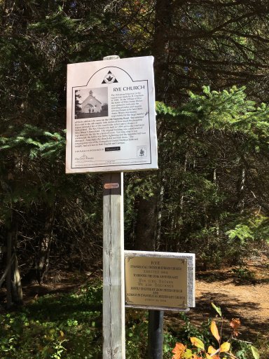
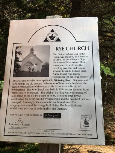
I decided to stop at the old site of the Rye church for lunch. All that left of the church now is a cement pad the was the front doors.

IMG_0361.JPG
IMG_0362.JPG

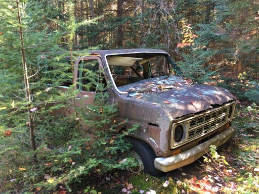
After walking around the site I found what wouldn't exactly have expected to find about 100m off the road...IMG_0363.JPG
Overland van anyone?

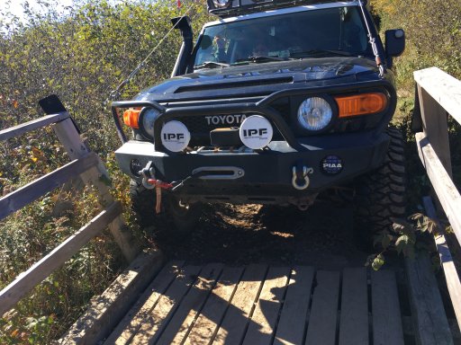
No less the 10min from the church I came of find out why the road was impassible....at least for non atvs.
IMG_0366.JPG
The side rails were very loose and you can tell the a few people had squeezed there way through. I decided against this and just turned around.

Finding myself back on the main route I continued on to my destination of Commanda!

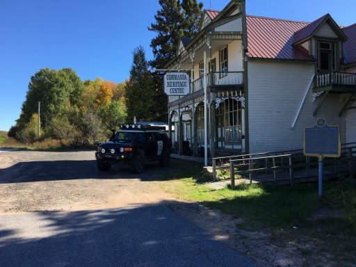
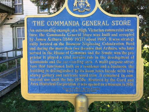
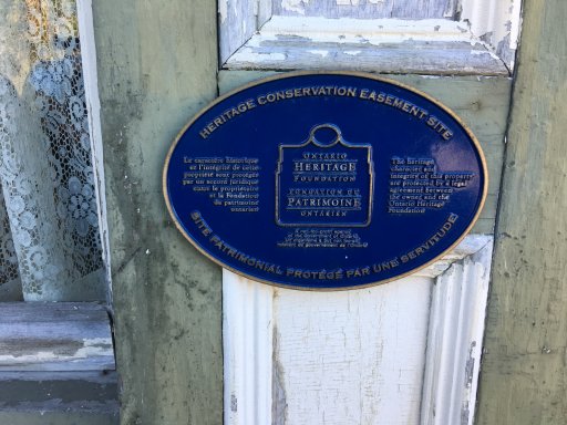
Just under an hour of simple gravel roads and passing some very confused cottagers I arrived at the Commanda general store (now a museum and heritage site)

IMG_0367.JPG
IMG_0368.JPG
IMG_0369.JPG


Thanks for viewing! Next year I want fully explore the route and some more offshoots that I came across.
 
Last edited:

Winterpeg

CDN Prairie Ambassador
Staff member
Launch Member

Influencer II

3,278
Winnipeg, MB
Member #

2861

Nice!
I've also heard of reports of people using their quads on this trail, although I don't know any details about that..... they must have ventured further though as they were much smaller than an FJ.
 
  • Like
Reactions: Ontario Overland

Ontario Overland

Rank V
Launch Member

Pathfinder I

2,268
Hanover,Ontario, Canada
First Name
Mike
Last Name
Cerutti
Member #

0939

Nice!
I've also heard of reports of people using their quads on this trail, although I don't know any details about that..... they must have ventured further though as they were much smaller than an FJ.
There's quite a few quad and sled trails that jump on and off the route. Most were unsigned, hopeimg to explore some of them this year.
 

hadam380

Rank 0

Traveler I

Awesome trail report especially since the property I camp on once a month is right by sprucedale might have to detour and check it out for a day with the quad.

Sent from my SM-G903W using Tapatalk
 

k_dipietro

Rank I
Launch Member

Traveler I

271
Toronto, Ontario, Canada
First Name
Kris
Last Name
D
Member #

9086

Hey! Im planning to do this trip in the spring. Looks like a great little history tour. My worry about the spring is mud, and high water. Did you encounter many low points, or water crossings on this trip? From all I've read, we should be in the clear but wanted to get your opinion. Thanks!
 

Ontario Overland

Rank V
Launch Member

Pathfinder I

2,268
Hanover,Ontario, Canada
First Name
Mike
Last Name
Cerutti
Member #

0939

Hey! Im planning to do this trip in the spring. Looks like a great little history tour. My worry about the spring is mud, and high water. Did you encounter many low points, or water crossings on this trip? From all I've read, we should be in the clear but wanted to get your opinion. Thanks!
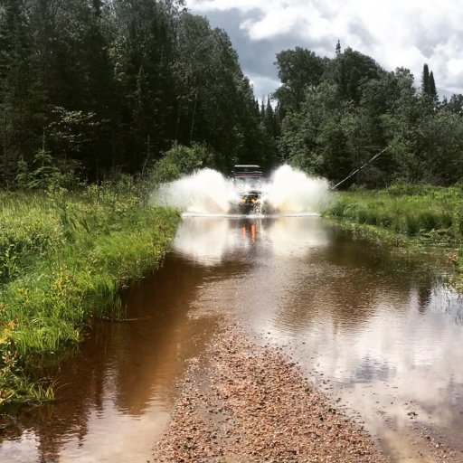
I’d expect the “forgotten trails” section to be a bit wet in the springtime. The only water I encountered was just after passing Jerusalem RD on the other side of the bridge I could cross. It wasn’t much and there’s a hard bottom, even a stock truck wouldn’t have any problems.

@jz8ty makin waves when we passed though last year in July.
17015E8D-A246-43C5-9FA1-60128C9C3A43.jpeg
 

k_dipietro

Rank I
Launch Member

Traveler I

271
Toronto, Ontario, Canada
First Name
Kris
Last Name
D
Member #

9086

Damn, that looks like a blast, haha!
Wow, that map would have been convenient a month ago... :neutral: I just finished plotting the entire route, off shoots, and detours on GAIA... aha. The good news is my map looks very similar!
Thanks for sharing. :smiley:
 
  • Like
Reactions: Ontario Overland

Blacksmith Scott

Rank I
Launch Member

Contributor II

Old Nipissing Road Trip Report

View attachment 9337

over thanksgiving weekend I ran the old nipissing road/forgotten trails from Orville to Commanda. I did this over 2days staying overnight in magnetawan, it can easily be done in one day but spreading it out gave me the chance to explore a few offshoots and stop at the ghost towns and graveyards.

Great map and trip planning resource.
http://www.thenipissingroad.com/

Here's a few historical/useful links.
http://www.nipissingroad.ca/
http://www.northernontario.travel/atving/old-nipissing-road-ghost-town-atv-trip-pt-1
http://www.overlandcanada.com/forum/showthread.php?1587-Nipissing-Road-planning


Day1
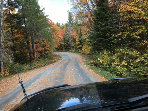
I started my journey by heading north on old Nipissing Rd off of Hwy552. This section is nice 50km of smooth winding gravel road through the woods. There's a few ghost towns and graveyards along this part, most noteable is duffern bridge. When I reached the town of magnetawan I had a great meal of fresh pickerel at the magnetawan hotel and bar and called it a day.
View attachment 9338
View attachment 9339
View attachment 9340
View attachment 9342
View attachment 9341

Day2
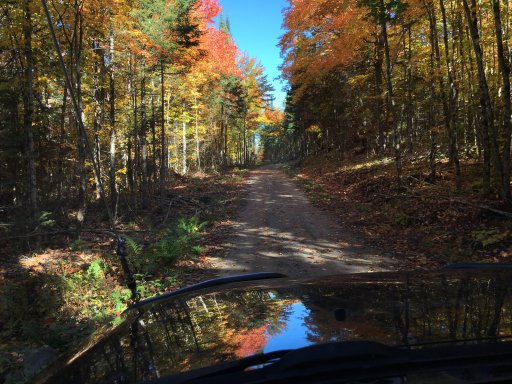
I continued along the old nipissing road by leaving magnetawan and crossing over Hwy124. This section was completely foreign to me. It didn't take line for the nicely groomed gravel roads to end and the single track atv/sled trails to start.
View attachment 9343
View attachment 9344

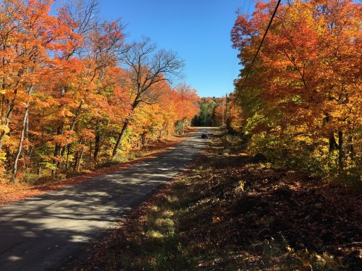
Once I left the forgotten trails and found myself back on some more well used gravel roads. I was then greeted with the fall colours of northern Ontario in their full glory.
View attachment 9345
View attachment 9346

Continued....
The colour does not get any better than that!


Sent from my iPad using OB Talk
 
  • Like
Reactions: Ontario Overland

JGribbs

Rank I

Contributor III

154
Ontario, Canada
First Name
Josh
Last Name
Gribbon
Damn, that looks like a blast, haha!
Wow, that map would have been convenient a month ago... :neutral: I just finished plotting the entire route, off shoots, and detours on GAIA... aha. The good news is my map looks very similar!
Thanks for sharing. :smiley:
How were the road conditions? Lots of water & mud right now?

Planning on hitting up the trail in a couple weeks once I have my Fox 2.0 coilovers put on
 

k_dipietro

Rank I
Launch Member

Traveler I

271
Toronto, Ontario, Canada
First Name
Kris
Last Name
D
Member #

9086

How were the road conditions? Lots of water & mud right now?

Planning on hitting up the trail in a couple weeks once I have my Fox 2.0 coilovers put on
Hey! I have not had a chance to go up yet. My May schedule has shuffled around a bit.
We were just in Gooderham yesterday running some trails. Water levels seems normal, and the ground was stiff enough to support our group.
The Nipssing trail is not too far North West of Gooderham (like 2-3 hours I think) so I imagine it may be similar by now. Gooderham did have some wet and snowy spots still in the heavily shaded areas, but for the most part the sun has thawed everything out.
 

Ontario Overland

Rank V
Launch Member

Pathfinder I

2,268
Hanover,Ontario, Canada
First Name
Mike
Last Name
Cerutti
Member #

0939

the old nipissing road is pretty tame, the majority of the route is a 2 lane gravel road. the optional section of the forgotten trails system is pretty much the only spot where there would be low spots with standing water and or mud.
 

Tom Thayer

Rank 0

Traveler I

Great thread and trip report. I was thinking of spending a bit of time on this trail. How much of this trail do think is not accessible using a Jeep Grand Cherokee? I see the bridge is out but do you know is the rest of it accessible up to the bridge from the other side as well? I am wondering because I will hike the other parts if there is a large portion that is not accessible and will make arrangements for someone to drive my Jeep. Cheers
 
  • Like
Reactions: Ontario Overland

Ontario Overland

Rank V
Launch Member

Pathfinder I

2,268
Hanover,Ontario, Canada
First Name
Mike
Last Name
Cerutti
Member #

0939

Great thread and trip report. I was thinking of spending a bit of time on this trail. How much of this trail do think is not accessible using a Jeep Grand Cherokee? I see the bridge is out but do you know is the rest of it accessible up to the bridge from the other side as well? I am wondering because I will hike the other parts if there is a large portion that is not accessible and will make arrangements for someone to drive my Jeep. Cheers
Aside form the bridge and the southern most section towards rosseau everything won’t be a problem for you.