
I know this is late, so you can file it away for next year. Abrams Creek Camp Ground located in the south east corner of the Great Smokey Mountain Park is a nice peaceful place to rest. Also Look Rock campground located on the Foothill Parkway between Hwy 129 and Hwy 321.
Nantahala National Forest/ Great Smoky Mountains State Park?
- Thread starter killallninjas
- Start date
You are using an out of date browser. It may not display this or other websites correctly.
You should upgrade or use an alternative browser.
You should upgrade or use an alternative browser.


Traveler III
- 1,127
- First Name
- stephanie
- Last Name
- Curlee
- Member #
7864
- Ham/GMRS Callsign
- KM4CNY
- Service Branch
- Army
Oh my that's awesome.This works!
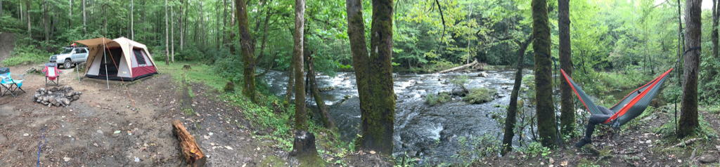

I spent some time near the Horsepasture River this weekend. Beautiful weather Friday night...


Contributor I
I’ll be heading up there tomorrow after work. Going to be camping Friday and Saturday. Should be interesting, hopefully I can find a decent place to park and camp. Not really looking for a paid for camp spot if you know what I mean. My buddy gave me a decent place it sounds like what was mentioned on the first page, he fly fishes the area frequently and suggested it.

Member I
Could you give me a map point. I cannot not find fs81 on maps or my atlas . ThanksGreat forest service roads in the area. You may want to try FS 81 along Santeetlah creek. Located near Joyce Kilmer Memorial Forest this gravel FS road travels along Santeetlah creek for about 15 miles or so. Plenty of open backcountry sites available and lots of road to drive and explore. You can also cross over the mountains into TN along this road and end up along the North River and Tellico in TN, also some great spots here. There are some sites near Lake Santeetlah - Carver Cemetery/Long Hungry road offer the best sites also along a FS road. Let me know if I can help you in anyway, I live here in the southern Nantahala and am very familiar with the area
Good luck and enjoy!

Could you give me a map point. I cannot not find fs81 on maps or my atlas . Thanks
Forest Service roads tend to not be on Atlas maps, but rather on DeLorme Gazetter maps, quad maps and most of the National Geo maps. FS 81 is located at the juncture of Hwy 143W (cherohala Skyway) and the Joyce Kilmer Forest rd. It continues through the valley and then up and under the Skyway at the NC/TN State line where the designation changes from FS 81 to North River rd. Gravel improved for approx 40 miles with plenty of improved and unimproved campsites. This road along with all FS roads in the Nantahala National Forest are gated closed until April 1 to avoid damaging the roads through the winter freeze/thaw push. Let me know if I can help in any way!
Sent from my iPhone using OB Talk
Traveler III
Do you remember where this was located! Exactly what I’m looking forThis works!

Contributor III
Do you remember where this was located! Exactly what I’m looking for
I was on 81 last Sunday night...here.
