Map suggestion

  • HTML tutorial

Dusther210

Rank VI
Member

Influencer I

4,765
Oakland, Bergen County, New Jersey, United States
First Name
Dustin
Last Name
Helms
Member #

24720

Ham/GMRS Callsign
KD2UNH
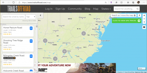
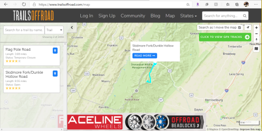
I recently stumbled upon trailsoffroad.com and clicked on "MAP" at the top of their site. You can view an area and it shows the route in the map by hovering over the grey trailhead icon on the map, doing this will also give details like distance, difficulty and name of the route with pictures and reviews. It is a very slick idea and I would love to see this incorporated into the OB map. Just thought I would share
 

Attachments

Trail_pilot

Rank III

Enthusiast III

830
First Name
James
Last Name
Girard
Does it work outside of the US? I have access to a similar map system here via paid membership but it's not as detail. They used to have lengths and estimated completion time noted on it but for some reason they ditched those bits of info.
 
  • Like
Reactions: Dusther210
D

Deleted member 21788

Guest
Additional map feature, the ability to submit a correction. I submitted one and it didn't geocode correctly and I've caught some posts from others that are either geocoded incorrectly or have some incorrect info. It would be nice to have a correct request (or similar title) link that could be submitted and then go to admin for review. Similar to Waze maybe.
 
  • Like
Reactions: Dusther210

Dusther210

Rank VI
Member

Influencer I

4,765
Oakland, Bergen County, New Jersey, United States
First Name
Dustin
Last Name
Helms
Member #

24720

Ham/GMRS Callsign
KD2UNH
Additional map feature, the ability to submit a correction. I submitted one and it didn't geocode correctly and I've caught some posts from others that are either geocoded incorrectly or have some incorrect info. It would be nice to have a correct request (or similar title) link that could be submitted and then go to admin for review. Similar to Waze maybe.
It’s happened to me too
 

RoarinRow

Rank V
Launch Member

Member III

2,771
Elk Grove, CA, USA
First Name
Rolando
Last Name
Nispiros
Member #

17011

Ham/GMRS Callsign
KN6JJS
I like their easy to use site. Provides good information on trails, pictures, terrain type, reviews of trails, ratings, etc.
 
  • Like
Reactions: Dusther210

Alanymarce

Rank IV

Trail Mechanic III

1,392
Colombia
Does it work outside of the US? I have access to a similar map system here via paid membership but it's not as detail. They used to have lengths and estimated completion time noted on it but for some reason they ditched those bits of info.
Apparently not outside the US (neither USA nor USM). I had a look and although the map is the world, there are none shown anywhere else, it seems.
 

Trail_pilot

Rank III

Enthusiast III

830
First Name
James
Last Name
Girard
Apparently not outside the US (neither USA nor USM). I had a look and although the map is the world, there are none shown anywhere else, it seems.
Damn that would be great for my longer trips if i needed to find a spot 3nearby if I don't make the miles planned. I'll have to stick to google earth and the Ontario crown land atlas and hope fur the best LOL.
 
  • Like
Reactions: Dusther210

Alanymarce

Rank IV

Trail Mechanic III

1,392
Colombia
iOverlander has good coverage in Canada. Wikicamps Canada is probably another good option (haven't used the Canada version however we've used Wikicamps Australia and it's good). Maps.me is also useful for routes although it's not focussed on campsites specifically.
 

Trail_pilot

Rank III

Enthusiast III

830
First Name
James
Last Name
Girard
iOverlander has good coverage in Canada. Wikicamps Canada is probably another good option (haven't used the Canada version however we've used Wikicamps Australia and it's good). Maps.me is also useful for routes although it's not focussed on campsites specifically.
I have tried iOverlander and I really don't like it. It doesn't show any off grid sites that are off of any trail systems but shows Walmart parking lots, there are no indication of what is private property or crown land, and a lot of the spots it lists are actually on private land. I haven't tried many others, but I have been using a combination of the Ontario Crown land Atlas and Google Earth for years and it has never let me down. A lot of research into longer trips with a lot of contingency plans in place is basically how I have planned out every exploration trip for the last 8 or so years.
 

Alanymarce

Rank IV

Trail Mechanic III

1,392
Colombia
I have tried iOverlander and I really don't like it. It doesn't show any off grid sites that are off of any trail systems but shows Walmart parking lots, there are no indication of what is private property or crown land, and a lot of the spots it lists are actually on private land. I haven't tried many others, but I have been using a combination of the Ontario Crown land Atlas and Google Earth for years and it has never let me down. A lot of research into longer trips with a lot of contingency plans in place is basically how I have planned out every exploration trip for the last 8 or so years.
Hmm: good information- we’ve used iOverlander principally in Africa & Australia and it’s good in these regions, with wild campsites and places off the beaten track; we’ll have to take your advice for Canada later this year (we hope...). Thanks and hope you find what you’re looking for. How about Wikicamps Canada? Once again, we have no experience with this in Canada, but it’s been useful in Australia.
 
  • Like
Reactions: Trail_pilot

Trail_pilot

Rank III

Enthusiast III

830
First Name
James
Last Name
Girard
Hmm: good information- we’ve used iOverlander principally in Africa & Australia and it’s good in these regions, with wild campsites and places off the beaten track; we’ll have to take your advice for Canada later this year (we hope...). Thanks and hope you find what you’re looking for. How about Wikicamps Canada? Once again, we have no experience with this in Canada, but it’s been useful in Australia.
I havnt tried Wicicamps, and there are some spots listed on Ioverlander but they are spots that are well known and are never free of people. I tend to try to get out and away from people and my experiences with it are mainly central Ontario and it may be different in northern ontario and other provinces, but its just how I found it.
 

Michael

Rank IX
Staff member
Founder 500
Member

Benefactor

15,584
Livermore, California, United States
First Name
Michael
Last Name
Murguia
Member #

0000

Ham/GMRS Callsign
KM6YSL
Hey all - many things mentioned in this thread - let me offer some info!

90% of our attention is the Overland Bound One app - worldwide, and most of the features mentions are done or slated for completion very soon. Furthermore, we will be providing detailed info for free.

For the web map, will be making a complete replacement of the Overland Bound web map next year - to bring it's features in parity with Overland Bound One. All of our offline mode, offline map download, GPX import share, and details track recording are currently in Beta testing - so this is not far away.

The overland community needs a better mapping and navigation app, built by the community (from feedback and actual use), and by folks who use it. I know there are apps out there, but oh boy, is there a good one?

We won't make our community pay for location details. We prefer to make location information available for free. You can pay OLB to be a Member and get all the social, planning, and offline features - but information is free in keeping with our founding principles.

Lots of great features in the works - and we are also collection feedback and other feature requests for the app here. You can also upvote features: Overland Bound One Feature Upvote

Some feature details:

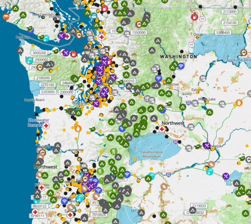
A pro tip: if a location on our map is grey - it is not verified. If it is colored, it has been verified by an Overland Bound Member:

1630523165575.png


GPX Support:

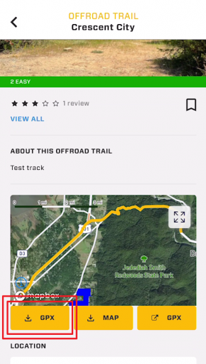
Members can currently import and share GPX files. Its kind of a pain, and when you add a GPX file it has to go through admin approval which takes 24 hours. We are fixing all of this to make much easier. You can also navigate along a GPX trail even if you are offline.

1630523352627.png


Locations and POI

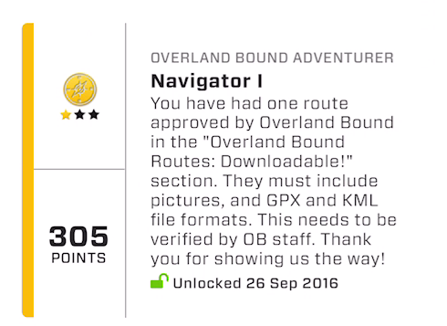
Anyone can add a location, and we are at a 300 location per month rate currently. We are planning to increase this rate significantly by rewarding the community in addition to the badge system:

1630523486885.png

I mean real rewards like discounts, useful gear, or physical challenge coins. @Corrie is working on this program now.

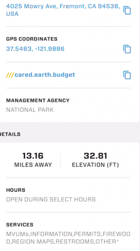
Pour POI have "all the details" and each POI type has different details appropriate to the type. For example, Ranger stations have office hours, Camp Sites do not, etc.

Some Expedition features in Beta Testing:

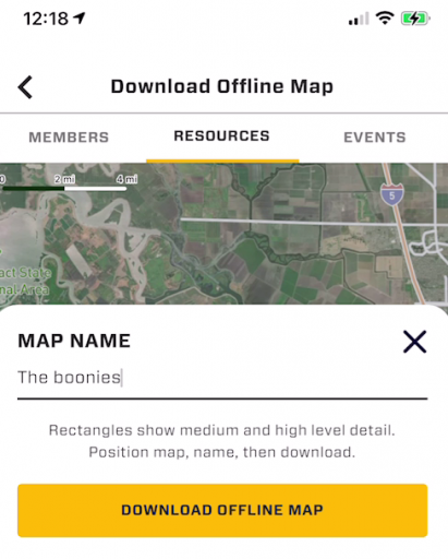
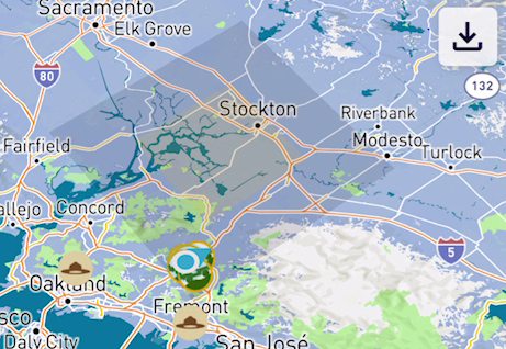
Offline Map Download:

1630523910037.png

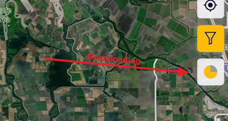
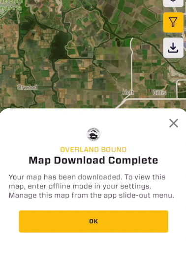
This feature is simple to use. You just center the map and hit download. Boom. Done. Easy of use is of primary importance to us.

1630523977533.png

1630524023041.png

You can easily see areas that are available offline:

1630524098510.png

and manage them from the slide out menu.

Also, there are buttons to automatically download maps around Rally Points waypoints or GPX tracks with a single tap.

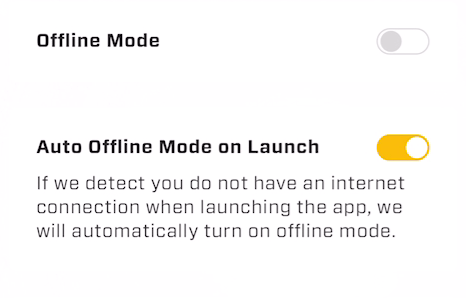
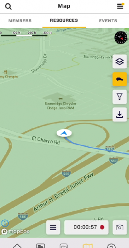
Offline Mode:

1630524797711.png

This allows the usage of the app when offline for navigation and location lookup when there is no cell connection. It also insures you will not get an "App update required" when you have no connection and are 20 miles off grid :) We think about these things cause built by overlanders for overlanders. :)

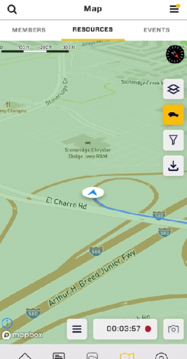
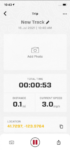
GPX Track Recording

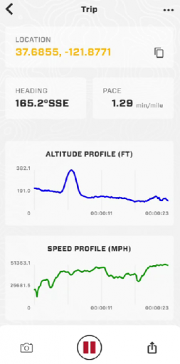
Track recording is a science, and we have spent countless hours on our tech. We will continue to improve this, but out of the gate it will do what you expect, and again - one tap to start recording. Peasy-peasy.

1630525339163.png

1630525165276.png

1630525211532.png

Three Word Navigation

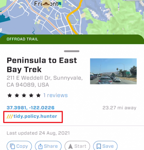
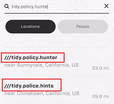
GPS coordinates are hard to remember, and street addresses are insufficient for Overlanders. In our app, every 10x10 ft square on the planet has a 3 word designation which can be shared and searched:

1630525653231.png

1630525742638.png

but wait there is more... haha
 

Attachments

Dusther210

Rank VI
Member

Influencer I

4,765
Oakland, Bergen County, New Jersey, United States
First Name
Dustin
Last Name
Helms
Member #

24720

Ham/GMRS Callsign
KD2UNH
Hey all - many things mentioned in this thread - let me offer some info!

90% of our attention is the Overland Bound One app - worldwide, and most of the features mentions are done or slated for completion very soon. Furthermore, we will be providing detailed info for free.

For the web map, will be making a complete replacement of the Overland Bound web map next year - to bring it's features in parity with Overland Bound One. All of our offline mode, offline map download, GPX import share, and details track recording are currently in Beta testing - so this is not far away.

The overland community needs a better mapping and navigation app, built by the community (from feedback and actual use), and by folks who use it. I know there are apps out there, but oh boy, is there a good one?

We won't make our community pay for location details. We prefer to make location information available for free. You can pay OLB to be a Member and get all the social, planning, and offline features - but information is free in keeping with our founding principles.

Lots of great features in the works - and we are also collection feedback and other feature requests for the app here. You can also upvote features: Overland Bound One Feature Upvote

Some feature details:

A pro tip: if a location on our map is grey - it is not verified. If it is colored, it has been verified by an Overland Bound Member:

View attachment 208560


GPX Support:

Members can currently import and share GPX files. Its kind of a pain, and when you add a GPX file it has to go through admin approval which takes 24 hours. We are fixing all of this to make much easier. You can also navigate along a GPX trail even if you are offline.

View attachment 208562


Locations and POI

Anyone can add a location, and we are at a 300 location per month rate currently. We are planning to increase this rate significantly by rewarding the community in addition to the badge system:

View attachment 208563

I mean real rewards like discounts, useful gear, or physical challenge coins. @Corrie is working on this program now.

Pour POI have "all the details" and each POI type has different details appropriate to the type. For example, Ranger stations have office hours, Camp Sites do not, etc.

Some Expedition features in Beta Testing:

Offline Map Download:

View attachment 208564

This feature is simple to use. You just center the map and hit download. Boom. Done. Easy of use is of primary importance to us.

View attachment 208565

View attachment 208566

You can easily see areas that are available offline:

View attachment 208567

and manage them from the slide out menu.

Also, there are buttons to automatically download maps around Rally Points waypoints or GPX tracks with a single tap.

Offline Mode:

View attachment 208570

This allows the usage of the app when offline for navigation and location lookup when there is no cell connection. It also insures you will not get an "App update required" when you have no connection and are 20 miles off grid :) We think about these things cause built by overlanders for overlanders. :)

GPX Track Recording

Track recording is a science, and we have spent countless hours on our tech. We will continue to improve this, but out of the gate it will do what you expect, and again - one tap to start recording. Peasy-peasy.

View attachment 208574

View attachment 208571

View attachment 208572

Three Word Navigation

GPS coordinates are hard to remember, and street addresses are insufficient for Overlanders. In our app, every 10x10 ft square on the planet has a 3 word designation which can be shared and searched:

View attachment 208575

View attachment 208576

but wait there is more... haha

This is fantastic stuff! It’s my first time hearing about the upvote