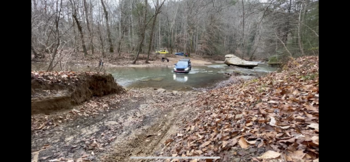
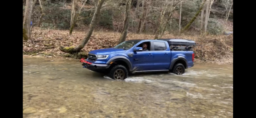
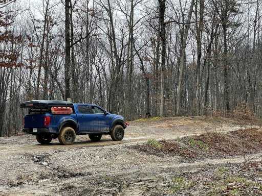
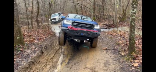
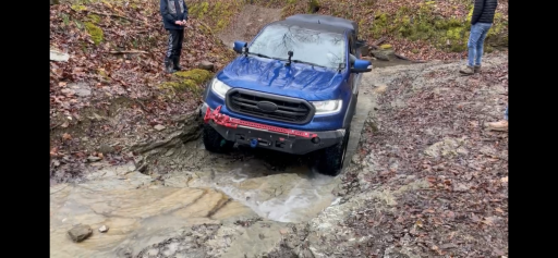
Well from the looks of things HoosierT has already committed me to this run. Looking forward to it!My buddy is good with 18-20 if you’re sure that weekend is good for you. Let me know and we can lock it in. Nice little pre-Christmas run.That makes me feel better about it then. Thank you for all the good intel!
US Midwest Daniel Boone Backcountry Byway 12/12-12/23
- Thread starter HoosierT
- Start date
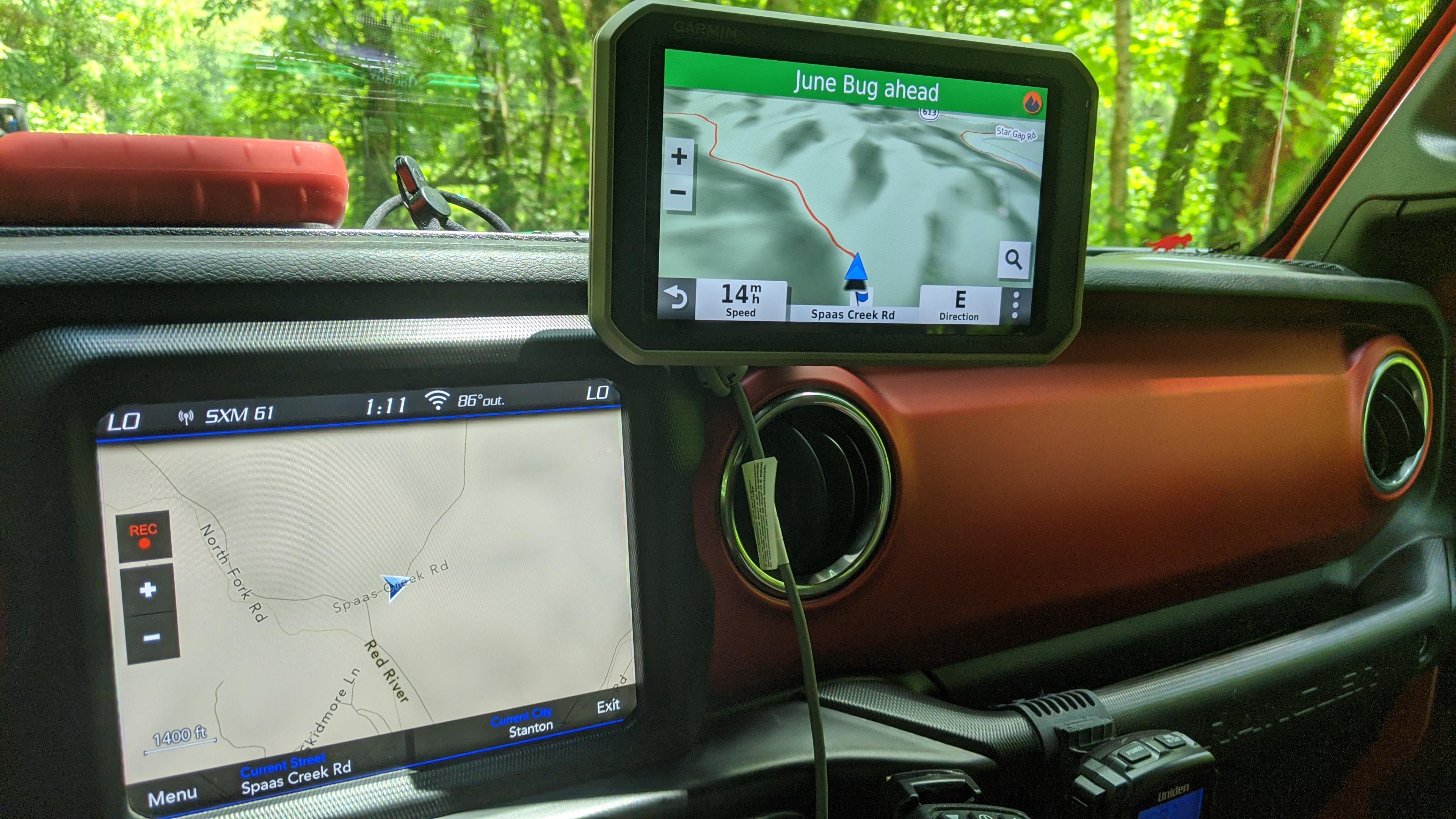
I think you'll love it! The magnetic mount is really nice, too! Here is the pic of the 3d topo view. The red trail is the DBBB GPX file route.Awesome thanks for the review! That sold me as it was on sale today. Normally $699 but got it for $599 plus traffic attachment.

Trail Blazer II
- 6,140
- First Name
- Shaun
- Last Name
- Johannes
- Member #
-
15310
- Ham/GMRS Callsign
- KE8TDZ
As am I. Hope we get some good weather. Looks like it may rain a bit the week before.Well from the looks of things HoosierT has already committed me to this run. Looking forward to it!My buddy is good with 18-20 if you’re sure that weekend is good for you. Let me know and we can lock it in. Nice little pre-Christmas run.That makes me feel better about it then. Thank you for all the good intel!

Contributor II
Hey all, I'm the other half of @DK4Runner's DBBB gang. I may or may not be able to head down the 18-20th. Definitely can send you all my GPX files. I've been down and done various parts of the entire route 4 times now. Have made an "easy" loop that misses out on some of the real fun, but should be doable in pretty much any truck as well. A good option if you want to take it easy on the first time through.
I've got a 100 series Land Cruiser and everything is passable, but narrow. Lots of pinstriping.
Have good recovery gear and/or a winch at minimum. Sounds like you all have that covered. I use CB for comms. Would suggest everyone have something to communicate with at least one other member in real time. Cell phone service is garbage, don't rely on it.
I can point out where that large rock is as well. I don't think it's what you've got mapped out earlier in this thread. There's no bypass per se, but there is an alternate route one river crossing prior to it. It ends up off the loop and you have to take some country roads back to the next juncture. It's a medium difficulty alternate route. Also very narrow and in some parts off camber quite a bit.

Trail Blazer II
- 6,140
- First Name
- Shaun
- Last Name
- Johannes
- Member #
-
15310
- Ham/GMRS Callsign
- KE8TDZ
That would be great to have you especially since we’re all first timers. But if not no worries. As for the files you have definitely please send them our way. Personally I’m almost always one for more knowledge in unknown territory.Hey all, I'm the other half of @DK4Runner's DBBB gang. I may or may not be able to head down the 18-20th. Definitely can send you all my GPX files. I've been down and done various parts of the entire route 4 times now. Have made an "easy" loop that misses out on some of the real fun, but should be doable in pretty much any truck as well. A good option if you want to take it easy on the first time through.
I've got a 100 series Land Cruiser and everything is passable, but narrow. Lots of pinstriping.
Have good recovery gear and/or a winch at minimum. Sounds like you all have that covered. I use CB for comms. Would suggest everyone have something to communicate with at least one other member in real time. Cell phone service is garbage, don't rely on it.
I can point out where that large rock is as well. I don't think it's what you've got mapped out earlier in this thread. There's no bypass per se, but there is an alternate route one river crossing prior to it. It ends up off the loop and you have to take some country roads back to the next juncture. It's a medium difficulty alternate route. Also very narrow and in some parts off camber quite a bit.

Contributor II
Here are the GPX files for both the original DBBB as I understand it, as well as a much easier version I've done. The files should work on Gaia and on pretty much any Garmin GPS.
The DBBB itself doesn't go to the Nada Tunnel, which is a crime, but you should definitely check it out.
There should be waypoints included with the main DBBB GPX. That includes the giant rock that's been discussed here, a large mud pit at the end of Spaas Creek Rd, and gas, food, camping, etc. I forget who I got this from, but the credit is not mine for the most part (I added the rock and mud pit).
The very west end of the DBBB loop is where you go through what feels like someone's property/driveway, but is in fact a public road. He's got a gate across the road that should be open. I've never been harassed by anyone there other than a dog that likes to chase.
The last part of the file is a segment labelled "Hard 11" and is part of the KY Adventure Tour and overlaps some with the DBBB. The easy route uses a few parts of the DBBB, some of the KAT, and some of my own routing. The Hard 11 alternate route avoids the giant rock by turning just beforehand onto Walker Creek Rd. Again, it's not a super easy route on it's own, but it shouldn't wreck your trucks.
I'll keep you posted on what my plans are for next weekend.
GPX viewer
GPX viewer
Attachments
-
459.4 KB Views: 58
-
953.1 KB Views: 51

Trail Blazer II
- 6,140
- First Name
- Shaun
- Last Name
- Johannes
- Member #
-
15310
- Ham/GMRS Callsign
- KE8TDZ
Thanks for all the help! I’ll have to download these off the website it appears the app doesn’t seem to want to dl the files.Here are the GPX files for both the original DBBB as I understand it, as well as a much easier version I've done. The files should work on Gaia and on pretty much any Garmin GPS.
The DBBB itself doesn't go to the Nada Tunnel, which is a crime, but you should definitely check it out.
There should be waypoints included with the main DBBB GPX. That includes the giant rock that's been discussed here, a large mud pit at the end of Spaas Creek Rd, and gas, food, camping, etc. I forget who I got this from, but the credit is not mine for the most part (I added the rock and mud pit).
The very west end of the DBBB loop is where you go through what feels like someone's property/driveway, but is in fact a public road. He's got a gate across the road that should be open. I've never been harassed by anyone there other than a dog that likes to chase.
The last part of the file is a segment labelled "Hard 11" and is part of the KY Adventure Tour and overlaps some with the DBBB. The easy route uses a few parts of the DBBB, some of the KAT, and some of my own routing. The Hard 11 alternate route avoids the giant rock by turning just beforehand onto Walker Creek Rd. Again, it's not a super easy route on it's own, but it shouldn't wreck your trucks.
I'll keep you posted on what my plans are for next weekend.
GPX viewer
GPX viewer

Contributor II
I think I'm out for this weekend unfortunately, but if you all enjoy it, let's get a DBBB/KAT regular trips thread going so we can plan many more.

Contributor II

Enthusiast III

Pathfinder I
Looks like a lot of fun. I may try to head down there sometime in January...
Bash Brothers Overland
Rank V

Advocate III
- 1,744
- First Name
- Jasen
- Last Name
- Ulmer
- Member #
-
26569
- Ham/GMRS Callsign
- KD9HBC

Trail Blazer II
- 6,140
- First Name
- Shaun
- Last Name
- Johannes
- Member #
-
15310
- Ham/GMRS Callsign
- KE8TDZ
If you want some company post back up on here closer to then. Think we’d be willing to run it back knowing what we know now.Looks like a good time. Can't wait to get down there on Memorial Day.
Bash Brothers Overland
Rank V

Advocate III
- 1,744
- First Name
- Jasen
- Last Name
- Ulmer
- Member #
-
26569
- Ham/GMRS Callsign
- KD9HBC
Will definitely keep you posted.If you want some company post back up on here closer to then. Think we’d be willing to run it back knowing what we know now.Looks like a good time. Can't wait to get down there on Memorial Day.

Enthusiast III
Yep, I'm totally down.Will definitely keep you posted.

Trail Blazer II
- 6,140
- First Name
- Shaun
- Last Name
- Johannes
- Member #
-
15310
- Ham/GMRS Callsign
- KE8TDZ
We cannot get out enough right now. Am I right?Yep, I'm totally down.
Bash Brothers Overland
Rank V

Advocate III
- 1,744
- First Name
- Jasen
- Last Name
- Ulmer
- Member #
-
26569
- Ham/GMRS Callsign
- KD9HBC
Absolutely right, I wish they would open the forest roads back up in the Hoosier N.F. All the indefinitely closed roads are irritating. I'd be down there more often if there were longer high clearance routes to run.We cannot get out enough right now. Am I right?Yep, I'm totally down.

Trail Blazer II
- 6,140
- First Name
- Shaun
- Last Name
- Johannes
- Member #
-
15310
- Ham/GMRS Callsign
- KE8TDZ
Agreed I’d go in a heartbeat. But just goes to show you if we don’t take care of stuff and don’t correct bad campers/wheelers it all goes a way. It truly is a great blessing we have the privilege of using these lands.Absolutely right, I wish they would open the forest roads back up in the Hoosier N.F. All the indefinitely closed roads are irritating. I'd be down there more often if there were longer high clearance routes to run.We cannot get out enough right now. Am I right?Yep, I'm totally down.

Contributor III
I’ve been wanting to go here for a while, I am planning to go this year too
Bash Brothers Overland
Rank V

Advocate III
- 1,744
- First Name
- Jasen
- Last Name
- Ulmer
- Member #
-
26569
- Ham/GMRS Callsign
- KD9HBC
It just takes one person to ruin it for everyone.Agreed I’d go in a heartbeat. But just goes to show you if we don’t take care of stuff and don’t correct bad campers/wheelers it all goes a way. It truly is a great blessing we have the privilege of using these lands.Absolutely right, I wish they would open the forest roads back up in the Hoosier N.F. All the indefinitely closed roads are irritating. I'd be down there more often if there were longer high clearance routes to run.We cannot get out enough right now. Am I right?Yep, I'm totally down.


