
Enthusiast III
Cool, that’s what we’ve used so far.A standard frs handheld would work though at least close range.
Enthusiast III
Cool, that’s what we’ve used so far.A standard frs handheld would work though at least close range.

Trail Blazer II
15310
A standard frs handheld would work though at least close range.
Cool, that’s what we’ve used so far.
Enthusiast III
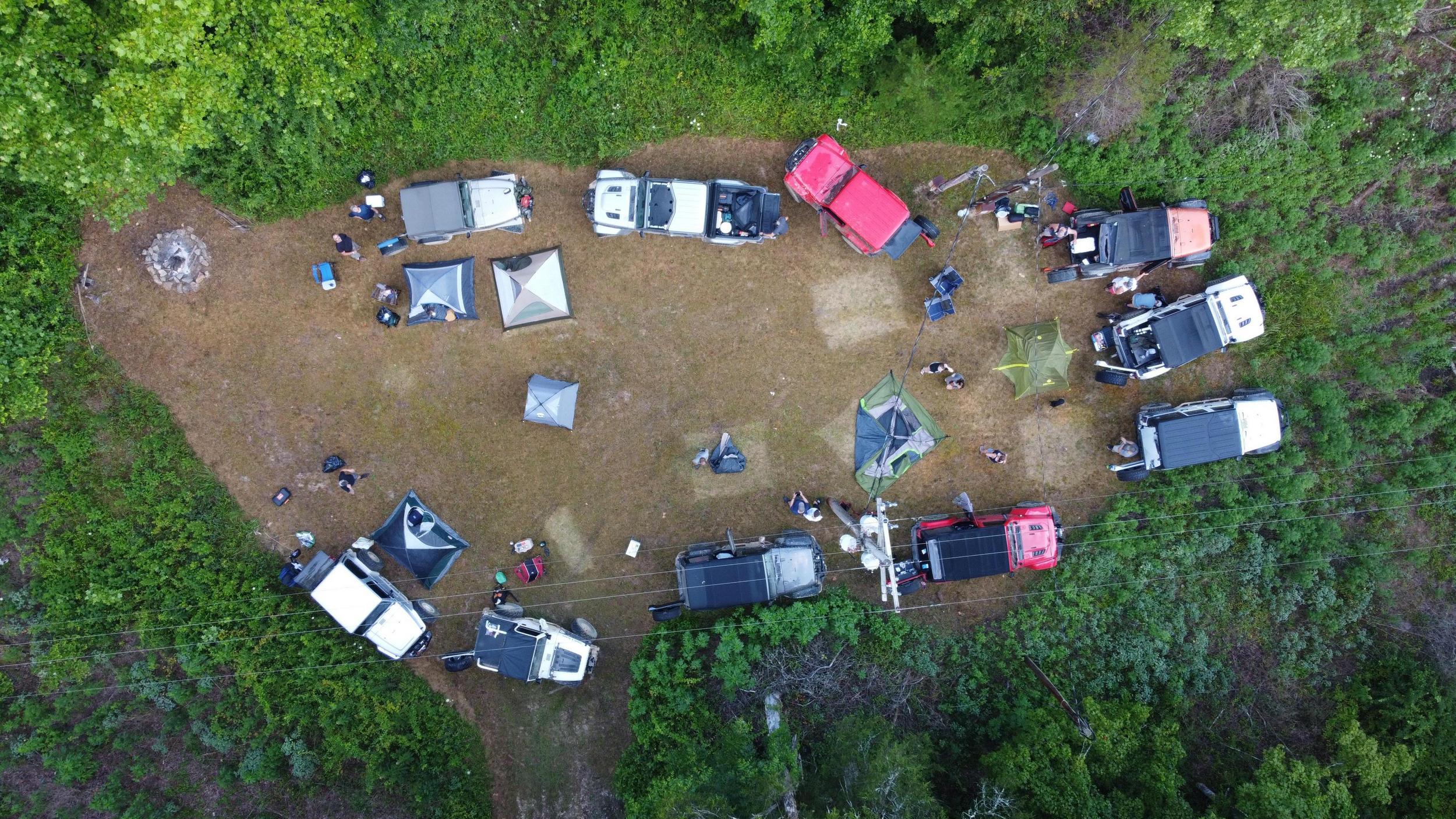
That’s awesome. We can just plan another one right after the first of the year. I already drive down there a few times a year and hike RRG so it’s no biggie to me. I just like to get out.Here is a drone shot of a clearing where we set up camp. It was perfect. It was a clearing for a power line where there was a maintenance box of some kind. It was mowed for access. Overall, it was just a great trail.

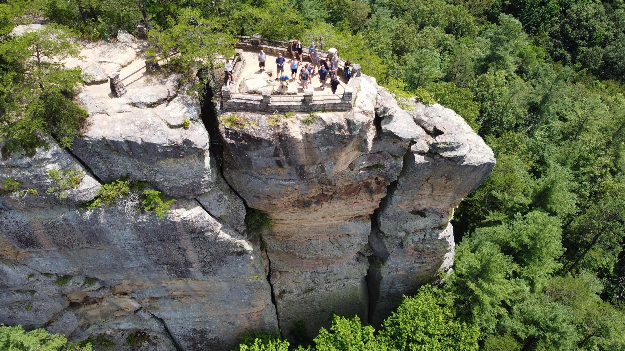
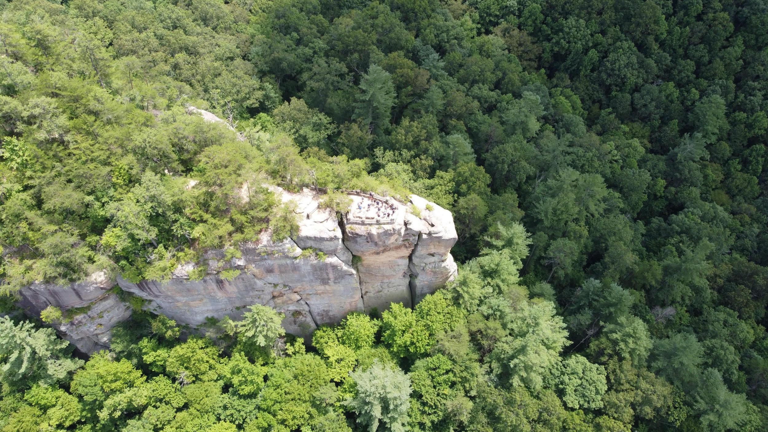
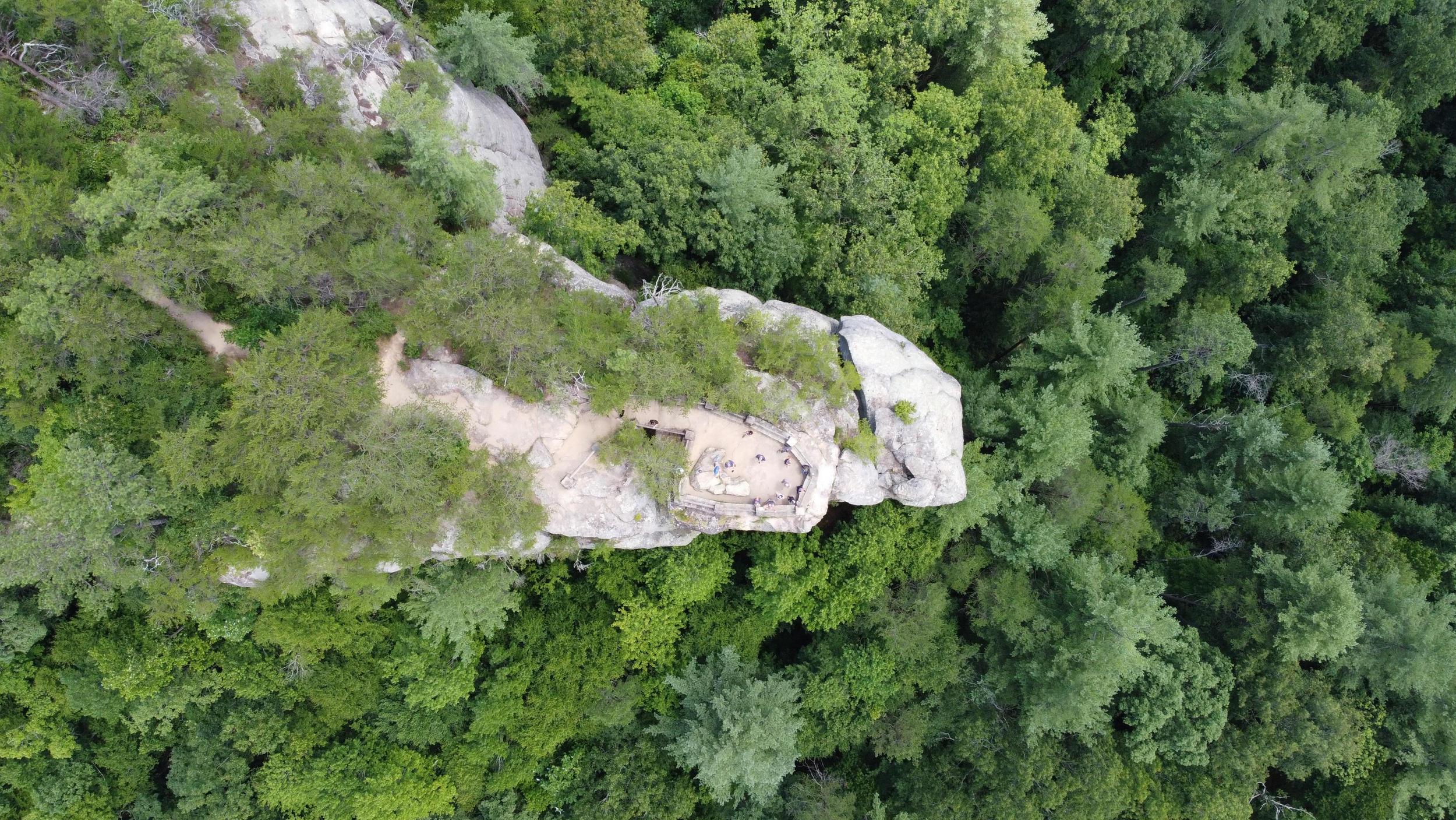
Here are a couple drone shots of an overlook over the Red River Gorge. Beautiful country down there! Well worth the trip!
I really wish I could go with you guys!
Trail Blazer II
15310
Alright I'm good to go for 12-18/12-20. Waiting to hear from my buddy if he'll go. But I'll go regardless.That’s awesome. We can just plan another one right after the first of the year. I already drive down there a few times a year and hike RRG so it’s no biggie to me. I just like to get out.
Enthusiast III
Done deal, you gonna roll down Friday night and camp then?Alright I'm good to go for 12-18/12-20. Waiting to hear from my buddy if he'll go. But I'll go regardless.
Trail Blazer II
15310
Yep that is the plan. Do you have a site in mind?Done deal, you gonna roll down Friday night and camp then?
Enthusiast III
I don’t yet. Need to research for one that’s relatively close to the main roads so we can just pull off and get camp setup.Yep that is the plan. Do you have a site in mind?
Trail Blazer II
15310
Agreed. Do you have a Gaia account? I can PM you a few suggestions once I find some.I don’t yet. Need to research for one that’s relatively close to the main roads so we can just pull off and get camp setup.
Enthusiast III
Yes sir, I have premium so I’m good to go.Agreed. Do you have a Gaia account? I can PM you a few suggestions once I find some.
Trail Blazer II
15310
Okay I'll dig through some notes and get them up on Gaia.Yes sir, I have premium so I’m good to go.
Enthusiast III
Awesome, thanks man. I have a tow strap, 12k winch (and tree strap of course), and maxtrax. Should be enough to get us out of trouble. I also have on board air to air us back up.Okay I'll dig through some notes and get them up on Gaia.
Trail Blazer II
15310
Awesome. Yeah i have a kinetic rope, compressor, and hitch mounted recovery point if needed as well. Same as my buddy too so between the 3 (possibly 4 of us if he can make it we should be good).Awesome, thanks man. I have a tow strap, 12k winch (and tree strap of course), and maxtrax. Should be enough to get us out of trouble. I also have on board air to air us back up.
Enthusiast III
Perfect. What does he drive?Awesome. Yeah i have a kinetic rope, compressor, and hitch mounted recovery point if needed as well. Same as my buddy too so between the 3 (possibly 4 of us if he can make it we should be good).
Trail Blazer II
15310
He's gonna be in a full-size Ram 1500. So he will likely be the limited one of the group. He'll need to definitly bypass that one particular part that @DanW brought up.Perfect. What does he drive?
Enthusiast III
No worries at all, we’ll make it work!He's gonna be in a full-size Ram 1500. So he will likely be the limited one of the group. He'll need to definitly bypass that one particular part that @DanW brought up.
Trail Blazer II
15310
I'd bet that's it! We went north, so the narrows hazard is a consistent description of what I remember going through before we got to the rocks. And it was pretty straight, too. It was also downhill with occiasional ruts, but I still think a full size would handle that part of it, albiet with a few pin stripes from brush. But as more people run the trail, it might beat back some of the brush. I was there in July, I believe.Hey @DanW these look like they match your description of the rock obstacle. Do you mind taking a look?
View attachment 179167
Also, I found a GPX file on a motorcycle site of the whole map. I uploaded it to my Garmin Overlander and the map was spot-on. I'm sure it can be uploaded into Gaia, too. I'll try to remember where I got it. Everyone in our Jeep club, plus the DNR, cautioned me that it probably would not be accurate, but it was. Like I said, spot-on. Every turn.
Thanks for the info! Out of curiosity. How do you like the Garmin Overlander? I really like Gaia but I’ve been wanting a dedicated GPS unit for sometime now to run along with Gaia.
Trail Blazer II
15310
Awesome thanks for the review! That sold me as it was on sale today. Normally $699 but got it for $599 plus traffic attachment.I love it. I particularly love the 3D view of the terrain. I'll throw a pic up later of what that looks like right on the DBBB. I also love that it interfaces with my Inreach and it has wireless camera capability. I had one on the bottom of my Jeep looking forward so I could spot wheel placement and avoid rocks with the diff. It even came in handy to tell how deep I was getting into water or mud. I had it mounted on a cross member in a place I've not hit in a Jeep in 30 years of off-roading. Then on about the 2nd trip out, I nailed the thing, cutting the power cable and beating the hell out of the camera itself. Lol. So I bought another camera and have mounted it to the front bumper. I can now at least see better when cresting a steep hill. But you can add up to 4 cameras and reverse the image for forward view. Garmin made that software change about a week after I suggested it to them, so they are a super responsive company. It also uploads GPX files easily and I've used its campground finder to good effect on the Appalachian Byway. The price is steep, but I lucked into one for $400 bucks, brand new and unopened, on Ebay. I like it enough that I'd pay a sale price for one if I didn't have it. That'd be $499 or so, I think.


