Burns Canyon Trail - 2N02 (Yucca Valley, CA to Big Bear, CA)

  • HTML tutorial

Adventure-Yeti

Rank I
Launch Member

Contributor I

271
Cypress, California
Member #

0752

Hello fellow OLB Members,

If you're interested in a fun, Southern California Trail? Here you go!

We took a fairly popular Southern California trail this past weekend and had a blast. It has a fair amount of terrain & elevation changes, along with some challenging sections that will allow novice overlander to really get comfortable with their rigs while remaining safe & in control.

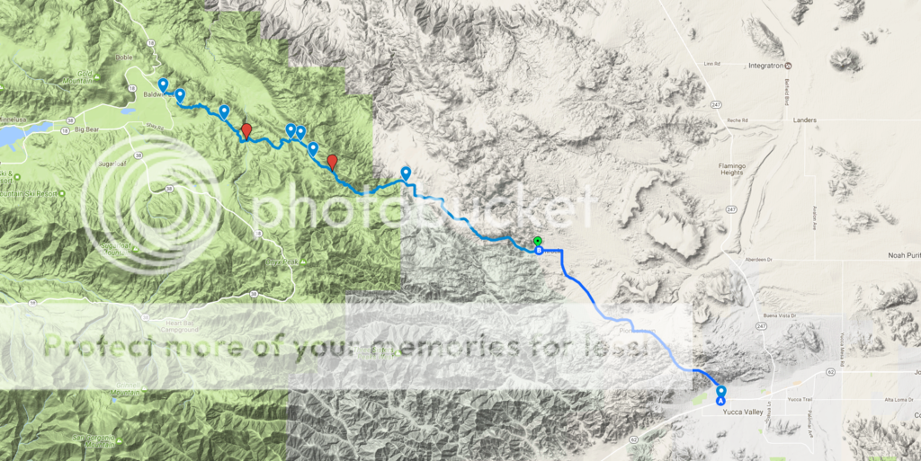
I would recommend starting the trail from the Yucca Valley Side (Pioneertown) and making your way up towards Baldwin Lake/Big Bear. The route is approx. 2hrs off-road, and comes out to 20.0 Miles one-way.

Here are some specs for the route:

Starting Reference Address: 53441 Mane St, Pioneertown, CA 92268
Ending Reference Address: 46040 Vale Dr. Big Bear, CA 92314
Difficulty: Easy
Length: 20.0 Miles
Category: Altitude, Forest, Iconic, Mine, Overland, Rock, Snow Wheeling
Highest Elevation: 7,072 '
Duration: about 2 hours
Shape of Trail: Straight Through
Best Direction to Go: West
Connecting Trails:
2N61Y - Heartbreak Ridge, 2N76Y - Old Timer Canyon, 2N90 - Tip Top Mountain, 3N03 - Smarts Ranch, 2N70Y - Sidewinder Canyon, Rattlesnake Canyon - RC3331
Nearest Town:
Yucca Valley
Nearest Town w/ Service:
Big Bear City
Nearby Trails:
1N01 - Pipes Canyon, 2N61Y - Heartbreak Ridge
Forest Service Road: # 2N02
Forest Service / Park District:
US Forest Service

A friend & I made a google map that you can download "offline" for ease of navigation if desired that can be accessed here: https://drive.google.com/open?id=1q5DPQxyy0YAFmQTClUknd-MINfI&usp=sharing

Also embedded below:


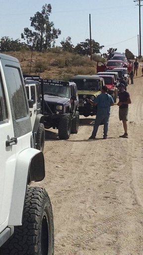
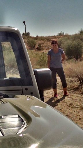
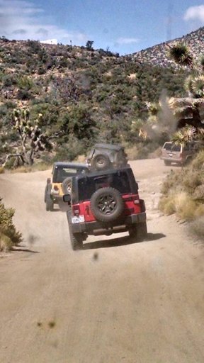
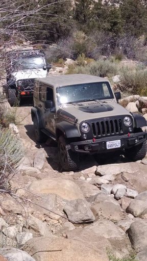
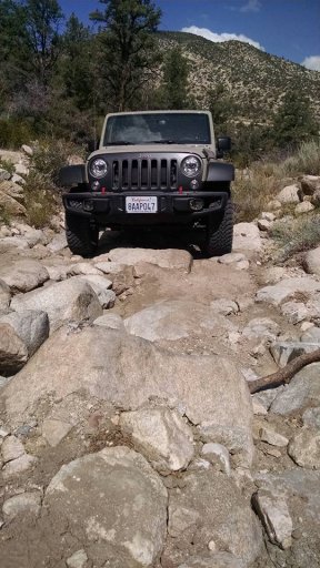
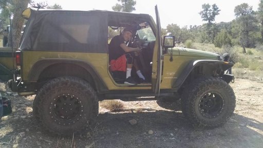
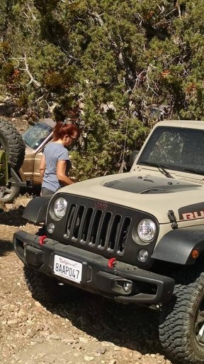
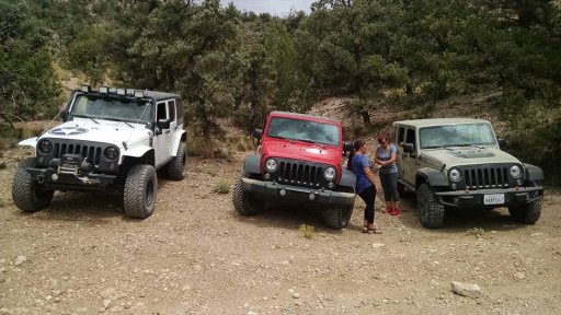
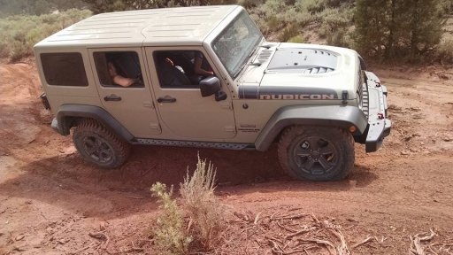
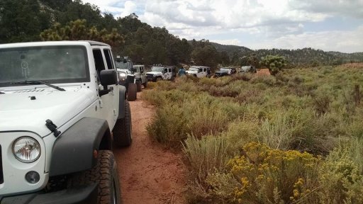
Some pictures on the trail:


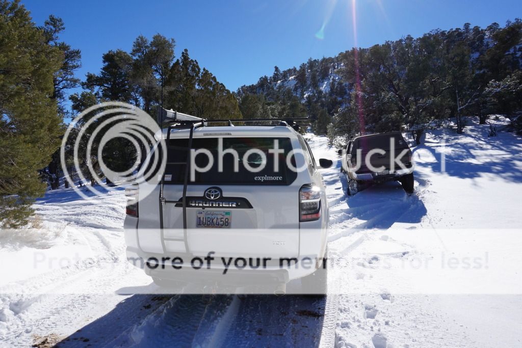
We encountered a fair amount of fresh snow as we ascending up, right around the split between 2N02 & Smarts Ranch Rd. the snow pack was too deep to continue on this past weekend, so be cautious when traveling in the winter months. Air-down, travel slow and tread lightly.

Safe travels OLB friends! Please message me with any questions you may have, I am happy to help.

Until the next adventure...
Matt
 

ASNOBODY

Rank VI
Launch Member

Advocate II

3,984
Detroit, Michigan
Member #

3270

This is awesome! I plan on doing the Mojave Road and hopefully Rubicon Trail this year. I'll be spending quite a bit of time in Southern California and LOVE Big Bear and especially the geology of the area sooo…. *puts this on list* Thanks!
 
  • Like
Reactions: Adventure-Yeti

Scott

Rank VI
Launch Member

Influencer II

3,921
Bates City, MO, USA
First Name
Scott
Last Name
Heiser
Member #

2486

This looks like a fun run. I assume it can be run in both directions? Is it full-size friendly? Are there any sections where rocker or underbody protection is required?
 

Adventure-Yeti

Rank I
Launch Member

Contributor I

271
Cypress, California
Member #

0752

This looks like a fun run. I assume it can be run in both directions? Is it full-size friendly? Are there any sections where rocker or underbody protection is required?
  • It is a really fun, fairly easy trail. Great for a day-trip that doesn't require too much effort. (Beautiful views and terrific terrain changes)
  • It can be done in both directions. The Baldwin Lake / Big Bear side down starts off with much more "snow" in the winter months and thins out as you drop in elevation. At times, like right now - it's unpassable unless you have a pretty built rig that can carve through 3'-4' of fresh powder pack. I think it's better to start from the Yucca Valley side and work your way up.
  • Full-size rigs are fine. I saw a few Tundra's, Suburbans and Bronco's last Saturday on our run up. Some of the tighter turn sections require the oncoming traffic to pull-off and allow you to pass, for the most part, everyone is courteous and will see you coming up or down and pull off.
  • Factory underbody protection will suffice, nothing too tall that could penetrate your undercarriage. Some sections are fairly "rocky" and require some slow crawling to avoid tire puncture or possible frame/gas tank contact. (My TRD PRO Factory under-armor was untouched on the entire trail.
Let me know if I can help any further! Happy to assist.

Cheers!
 

Scott

Rank VI
Launch Member

Influencer II

3,921
Bates City, MO, USA
First Name
Scott
Last Name
Heiser
Member #

2486

Awesome.. Thank you. I live in lake arrowhead and we just got 2.5 feet of snow so I have plenty of snow driving experience from 32 years of living up in the mountains. Sounds like an awesome trail. May be something I'll have to run in the spring.
 
  • Like
Reactions: Adventure-Yeti

thedonnysosa

Rank 0

Contributor I

That's a fun trail. Does anyone know the snow situation from the Big Bear side? We plan on riding dual sport motos next thurs (feb 9) from Big Bear-2-Pioneertown if the standing snow/ice isn't too bad
 

Adventure-Yeti

Rank I
Launch Member

Contributor I

271
Cypress, California
Member #

0752

We drove the entire trail this past Sunday. At "Smarts Ranch Road" fork, the snow got really deep. 4-Low and airing down to 20psi on all four tires did the trick however. Only one of us got stuck, but thankfully our freind behind him had a proper winch setup, and was able to assist with the recovery. Go figure, he was running the most eloborate setup on 33's haha.

On the Bear side, the snow is probably 3' deep, heavily rutted. I would think by now, since there has not been any "fresh" snowfall, you'll be good to go. Just make sure you air down, and take it slow. Cheers-

Here is a video of the run:
 

thedonnysosa

Rank 0

Contributor I

Sweet Video! Thanks for the heads up - I wasn't expecting that much snow ... I may need to make a quick run this weekend to check snow levels for Burns Canyon/Smarts Ranch roads. I'm assuming there isn't a website that gives trail report details like that?

Here's a short video riding last week (1N12 & Thomas Hunting Ground Trail).... here's what we're trying to avoid... Bikes + Ice = No Bueno :)

 
  • Like
Reactions: Irving Zisman

Adventure-Yeti

Rank I
Launch Member

Contributor I

271
Cypress, California
Member #

0752

Sweet Video! Thanks for the heads up - I wasn't expecting that much snow ... I may need to make a quick run this weekend to check snow levels for Burns Canyon/Smarts Ranch roads. I'm assuming there isn't a website that gives trail report details like that?

Here's a short video riding last week (1N12 & Thomas Hunting Ground Trail).... here's what we're trying to avoid... Bikes + Ice = No Bueno :)

Thanks! It was a fun run in the trucks.

Cool video too! Glad neither of you got hurt. I've been wanting to get a dual-sport for a while, my buddies have a sweet company WLF Enduro that's all about it. One day I'll get myself a Husky....

There is a group on Facebook of all places that one could ask a question regarding trail conditions and recieve an answer fairly quick. The group is large, and socal based: SoCal Off-road Trail Reports.

Cheers! Safe riding-
Matt
 
  • Like
Reactions: BD_P4X

Roxxie

Rank IV
Launch Member

Advocate II

1,240
Palm Desert
Member #

7039

I'm going to try this trail tomorrow (with any luck) and Ill post pictures!
Thanks!!!
Im sooooooo excited!!!

Here are my pics from todays ride!!!! From Pioneer Town to Big Bear 2N02 9-3-17
Photos by Shane Slee


PTown 1.jpg PTown 2.jpg PTown 7.jpg PTown 8.jpg PTown 9.jpg PTown 10.jpg PTown 11.jpg PTown 14.jpg PTown 15.jpg Ptown 16.jpg
 
Last edited:

LostInSocal

Rank V
Launch Member

Advocate III

1,836
Chino Hills, CA, US
Member #

5448

@Adventure-Yeti
Thanks for the info on this trail. I got a chance to run it yesterday morning after an overnighter on BLM land near 29 Palms. The trail was a good mix of easy to the light side of moderate. I didn't get to any of the side trails though because I was by myself. I've not been on a trail for months so I'm just glad I got out at all. Thanks again.
 
  • Like
Reactions: Roxxie