
All Going

Broken Bow to Buffalo through the Ouchita and Ozark National Forests
-
START DATE
09:00
09:00 AM Central Time (US & Canada), Mexico City09:00 Hrs GMT -6:00 -
END DATE
Saturday, June 15, 2019
10:00 AM Central Time (US & Canada), Mexico City10:00 Hrs GMT -6:00
 RALLY POINT EVENT
 OVERLAND BOUND REGION
US Southeast
 EVENT TYPE
Trip
 DIFFICULTY
9 - SEVERE 2
Rally Point Event

Terrain Type
- Dirt Road
- Highway
- Mud

Recommended
- 4WD
- Lift
- Off Road Tires

Channel
- HAM 146.565
- CB 14
- GMRS 5
Rally Point Details:
Friday Route - Tentative: https://www.gaiagps.com/datasummary/track/158d7056-9849-43ae-86a1-7bfb57bb1f53/
Saturday Route - Tentative: https://www.gaiagps.com/datasummary/track/42354567-66fa-4fcf-95b8-d7bf39bf817b/
Routes are subject to change, because, well, overlanding: Make a plan > Execute the plan > Forget the plan. I fully expect to discuss and plan routes along the way.
I've marked what I believe could be acceptable campsites; however, I don't have any experience in this region. Therefore, exact camping coordinates are unknown. Camping will be dispersed, with no facilities or services. This will be a 100% pack it in, pack it out adventure. No trash will be left behind. If you plan to attend, please read the rules and information at the Forest Service website as well as for the Buffalo National River.
I currently have 2 confirmed, including myself, and one other tentative. I'm setting this up for 6 rigs, PLUS the other two that I have coming for a total of 8. Anything more and I might not enjoy myself unless someone else wants to take lead.
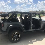
These roads are new to me, so i'm not sure what to expect. I believe they are mostly simple dirt roads, but I did route a few short "trails." There are a couple creek fords in the route, but I don't expect much water unless we get rain, in which case we can route around. Because this will be off-highway and i'm not sure what to expect, i'm going to require 4x4 and high clearance.
Finally, if you're really familiar with this area and have any thoughts, tips, tricks, awesome camping spots, things we need to see, or want to play leader for a weekend, feel free to let me know. I'm open to suggestions.

Skipper Wright
Member# 1
 I
I
Jack Williams
Member# 3408
- Start Point: Broken Bow, OK 74728, USA GPS Coordinates: 34.00569, -94.74123 Notes: I plan to rally in the Casino parking lot in the North East corner
- End Point: Western Grove, AR 72685, USA GPS Coordinates: 36.01369, -92.95017 Notes: Might not actually camp here, but it\'s an option.
This Rally Point location and route can be downloaded if the buttons are active. The “Launch Google Earth" option will allow you to review the location in 3D. Please keep in mind, actual terrain may vary greatly. This should be used for reference only.
Save KML Save GPX PDF Launch in Google Map Launch in Google Earth
Comments