
All Going
All Not Going
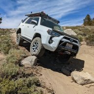
Coyote Flats-Inyo National Forest
-
START DATE
09:00
09:00 AM Pacific Time (US & Canada)09:00 Hrs GMT -8:00 -
END DATE
Sunday, July 10, 2022
12:00 PM Pacific Time (US & Canada)12:00 Hrs GMT -8:00
 RALLY POINT EVENT
 OVERLAND BOUND REGION
US West
 EVENT TYPE
Trip
 DIFFICULTY
4 - MODERATE 2
Rally Point Event

Terrain Type
- Dirt Road
- Highway
- Mud
- Rock Crawling
- Sand

Recommended
- 4WD
- Lift
- Off Road Tires
- Winch

Channel
- GMRS 15 Simplix
Rally Point Details:
We are a group of friends ready to explore this high country trail rated in areas from easy to moderate. Includes narrow steep sections and switchbacks. Spur roads range from nearly groomed trail to rocky and very steep. Sweeping vistas of the Owens Valley, Inyo and White Mountains and eastern Sierra escarpment will be experienced along with meeting new friends, sharing stories and finding new spur roads to explore.
General Expectations
- Prepare & have fun!
- Conduct your vehicle safety and operational worthiness check prior to trip, this includes fluid checks, tire check, spare tire, necessary tools (recovery included), fire extinguisher, air tank, first aid kit, etc.
- Each rig should be self contained with food, water, shelter items (tent/cot sleeping gear), camp tables, chairs, stoves, headlamps, maps and extra fuel (vehicle and stove) for the entirety of trip.
- Be adaptable to trail conditions and unexpected vehicle challenges and be ready to help fellow trail users in need.
- Share your knowledge of the area with the group and be willing to learn something new.

 II
II
Mnt. Rhino
Member# 29124

 I
I
Ian G
Member# IV
IV
SWLands
Member# 24995 III
III
Olander1
Member# 14862 III
III
MT_AYON
Member# 28342- Start Point: 6498 Pony Express Trail, Pollock Pines, CA 95726, USA GPS Coordinates: 38.76205, -120.57666 Notes: Meet Up in Safeway Parking Lot closest to Pony Express Trail Road
- End Point: 2899 Underwood Ln, Bishop, CA 93514, USA GPS Coordinates: 37.34669, -118.43868 Notes: Trail begins at Reata Road and Underwood Lane (Intersection of Coyote Valley Road)
This Rally Point location and route can be downloaded if the buttons are active. The “Launch Google Earth" option will allow you to review the location in 3D. Please keep in mind, actual terrain may vary greatly. This should be used for reference only.
Save KML Save GPX PDF Launch in Google Map Launch in Google Earth
Comments