
All Going
Cincinnati Area Meetup Group
-
START DATE
11:00
11:00 AM Eastern Time (US & Canada), Bogota, Lima11:00 Hrs GMT -5:00 -
END DATE
Sunday, August 29, 2021
01:00 PM Eastern Time (US & Canada), Bogota, Lima13:00 Hrs GMT -5:00
 RALLY POINT EVENT
 OVERLAND BOUND REGION
US Midwest
 EVENT TYPE
Meetup
 DIFFICULTY
1 - EASY 1
Rally Point Event

Terrain Type
- Highway

Recommended

Channel
- Other
Rally Point Details:
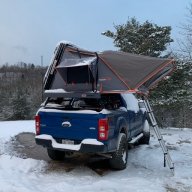
This meetup is to get to know others in the area, build relationships, organize some adventures, share knowledge, learn, show off our rigs, work on rigs, etc.
This is the inaugural meetup so the goal for this first meeting will be meet everybody and get some feedback on what people are looking to get out of the group, what activities they are interested in and what frequency, time and location best accommodates them.
note: This location is a parking area in Caesar Creek State Park. The location is not reserved so if the location is unavailable for any reason I will update to another location with in the park. Check the rally point for changes.

 VII
VII
SJ.Overland
Member# 15310
 VI
VI
DaPyrate
Member# 25234 IV
IV
SugarFreeShooter
Member# 21788 VI
VI
MWallace
Member# 21920
awfroader
Member# III
III
Hattyz
Member# 24615
- Start Point: Unnamed Road, Waynesville, OH 45068, USA GPS Coordinates: 39.50107, -84.03586 Notes:
This Rally Point location and route can be downloaded if the buttons are active. The “Launch Google Earth" option will allow you to review the location in 3D. Please keep in mind, actual terrain may vary greatly. This should be used for reference only.
Save KML Save GPX PDF Launch in Google Map Launch in Google Earth
Comments