
All Going
All Not Going
Getting Unstuck!
Location access: follow pyramid highway to coordinates (39.8842, -119.6015).
After turning off of pyramid follow the offroad trail to the left(west) that parallels pyramid highway back towards Reno. That path will follow pyramid highway until you get to the small sand dune the event will be held at.
Ham Frequency: 146.460 if you need help finding the location.
-
START DATE
09:00
09:00 AM Pacific Time (US & Canada)09:00 Hrs GMT -8:00 -
END DATE
Sunday, May 23, 2021
01:00 PM Pacific Time (US & Canada)13:00 Hrs GMT -8:00
 RALLY POINT EVENT
 OVERLAND BOUND REGION
US West
 EVENT TYPE
Training
 DIFFICULTY
1 - EASY 1
Rally Point Event

Terrain Type
- Dirt Road
- Highway
- Sand

Recommended

Channel
- HAM 146.460
Rally Point Details:
We plan to show a few different types of recovery options for yourself, or others.
Winching, Static Straps, Kinetic Straps/Ropes, Digging, Recovery Boards, Airing down and back up.
We will have volunteers get stuck and extract others for practice with the different methods available so people can see how each method works.
Bring all your recovery gear, Lunch, and some shade. Any questions about recoveries can be answered as well.

 V
V
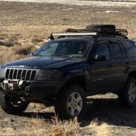
WJeeper
Member# 16971
FlyReno
Member# II
II
TheDrakes
Member# 12169

tcon48
Member#- Start Point: 25580-25720 NV-445, Reno, NV 89510, USA GPS Coordinates: 39.88428, -119.60109 Notes: Highway turnoff
- End Point: 23586-24394 NV-445, Reno, NV 89510, USA GPS Coordinates: 39.88013, -119.61529 Notes: Recovery Locations.
This Rally Point location and route can be downloaded if the buttons are active. The “Launch Google Earth" option will allow you to review the location in 3D. Please keep in mind, actual terrain may vary greatly. This should be used for reference only.
Save KML Save GPX PDF Launch in Google Map Launch in Google Earth
Comments