
All Going
All Not Going
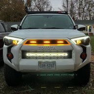
RVA Outbound - Canaan Loop Trail Campout
-
START DATE
10:00
10:00 AM Eastern Time (US & Canada), Bogota, Lima10:00 Hrs GMT -5:00 -
END DATE
Sunday, April 25, 2021
12:00 PM Eastern Time (US & Canada), Bogota, Lima12:00 Hrs GMT -5:00
 RALLY POINT EVENT
 OVERLAND BOUND REGION
US East
 EVENT TYPE
Trip
 DIFFICULTY
4 - MODERATE 2
Rally Point Event

Terrain Type
- Dirt Road
- Highway
- Mud
- Rock Crawling

Recommended
- 4WD

Channel
- GMRS 12
Rally Point Details:
This will be a 3 day/ 2 night trip from Richmond, VA to Monongahela National Forest, WV. We leave Friday, April 23rd and return Sunday, April 25th. Most likely we will all meet up at one location in RVA and roll out from there. The route is mostly highway, with some backroads, and the majority of the trails we plan to drive once in Monongahela are gravel/loose rock roads. There will be a few technical sections, but nothing that any AWD/4WD vehicle can't handle.
We have some great trails planned, delicious meals to make and just have a fun time doing what we love... overlanding!

 IV
IV
Levine98
Member# 28390
 V
V
foamy_squirrel
Member# 19075

Zombie
Member# 14001- Start Point: Canaan Loop Road, Davis, West Virginia 26260, United States GPS Coordinates: 39.06931, -79.49862 Notes:
This Rally Point location and route can be downloaded if the buttons are active. The “Launch Google Earth" option will allow you to review the location in 3D. Please keep in mind, actual terrain may vary greatly. This should be used for reference only.
Save KML Save GPX PDF Launch in Google Map Launch in Google Earth
Comments