Ozark Mountains - High Water Mark Trail Run

  • HTML tutorial

PicNick

Rank IV
Launch Member

Advocate III

1,402
Gonzales, La
First Name
Nick
Last Name
deVeer
Member #

12073

So I'm headed up to Arkansas for a long weekend on the High Water Mark Trail on the weekend of the 13th with some buddies. I'll be in my Lifted WK2 Grand Cherokee, one buddy is in his XJ and another is taking is RWD mid-2000s 4Runner. We're tackling the trail coming from the southeast, which from what I understand is the more technical part. I've done a portion of the trail near Jasper before which was no problem, but I'm somewhat concerned with the RWD vehicle making the southern section.

Has anyone here recently ran the trail? I'm trying to figure out pacing and if we should leave his car somewhere while we're on the more difficult sections. I'd hate to do that to him, though.

Also, if anyone wants to meet up on the trail just let me know.
 
  • Like
Reactions: eagle_A40

Boostpowered

Rank VI

Member III

4,879
Hunt county, TX, USA
First Name
Justin
Last Name
Davis
Member #

14684

Right now not in the wet spring season it will likely be a low water mark trail, and there are multiple different high watermark trail maps so depends on which your following. I wouldnt expect more than maybe 15 inch of water, up to the hubs at most. Tons of folks have done the various trails and i would consider them tame when dry as most forrest roads are.

Worst case is depending on the 2wd guys lift and tires is spotting him over a few rocks and pulling out of slippery sticky mud on banks.

Honestly id be more worried about fallen trees this time of year. Just be sure to take a axe or chainsaw and any recovery gear you have just in case.
 

grubworm

Rank V
Launch Member

Member III

2,358
louisiana
First Name
grub
Last Name
worm
Member #

17464

Service Branch
USN-Submarines
I just posted on another thread about this...we just got back from Buffalo River and the Jasper area and the water was said to be high. I hadn't been there before, but we kayaked the Buffalo at Steel Creek and the water was moving pretty good, the ranger said it was higher than normal and the Glory Hole has water going thru it and was told that is rare this time of year. Not sure about crossings, but apparently the water is higher than normal right now.
 
  • Like
Reactions: PicNick

PicNick

Rank IV
Launch Member

Advocate III

1,402
Gonzales, La
First Name
Nick
Last Name
deVeer
Member #

12073

Thanks, I'll load that up into Gaia and save it for reference. We've got a chainsaw and a mess of hand axes, so I'm hoping we will be good to go. His lift is more of a level spacer, so maybe only 2 inches in the front. I'll have to see how his tires are looking when we do pre-trip vehicle checks this weekend. Worse case scenario I hope is that he uses his maxtrax a bunch
 

sjflemingusa

Rank I
Launch Member

Member I

233
Rogers, AR, USA
First Name
John
Last Name
Fleming
Member #

20777

I live in NW Arkansas.. we have had plenty of rain this year and plenty recently.. You can view the water levels here Buffalo River Floating Conditions If its raining before you get here the waterflow will rise fairly quickly . It also recedes quickly.. It's been plenty wet. I can't attest for the Trail.. I can relate to the trails around me.. Pretty wet conditions.. I would make sure to have recovery gear if your friend is going to 2 wheel it.
 

PicNick

Rank IV
Launch Member

Advocate III

1,402
Gonzales, La
First Name
Nick
Last Name
deVeer
Member #

12073

I just found this KMZ file that you can import into most map software.. it has the route someone has recorded or layed out.. looks pretty fun..
Now that I've actually sat down to look at it, that looks like the same one I was using.

We did vehicle checks over the weekend and some last minute mods (buddy wanted disc brakes instead of drums on his XJ) and we're looking like we're good to go. The low for the weekend is still showing in the 20s, so it may be a bit chilly at camp.

If it weren't for me spilling gas out of a pressure washer into the back of my Grand Cherokee, I'd say we'd be riding in comfort. Installed some Bilstein 5100's on the front of mine and did a tire rotation and the ride is much better. Last ride through these mountains had my teeth rattling out of my head until I aired down from 32 to 24. I'll probably still air down for the majority of the trip, but the less rattling in the cab the better.
 

sjflemingusa

Rank I
Launch Member

Member I

233
Rogers, AR, USA
First Name
John
Last Name
Fleming
Member #

20777

Now that I've actually sat down to look at it, that looks like the same one I was using.

We did vehicle checks over the weekend and some last minute mods (buddy wanted disc brakes instead of drums on his XJ) and we're looking like we're good to go. The low for the weekend is still showing in the 20s, so it may be a bit chilly at camp.

If it weren't for me spilling gas out of a pressure washer into the back of my Grand Cherokee, I'd say we'd be riding in comfort. Installed some Bilstein 5100's on the front of mine and did a tire rotation and the ride is much better. Last ride through these mountains had my teeth rattling out of my head until I aired down from 32 to 24. I'll probably still air down for the majority of the trip, but the less rattling in the cab the better.
Sounds like you're ready to run! Take lots of pics.. Share .. enjoy and stay safe.. The weather this week is going to be wet early and dry late in the week.. so I would def make sure the wet weather gear is packed.. We ran some off road trails this weekend and most were damp and not too slick.. lots of leaves on the trails so they hold moisture and keep things slick .. we didn't air down this weekend but when we do i try to get to 20lbs for trails . seems to help the ride and traction on our leaf slime.
 
  • Like
Reactions: PicNick

PicNick

Rank IV
Launch Member

Advocate III

1,402
Gonzales, La
First Name
Nick
Last Name
deVeer
Member #

12073

Sounds like you're ready to run! Take lots of pics.. Share .. enjoy and stay safe.. The weather this week is going to be wet early and dry late in the week.. so I would def make sure the wet weather gear is packed.. We ran some off road trails this weekend and most were damp and not too slick.. lots of leaves on the trails so they hold moisture and keep things slick .. we didn't air down this weekend but when we do i try to get to 20lbs for trails . seems to help the ride and traction on our leaf slime.
For some reason I didn't even think of the leaves on the trail. I was more enthralled with the chance of snow since us Louisiana boys don't see too much of it. But then the weather took a turn and doesn't look like we will see any precipitation of the fluffy variety.
 

sjflemingusa

Rank I
Launch Member

Member I

233
Rogers, AR, USA
First Name
John
Last Name
Fleming
Member #

20777

For some reason I didn't even think of the leaves on the trail. I was more enthralled with the chance of snow since us Louisiana boys don't see too much of it. But then the weather took a turn and doesn't look like we will see any precipitation of the fluffy variety.
We keep getting out hopes up for some snow.. but like most times in AR.. it's not gonna happen, or not enough to really enjoy. This is why we spend the 13hrs driving to CO! Headed there in a couple weeks .. gonna play in the snow and see if we can still get some 4 wheel action on some trails.. Last year it was so dang cold.. -25 in Steamboat, and barely made single digits in Vail.. I don't need it that cold but the snow was awesome!
 

PicNick

Rank IV
Launch Member

Advocate III

1,402
Gonzales, La
First Name
Nick
Last Name
deVeer
Member #

12073

We keep getting out hopes up for some snow.. but like most times in AR.. it's not gonna happen, or not enough to really enjoy. This is why we spend the 13hrs driving to CO! Headed there in a couple weeks .. gonna play in the snow and see if we can still get some 4 wheel action on some trails.. Last year it was so dang cold.. -25 in Steamboat, and barely made single digits in Vail.. I don't need it that cold but the snow was awesome!
I've got some coworkers headed to CO for the week of Christmas and I'm quite jealous. I've never been, but I've heard that it is beautiful up there. +25F is cold enough, I couldn't imagine -25F lol
 

sjflemingusa

Rank I
Launch Member

Member I

233
Rogers, AR, USA
First Name
John
Last Name
Fleming
Member #

20777

I've got some coworkers headed to CO for the week of Christmas and I'm quite jealous. I've never been, but I've heard that it is beautiful up there. +25F is cold enough, I couldn't imagine -25F lol
This was one very unhappy diesel ... Even with the block warmer it was slow to start and a long time to warm up! We're taking the Jeep this trip.. Gonna see how much fun that wll be!
 

Attachments

  • Like
Reactions: PicNick

PicNick

Rank IV
Launch Member

Advocate III

1,402
Gonzales, La
First Name
Nick
Last Name
deVeer
Member #

12073

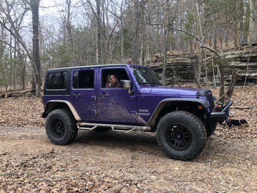
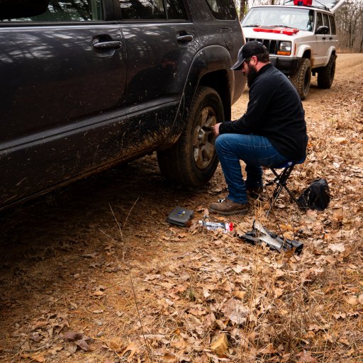
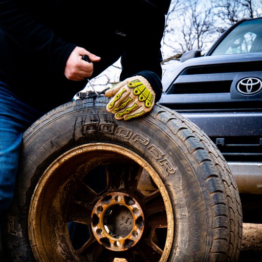
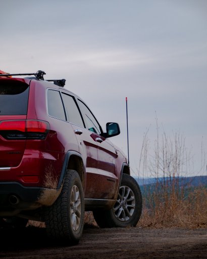
So we didn't get to do the entire trail this trip since we didn't cover enough ground on the first day thanks to my smart self leaving the propane regulator at the house. I probably could have gotten by cooking over the fire, but someone else needed to get better thermals so we ended up running to the Russellville Walmart first thing Friday morning. We didn't get very far before we noticed the 4runner had a flat tire. After patching up the nail hole, we hit the road and ran our errands.

P1120482.jpg
P1120632.jpg

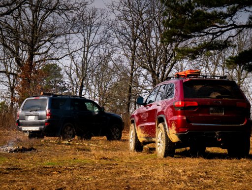
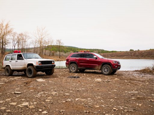
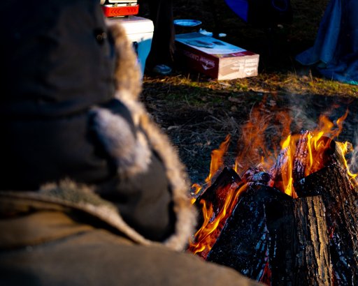
We made it back to the trail a couple hours later and headed to Brock Creek Lake. Took a couple photos and headed down the trail some more before turning around and heading to the White Oak Mountain camp on the map. We lucked up and some previous campers left a TON of firewood behind, just needed to be split. A local came and visited with us and told us the wood was free for us to use, which was great because we were all nervous to use it. He also told us that we turned around just a bit too soon at the lake and missed out on a small waterfall on an offshoot trail.

P1120994.jpg
P1120931.jpg
P1120693.jpg
P1120745.jpg
P1120955.jpg
P1120969.jpg

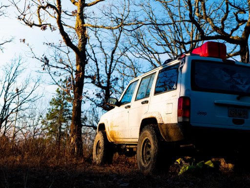
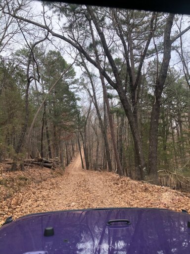
The trail that the White Oak Mountain Camp is on goes back for quite a long way with some great wheeling. It has probably an 800' elevation drop along it and eventually opens up to a football field sized clearing. The way back up is pretty fun with loose rock, rock steps, and off camber turns near shear drops. We were racing against the sun so I unfortunately didn't get any photos of the trail there.

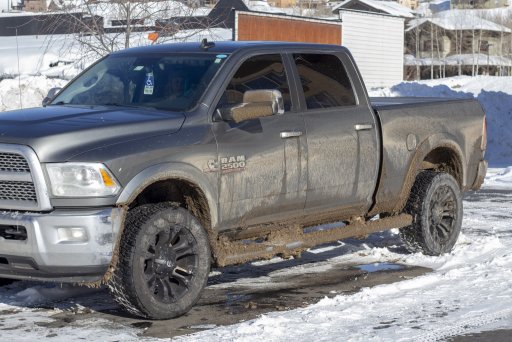
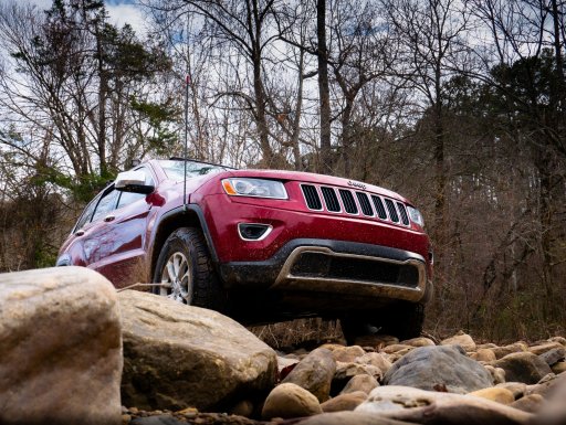
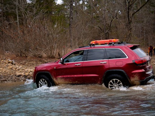
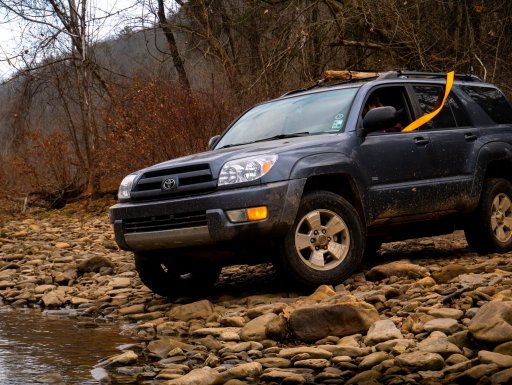
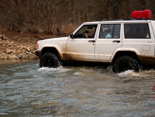
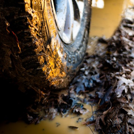
There was a small river crossing that wasn't any more than knee deep at the time, but the rocks were super slick. No drama, no hidden holes, but we strapped the snatch strap to the back of the 4runner just in case.

P1130189.jpg
P1130520.jpg
P1130349.jpg
P1130298.jpg

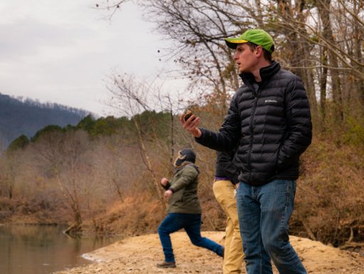
The third day we covered quite a bit more ground and we able to stop and check out a little foot trail just outside of Long Pool Falls. The trail entrance is on the west side of the road and looks like just a little parking area for a scenic overlook. We skipped some stones in the river while stretching our legs and hit the road shortly after.

P1120430.jpg
P1130676-2.jpg
P1130810.jpg

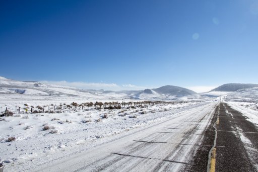
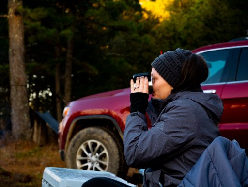
We drove a bit north and ended up finding a campsite on Indian Creek Road (1808) just north of 93691I and called it a night. Mainly because it was night when we got there. Now THAT was a rough night of camping. Got down to the mid 20s with super high humidity. Spent more time shivering that taking photos at camp.

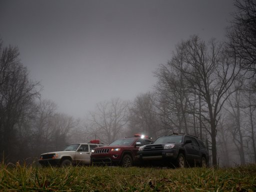
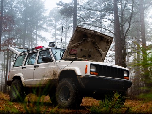
The weather took a turn and heavy fog set in on us with a forecast of thunderstorms that night. We decided to take the trail to highway 7 after stopping on McMinn Knob and taking some eerie crew photos.

P1140054.jpg
P1140121.jpg

We called the trip finished a day early and aired up to highway pressure. A good thing too, since a series of really bad thunderstorms hit the next day for what looked to be the entire route home.
 

Attachments

PicNick

Rank IV
Launch Member

Advocate III

1,402
Gonzales, La
First Name
Nick
Last Name
deVeer
Member #

12073

I can’t get this file to work in Gaia. I’m guessing I’m doing something wrong.
Did you download it to your computer first? You have to go to your account, click upload, then it will give you the option to select to file. It says that it can only do GPX, KML, or FIT, but it works with KMZ as well
 

BrandonH

Rank II
Launch Member

Enthusiast I

Thanks for that route file. I plan on taking my Son and pup camping once his basketball season is over (2 more weeks). Been looking for a trail we could follow through the national forest. This is a very good starting point. Can't wait to get out there!

Greetings from Fayetteville!
 

sjflemingusa

Rank I
Launch Member

Member I

233
Rogers, AR, USA
First Name
John
Last Name
Fleming
Member #

20777

Cool deal ... It will be a great trip I'm sure!! we're gonna hit it in the spring when the trees start blooming