Oregon Backcountry Discovery Route

  • HTML tutorial

John Galt

Rank III

Advocate II

626
Bend, OR
Well we just got back from a couple days on the OBDR. We knew we were pretty early in the season going into this trip but thought we would give it a shot anyway. The original plan was to go from Prineville to just outside of Seneca. Then from Seneca up to the Olive Lake area outside of Granite. Then from Granite up to Meacham. And from Meacham up to Walla Walla. Well as we all know as overlanders, plans dont always go as planned and this trip was no different. We had 9 vehicles and a great group of people.

Day #1
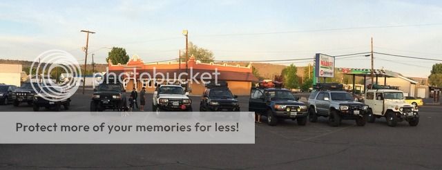
We left Prineville at 6:15 am and headed out on Route 4 of the OBDR. We wanted to get a good early start because we knew it would be a long day. The total miles that day was supposed to be 155.


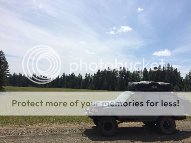
It was a beautiful sunny day with nice warm weather. The trail climbs out of Prineville up into the Ochoco National Forest and up toward Big Summit Prairie. The OBDR follows the "Summit Trail" which is conveniently named because it pretty much follows the highest elevations from peak to peak. Our first issues came when trying to get up and over Mount Pisgah. Although it has been pretty warm the last few weeks, the snow fall this winter was very high and there are spots on the northern facing slopes that still have super deep snow drifts. We were forced to reroute back down the way we came and head south and then east to get around Mt Pisgah.


By the time we got back to the route it was time for lunch!


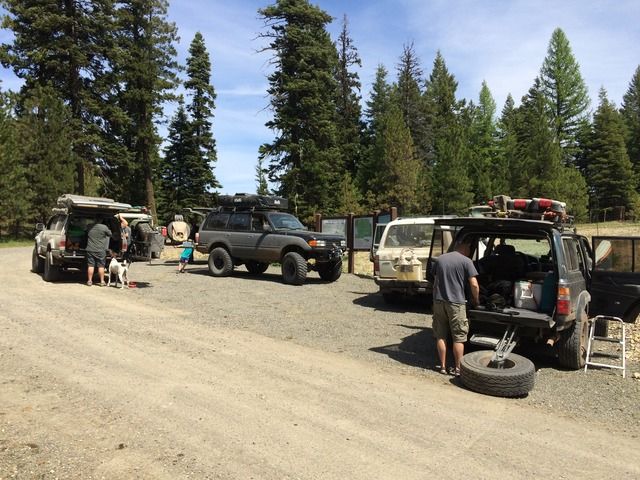
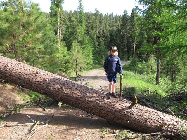
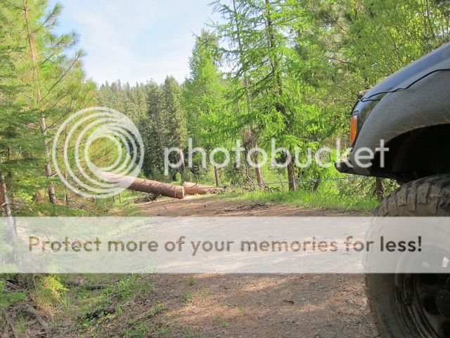
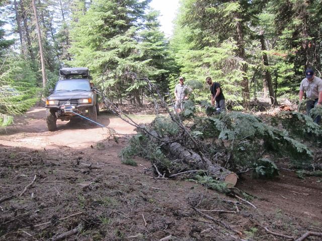
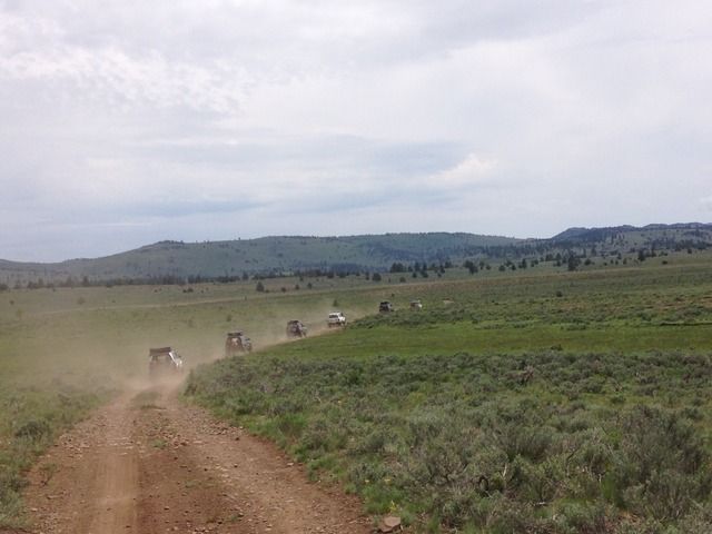
After Lunch the route became more of a trail than a gravel road and since we were the first people on the route for the season we were definitely breaking trail. The high snow fall this year created a lot of dead fall. We had 4 chainsaws in our group and need them for sure. Progress was very slow as every couple hundred feet it seemed like we were cutting trees and pulling them out of the way with winches. We went 7 miles in the 3 hours after lunch. Ouch!!


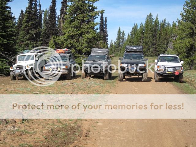
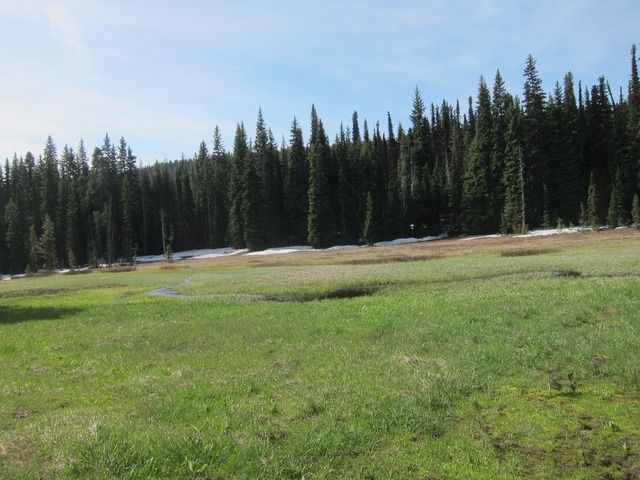
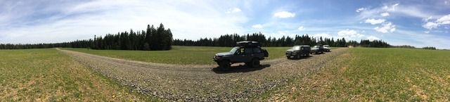
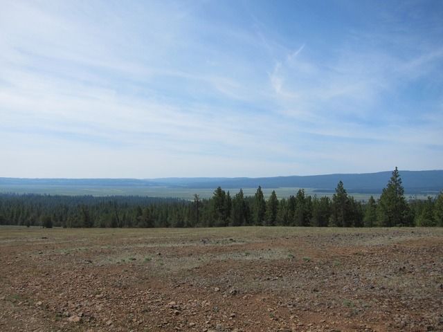
After we got out of the thick stuff the route opened up to beautiful views and vast meadows. It was all about speed at that point as we were hoping to be into camp by 5 pm and we still had a very long way to go.


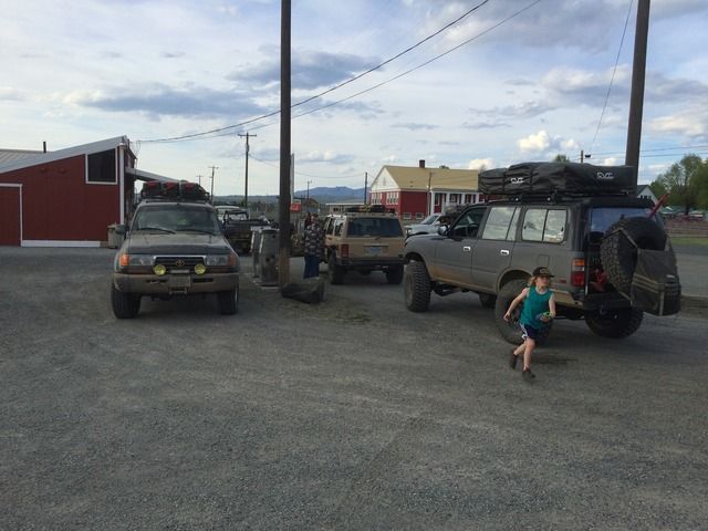
We got close to the end of our route and decided to take a little quicker detour so we could get to camp before dark. We really didnt want to but we ended up in camp at 7 pm instead of possibly getting in at 10 pm or later. We stopped in the huge metropolis of Seneca and got fuel before heading out to camp.


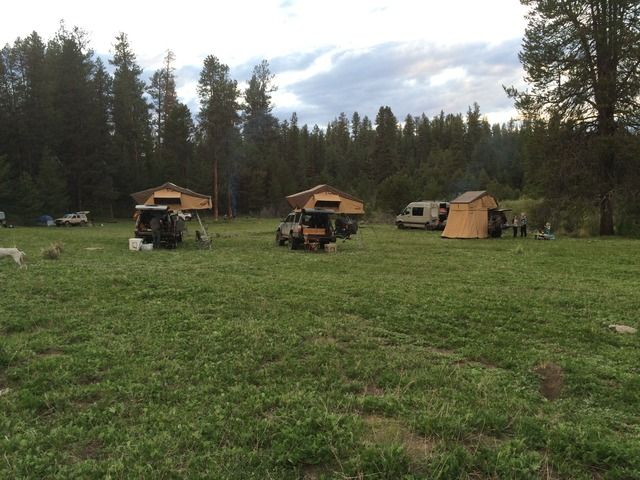
The campspot for night #1 was an awesome spot just outside of Seneca. It was a nice clear field right on a little creek. Plenty big to fit all 9 vehicles. Just as we had set up camp it started to rain!! We knew we were going to have some rain but the forecast wasnt calling for rain until later in the day Saturday and it was only Friday. Oh well. Its an adventure.


I will post day #2 in the next post. I apologize that I am no photographer and most of my pics are on an iphone and a cannon point and shoot. Some of the other guys had awesome cameras and even drones. I will get those later on when everyones done compiling their footage.
 

John Galt

Rank III

Advocate II

626
Bend, OR
Day #2
We woke up on Saturday to pouring rain! Camping in the rain is bad enough, but packing up camp in pouring rain is even harder. But what do you do? You cant control mother nature so we endure.
Oh and I think everyone should have a wife that is willing to climb on top of your lifted vehicle in pouring rain to help put the RTT away. My wife rocks!


The rain eventually stopped and it was pretty nice for the first half of the day. We were now in the Malheur National Forest. We headed East out of Seneca and wouldnt hit pavement until we reached the town of Unity for fuel. First order of business was a water crossing of the South Fork of the Malheur River.


It was just deep enough to have fun but not too beep that anyone has issues. The next leg of the day was pretty fun. It was slow going on some more technical trail, but we were fortunate enough to only have to stop and cut a few trees. We stopped at an awesome spot for lunch at our second water crossing of the day. The North Fork of the Malheur River. One person got some awesome drone footage of us crossing here that I will have to get ahold of. This would be an incredible camp spot! Also the biggest casualty of the trip happened at this crossing. After getting some incredible drone footage of everyone crossing the river, Ben decided to try and pull off the incredible feat of filming himself crossing while flying his drone. Everything looked good for the first 50 feet or so. That is when things took a turn for the worse. What we all thought was Ben doing some fancy flying and trying to get a low level shot, turned into the drone deciding to try and land in the river. It succeeded in landing in the river and luckily Ben jumped out of the truck and ran through the water to save the drone before it went down through the rapids and was lost. I really hope this footage survived. Time will tell.

This is where the day got "Adventurous." Our route climbed from where we crossed the North Fork of the Malheur River. We started running into small snow drifts at around 6500 ft. However, they were fairly small and we were able to push on. We peaked out at around 6900 ft and thought we had made it since we made it over the highest elevation. However, we were wrong. As soon as we started down the north side of the peak we hit deep snow. I broke trail a couple hundred yards down the route before radioing back to the others that this wasnt going to be passible for everyone and that we should reroute back. By that time a few more vehicles had followed down the route and were now stuck. What followed was a couple hours of trying to get everyone back up the hill. On top of all of that, a very large (at least to what I am used to) thunder and lightning storm decided to roll right over top of us. So we are on top of a mountain, in the snow, with multiple stuck vehicles, in the pouring rain with thunder and lightning! This is what we live for right!?? Haha. Cant say we werent frustrated at the time but that is just part of the adventure.


(Photo Credit to TacoSupreme)

We finally got everyone back out of the snow and back up the hill. At this point it was already 5 pm. We were 7 miles from the end of the route where it joined back up with the main roads to Unity. However, because of the snow we had to reroute way back and around. We ended up dropping down into Prairie City and then continued on the highway up to Sumpter. This is where our plans took the biggest hit. First the only gas station in Sumpter was closed for the rest of the day and everyone was running pretty low on fuel. Next we found out that because of the elevation of our planned camp spot up by Olive Lake, it was impossible to even get to because of the snow. Also the rest of the Route all the way to Meacham was impassible as it is almost all over 6000 ft and often pushes 7000. So the plan turned into camping just outside of Sumpter and then unfortunately all heading our seperate ways back home the next day. We were pretty bummed about cutting the trip a little short but what can you do? We will have to come back later in the summer to run the last day or two of the Route 5.
The camp spot was 3 miles outside of Sumpter and was beautiful.


So Sunday morning we all said our goodbyes and went our seperate ways. We will have to try and complete the rest of the journey at another time (preferably later in the summer). I have lived in Oregon my whole life and through this adventure my eyes were opened to a whole new part of the state that I never new existed. I cant wait to get back out there and explore the seemingly endless country that the Ochoco and Malheur wildernesses provide.

On the way out we stopped at the old Gold dredge that you can tour in Sumpter. It is an incredible piece of engineering for the time and is open to the public to walk around in. The last day of operation was in 1954. Each bucket on the line weighs 2000 lbs and holds 9 yards of dirt!!


Steve

lost again...
Founder 500
Launch Member

Traveler III

4,312
Lorain County, OH, USA
First Name
Steve
Last Name
None
Member #

202

@John Galt Great trip and report! Too bathe weather didn't cooperate, but sometimes, that's what makes memorable stories. We had snow flurries here at 686' elevation on Sunday...

We were in Sumpter last fall in the Outback, making the loop looking for ghost towns. Their version of ghost towns is not what we were expecting. Either two ramshackle buildings that had obviously been occupied in the last 20 years or so, or small towns with miner's shacks that were still occupied. The best drive of the day was just north of Sumpter, up Cracker Creek Road to Bourne, and beyond. We got to where the rocks were melon sized, and the turbo Outback with manual tranny was too bogged down to go slow, and not the right vehicle to go any faster. After slipping the clutch too many times 15 miles up the road and 2000 miles from home, we decided to head back. That day, and one crossing water in Florida, were what made us decide to get the 4Runner.

Thanks for the great trip!
 

RiverCityDave

Rank V
Founder 500
Launch Member

Advocate II

1,788
Austin, Texas
First Name
Dave
Last Name
Hunter
Member #

267

Service Branch
Army
You really owe your wife something nice for climbing up there in the rain and stowing that tent. Thats pretty BA.
 

raundhaus

Rank III

Advocate II

Hey @John Galt, sweet trip and pics man. I am trying to get on the OBDR soon and am curious about the difficulty of navigating routes 4 and 5 specifically. Can you tell me what resources you used and found to be essential? I know the organization that oversees the routes sells maps, along with a GPS, is that all I should need?
 

John Galt

Rank III

Advocate II

626
Bend, OR
@raundhaus I have a file that is the complete routes ran by a guy on a moto. I use Garmin Basecamp to read the file and then transfer the routes I want to my hand held. The stuff you get from the obdr organization is worthless. Honestly I don't think we could have found our way with what they provide. If PM me your email address I will send you the complete tracks that we used.

When do you plan on going? I'm thinking of running parts of route 4 in October.
 
  • Like
Reactions: Neil&leabaxter

boehml

Rank VI
Launch Member

Member III

3,316
British Columbia
First Name
Liam
Last Name
-
Member #

2489

Great trip report, I love that white FJ. As for the rain and packing, I know that feeling being from the PNW with about 168 days of rain a year.
 

Neil&leabaxter

Rank II
Launch Member

Traveler I

365
Sherwood park alberta canada
First Name
NeilLea
Last Name
Baxter
Member #

7086

Hey, could you PM or email me about where you got your maps and information for your route? We are planning on doing this trip from Seneca to coos in July with another couple and would really like some insight. Thanks
 

CJ Adventure Oregon

Rank V
Launch Member

Member III

1,816
Coos Bay, Oregon
Member #

9399

Hey, could you PM or email me about where you got your maps and information for your route? We are planning on doing this trip from Seneca to coos in July with another couple and would really like some insight. Thanks
I don’t know if he responded to you, but are you looking for the actual physical maps? Or gps? We have done route 6 (we live in Coos Bay) and route 2 with plans to do route 4 and 5-2 in July.


Sent from my iPad using OB Talk
 

Neil&leabaxter

Rank II
Launch Member

Traveler I

365
Sherwood park alberta canada
First Name
NeilLea
Last Name
Baxter
Member #

7086

I don’t know if he responded to you, but are you looking for the actual physical maps? Or gps? We have done route 6 (we live in Coos Bay) and route 2 with plans to do route 4 and 5-2 in July.


Sent from my iPad using OB Talk
No he did get back to me .. I am actually looking for both any info I can get would help
 

CJ Adventure Oregon

Rank V
Launch Member

Member III

1,816
Coos Bay, Oregon
Member #

9399

No he did get back to me .. I am actually looking for both any info I can get would help
Well, the maps are nice but definitely need gps too. We thought the combo of using both worked great. We made a pretty detailed video about route 6.....if you can’t find the gps tracks for route 6, I can share our gpx file with you.


Sent from my iPad using OB Talk