Educator I
- 10,890
- First Name
- Jim
- Last Name
- Bro
- Member #
12989
- Service Branch
- USAF DAV
Educator I
12989
Educator I
12989
The instructions are for you to click the link and it automatically updates your status...Hey, Michael and team. Hope you guys are doing well. Please upgrade my account per instructions. Member number 13144.
Many thanks!
Kevin
handle: Monaco

Enthusiast III

Advocate III
20990
The maps are populated by us the members and vetted by the development crew. When we find descrpincies in the maps there is a way to flag it for additional information and corrections.Morning...Scanned the 28 pages before posting to make sure I was not asking a redundant question, I am new so bear with me. If this is not the proper place to ask please point me in the correct location within the forum. So here goes...
Who adds trail locations to the Overland Bound Map? Are they vetted by a moderator for accuracy etc. I recently traveled from MO to ID and found the map to be blunt, lacking. With that said how can we as a community make it excellent? It looks like the map feature is relatively new so I understand why. Being new I have been scanning forums till my eyes bleed and I am consistently finding reports of trail great trail opportunities that are not marked on the map. How can we change this? I understand not adding tracks as the map would get very busy, but the jeep icon indicating trail heads is a good idea. I am thinking something similar to Waze or other GPS Apps. that allow you to mark cops location, hazard, etc.
Instead of using Cop it could be tagged as Member trail head tag (Different color then the green jeep to separate these from Overland Bound Markers) with a comments section to capture information related to the trail such as:
Trail length, Connector info if applies, difficulty, full size vehicle capable and so on. Similar to Waze (forum "Members Only" as we have skin in the game) can rate the trails or update / remove if no longer valid (Member added markers only). In my opinion this would greatly expand the maps usefulness and encourage more members to join.
Thoughts?
Enthusiast III
Advocate III
20990
Sorry for the “Obvious” statement, it was supposed to be tongue and cheek. I like the QR code idea and will forward it on to those higher.Excellent video...excited about knowing were your crew is during rallies to include recording tracks. Looks like Overland Bound has some good experienced staff to make the App. / Map a really nice tool. Down the road might put Gaia out of business. haha As a new member, had no idea I could populate the map with POI. Would have tagged several primitive camps along the way on my last trip. Clearly I have much to learn about the tools available to me via my membership. As for it being obvious I would disagree, otherwise I wouldn't be asking, Not to mention other new members may feel the same, just didn't think to ask.
I think it would be beneficial for the new member packet to have QR code(s) included in the materials with a welcome video and a good overarching demo of the maps functionality and possible future enhancements and so on. My reasoning behind including it in the materials mailed out is (at least for me) members might be more apt to see it. This information might have been included in the emails but, honestly I most likely glazed over it, if it were.
Really appreciate the information provided. Looking forward to the future enhancements and seeing the App grow. Now I need to start binge watching your YouTube channel. Cheers

Benefactor
0000
I so agree with this! We are improving our on-boarding documentation and what goes in our welcome kit as we speak - it will also be an iterative process and something we maintain on an on-going basis. We have the how-to's, which are not currently included in welcome kits, which need to be updated for our mobile app.Excellent video...excited about knowing were your crew is during rallies to include recording tracks. Looks like Overland Bound has some good experienced staff to make the App. / Map a really nice tool. Down the road might put Gaia out of business. haha As a new member, had no idea I could populate the map with POI. Would have tagged several primitive camps along the way on my last trip. Clearly I have much to learn about the tools available to me via my membership. As for it being obvious I would disagree, otherwise I wouldn't be asking, Not to mention other new members may feel the same, just didn't think to ask.
I think it would be beneficial for the new member packet to have QR code(s) included in the materials with a welcome video and a good overarching demo of the maps functionality and possible future enhancements and so on. My reasoning behind including it in the materials mailed out is (at least for me) members might be more apt to see it. This information might have been included in the emails but, honestly I most likely glazed over it, if it were.
Really appreciate the information provided. Looking forward to the future enhancements and seeing the App grow. Now I need to start binge watching your YouTube channel. Cheers
Enthusiast III
Advocate III
20990
from my understanding yes.eventually.Do any of your future enhancements include licensing for Apple Car Play or Android Auto for the Map?

Traveler I
When you become an Overland Bound Member with membership number, you get access to the OB Members Map . This allows you to see what others in your area or an area you're visiting, see trails, mechanics, camping spots and much more! Our map is ever growing with member inputs.
Some of the Colors and Symbols:
1. Gold - OB Member
2. Black - Forum user, not OB member yet
3. Red Badge - Rally Point event
4. Purple Badge - Mechanic
5. Jeep - Trail & Info
6. Feather - SVRA
7. Tent - Camping Spot
And many others....
There are a few steps to gaining access:
- You MUST be an OB Member (have membership number) and have your forum account upgraded to "Member" (you will have a gold banner in your forum profile card that says "Member".
- If you are not a member with a number, Go here: OB Member, then contact us to upgrade your forum account.
- You can now access the Member Map!
- In your user drop down menu, edit "Personal Details".
- Edit "Map Location" - This is your location on the member map.
PLEASE NOTE: The Member Map updates once a day at Midnight Pacific time. When you add yourself or make any changes to your location, please wait until after that time to see your changes.
- Also edit "Host and "Helper" to indicate if you are available for members to stay, or call you for assistance!
Advocate III
20990
Educator I
12989
This is resolved now I believe...What do we do when we are a member and can't access maps???
Traveler I
Enthusiast III
Enthusiast III
Enthusiast III
Oh! Well that makes sense! I never even thought about that really! Thank you!Its a security concern, they they dont want others to know were you are or live. Your dot will also move around from time to time.
Traveler I
Advocate III
20990
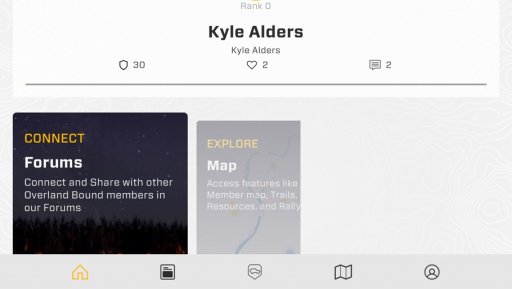
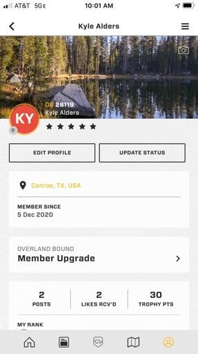
You need to use the activation email... check your junk folder if you didn’t receive oneI may be missing something but I purchased a membership but I don’t have access to the maps. Please let me know what I am doing wrong. Thanks Kyle
Traveler I
You need to use the activation email... check your junk folder if you didn’t receive oneI may be missing something but I purchased a membership but I don’t have access to the maps. Please let me know what I am doing wrong. Thanks Kyle