Navigation, how do you do it?

  • HTML tutorial

Robert OB 33/48

Rank VI
Founder 500
Member

Pathfinder III

4,697
Gaanderen
First Name
Robert
Last Name
Keim
Member #

0033

Hello folks,

As I started the topic about camera's, I just was curious about how you all record your trips.
Well, this topic is about how you prepare for a trip and how you navigate on the "road".

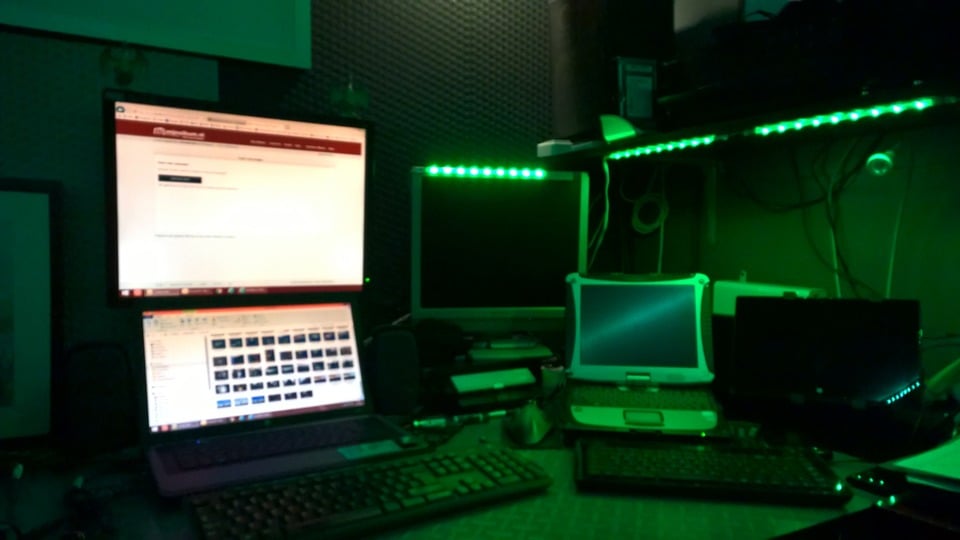
For starters, I do most of the preparation at "Houston". That is the nickname of my little corner in the house where I have my computer stuff.
And one said at a certain time, its like Houston. So, that is why.
Since that time, loads of changes, but still the name staid.
Anyway, here I work with my Panasonic Toughbook in a docking station and extra screen to plot and write routes. And with my normal laptop I am searching Google Maps and satelite to find little roads. With streetview I try to find out if I can go into the fields at a certain point.
So, here is Houston

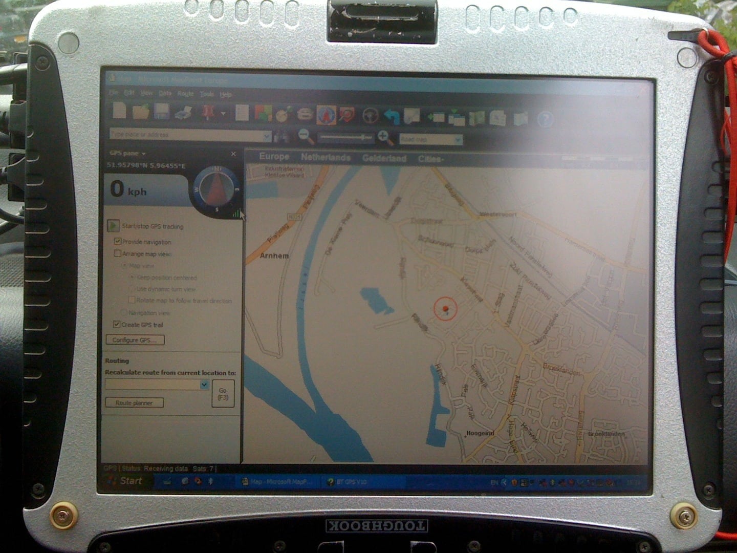
During trips, I put the toughbook in the Van or in the Frontera and then it is my navigation system. Working with Microsoft Mappoint, TTQV-4 and Memory Maps I can find my way through the world.


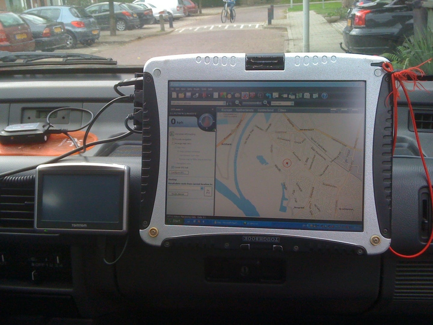
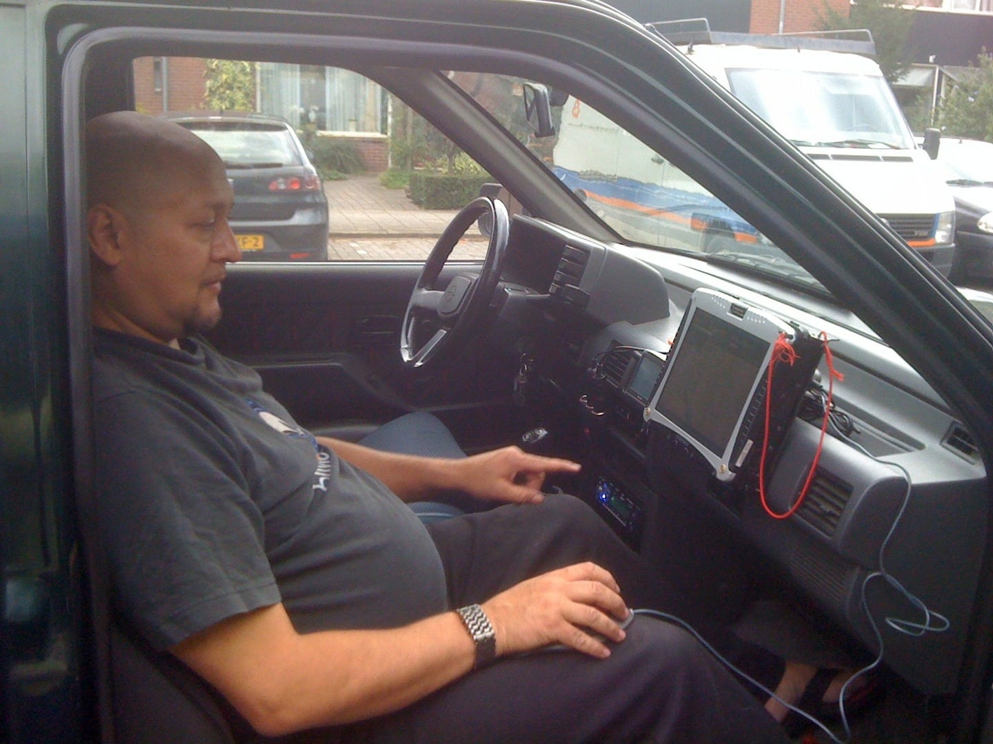
Although the car changed, the mount didnt, and sorry its the only picture I have about it.
We started with a Panasonic Toughbook CF-18 and upgraded it to CF-19.
My tomtom I use mostly as a tripmaster, for speed, direction and tracking. Tracking just in case.
Mappoint isnt official a navigation system, but a sales support product from Microsoft. But it turns out to be a bgreat navigation system for Europe. We wonder very often when we are in the woods or fields, that the tracks we are driving on are still on Mappoint and not anymore on tomtom. So, happy with that.
When we dont have any coverage on mappoint, we switch to memory maps in the netherlands and UK. And then we have maps 1:25.000cm. So, very detailed and accurate.
For other countries, we use TTQV-4, which can use Garmin maps and Openstreetmaps.
All together works out pretty nice. And with meory maps and TTQV we can drive using waypoints as well.

For our trip to morocco, i bought for memory maps a bundle of maps of morocco and I have a Garmin Topo Maroc. So, I guess that is covered.
However, because of the fact that both have a little problem with overall large coverage, we will use a paper map there for global location and directions. Then plot everything into the computer.
As a backup we will bring on bloody old laptop which we used before we had the Toughbook. But as a back up device, it will work good enough.

So, that is how we do things here. How is your way of navigation?

Greetings from Robert
 

Shawn_Dobbels

Rank 0

Contributor I

60
I'm more of a backwoods camper. So with that in mind I use a Garmin Nuvi gps and Gaia app on my ipad. I don't really plan a route either I just kinda wing it. I do study the map looking for anything interesting that might pop up
 
E

expeditionnorth

Guest
nice tuffbook you have there, not familiar with that software, I'll check into that

If I'm not using my notebook with delorme topo & GPS puck on the window

its these 2 since they are so small & easy to use

we were on a USFS road that went back in for several miles though the magellan roadmate 7" didnt show it existed
 

Robert OB 33/48

Rank VI
Founder 500
Member

Pathfinder III

4,697
Gaanderen
First Name
Robert
Last Name
Keim
Member #

0033

Yes, sometimes even the best digital map, or even paper map wont give everything.
But with a digital map, working together with GPS, you normally will know where you are. Which is always good.

Here in the Netherlands, I have to plan every trip very carefully, as a lot of our forest and such are prohibited for cars and motorbikes.
So, I have to do an excessive search for the ones that are open for us.
I wished I could just drive into the open and go for an exploring tour for a couple of days and dont hit any tarmac. Well, that is impossible here in the Netherlands.

So, having araound 25 trips through the netherlands, I try to extend them everytime Iam driving them. And I just take turns and see were we going.

Our trip this year to Morocco will be much more of a challenge for navigation and such.

That will be a complete other topic. Three, maybe four weeks of going overland. Yes.

Greetings from Robert
 
E

expeditionnorth

Guest
Robert I concur

cant wait to see some video(s) & lots of pics
 

SLO Rob

Rank VI
Staff member
Founder 500
Member
Investor

Pathfinder III

3,614
San Luis Obispo, CA
First Name
Rob
Last Name
Petterson
Member #

0012

I love PDF Mobile Maps App. It's free, for one. But I can plan the route, measure and calculate fuel ranges and map points in advance, then create a trip map that's saved to pdf for use on my iPad Air. But, I do have some paper map back ups too. Also, if out very remote, we can make li-dar maps of specific areas if we need details. This works great in Colorado/Utah trips.
Mostly though, when in California, I just need to know " can I drive here?" Because of the many restrictions.
 

Robert OB 33/48

Rank VI
Founder 500
Member

Pathfinder III

4,697
Gaanderen
First Name
Robert
Last Name
Keim
Member #

0033

Hello Robert,

Question, are they compatible with a GPS mouse. So you can see where you are?
One of the things we noticed during our trips through the inlands of Spain, is when we took of from the route, so just going into a track, we where able to see were we going and could see if we could come back on our original route somewhere. Which meant that we just could fool around without losing the original route of the day.

I love maps that are digital and gps orientated.

In the Netherlands and Europe as well, are also many restrictions, so that is why we have to plan our trips so carefully, as otherwise we just drive tarmac.

Greetings from Robert
 

SLO Rob

Rank VI
Staff member
Founder 500
Member
Investor

Pathfinder III

3,614
San Luis Obispo, CA
First Name
Rob
Last Name
Petterson
Member #

0012

Question, are they compatible with a GPS mouse. So you can see where you are?
One of the things we noticed during our trips through the inlands of Spain, is when we took of from the route, so just going into a track, we where able to see were we going and could see if we could come back on our original route somewhere. Which meant that we just could fool around without losing the original route of the day.

Euro Robert,

It wouldn't me compatible, most likely

They are free downloads from either Apple or Google Apps, but some maps require purchase, which is commonly less than paper maps. I'm not sure if Europe participates in some. Try "topo maps for iPad" perhaps. That's also a great one. But I haven't tried them in conjunction with gps.

The interior of Spain sounds like a great trip though!

Robert in California
 

Robert OB 33/48

Rank VI
Founder 500
Member

Pathfinder III

4,697
Gaanderen
First Name
Robert
Last Name
Keim
Member #

0033

Hello Robert,

Ok, well, Iam very much a windows guy, so I have it all. Windows phone, tablet and laptop. And I dont use my tablet in the car. As I have the toughbook.
But thanks for the advice. Will have a talk with a friend of mine about that one.

About Spain,

It is a great country. One of the biggest ones in Europe, and the one I think with still a lot of tracks. And even longer ones.
And I loved it to drive around there and just go left or right.
You can see some pictures about both our trips here;
Spain 2009
And
Spain 2010

Enjoy.

Greetings from Robert
 

Wolvee

ᕕ( ͡° ͜ʖ ͡° ) ︻デ═一 pew pew
Staff member
Moderator
Founder 500
Launch Member

Advocate II

2,271
Member #

0150

I have a small handheld GPS I've had for a few years. It's pretty much outlived its lifespan so I'll end up getting a new on before the next trip. I used to do the map and compass routine but it got pretty pointless. Great skill to have of course but using it most of the time just complicates matters.
 

Robert OB 33/48

Rank VI
Founder 500
Member

Pathfinder III

4,697
Gaanderen
First Name
Robert
Last Name
Keim
Member #

0033

Hello Wolvee,

If you going the change it, I would really recomend the panasonic toughbook CF-19. On Ebay, second hand they come with an interesting price.
If you put on a good navigational programm on it with a GPS mouse attached, you are always in charge. You know where you are, and depending on the programm, you know also what your surroundings are.
Most navigational systems are what I call one track minded. You make the track, and you have to follow it.
With our programms on the toughbook, we are able to make a route, keep it in sight, but go anywhere we like. As the 10" screen and the zooming out and in function of the programm provides you a real good helicopter view, it is easy to navigate into unknown land.

Once we were in Rumania with our Buggy, and had to do a real cross country.
The only thing we knew for sure, was that we had to find a way into the distance, where a road was. So, I drove just as the terrain let me, and Frederique, my girlfriend, told me how my direction globally was, and how far we needed to go.


And this was one of the routes we drove and put on google maps later on.


I really love this kind of navigation. Point is, I always make the roughly route, and Frederique does the fine tuning during the trip. As she can over see the possibilities of the area we drive through.

Good luck with finding a new toy to play with.

Greetings from Robert
 

BlackDogTundra

Rank IV
Founder 500
Launch Member

Enthusiast II

1,027
Santa Cruz, CA
Member #

144

Hi Robert, wow, you have to do some work!  Living in California, we have it pretty easy when it comes to navigating.  Primarily, I use Scenic Map Western United States on my iPhone 6.  It preloads Nevada, California, Oregon, Washington, Idaho, Utah, Arizona, and Montana 3D topo maps on your phone and takes up about 2GB.  It's 10.00 bucks - the free non 3D version is You Need A Map.  You don't need cell service to see where you are, only a GPS signal.  In fact, I get a better GPS fix on my cell phone than my Garmin 60 CXS.  But it kills your phone battery, so if I'm hiking, I usually turn it off when I don't need it.

I also use the Maplets App which downloads National Park/Forest Service/State Park official maps onto your phone.  So when you are in one of the parks, you open that particular map and it shows your location, on the official map!  It's pretty sweet.

Lastly, I use the Google Maps, "ok maps" feature to download particular areas if I know in advance I'm going somewhere specific.  But this is kind of a pain to do and Google decided to make them expire so you have to constantly download the maps.  Kind of annoying.
 

Iubootgater

Rank III
Founder 500
Launch Member

Advocate II

761
Greenwood IN
Member #

062

Stumbled onto this awhile back, been thinking it looks like a system we might try this summer.

Here is a link... Maybe, not real tech savvy

http://youtu.be/b19cURY8ESQ"
 

SLO Rob

Rank VI
Staff member
Founder 500
Member
Investor

Pathfinder III

3,614
San Luis Obispo, CA
First Name
Rob
Last Name
Petterson
Member #

0012

Yeah, pdf maps are great. I did download Gaia Pro and I'm playing with that over the weekend. That is a good video you found @Wilson. That gave me a lot of help.
 

Iubootgater

Rank III
Founder 500
Launch Member

Advocate II

761
Greenwood IN
Member #

062

Got the Avenza pdf maps and the Goodreader app. last night for some navigation aid this summer, looking at "Ram" mounts for Iphone 6 and Ipad mini. Think it will be a nice system. Impressed with the apps already with what little time I have had to play.

Never had any "Ram" mounts, anyone have any experience with them?
 
E

expeditionnorth

Guest
7335 said:
I use motion x gps. It’s a $2.00 app I use on my iPhone. It works great for a $2.00 app.
I too downloaded avenza & then went & downloaded a lot of USGS tops maps

it seems accurate yet my complaint is with the map clarity, it seems rather dull as compared to my delorme
 

MOAK

Rank V
Launch Member

Off-Road Ranger I

2,865
Wernersville Public Library, North Reber Street, Wernersville, PA, USA
First Name
Donald
Last Name
Diehl
Member #

0745

Ham/GMRS Callsign
WRPN 506
On asphalt highway, here in the US, I use the Googke Map  app on my Iphone.  Once we are off highway, and into the outback I rely upon my ever increasing collection of National Geographic Topo maps, National Forest maps, State Forest maps, any other maps I can get my hands on for the regions we are going into, and my compass. for our next trip we'll be getting more maps from National Geographic,, #s 213, 710, 219, 705, 702, and 214, and a select few of the 800 series maps covering the area from Prescott down and thru the Tonto National Forest.  If per chance, we would ever break down in any of these type of areas, I'd want to be able to strap on our back packs and walk out, with map and compass in hand....
 

SGTUSMC

Rank III
Launch Member

Enthusiast I

874
Chicago
Member #

12275

Most of the time I just reprogram my gps to shortest distance and avoid highways, then pick some interesting distant point. That has routed me through small towns and back roads, forests, water crossings, and once down what eventually turned into what can only be described as a game trail. I also turn off u-turns on the gps, that way if I see an interesting dirt road it will route me through rather than turn me back.