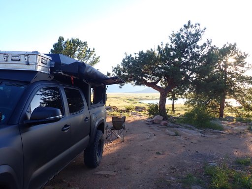
Nice! I have been through there in my past with my old IH Scout 2. Was that the South Platte river?
Might as well start at the beginning. "Sawatch" (2022 Tacoma)
- Thread starter TCBTacoma
- Start date
-
Guest, UPDATE We went through the site migration runbook and completed all steps. We will need to complete the migration next week, but will leave the forums up for the weekend. A few days after maintenance, a major upgrade revision to the forum site will occur.
I think that's probably an offshoot (but it looks like it's pretty close). I think that's actually called (based on some Gaia map hunting), "Rough and Tumbling Creek"...but I can see the South Fork South Platte River just a wee bit north of the crossing. Either way, I would generally say, "yep" as it looks like it's too close to not be a part of the same thing (looks like some intersection of South Fork South Platte, Twelvemile Creek, and this Rough and Tumbling Creek.
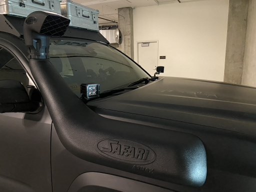
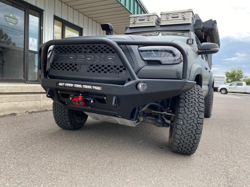
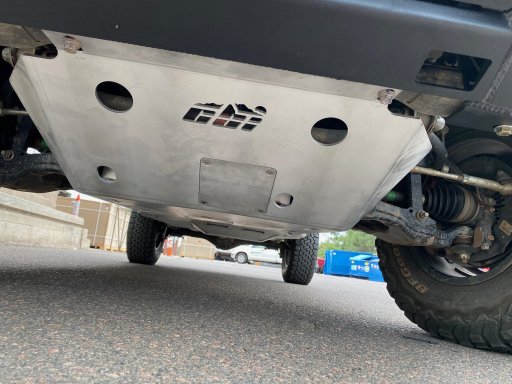
OK, I know *useless without pics*, but I'll have pics at some point (and these mods are kind of least picture worthy, at least with wheels on). I got the Garmin Powerswitch for my *running* power switch (separate from *camper*). The wrong brackets came in for the ditch lights, but I have some ready to go on. Also added in the ARB twin compressor. It's under the hood, back of engine bay on passenger side (common Taco place for this). The most fun was getting the PowerBrakes probably. They're great, but taking it easy on them for a bit longer. Did manage to get out this weekend (was helping support the Hardrock 100 endurance run, if you don't know...well, google will do better than I will) and run a couple fun passes. The camping was [mostly] in a designated area for the event, camping somewhere else would have been impractical given that the 2 days I volunteered, I was up at, or before 5AM..without having to pack up/commute (although I did because I had to drive each day for my tasks).
First Day of volunteering was to help setup an aid station. It just happened that the only way to access the aid station was a short-ish (1-1.5 mile?) hike from Engineer Pass. I thought that was pretty cool, so happy to do it:
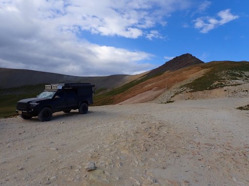
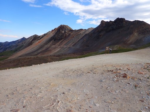
A picture from the aid station down below Engineer Pass:
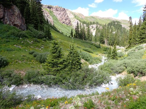
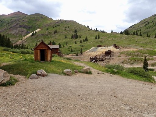
And I did stop in at Animas Forks on the way back down to Silverton:
First Day of volunteering was to help setup an aid station. It just happened that the only way to access the aid station was a short-ish (1-1.5 mile?) hike from Engineer Pass. I thought that was pretty cool, so happy to do it:


A picture from the aid station down below Engineer Pass:

And I did stop in at Animas Forks on the way back down to Silverton:

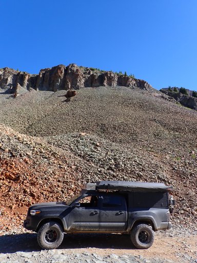
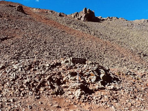
The next day we were to begin course clean-up (picking up course markings and the like). I was driving (although initially I had offered to run/hike and sweep the course), and today required me to drop a runner off, and then drive over Ophir Pass to meet him before he set off on leg 2 of his clearing. It was a fun road, but glad I was there early as that one section is narrow, so traffic could become a concern. And to the *build thread* part, you can see the red calipers in some of the pictures below from the brake upgrade.
Up at the pass:
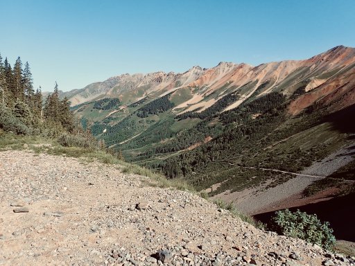
Starting down the narrow part on the western side of Ophir Pass:
Parked the truck to wait for Roger to come through:
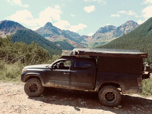
Up at the pass:


Starting down the narrow part on the western side of Ophir Pass:

Parked the truck to wait for Roger to come through:

Was able to get out and explore some of the Enchanted Rockies Trail (segments 6-9) over the last weekend. Weather was questionable the first couple of days, and cleared up for the last evening before taking a spin through RMNP on my way home.
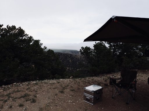
First campsite on the way down to Great Sand Dunes National Park (just outside of Poncha Springs)
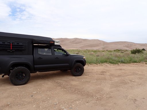
Made it to the Sand Dunes, but had to keep moving as there were risks of flash floods with some of the storms starting in the early afternoon:
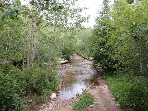
There are quite a few water crossings while going up Medano Pass, but made those before the rains came through (one example, but there are many water crossings):
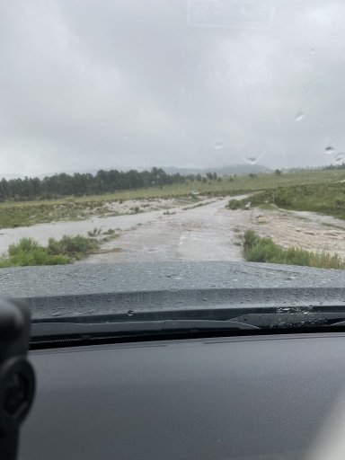
However, while Medano Pass was fine, by the time I made it to some of the next sections, things had degraded a bit:
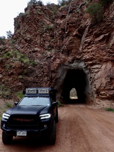
The rain lightened up a bit, and the roads became a bit more secure after making through this section. I always enjoy tunnels...
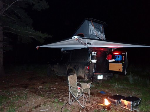
Found a spot for camping, with the truck carrying a bit more mud than it started with.
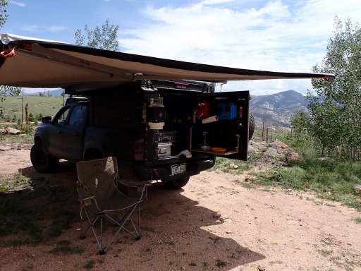
The next day was kind of fun, but was in a lot of areas I am very familiar with. Found a nice spot to pause for lunch while continuing up towards Hot Sulphur Springs.
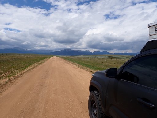
Some sections with nice open roads with expansive views as I approached Como, before hitting a lot of pavement (after Boreas Pass road drops into Breckenridge).
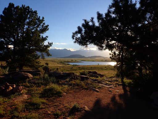
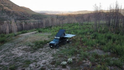
Final campsite of the trip, probably one of my favorite ones this year.
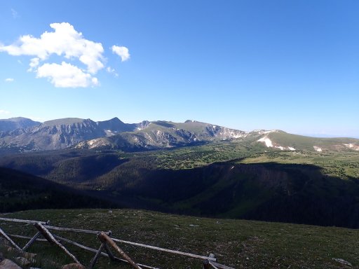
Finished up by driving through RMNP on Trail Ridge Road...while totally passable by any passenger vehicle, it's still a road worth driving for anybody exploring in the area.
Outside of the challenges presented by the weather, this is a very mild route overall. Medano Pass is probably the most difficult part of the route, and in good conditions that's shouldn't present any real issues for a reasonably capable stock rig.
First campsite on the way down to Great Sand Dunes National Park (just outside of Poncha Springs)

Made it to the Sand Dunes, but had to keep moving as there were risks of flash floods with some of the storms starting in the early afternoon:

There are quite a few water crossings while going up Medano Pass, but made those before the rains came through (one example, but there are many water crossings):

However, while Medano Pass was fine, by the time I made it to some of the next sections, things had degraded a bit:

The rain lightened up a bit, and the roads became a bit more secure after making through this section. I always enjoy tunnels...

Found a spot for camping, with the truck carrying a bit more mud than it started with.

The next day was kind of fun, but was in a lot of areas I am very familiar with. Found a nice spot to pause for lunch while continuing up towards Hot Sulphur Springs.

Some sections with nice open roads with expansive views as I approached Como, before hitting a lot of pavement (after Boreas Pass road drops into Breckenridge).

Final campsite of the trip, probably one of my favorite ones this year.

Finished up by driving through RMNP on Trail Ridge Road...while totally passable by any passenger vehicle, it's still a road worth driving for anybody exploring in the area.

Outside of the challenges presented by the weather, this is a very mild route overall. Medano Pass is probably the most difficult part of the route, and in good conditions that's shouldn't present any real issues for a reasonably capable stock rig.


