
The snow is finally melting on the passes here in Siskiyou County, so the girlfriend and I decided it was time to do our first dispersed camp trip of the year. A few weeks back we were out exploring and found this beautiful camp site on the East Fork of the Trinity River, above Trinity Lake. It's totally secluded and remote, nobody for miles. In the winter this would be a 3+ hour drive but when the snow melts it's a great opportunity to take the backroads over some high passes down in to this drainage. The great thing is there are several routes here from my house so we decided to go a different way there and back.
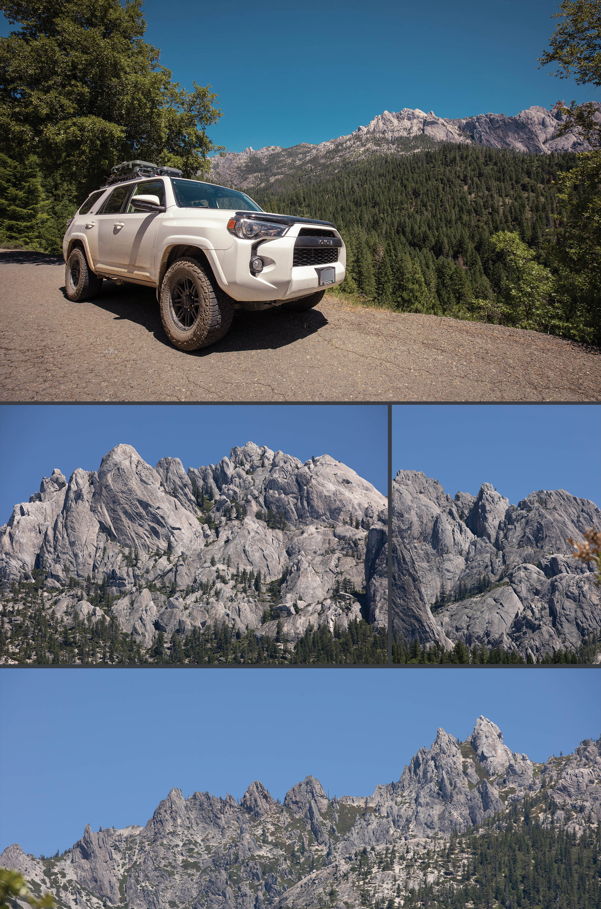
So we loaded up the 4 runner and hit the road for a weekend adventure. On the way there we took off down I5 and exited in Castella, CA, about 15 miles down the road from my house. From there we winded up Castle Creek Road along the beautiful rocky formations of Castle Crags, a much overlooked mountain here in Northern California, overshadowed by neighboring Mount Shasta.
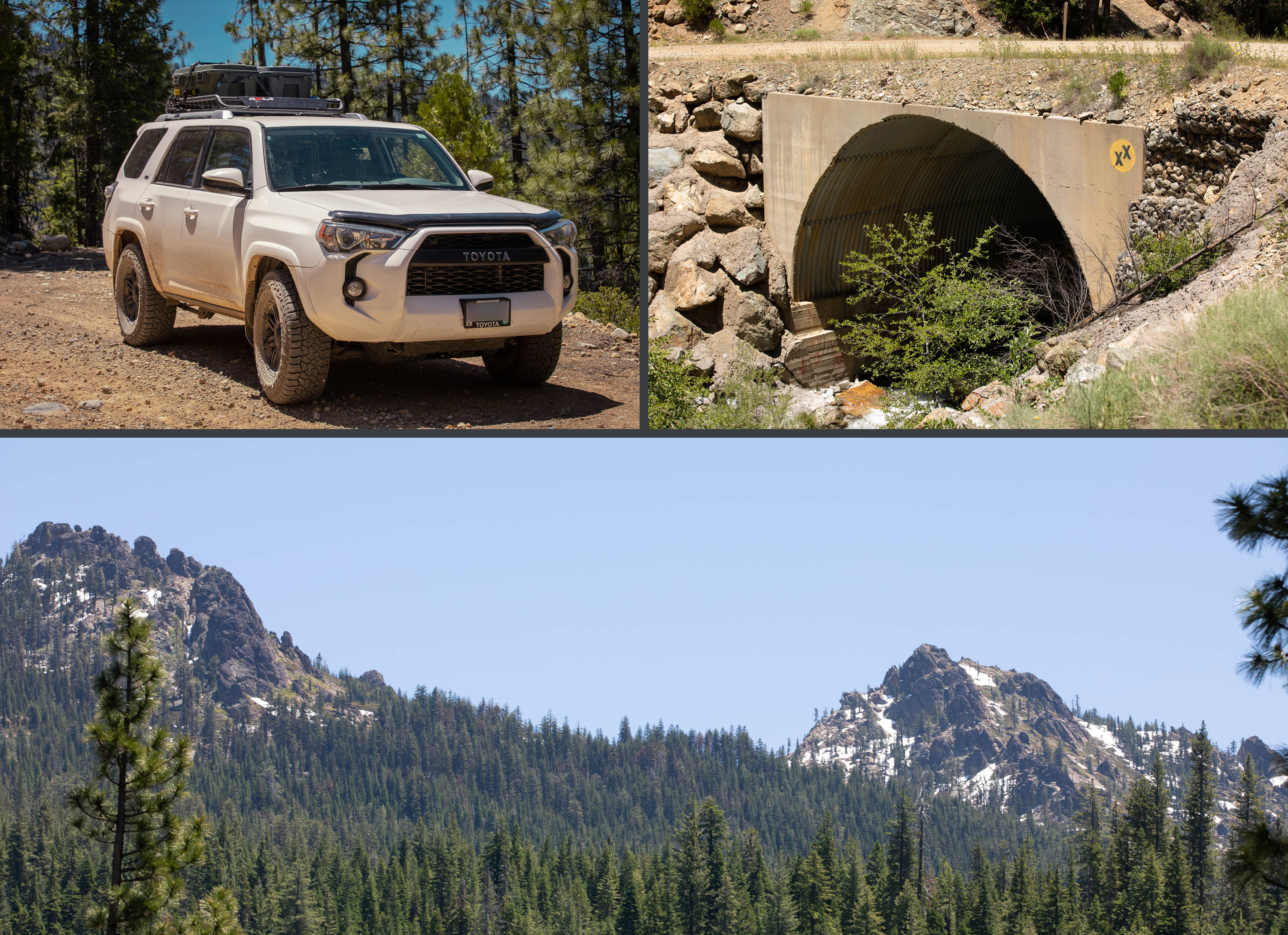
After crossing over the highest point (~5500ft) the single lane paved forest service road turned to dirt and we left the Sacramento River watershed to descend in to the Trinity River watershed. They call this intersection of drainages the Trinity Divide. I've always been fascinated by watersheds and how 2 drops of water could land a few inches from one another and one could end up hundreds of miles away on their course to the ocean.
On the culvert of Crow Creek you can see someone spray painted the emblem of the State of Jefferson, a proposed U.S. state that would span the contiguous, mostly rural area of southern Oregon and northern California. It's a movement that is pretty popular around here.
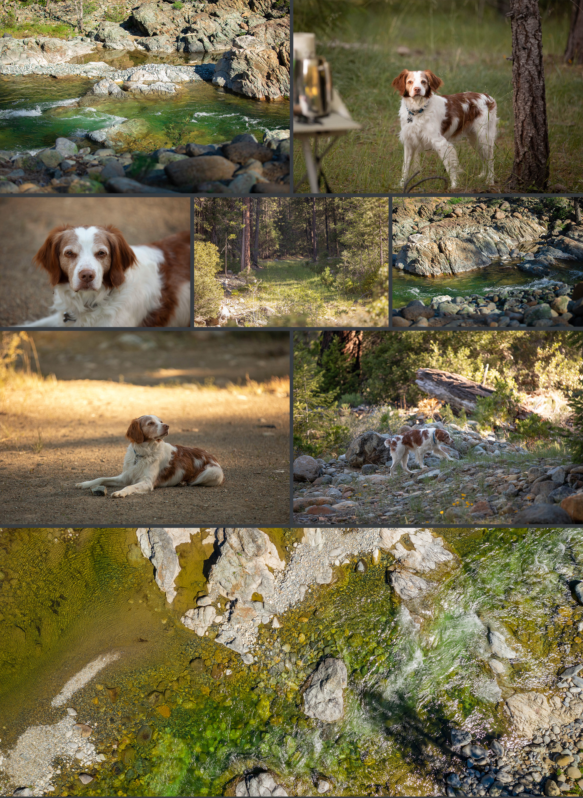
After winding down the mountain we reached the East Fork of the Trinity River. The emerald water here is just unspeakably beautiful. Here there is a surprisingly nice bridge (for such a low traffic area) that crossed over to the other side of the creek. There are some world class swimming holes here.
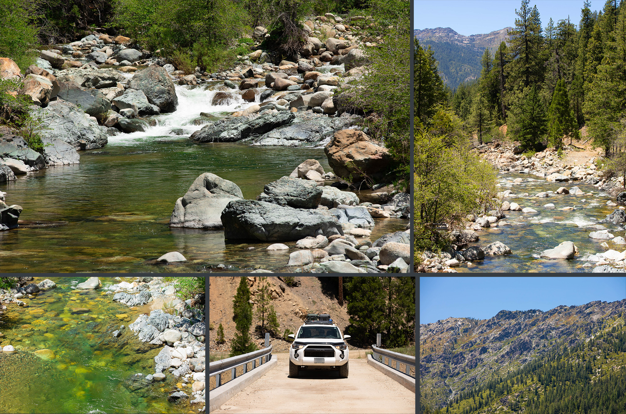
The road gets rougher and rougher as we wind our way down the canyon, towards our destination. Here in the first image you can see a lovely mountain called Bonanza King, which hovers menacingly over the river. There's a wonderful fire lookout at the top of Bonanza King that I've dirt biked to before, amazing view! After winding back down to the water, this time on the east side of the river we arrived at our little slice of heaven.
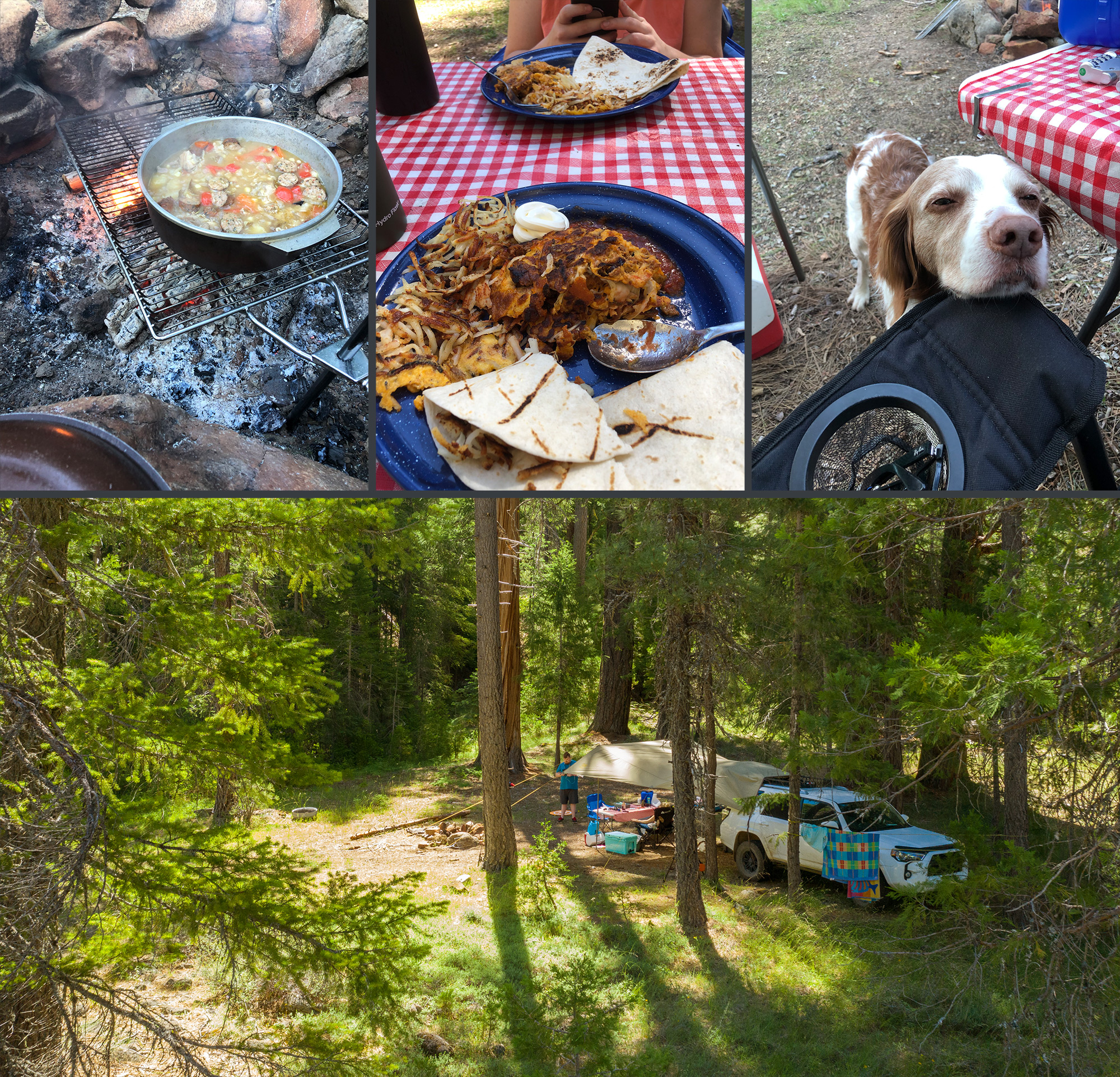
We set up camp and relaxed by the river for a few hours. In the second photo here you can see an aerial photo of the camp area and the bedrock formations that make for such good swimming holes. Lots of gold here too! We cooked up some Italian sausage over the campfire and I enjoyed one of my favorite IPAs, Hop Venom by Boneyard Brewing out of Bend, Oregon. I set up my $10 led string over our Slumberjack Roadhouse Tarp (highly recommended) for some mood lighting. The lights are perfect for keeping your campsite lightly illuminated and creating a nice atmosphere; I plug them in to a solar powered USB battery pack and they'll last for weeks.
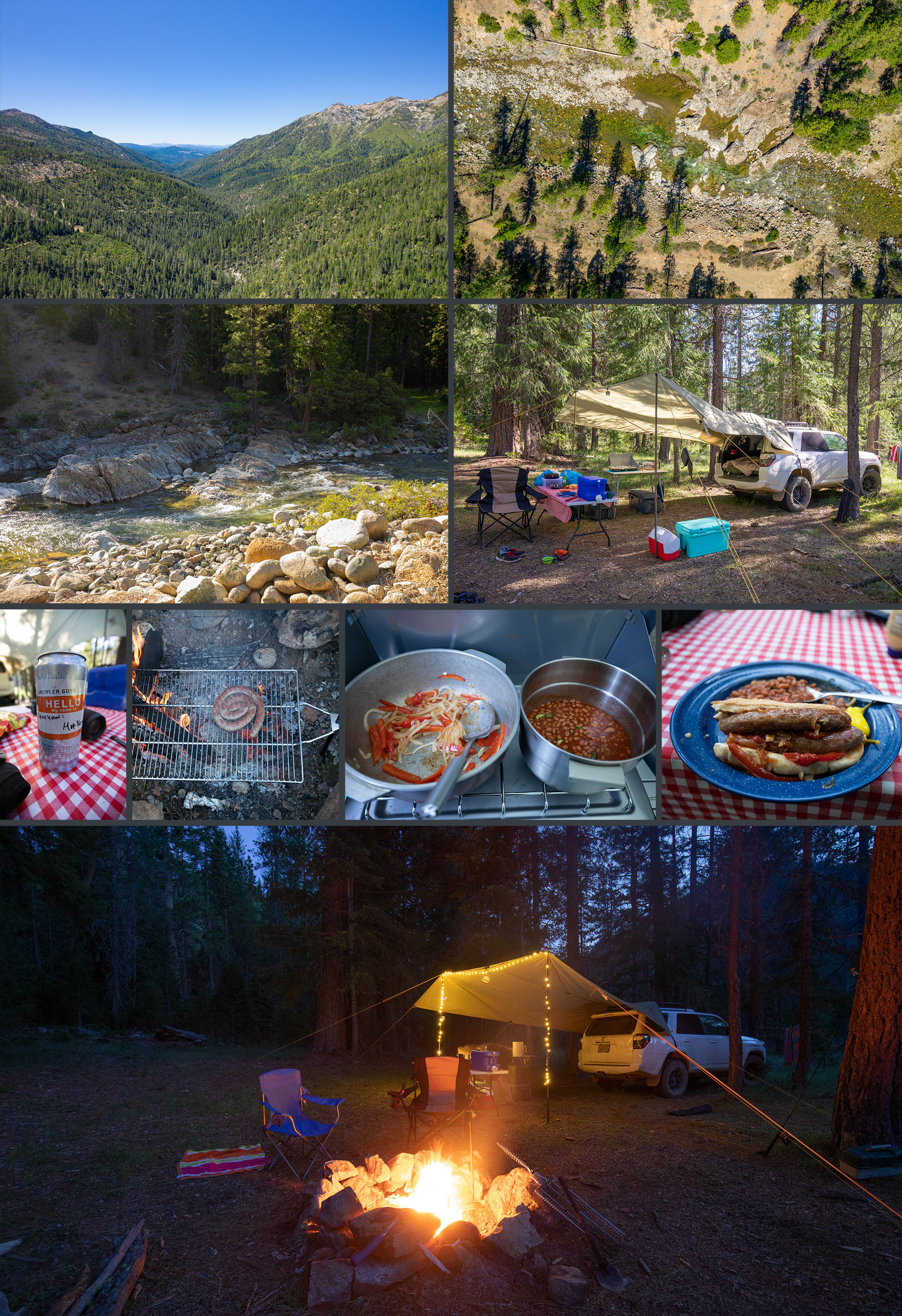
Some more pics of the camp site and the verdant and frigid swimming holes. I also had to throw in some pics of my dog Dexter, as he's, as they say, a damn good boy. He'll be 9 years old next month and besides his graying face, you'd never know it. He is still as adventurous as ever - a true companion, and fantastic camp guard dog (friendly as can be but will not abide any animal intruders).
After a few hours of swimming a buddy joined us and we made some amazing spicy sausage and chicken stew over the campfire. Also pictured is some chorizo and eggs I made for breakfast that morning, along with my little buddy who swears that isn't begging. The next morning I flew the drone for some aerial shots before getting packed up and hitting the road.
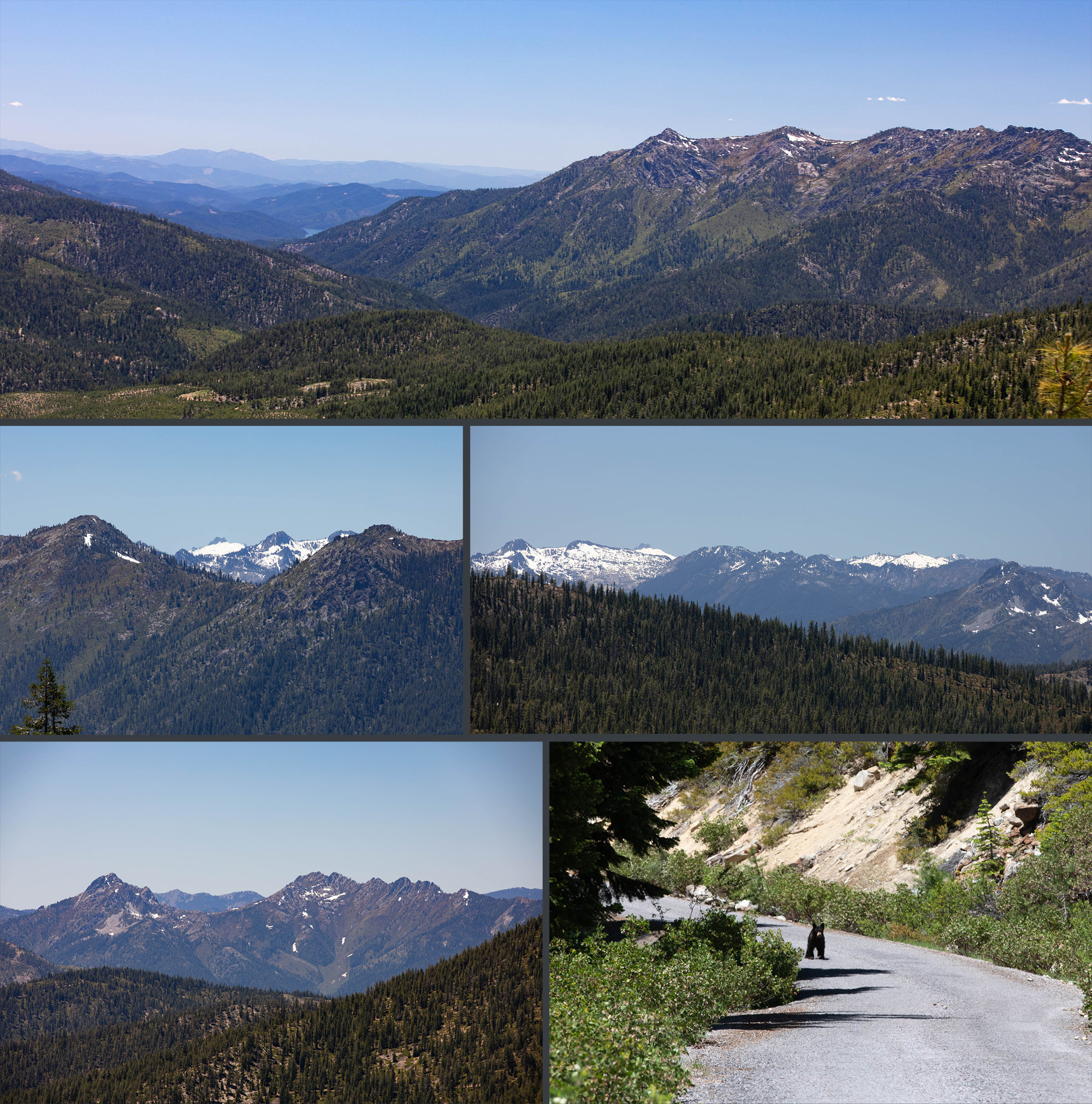
We went back up to the Trinity Divide but instead of descending in to Castella again, we took Forest Service route 26, which stays along the Trinity Divide before dropping in to Mount Shasta, my hometown, along the headwaters of the Sacramento River. In this first picture you can see the East Fork drainage, Bonanza King, and just a slight hint of Trinity Lake. Also pictured are some of the peaks of the incredible Trinity Alps, a lesser known but very impressive rugged and remote range here in Northern California. We also came across a little bear cub on the road.
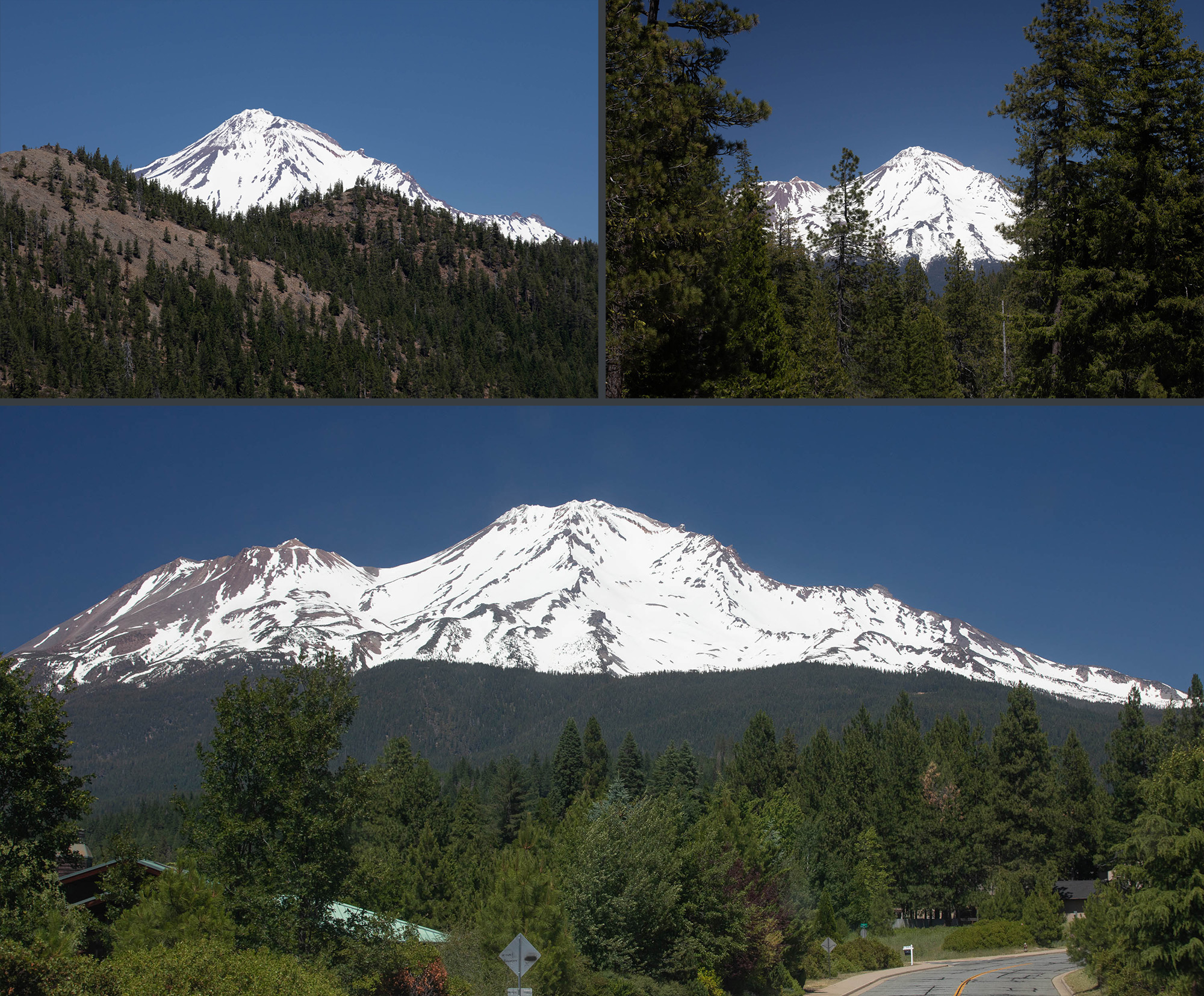
As we cross back over the Trinity Divide at 6,600 ft we get our first glimpse of being back home, glorious 14,179 ft Mt. Shasta. As we wind down the Canyon we get a few more glimpses of the home shrine before finally returning back to the comforts of home. Only a 48 hour getaway but it sure was sweet.
So we loaded up the 4 runner and hit the road for a weekend adventure. On the way there we took off down I5 and exited in Castella, CA, about 15 miles down the road from my house. From there we winded up Castle Creek Road along the beautiful rocky formations of Castle Crags, a much overlooked mountain here in Northern California, overshadowed by neighboring Mount Shasta.
After crossing over the highest point (~5500ft) the single lane paved forest service road turned to dirt and we left the Sacramento River watershed to descend in to the Trinity River watershed. They call this intersection of drainages the Trinity Divide. I've always been fascinated by watersheds and how 2 drops of water could land a few inches from one another and one could end up hundreds of miles away on their course to the ocean.
On the culvert of Crow Creek you can see someone spray painted the emblem of the State of Jefferson, a proposed U.S. state that would span the contiguous, mostly rural area of southern Oregon and northern California. It's a movement that is pretty popular around here.
After winding down the mountain we reached the East Fork of the Trinity River. The emerald water here is just unspeakably beautiful. Here there is a surprisingly nice bridge (for such a low traffic area) that crossed over to the other side of the creek. There are some world class swimming holes here.
The road gets rougher and rougher as we wind our way down the canyon, towards our destination. Here in the first image you can see a lovely mountain called Bonanza King, which hovers menacingly over the river. There's a wonderful fire lookout at the top of Bonanza King that I've dirt biked to before, amazing view! After winding back down to the water, this time on the east side of the river we arrived at our little slice of heaven.
We set up camp and relaxed by the river for a few hours. In the second photo here you can see an aerial photo of the camp area and the bedrock formations that make for such good swimming holes. Lots of gold here too! We cooked up some Italian sausage over the campfire and I enjoyed one of my favorite IPAs, Hop Venom by Boneyard Brewing out of Bend, Oregon. I set up my $10 led string over our Slumberjack Roadhouse Tarp (highly recommended) for some mood lighting. The lights are perfect for keeping your campsite lightly illuminated and creating a nice atmosphere; I plug them in to a solar powered USB battery pack and they'll last for weeks.
Some more pics of the camp site and the verdant and frigid swimming holes. I also had to throw in some pics of my dog Dexter, as he's, as they say, a damn good boy. He'll be 9 years old next month and besides his graying face, you'd never know it. He is still as adventurous as ever - a true companion, and fantastic camp guard dog (friendly as can be but will not abide any animal intruders).
After a few hours of swimming a buddy joined us and we made some amazing spicy sausage and chicken stew over the campfire. Also pictured is some chorizo and eggs I made for breakfast that morning, along with my little buddy who swears that isn't begging. The next morning I flew the drone for some aerial shots before getting packed up and hitting the road.
We went back up to the Trinity Divide but instead of descending in to Castella again, we took Forest Service route 26, which stays along the Trinity Divide before dropping in to Mount Shasta, my hometown, along the headwaters of the Sacramento River. In this first picture you can see the East Fork drainage, Bonanza King, and just a slight hint of Trinity Lake. Also pictured are some of the peaks of the incredible Trinity Alps, a lesser known but very impressive rugged and remote range here in Northern California. We also came across a little bear cub on the road.
As we cross back over the Trinity Divide at 6,600 ft we get our first glimpse of being back home, glorious 14,179 ft Mt. Shasta. As we wind down the Canyon we get a few more glimpses of the home shrine before finally returning back to the comforts of home. Only a 48 hour getaway but it sure was sweet.


