
Anyone running an integrated system for mapping? I am about to embark on an Epic Road Trip and wondered if there was a way I could integrate my iPad as a GPS/Topo Mapping system. Any descriptions and pictures would be greatly appreciated
GPS/iPad/Topo Map system
- Thread starter SonOfNeptune
- Start date
You are using an out of date browser. It may not display this or other websites correctly.
You should upgrade or use an alternative browser.
You should upgrade or use an alternative browser.

Traveler II


Off-Road Ranger I

Traveler III
Here are a couple threads for you:
Offline gps for iPad
http://www.overlandbound.com/forums/index.php?threads/gps-apps-what-do-you-recommend.986/
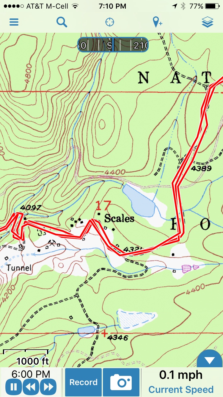
I use Gaia, and am happy with it.
Offline gps for iPad
http://www.overlandbound.com/forums/index.php?threads/gps-apps-what-do-you-recommend.986/
I use Gaia, and am happy with it.

I run Gaia and Earthmate on my iPad air2. I do not rely on the internal GPS of the iPad. I use a Delorme InReach Explorer and Bluetooth the signal into my iPad. The explorer also provides me with some additional service when there is no cell link. Depending on the InReach plan you use you can have weather, SMS text capability, mapping functionality and an SOS/evac options. If you plan to be by yourself a lot I highly recommend. I have never used the SOS function, but there is piece of mind knowing I have it. http://www.inreachdelorme.com/product-info/inreach-explorer.php

Influencer II
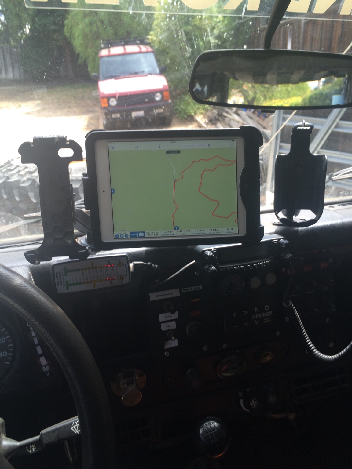
Im running an Ipad Air 2 mounted with mob armor mounts. I also run a external bluetooth gps (dual skypro gps). as far as software goes i use co pilot for street driving and a combanation of gia, backcountry and leadnav... so far i have found leadnav far superior but its also a paid subscription...
Thanks for the heads up Guys. I downloaded Gaia and I already had MotionX... Im going to play around with them both more on the trip to see which one I prefer. That being said, does anyone use a Garmin hand held as their GPS data collector. Is there a way to link the handheld and have it work as the interface/data collector (in real time). I presume you can use a Garmin hand held as a hiking platform and upload the data to Gaia on the iPad and Computer... can anyone confirm?
Thanks for the heads up Guys. I downloaded Gaia and I already had MotionX... Im going to play around with them both more on the trip to see which one I prefer. That being said, does anyone use a Garmin hand held as their GPS data collector. Is there a way to link the handheld and have it work as the interface/data collector (in real time). I presume you can use a Garmin hand held as a hiking platform and upload the data to Gaia on the iPad and Computer... can anyone confirm?
I believe Garmin has software to extract the files and make them GPX files. I don't own a Garmin device. I use my phone or Delorme InReach for tracks when outside the vehicle.
Garmin GPS devices do run a proprietary data stream. With that said, depending on the software you use, you can change the settings to run real-time off of a Garmin device. At one time (6 years ago), I had a laptop in my truck that I used for as my navigation platform. I had ESRI's ArcMap loaded on the laptop and used a Garmin GPS Map 76 as my GPS device. I had to go into the ESRI software setting and select the Garmin interface. Additionally, I had to set the output on the Garmin device to a different setting also. Once completed I had tracking/logging capability on my laptop. I would have to go back into the settings to see what they were.
I have never had a problem importing a Garmin track into any other navigation app/software.
I have never had a problem importing a Garmin track into any other navigation app/software.
Thanks Man!Garmin GPS devices do run a proprietary data stream. With that said, depending on the software you use, you can change the settings to run real-time off of a Garmin device. At one time (6 years ago), I had a laptop in my truck that I used for as my navigation platform. I had ESRI's ArcMap loaded on the laptop and used a Garmin GPS Map 76 as my GPS device. I had to go into the ESRI software setting and select the Garmin interface. Additionally, I had to set the output on the Garmin device to a different setting also. Once completed I had tracking/logging capability on my laptop. I would have to go back into the settings to see what they were.
I have never had a problem importing a Garmin track into any other navigation app/software.
Influencer II
Hey guys I just posted a full review on our GPS hardware setup on my blog.... Please let me know what you think http://overlandf150.com/our-gps-hardware-review/
Hey guys I just posted a full review on our GPS hardware setup on my blog.... Please let me know what you think http://overlandf150.com/our-gps-hardware-review/
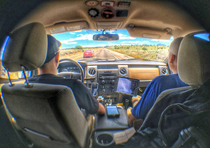
Nice write up man! Can you post some detail pics of the wiring setup?
