Gaia layers, overlanding and knowing where is OK to camp

  • HTML tutorial

Arepas

Rank II
Launch Member

Contributor III

365
USA
Member #

9339

Friends,

I am planning a trip in a couple of days I was wondering which layers do you use to ensure you are camping in a permitted area.

Found the Public Lands overlay but unsure based on this where it is OK from me to crash for the night:


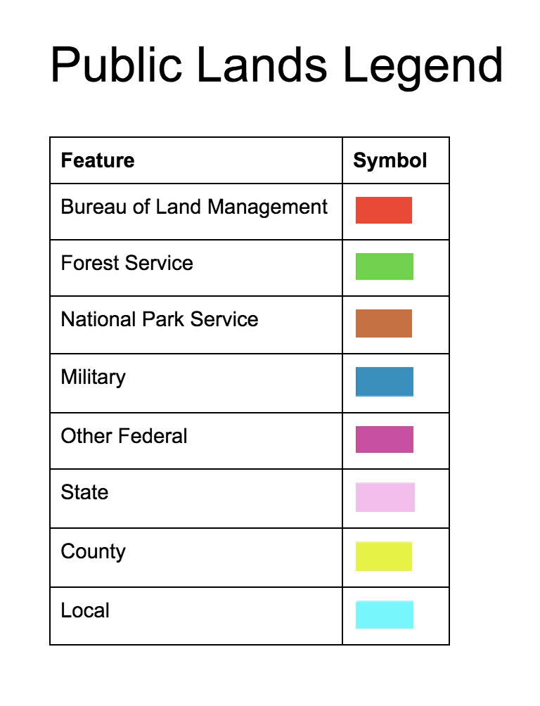
I am guessing that it is OK to do so in Red and green areas, on brown areas I need to register at the national park local office?

Any recommendation for which basemaps and layers to use?
 

Traveler I

Not sure exactly where you are at in the US but i have found that in Oklahoma i have had to check for each varying area. Some areas like the Kiamichi WMA will allow camping anywhere within the boundaries while others dont allow camping at all, and yet others have designated camp sites which may be remote but are still shown on the area specific maps that i can find through the Oklahoma Department of Conservation website. I have not been able to find the layer in GAIA that would show me these details. I have just looked prior to departing knowing where my travels may take me and plan accordingly. I still use GAIA exclusively on the trip and place waypoints in the center of the specific area with notes letting me know where i can camp. Hope this helps to some degree.
 

smlobx

Rank V
Launch Member

Member III

2,336
Mid Atlantic
First Name
Eddie
Last Name
Fort
Member #

8949

Ham/GMRS Callsign
KO4CPL
Most if not all (Death Valley being the only exception that I know of) National Parks only allow camping in designated campgrounds.

Letting us know your location might help with a more accurate answer...
 

Arepas

Rank II
Launch Member

Contributor III

365
USA
Member #

9339

This is for a trip to Death Valley but after leaving I would like to camp near 395 highway on my way back to the bay area. I just want to make sure where it is OK to camp.