East coast Appalachian Byway
- Thread starter Justin Lackey
- Start date
You are using an out of date browser. It may not display this or other websites correctly.
You should upgrade or use an alternative browser.
You should upgrade or use an alternative browser.


Contributor II
I am curious about how much of it is paved. If I may end up doing this before the end of this year. But am 100% on board for the run next year with a group. As long as its before or after I do the TAT

Enthusiast III
Since they are downloads, I don't think they can really be "sold out" though his site does show that to be the case. I assume, from reading the GA description, that he suggests you get them from Georgia Traverse site - though that link is "404" I did find them at The Georgia Traverse MapWhat dont you have? GA was sold out when I got my maps from them.
Contributor II
Since they are downloads, I don't think they can really be "sold out" though his site does show that to be the case. I assume, from reading the GA description, that he suggests you get them from Georgia Traverse site - though that link is "404" I did find them at The Georgia Traverse Map
I have the GA traverse as well.
Does anyone know how this site feels about people posting their gpx files via google drive? I have a LOT of them that I have been buying, downloading, and trading.
Enthusiast III
I've been mapping & preparing for an post-COVID trip from my home to Dalton, GA to Mt. Washington, ME then back home. It is awesome being retired. I hope for an April departure. Planning mostly secondary & county roads and camping roughly every other night & 2-3 Star dives other nights. My vehicle is a 06 Hummer H3 with 122K miles. I'm planning a thorough go-thru and new shocks, etc....

Right now, we're leaning toward the TN/NC/VA portion of the route. Anyone have a guess as to how many days that should take?
Our #2 option is the VT/NH/ME. I'd like to know a guess of how many days that one would take, too.
I've got a window of 7 days.
Our #2 option is the VT/NH/ME. I'd like to know a guess of how many days that one would take, too.
I've got a window of 7 days.
Just over a week from departure. GPX maps are loaded in the Garmin Overlander and Gaia. I'm now doing some maintenance on the Jeeps and sorting camping gear. Can't wait to check out the trail.
Enthusiast III
Jealous!!! Please post information along your way if possible or when you get back home. Be careful and have a great time!!!Just over a week from departure. GPX maps are loaded in the Garmin Overlander and Gaia. I'm now doing some maintenance on the Jeeps and sorting camping gear. Can't wait to check out the trail.
Jealous!!! Please post information along your way if possible or when you get back home. Be careful and have a great time!!!
Will do!
Contributor II
Just over a week from departure. GPX maps are loaded in the Garmin Overlander and Gaia. I'm now doing some maintenance on the Jeeps and sorting camping gear. Can't wait to check out the trail.
Have you figured out where you are starting?
Have you figured out where you are starting?
Yes, I think we're going to start in NC right off US 23 near Franklin. We're leaving after I get off work, so we'll probably stay in Dandridge, TN Friday night, then make the 1.5 hour drive to our starting point. We're going to mostly camp, but may do a hotel a night or two along the way. It'll probably depend on the weather.
Last edited:
Got the Jeeps' maintenance caught up. Now we just need to clean them up and load them out. I spent yesterday swapping the hard top/Sunrider back onto the JL, then changed oil/filters on both Jeeps and diff and t-case fluid on the JK. Both had tires rotated/balanced, so they are good to go for the highway drive as much as the trails. Long-term weather is looking good. At this point, three Jeeps are going, including my two with me, 3 kids, my brother, and my friend with his 2 door JK. We'll be using GMRS, probably on channel 15, the whole way, with CB as a back-up.
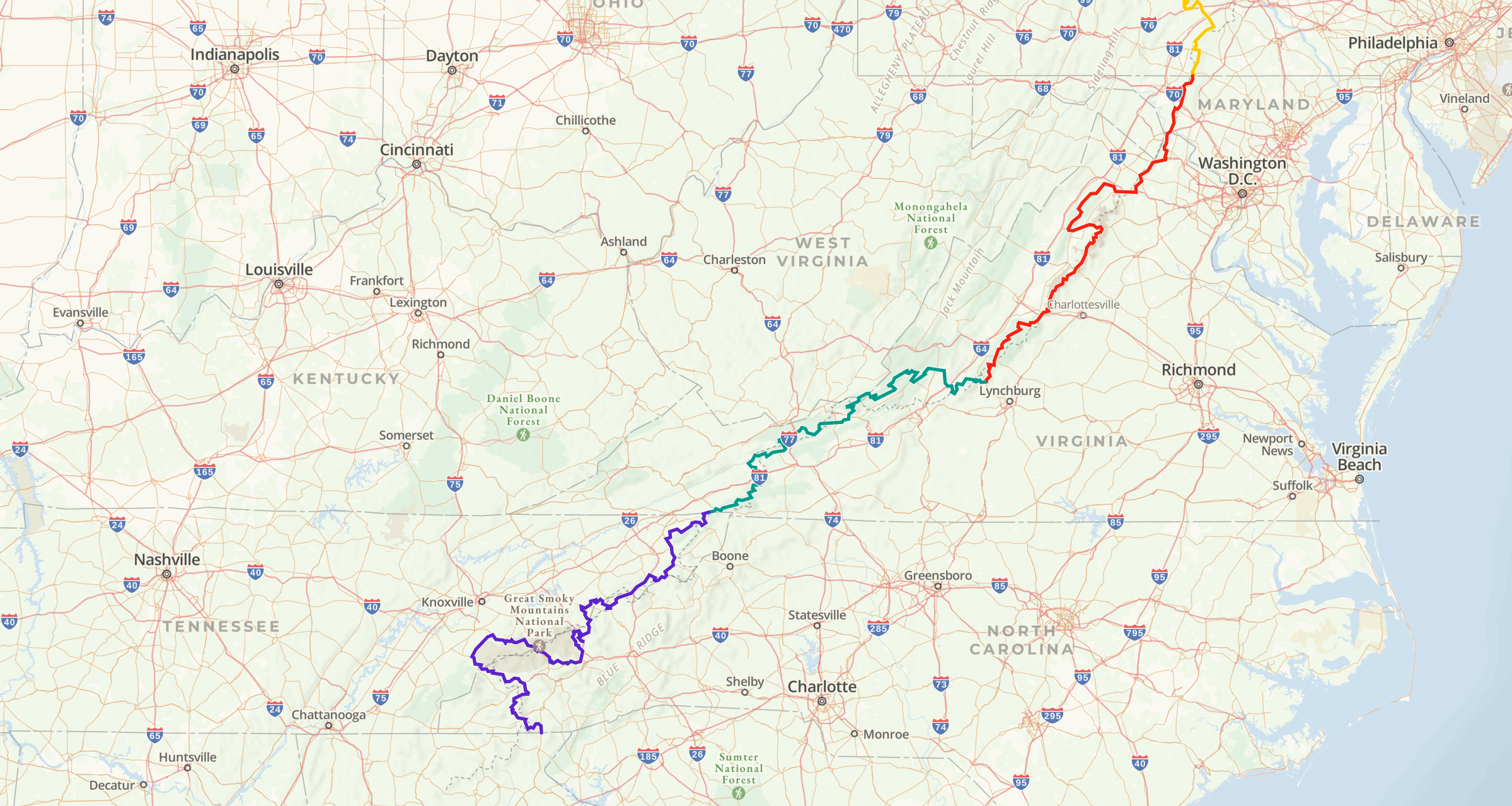
Here is the route. I've been discovering some cool features of Gaia, which includes cell coverage map overlays for each cell company! Very cool!
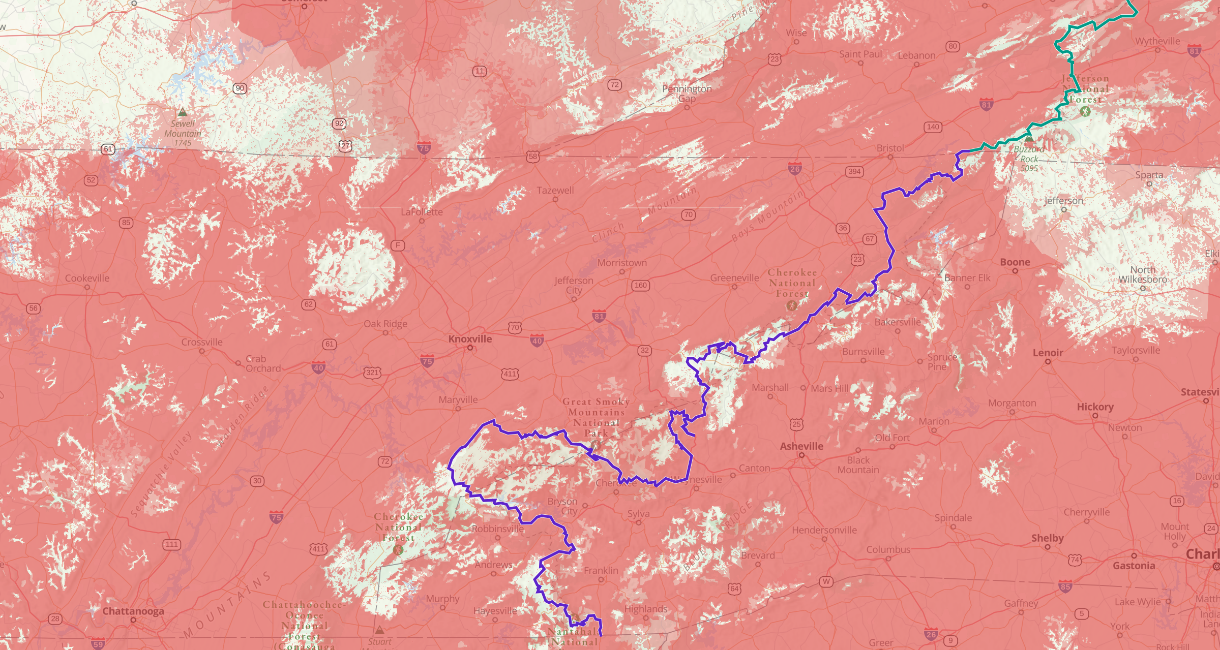
Here is Verizon's map. All 3 of us have Verizon, but I've also got AT&T for my JL's wifi. I'll be exploring Gaia for other features this week, so stay tuned.
Here is the route. I've been discovering some cool features of Gaia, which includes cell coverage map overlays for each cell company! Very cool!
Here is Verizon's map. All 3 of us have Verizon, but I've also got AT&T for my JL's wifi. I'll be exploring Gaia for other features this week, so stay tuned.
To anyone who has actually purchased these maps, are they worth purchasing? Can you provide any information on what is actually including on the maps?
Are they just gpx files? The website doesn't really have much info.
Are they just gpx files? The website doesn't really have much info.
We are almost done with the NC/TN route. The route has been spot-on. Well worth it.To anyone who has actually purchased these maps, are they worth purchasing? Can you provide any information on what is actually including on the maps?
Are they just gpx files? The website doesn't really have much info.

Enthusiast II
How has the route been so far? I haven't done much more planning since I started this thread but glad to see it has helped others. I'm still stuck in Africa. Also what do yall like better Gaia or the Garmin Overlander?
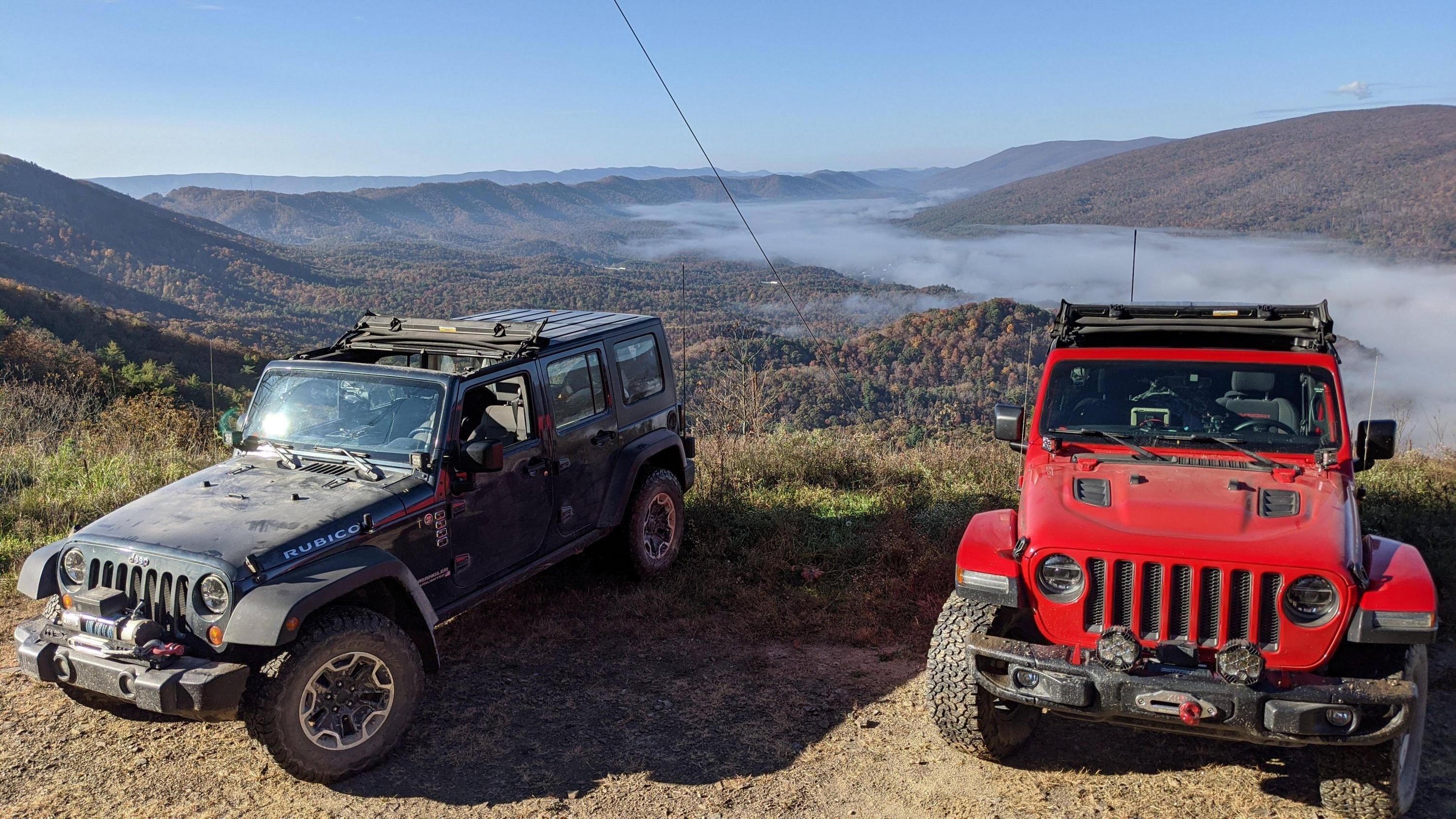
It was fantastic. There wasn't much in the way of techical off-roading, with 95% of it not requiring 4wd, but it was just beautiful. Hurricane Creek Road was the only part that required 4wd and the ruts there weren't too bad. There was also one small climb out of a creek crossing in the NE part of Smokey Mt National Park. Virginia had some tight, rough trails with a few big mud holes but there were always bypasses around the biggest ones. We probably only got about 1/5 maybe 1/4 of the way into the Jefferson Nat. Forest and it was getting more challeging as we went. Even the country roads were gorgeous, though, so I'm not at all disapointed in the lack of 4wd challenge. It was fine by me. I like variety and I like to explore, and I LOVE scenery and this route had those things in spades.How has the route been so far? I haven't done much more planning since I started this thread but glad to see it has helped others. I'm still stuck in Africa. Also what do yall like better Gaia or the Garmin Overlander?
One more thing...We had so much fun my brother, who drove my JK, went straight to the Jeep dealer and traded his Camaro ZL-1 1LE on a Gladiator Rubicon! LOL! I think he's hooked!
Enthusiast II
How long did your trip end up taking? We would just be going from around Washington DC down into GA. Have to plan it around the wifes and kids school schedule.
