Hi Everyone,
My name is Brooke, I'm new to the 4x4 thing. I drive a 2006 Xterra Off Road model. I took a trip this weekend to the Barney Riley Campground, and thought I would post my experience for everyone. I know there is another thread here about this trail, but I came in from a different road (north entrance) addtionally after the weather we've had in the Sierra's this year a lot has changed on the trail. I would say that it is actually no longer suitable for stock rigs and if I were to do it again I'd make sure to go with a group because it was a very rough road. Anyways, I hope this report helps anyone who is planning a trip out to the Barney Hot Springs.
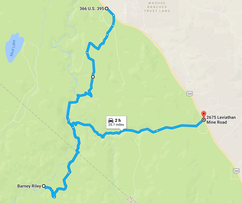
Trail Head: 38.860981, -119.673541
Trail End: 38.769317, -119.714422
Rating: High end of intermediate
Features: Rock gardens, hill climbs, primitive trail, scenic views of the Carson Valley, Carson River (suitable for tubing/rafting), hot springs.
I decided to take this trail over the weekend because it had a lot of features, and it was rated a beginner trail - suitable for a stock rig.
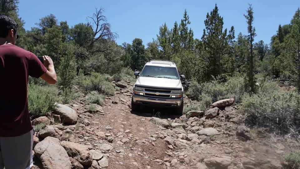
When you enter the trail after about .5 miles you will begin a rocky decent (crushed granite) and this goes on for about 2 miles. Then will empty out into marshy high alpine area along the Carson River. As you continue along the river you will encounter obstacles such as sand, mud, and low hanging trees. This is the easy part of the trail. And then you will come to your first ascent, its about 40ft to the top of loose rutted out dirt don't be shy with the gas and get a running start. Then you will hit some nice dirt road that will last all of 300yds before you are spit into some of the harshest trail I've ever done. I would recommend that your vehicle be lifted at least 2" and sufficient under armor. Your first major obstacle here is going to be crossing a dried out creek bed, riddled with boulders about the size of shopping carts and volkswagens. After you creep up here the road will split, you are going to want to stay to the left. If you go right, the trail will narrow and dead end at a river crossing and at the time of writing this, the water is both too swift and too high to cross. You'll continue on a reasonable dirt road with plenty of dips and ascents that are happy to scrape your bottom so be careful. You will eventually find yourself at an old abandon weigh station from the 1800's - it's a pretty cool sight so make sure to stop and check it out.
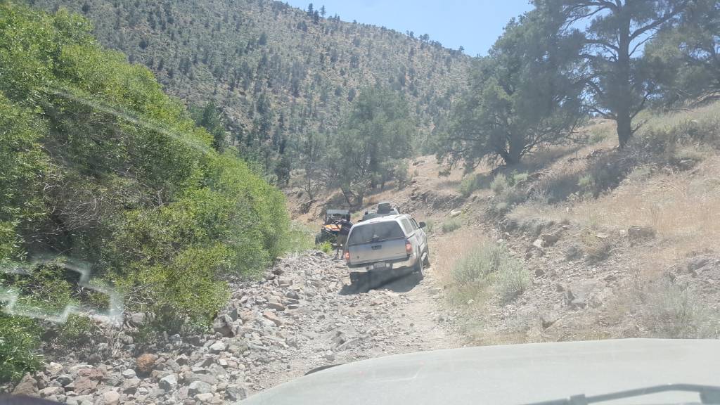
You are going to want to stay to the right at the fork here and continue on Cottonwood Canyon Rd. (Entering California). Things aren't that bad from here on out, there are short sections of intense technical driving but as long as you stay in lo and go slow you should be fine. You will come to your final decent here, there are 3 lines. The one on the left does not look all that bad, but I could not pass on this one, I was getting too much roll and thought I would flip so I backed off. The middle is rough, lots of BIG boulders here and I did get high center on one of them and ended up having to use all of my tricks to get free. Ended up banging my diff bad enough for it to start leaking. The line on the right is for the lunatics out there, guys with trucks that have tires the size of grizzly bears, it is so rutted out and scary... if you have a wide wheel base I'd recommend the left most line, you will probably still end up with 2 wheels off the ground though. If your in a stock rig, and you've made it this far then you can probably get down the middle line, just maybe walk it first. Once you get to the bottom you are home free.
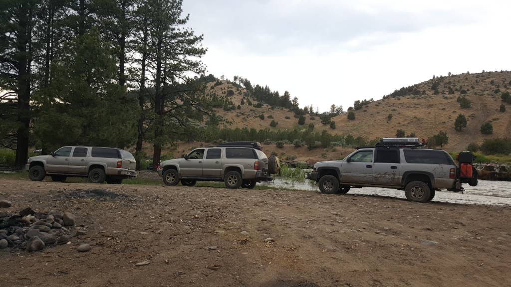
You will see a small camp ground, the river, and directly across the hot springs. Some people cross the river here, I heard this was illegal starting in 2011 but there were 3 rigs over there when I was there... (which is insane because the current is so strong they are lucky they didn't get swept away, just youtube "carson river crossing fail") there is a hill climb over there for the brave (though I hear that is an unofficial route and you may be ticketed for being over there) we saw a truck attempt it only to lose traction about 30ft from the summit, and watched him back down - we all thought for sure he was going to roll - so if you do attempt it for the love of god please be super careful and don't die.
The map indicates the road goes through the Carson and then crosses back to the otherside a little up the ways, from there you can take the Barney Riley all the way out to Loope, CA. Again, I'm not sure if it is legal or not to cross the river - I do not advise you try it this year due to the height of the river. In this case you can backtrack just past the weigh station and turn right onto Leviathan Mine Rd. This road has only one major obstacle on it - there is a very long stretch of dried out river bed, I'd describe it as a half pipe of boulders. Crawl cautiously, and slowly, and find yourself a small water crossing (creek?) on your way out. From here it will be just a rocky dirt road all the way up. The last bit of the road is paved, a great time to air up before hitting the highway.
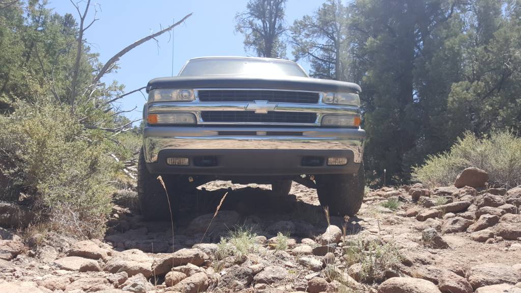
I managed to do this trail in a stock 2006 Xterra Off Road Edition. I at several points had to use my lockers and 4lo. At one point I had to use traction pads and a shovel to free myself from a boulder I got high center on. My skid plates were used plenty and about 2" of lift would have saved me a ton of scary. This to date is the hardest trail I have ever done. I was actually scared I wouldn't be able to get out the next day, so if you do this trail in a stock rig I'd recommend that you carry everything you need to get yourself out and a radio. GPS is a must. Tire repair kit, and a spare too. The information out there about this trail is not current. After the snow/rain of 2016 the trail has changed a LOT.
That's all I got! Cheers~
My name is Brooke, I'm new to the 4x4 thing. I drive a 2006 Xterra Off Road model. I took a trip this weekend to the Barney Riley Campground, and thought I would post my experience for everyone. I know there is another thread here about this trail, but I came in from a different road (north entrance) addtionally after the weather we've had in the Sierra's this year a lot has changed on the trail. I would say that it is actually no longer suitable for stock rigs and if I were to do it again I'd make sure to go with a group because it was a very rough road. Anyways, I hope this report helps anyone who is planning a trip out to the Barney Hot Springs.
Trail Head: 38.860981, -119.673541
Trail End: 38.769317, -119.714422
Rating: High end of intermediate
Features: Rock gardens, hill climbs, primitive trail, scenic views of the Carson Valley, Carson River (suitable for tubing/rafting), hot springs.
I decided to take this trail over the weekend because it had a lot of features, and it was rated a beginner trail - suitable for a stock rig.
When you enter the trail after about .5 miles you will begin a rocky decent (crushed granite) and this goes on for about 2 miles. Then will empty out into marshy high alpine area along the Carson River. As you continue along the river you will encounter obstacles such as sand, mud, and low hanging trees. This is the easy part of the trail. And then you will come to your first ascent, its about 40ft to the top of loose rutted out dirt don't be shy with the gas and get a running start. Then you will hit some nice dirt road that will last all of 300yds before you are spit into some of the harshest trail I've ever done. I would recommend that your vehicle be lifted at least 2" and sufficient under armor. Your first major obstacle here is going to be crossing a dried out creek bed, riddled with boulders about the size of shopping carts and volkswagens. After you creep up here the road will split, you are going to want to stay to the left. If you go right, the trail will narrow and dead end at a river crossing and at the time of writing this, the water is both too swift and too high to cross. You'll continue on a reasonable dirt road with plenty of dips and ascents that are happy to scrape your bottom so be careful. You will eventually find yourself at an old abandon weigh station from the 1800's - it's a pretty cool sight so make sure to stop and check it out.
You are going to want to stay to the right at the fork here and continue on Cottonwood Canyon Rd. (Entering California). Things aren't that bad from here on out, there are short sections of intense technical driving but as long as you stay in lo and go slow you should be fine. You will come to your final decent here, there are 3 lines. The one on the left does not look all that bad, but I could not pass on this one, I was getting too much roll and thought I would flip so I backed off. The middle is rough, lots of BIG boulders here and I did get high center on one of them and ended up having to use all of my tricks to get free. Ended up banging my diff bad enough for it to start leaking. The line on the right is for the lunatics out there, guys with trucks that have tires the size of grizzly bears, it is so rutted out and scary... if you have a wide wheel base I'd recommend the left most line, you will probably still end up with 2 wheels off the ground though. If your in a stock rig, and you've made it this far then you can probably get down the middle line, just maybe walk it first. Once you get to the bottom you are home free.
You will see a small camp ground, the river, and directly across the hot springs. Some people cross the river here, I heard this was illegal starting in 2011 but there were 3 rigs over there when I was there... (which is insane because the current is so strong they are lucky they didn't get swept away, just youtube "carson river crossing fail") there is a hill climb over there for the brave (though I hear that is an unofficial route and you may be ticketed for being over there) we saw a truck attempt it only to lose traction about 30ft from the summit, and watched him back down - we all thought for sure he was going to roll - so if you do attempt it for the love of god please be super careful and don't die.
The map indicates the road goes through the Carson and then crosses back to the otherside a little up the ways, from there you can take the Barney Riley all the way out to Loope, CA. Again, I'm not sure if it is legal or not to cross the river - I do not advise you try it this year due to the height of the river. In this case you can backtrack just past the weigh station and turn right onto Leviathan Mine Rd. This road has only one major obstacle on it - there is a very long stretch of dried out river bed, I'd describe it as a half pipe of boulders. Crawl cautiously, and slowly, and find yourself a small water crossing (creek?) on your way out. From here it will be just a rocky dirt road all the way up. The last bit of the road is paved, a great time to air up before hitting the highway.
I managed to do this trail in a stock 2006 Xterra Off Road Edition. I at several points had to use my lockers and 4lo. At one point I had to use traction pads and a shovel to free myself from a boulder I got high center on. My skid plates were used plenty and about 2" of lift would have saved me a ton of scary. This to date is the hardest trail I have ever done. I was actually scared I wouldn't be able to get out the next day, so if you do this trail in a stock rig I'd recommend that you carry everything you need to get yourself out and a radio. GPS is a must. Tire repair kit, and a spare too. The information out there about this trail is not current. After the snow/rain of 2016 the trail has changed a LOT.
That's all I got! Cheers~