Best Places to OL in NC?

  • HTML tutorial

OperationContingency

Rank V
Launch Member
Member

Influencer II

1,905
Morganton, NC
First Name
Jonathan
Last Name
Shores
Member #

12214

Service Branch
Air Force
Here are a few I'd recommend for the beginner or person in search of beautiful scenery:
Old NC 105, beautiful views and easy trail for beginner;
https://www.gaiagps.com/public/YVZWI8iZEA3Js4LlTdCrNnrJ
Forest Service Road 105, easy drive with a few rocky parts (not rock crawling); https://www.gaiagps.com/public/WSi1NgrQMU4tI4RccBOHVdhj
Hurricane Creek, part of the Transamerican trail; https://www.gaiagps.com/public/320YZykR1cHLcH98fy0j2XaX

To a few of these, I've added good camping spots along the route and a few photos. All I ask is that if you use them and find something else better than what I've marked along the way, please add it in the comments section.
 

OperationContingency

Rank V
Launch Member
Member

Influencer II

1,905
Morganton, NC
First Name
Jonathan
Last Name
Shores
Member #

12214

Service Branch
Air Force
Anyone up for a ride for #optoutside on Friday, 11/23/2018? Say maybe the Old NC 105 trail and maybe a hike afterwards?
 

BigBlueOx_TRD

Rank VII
Member
Investor

World Traveler III

6,460
East Bend
First Name
Adam
Last Name
Brown
Member #

15454

Ham/GMRS Callsign
K04ACI
We traveled hurricane creek trail to max patch 2 days after hurricane Michael rolled through (ironic).
The trail I feel was more difficult than older videos tend to show. I was in stock Pro 4runner and gave my mud flaps quite the workout.
The trail offers everything from mud, to water crossings, to rock steps. Absolute fantastic time.
They're are some areas with rock steps that are slightly off camber toward the cliff side. We opted for a spot through those.
Not trying to scare anyone, just be safe as you normally would and this trail was a blast.
You absolutely have to go to Max Patch since you're basically 15 minutes away. The 360 views are unmatched anywhere.
 

PatriotT4R

Rank VI
Launch Member

Influencer III

3,984
Lillington, NC 27546
Member #

14619

That area is awesome and tons of camping. I've taken stock 4runner and stock Tacoma through hurricane Creek and Max patch is beautiful. If you don't want striping you can take the Forest Rd that's the next exit from hurricane Creek trail or travel through Harmon den system. Here is a new group I started just for sharing trails and campsites

https://www.facebook.com/groups/117132722405979/

I put some trails in there for around this area. I have more coming

Sent from my SAMSUNG-SM-T377A using Tapatalk
Hello are you the same Sir William on youtube w/ the Barcelona Red 4Runner ... If you are I've seen all your episodes.
 

Traveler I

98
Newport News VA
First Name
Mark
Last Name
Byerly
Member #

0

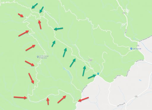
Considering heading out to Hurricane Creek over the MLK holiday. Are there any maps that have a trail laid out to go from Hurrican Creek to Max Patch?
Gotta hit the googles man. Can pull a map straight off there. Turn right off of I-40 on the west and and just keep going straight.

https://maps.google.com/maps?client=safari&hl=en-us&um=1&ie=UTF-8&fb=1&gl=us&entry=s&sa=X&ll=35.720728,-83.000413&z=13&ftid=0x885bd610098f342d:0x165be488f1848887&q=Hurricane+Creek+Rd,+Fines+Creek,+NC+28721&gmm=CgIgAQ==&ved=2ahUKEwiBqeKZ4dbfAhUFneAKHTSOA-gQ8gEwAHoECAoQAQ
 
  • Like
Reactions: RickLB

gunnyosu

Rank 0

Traveler I

Hi Y'all-

New to the group but looking to do some good trails in the NC/SC area. A few buddies and I were going to head to Hurricane Creek in a few weeks. For those that are familiar, do you think there is enough width to accommodate 2 Raptors and 2 Ram 2500's? The off-camber turns with drop-off on one side look a little tight for large trucks. Any input would be great! Thanks!
 
  • Like
Reactions: PatriotT4R

TheOverlandingGoat

Rank IV
Launch Member

Enthusiast III

1,183
Greensboro, NC
Member #

5605

I'm trying to figure out what road or trail this is with the red arrows. It is in North Carolina, just East of Old NC 105 and West of Fs 210 also known as Table Rock Mountain Rd. I see it on Google but it doesn't have a name. It appears to be gravel and at some points, in satellite view, I see a lot of cars parked. I wonder if it's public since it's in Pisgah or iif it may be private. I'm thinking of heading that way this weekend to ride through NC 105 and Fs 210, if I do, I will check it out and see what it is. If you know what this is, please let me know.
 

Attachments

Pitbull2o08

Rank 0

Contributor I

60
Fayetteville NC
First Name
Andrew
Last Name
Irizarry
Hey guys, new here, stationed in Fayetteville. I drive a lift F150 with roof rack. Do you think heading down to some of these spots, kayaking/fishing and camping would be possible? I downloaded Giai so that I can save some of the trails posted. Thanks!
 

Staticline40

Rank V
Launch Member

Member II

2,268
Fort Mill, SC, USA
First Name
Mark
Last Name
Tebo
Member #

12262

Service Branch
US Army Retired
Some places I've done recently,

Brown Mountain, you can run trail 1 and 8 (I believe) in a truck/Jeep. There are a few spots to camp on the entrance road to the parking area plus areas close by. We stayed at one of the spots on the entrance road.
1610 Brown Mountain Beach Road, Morganton, NC (35.88972, -81.73695)

107835

Old Highway 105, mainly a dirt/gravel road that runs through some very scenic areas. We ran South to North starting at Lake James State Park and turning off 126. if you look on Google it shows as SR 1238 (35.771496, -81.902660)
Make sure you stop at Wiseman's View and check it out. it dumps you off at 183 not far from Linville Falls visitor center. There are several good spots to camp along 105, first come first served though.

107838

Horse Pasture road to Jumping Off Rock Overlook in South Carolina is another dirt/gravel road to an awesome overlook of Lake Jocassee. We started at Foothills Trail Access 4x4 (35.050769, -82.812787)
We ran into a closed gate at the top by the overlook so we turned around, not sure if this is always the case. We camped on the other side of the lake at Cherry Hill Recreation Area (34.942511, -83.088465)

107842

107843

107844
 

Pitbull2o08

Rank 0

Contributor I

60
Fayetteville NC
First Name
Andrew
Last Name
Irizarry
Some places I've done recently,

Brown Mountain, you can run trail 1 and 8 (I believe) in a truck/Jeep. There are a few spots to camp on the entrance road to the parking area plus areas close by. We stayed at one of the spots on the entrance road.
1610 Brown Mountain Beach Road, Morganton, NC (35.88972, -81.73695)

View attachment 107835

Old Highway 105, mainly a dirt/gravel road that runs through some very scenic areas. We ran South to North starting at Lake James State Park and turning off 126. if you look on Google it shows as SR 1238 (35.771496, -81.902660)
Make sure you stop at Wiseman's View and check it out. it dumps you off at 183 not far from Linville Falls visitor center. There are several good spots to camp along 105, first come first served though.

View attachment 107838

Horse Pasture road to Jumping Off Rock Overlook in South Carolina is another dirt/gravel road to an awesome overlook of Lake Jocassee. We started at Foothills Trail Access 4x4 (35.050769, -82.812787)
We ran into a closed gate at the top by the overlook so we turned around, not sure if this is always the case. We camped on the other side of the lake at Cherry Hill Recreation Area (34.942511, -83.088465)

View attachment 107842

View attachment 107843

View attachment 107844
awesome pictures. Thank you!
 
  • Like
Reactions: Staticline40