Best gps nav, ?

  • HTML tutorial

donmontalvo

Rank III

Enthusiast III

503
Plano, TX
First Name
Don
Last Name
Montalvo
Ham/GMRS Callsign
KC3UNA
Service Branch
US Army Veteran
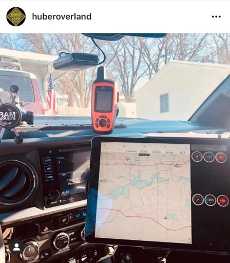
...Current iPad has GPS...
iOS devices are limited to Assisted-GPS, which require cell towersm and is not as fast or accurate as a true GPS. I pair my iOS devices to a Bad Elf for true GPS.

My apologies, learned on this thread that WiFi+GPS model iPads do have true GPS, not reliant on cell towers.

However I find myself using my Garmin Overlander, even if it isn't a well liked or popular device.

I'm going on a three tour in early June, passing through Moab on the way to Rubicon, then back to PA.

So glad I found this forum, so much information, its amazing.
 
Last edited:
  • Like
Reactions: Nivar3

Ubiety

Rank VI
Member

Explorer I

5,221
Sammamish, WA, USA
First Name
Greg
Last Name
Ubiety
Member #

6193

Ham/GMRS Callsign
Ribs
iOS devices are limited to Assisted-GPS, which require cell towersm and is not as fast or accurate as a true GPS. I pair my iOS devices to a Bad Elf for true GPS.

However I find myself using my Garmin Overlander, even if it isn't a well liked or popular device.

I'm going on a three tour in early June, passing through Moab on the way to Rubicon, then back to PA.

So glad I found this forum, so much information, its amazing.
Not all iOS devices are limited in that manner. iPhones and iPads with cellular capability contain a GPS.
 

Ubiety

Rank VI
Member

Explorer I

5,221
Sammamish, WA, USA
First Name
Greg
Last Name
Ubiety
Member #

6193

Ham/GMRS Callsign
Ribs
I posted an old URL, this newer URL lists “GPS” but I’m fairly certain the capability is married to cell towers. I’ll open a ticket with Apple to get confirmation.

I have an iPad with cellular and know for certain it has a GPS (it does not have a data plan and works in places far far away from cell service).
I work in the navigation industry and release products for iOS devices - all of our maritime customers who cannot count on cell towers are not wrong.
 

donmontalvo

Rank III

Enthusiast III

503
Plano, TX
First Name
Don
Last Name
Montalvo
Ham/GMRS Callsign
KC3UNA
Service Branch
US Army Veteran
I have an iPad with cellular and know for certain it has a GPS (it does not have a data plan and works in places far far away from cell service).
I work in the navigation industry and release products for iOS devices - all of our maritime customers who cannot count on cell towers are not wrong.
I stand corrected.

Apple confirmed that GPS is only on Cellular [corrected] enabled devices because their maps app needs to stream map data.
 
Last edited:
  • Like
Reactions: Ubiety

Ubiety

Rank VI
Member

Explorer I

5,221
Sammamish, WA, USA
First Name
Greg
Last Name
Ubiety
Member #

6193

Ham/GMRS Callsign
Ribs
Apple confirmed that GPS is only on WiFi enabled devices because their maps app needs to stream map data.
Did you mean "Apple confirmed that GPS is only on cellular enabled devices"? That is my understanding; it is entirely possible that Apple is now including a GPS in new WiFi only devices but a quick web search does not support that. I paid the extra $$$ for the cellular model specifically for the GPS and it works like a charm in the wild places w/o connectivity.

If you start a route in Apple maps it will not download all the maps for the journey but it will get enough info to allow nav along that route. If internet connectivity is in question and I plan on using Apple maps I will start the route when I do have internet to allow it to get enough data to do navigation. I don't believe that Apple maps supports map downloads which are required in the wild places w/o internet; for that you would want to look at something like Gaia. I use Gaia on highways and offroad and Apple maps for turn-by-turn when in town.
 

donmontalvo

Rank III

Enthusiast III

503
Plano, TX
First Name
Don
Last Name
Montalvo
Ham/GMRS Callsign
KC3UNA
Service Branch
US Army Veteran
Did you mean "Apple confirmed that GPS is only on cellular enabled devices"? That is my understanding; it is entirely possible that Apple is now including a GPS in new WiFi only devices but a quick web search does not support that. I paid the extra $$$ for the cellular model specifically for the GPS and it works like a charm in the wild places w/o connectivity.

If you start a route in Apple maps it will not download all the maps for the journey but it will get enough info to allow nav along that route. If internet connectivity is in question and I plan on using Apple maps I will start the route when I do have internet to allow it to get enough data to do navigation. I don't believe that Apple maps supports map downloads which are required in the wild places w/o internet; for that you would want to look at something like Gaia. I use Gaia on highways and offroad and Apple maps for turn-by-turn when in town.
Good catch, corrected.

The reason I prefer dedicated GPS devices is so there is no dependencies on an internet connection. Aside from updating the firmware or maps every quarter or so.

I rarely use the iPad Pro, even though I have several map apps including Gaia, and some that have full onboard maps. Just a personal choice.

From the newest iPad Pro specs page:


All models
  • Digital compass
  • Wi-Fi
  • iBeacon microlocation
Wi-Fi + Cellular models
  • Built‑in GPS/GNSS
  • Cellular
 
  • Like
Reactions: Ubiety

Ubiety

Rank VI
Member

Explorer I

5,221
Sammamish, WA, USA
First Name
Greg
Last Name
Ubiety
Member #

6193

Ham/GMRS Callsign
Ribs
The reason I prefer dedicated GPS devices is so there is no dependencies on an internet connection. Aside from updating the firmware or maps every quarter or so.
My cellular iPad does not have a sim/data plan and works flawlessly w/o connectivity. Have used it in the wild places many times where there is no connectivity of any kind.
I love the iPad for nav - big screen for my old eyes :) I also use it to hold tunes to play through the truck's radio and at camp (must download music first so connectivity/streaming is not an issue), make Facetime calls and run a VPN client connected to a pi that does other things.

Imagine an iPad there - used it to take the pic. Oh yeah it also does great for taking quick pics. When I drive it is facing me and I can use that for travelogues while motoring.
E59E763C-E4AA-4E77-908B-4163E5716970_1_105_c.jpeg
 
  • Like
Reactions: donmontalvo

MegaBug

Rank VII
Launch Member

Influencer II

6,414
Colwood, BC, Canada
First Name
Matt
Last Name
Lester
Member #

20270

We find a combination of technology used in appropriate situations works best for us (vehicle Nav, Android tablet, Garmin Zumo and Garmin Inreach)
On the highway on the way to the trails I find the vehicle Nav is the most convenient. For the ”big picture” my co-pilot follows along with a mapbook. If I want to locate a specific address, business or service I will bring up Google maps on my Android tablet. If I want to preplan a highway route I will do that in Garmin Mapsource and download it to the Zumo.
Once off road Gaia on the tablet is our goto. I have preloaded maps (most-used layers) for the areas we travel and the internal GPS means we need no external connections. Preloaded tracks keep us on the trail and I record our current progress as a new track for future reference. Paper resources such as Backroad Mapbooks, Funtreks and local guides (Parks, Forest Service) give us some ”old fashioned” backup.
We check in with family members each evening with the Inreach (which also gives our coordinates) and of course, in case of emergency we know we can get help anywhere via satellite.
It sounds like a lot, but each piece has its own purpose.
 

Ralph

Rank V
Launch Member

Member III

1,845
Szczecin, Westpomerania (PL)
First Name
Ralph
Last Name
Batkowski
Member #

22487

IMO it depends what unit is to be used for navi....
For smartphone - Gaia is giving the most - specialy if we consider what offline maps may be loaded on top.... Also the track is remembered wven if I'm off GSM and apps are off too!!! So the battery cons is very low.
For notebook - I use Thoughbook for years - very specific trips (historical themas or old street nets) I use old OZI-explorer - what makes it special I can calibrate old German or Russian maps and drive on XIX century streets or wilages - LOVE IT
For tablet I have OsmAnd+ but use it rare only on roads....
 

donmontalvo

Rank III

Enthusiast III

503
Plano, TX
First Name
Don
Last Name
Montalvo
Ham/GMRS Callsign
KC3UNA
Service Branch
US Army Veteran
I ride with:

1. iPad Pro (Gaia)
2. iPhone 11 Pro Max (music/podcasts)
3. Garmin Overlander (w/InReach Explorer+)
4. DeLorme paper maps

I find myself using the Garmin all the time, on and off road. I hope I don’t get slammed for admitting that. :)
 

MegaBug

Rank VII
Launch Member

Influencer II

6,414
Colwood, BC, Canada
First Name
Matt
Last Name
Lester
Member #

20270

IMO it depends what unit is to be used for navi....
For smartphone - Gaia is giving the most - specialy if we consider what offline maps may be loaded on top.... Also the track is remembered wven if I'm off GSM and apps are off too!!! So the battery cons is very low.
For notebook - I use Thoughbook for years - very specific trips (historical themas or old street nets) I use old OZI-explorer - what makes it special I can calibrate old German or Russian maps and drive on XIX century streets or wilages - LOVE IT
For tablet I have OsmAnd+ but use it rare only on roads....
Right on! I forgot about OsmAnd. I use that mainly for ”out of vehicle” navigation i.e. hiking to my photo spots. It is an excellent resource once offline maps are downloaded. For those photographers out there, my go to photo planning software once I'm onsite is ”Plan It for ”Photographers”. I find it much more capable than Photo Pills.
 
  • Like
Reactions: Ralph

1Louder

Rank VI
Launch Member

Member II

4,187
AZ
First Name
Chris
Last Name
K
Member #

1437

Ham/GMRS Callsign
K1LDR
It is very easy to download entire states for offline use in Gaia GPS. If you head to blog.gaiagps.com there are articles on how to do it. For me that really kills and benefit to a dedicated GPS device with maps that are not as good and general a pain to update.
 
  • Like
Reactions: Druckel

NMBruce

Rank V
Member

Advocate II

1,808
Pagosa Springs, CO, USA
First Name
Bruce
Last Name
Cooper
Member #

27527

Ham/GMRS Callsign
KE0NBD
Service Branch
U.S. Air Force
I use my Toyota Map sometimes, but it’s routes can be really weird, so I also have CarPlay and can use Google or Apple Maps unless there is no cell signal.
For off road, I carry paper maps, Benchmark, NFS and on planed trips, I use Gaia on my iPad (like iPad better, more information) or via CarPlay and for an accurate GPS, I use a Bad Elf
 
Last edited:

LostInThought

Rank VI
Member

Influencer I

3,514
Dripping Springs, Texas, United States
First Name
Jeff
Last Name
Kprotected
Member #

20371

I use my Toyota Map sometimes, but it’s routes can be really weird, so I also have CarPlay and can use Google or Apple Maps unless there is no cell signal.
For off road, I carry paper maps, Benchmark, NFS and on planed trips, I use Gaia on my iPad (like iPad better, more information) or via CarPlay and for an accurate GPS, I use a Bad Elf
I've tried Apple, Google, and Waze in NM. They mostly work, by I've had issues with them routing me over "state highways" that were really dirt roads - passable in my 4runner, but a Camry would never have made it. Some of the roads it used are even closed several months a year for weather. Definitely worth using a little common sense with any mapping software.
 

donmontalvo

Rank III

Enthusiast III

503
Plano, TX
First Name
Don
Last Name
Montalvo
Ham/GMRS Callsign
KC3UNA
Service Branch
US Army Veteran
I use my Toyota Map sometimes, but it’s routes can be really weird, so I also have CarPlay and can use Google or Apple Maps unless there is no cell signal.
For off road, I carry paper maps, Benchmark, NFS and on planed trips, I use Gaia on my iPad (like iPad better, more information) or via CarPlay and for an accurate GPS, I use a Bad Elf
+1 on the BadElf.
 

TN_4Runner

Rank V
Launch Member

Enthusiast III

2,064
Southside, TN, USA
First Name
Bud
Last Name
Bud
Member #

2121

I run Motion X on my iPhone and my iPad. My iPad doesn't have cellular so I bought a BadElf GPS unit that plugs into the lightning port. It pulls the gps so I can track my movement and was around $100 i think. It works great and have used it all over and even in different countries. Motion X lets you download maps and save it to your device so you don't need service. The only downfall is that sometimes the maps aren't the most up to date. The initial app is free but in order to unlock the map downloads of different map tiles you will need to pay $5. It uses .gpx files for navigation so after making a route in Google Earth I go to a website that converts the format from .kmz to .gpx (its a little time consuming but not bad).
 
  • Like
Reactions: LostInThought

1Louder

Rank VI
Launch Member

Member II

4,187
AZ
First Name
Chris
Last Name
K
Member #

1437

Ham/GMRS Callsign
K1LDR
I run Motion X on my iPhone and my iPad. My iPad doesn't have cellular so I bought a BadElf GPS unit that plugs into the lightning port. It pulls the gps so I can track my movement and was around $100 i think. It works great and have used it all over and even in different countries. Motion X lets you download maps and save it to your device so you don't need service. The only downfall is that sometimes the maps aren't the most up to date. The initial app is free but in order to unlock the map downloads of different map tiles you will need to pay $5. It uses .gpx files for navigation so after making a route in Google Earth I go to a website that converts the format from .kmz to .gpx (its a little time consuming but not bad).
I’m kind of surprised that still runs.It isn’t been in the App Store for a long time.


At some point it won’t run anymore. Older apps essentially get killed off over time.