Explorer I
Explorer I
iPad. I’ll check that out
Explorer I

Enthusiast III

Advocate II
27527
I would love to see CarPlay allow more information and features. Right now to me Gaia on CarPlay is a waste of space.
Advocate II
27527
ThanksYou would have to lobby Apple for that. The general take from Apple is CarPlay is for when driving your vehicle. Therefore it will have limited function. They don’t want you staring down at your radio making lots of changes. Worst case add functionality that requires you to not be moving. Plenty of apps do that including most things native to my Toyota radio.
In summary I agree with you. OnX has released it CarPlay app. I will have to make some comparisons. Obviously if some type of feature like start and ending a track we’re available in a competing app like OnX we could then go yell (politely :) ) at Gaia to add it.

Influencer III
19540
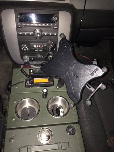
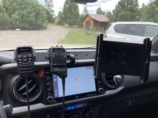
I use an Xgrip for my iPad to do the same thing.Thanks
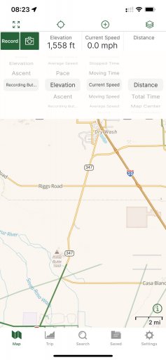
right now I have my iPad mounted for when I am off road and doing a trip and will just continue on that way.
Trail Blazer II
15310
Advocate II
27527
Enthusiast III
I have read through most of the posts and did not see my question covered. I have used GAIA for a number of years and have a lot of saved information but have purchased a new iPad and want to clean up my files. I use a lot of layers and have set up my folders by region with all the layers in the folder. Would it be better to set up a folder by region and then add each layer individually into the folder or all layers at once? Thx for all the tips on the forum. They have been helpful.
Enthusiast III
Agreed on starting clean with the new device. Any thoughts on folder management?

.jpeg")
.jpeg")

Pioneer II
24720
Just wondering if folks have been using the new Overland Layer in Gaia GPS yet? I along with another fine gentleman helped with the design. I find it most useful if you use this layer along with the USFS Roads and Trails hidden underneath. Then you can get all of the trail/track data when you tap on a trail.
The overland layer definitely simplifies things. Gives a better contrast of color along with the most popular data we tend to use.
Check out the full details here:
Gaia Overland: One Map to Rule Them All - Gaia GPS
Ditch the crowds with Gaia Overland, our brand new overlanding map and the definitive guide for all of your overlanding adventures.blog.gaiagps.com
View attachment 231784
View attachment 231785
Trail Blazer II
Enthusiast III
Influencer III
19540
Oh yay, another undocumented feature.Just wondering if folks have been using the new Overland Layer in Gaia GPS yet? I along with another fine gentleman helped with the design. I find it most useful if you use this layer along with the USFS Roads and Trails hidden underneath. Then you can get all of the trail/track data when you tap on a trail.
The overland layer definitely simplifies things. Gives a better contrast of color along with the most popular data we tend to use.
Check out the full details here:
Gaia Overland: One Map to Rule Them All - Gaia GPS
Ditch the crowds with Gaia Overland, our brand new overlanding map and the definitive guide for all of your overlanding adventures.
View attachment 231784
View attachment 231785