Android Apps for Overlanding

  • Thread starter Deleted member 7377
  • Start date
  • HTML tutorial
I think it would be cool to have a thread going as a resource for all Android apps that are useful to us as Overlanders. They can be related to communications, navigation, journal/information logging and other useful tools.

I'll get the ball rolling with a few apps:

NAVIGATION - ViewRanger for Android
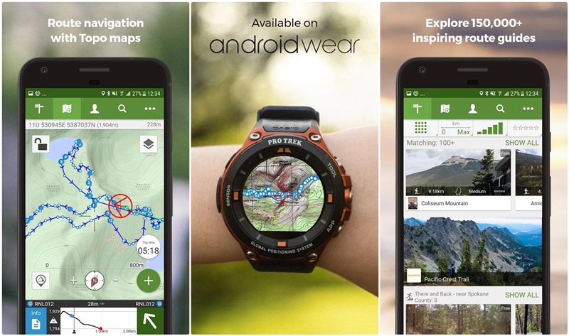

Great app for creating routes, tracking, saving POI, saving maps for offline use, ability to share on multiple devices with your ViewRanger account, great base maps with the option of purchasing additional maps, and the best part IT'S FREE!


COMMUNICATION - Zello for Android
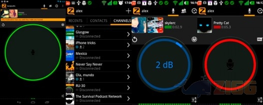

Simple walkie-talkie-style app, that allows a quick and efficient way to communicate as long as you have network. The data usage is very minimal and you can use this even with one bar. The app allows you to create groups and communicate to all group members at once (great for groups runs). It also allows for text messaging and sending images.
 

LostInSocal

Rank V
Launch Member

Advocate III

1,836
Chino Hills, CA, US
Member #

5448

I use Backcountry Navigator on my tablet. Sounds very similar in function to Viewranger, but it sounds similar to other products out there. Not hot on the interface of Backcountry Navigator so I may switch over to Gaia since so many people have had great experiences with it and I like the interface. Too bad it's $20 to get for Android.
 

ArmyofMike

Rank V
Launch Member

Off-Road Ranger I

2,838
fresno, ca
Member #

7890

Ham/GMRS Callsign
KM6YFE
Gaia GPS- Navigation App. Syncs with desktop computer and tablets so you can create, view and edit waypoints, routes, maps and trip planning. Also will record your tracks to create routes. Great for offroading, hiking or outdoor activity. Very accurate and easy to use interface.

Torque app (Along with OBDII sensor)-
Utilizes the on-board port on your vehicle (as long as you have an OBDII port) to get real time diagnostics, engine, transmission, electrical and other readings. Also has a code reader/clearer that can be used if engine codes appear on your dummy lights.

Earthquake Alert!- Great for keeping track of earthquake activity near you. Not that I'm a doomsdayer, but interesting to see all the local/regional activity in CA.

OB Talk (haha!)

Amazon Prime Music-
Great music variety, and playlists/stations. Easy to create your own playlists of your favorite tunes (ie Sturgill Simpson) and then download to your phone for off the grid listening on the trail! Is included with the $99 Amazon Prime Membership though...bleh.

Evernote- great for keeping notes, info, and lists. Can be synced to desktop, laptop, tablet and phone. Great resource/app for keeping daily journals, trip planning and creating lists. It is very easy to use, and that makes making a list easy!
 
Last edited:
  • Like
Reactions: Quicksilver
Gaia GPS
Torque app (Along with OBDII sensor)
Earthquake Alert!
OB Talk (haha!)
Amazon Prime Music
Evernote (great for keeping notes, info, and lists)
Thanks for sharing, Mike!

Would you mind including a quick description for each, it could be as simple as listing the few key features for which you use the app. Also list the type of application it is. I’d like for this page to be as useful as possible, some what of a Wiki for apps.

Cheers,
Nick


Sent from my iPhone using OB Talk
 
  • Like
Reactions: ArmyofMike

ArmyofMike

Rank V
Launch Member

Off-Road Ranger I

2,838
fresno, ca
Member #

7890

Ham/GMRS Callsign
KM6YFE
Thanks for sharing, Mike!

Would you mind including a quick description for each, it could be as simple as listing the few key features for which you use the app. Also list the type of application it is. I’d like for this page to be as useful as possible, some what of a Wiki for apps.

Cheers,
Nick


Sent from my iPhone using OB Talk
I went back and updated. I was creating my list while I was supposed to be working and when my wife came in, I just clicked reply. I panicked! I'm afraid of her! HAHA.
 

grover

Rank V
Launch Member

Enthusiast III

2,306
Silver Springs, Calgary, Alberta, Canada
First Name
Neil
Last Name
Grover
Member #

3806

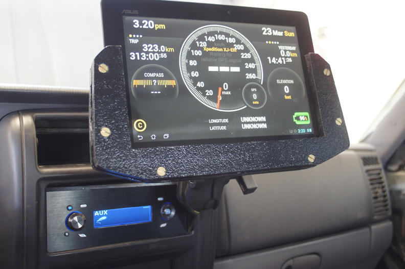
Ulysse Speedometer : This is a GPS based speedometer / compass /car-dashboard. The other feature I really like is that it acts as an app launcher. You can assign applications to the Ulysse app launcher for common types of apps (eg navigation) and never have to fumble around with the home-screen to find your most common driving related apps.


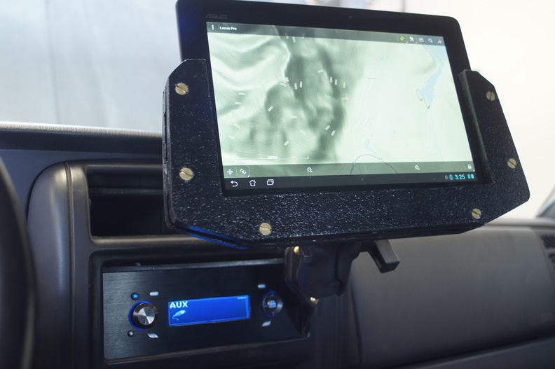
Locus Map : competitor to BackCountry Navigator, Gaia etc. I personally like the interface of Locus better than the others.


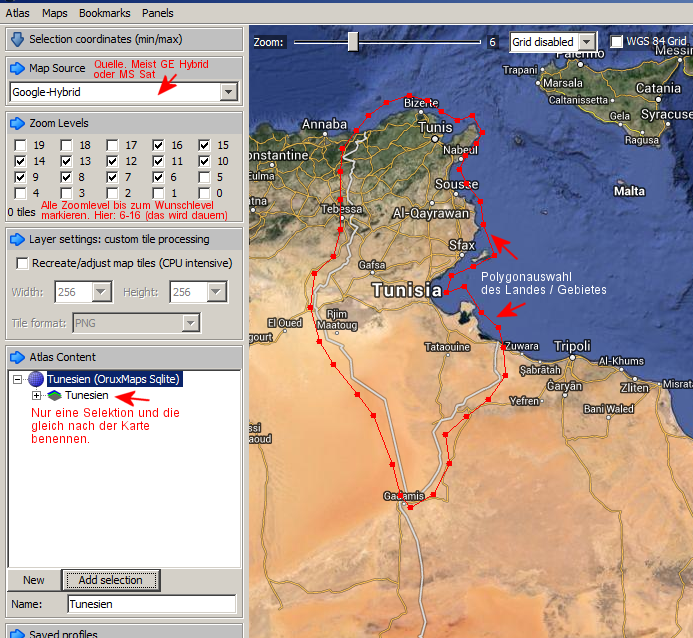
MOBAC ( Mobile Atlas Creator ): This is a free (open source) desktop app... not an Android app. It's worth mentioning because I use it on my desktop to create offline map tiles which I then load onto my tablet. It supports numerous formats ( I use sqlite for Locus Map ). The interface is clumsy and takes getting used to but it is very powerful. If you are interested, I recommend watching a few videos to get familiar with it ( here is a good video for getting started ).


Quicksilver

Rank VI
Launch Member

Advocate III

3,127
Molalla, OR
Member #

5353

COMMUNICATION - Zello for Android


Simple walkie-talkie-style app, that allows a quick and efficient way to communicate as long as you have network. The data usage is very minimal and you can use this even with one bar. The app allows you to create groups and communicate to all group members at once (great for groups runs). It also allows for text messaging and sending images.
That reminds me of Voxer. I use it almost every day for work. I have always had good luck with it.
https://play.google.com/store/apps/details?id=com.rebelvox.voxer&hl=en
Pretty much the same as Zello just another option.
These look interesting. I'll have to check them out.
 
  • Like
Reactions: Taz.beast

Quicksilver

Rank VI
Launch Member

Advocate III

3,127
Molalla, OR
Member #

5353

+1 for Gaia GPS. I tried Backcountry Navigator, but didn't like it. Horrible UI.

RollMeOver is kinda neat, too. It's an inclinometer with some GPS functions, and also has several vehicle icons to choose from.
 
  • Like
Reactions: Taz.beast

Rexplorer

Rank VI
Launch Member

Educator I

4,360
Lake Country, BC, Canada
Member #

6856

i dig viewranger. also use the mobile version of my pc software called memory map. its cheap but not free. i will check out some of these other ideas and suggestions as well.
 

EelRunner

Rank III
Launch Member

Influencer II

770
Bay Area
Member #

8502

Great thread! After reading this, I ended up getting Gaia GPS app. It is really intuitive and well made. I cannot wait to use it on my next trip. Thanks again for the recommendations.
 

Taz.beast

Rank IV
Launch Member

Advocate II

1,240
Middletown DE.
Member #

9006

My Jeep club uses the Zello app a lot. From convoies to charity events to trail rides. And you can make your own channels. Works just like the old Nextels, push to talk!!!
 
  • Like
Reactions: M Rose
Although I've been told that the Zello app isn't as reliable as others would expect, We've not had an issue with this app in almost 3 years. This is a great instant communications app (walkie talkie style) Both of our smart phones and now our tablet have this app active at all times. So if one device doesn't pick up, another surely will.

Just a suggestion if one doesn't need all the typographical images, We've been using the Offline Maps & Navigation app as offered by Google play.
 

RedClay

Rank V
Launch Member
Member

Off-Road Ranger I

1,570
Townsend, Georgia, United States
First Name
Clay
Last Name
Mahaffey
Member #

20207

Ham/GMRS Callsign
WRWH971
I like FatMap for visualizing the route and finding great camping spots. It is a 3D satellite map viewer (much like Google Earth) that is optimized for outdoor activities. While motorized vehicle travel isn't on that they emphasize at all (it's mostly for skiing and biking), it is really useful. I like to think of it as Google Maps on outdoor steroids. The biggest negative to is, in my opinion, is that you can't save offline maps to your storage card (which seems like a huge oversight by the developers to me.)

The ability to save maps offline is a premium feature, so there is an annual $30 subscription cost.

But for planning or looking for a great campsite it is very useful.