2015 Grand Canyon / North Rim /Parashant

  • HTML tutorial

Matt92101

Rank IV
Launch Member

Advocate II

1,095
Temecula ,CA
Member #

1516

So, there we were, we had made it to Mormon Lake on Friday afternoon, with our 11 month old son in tow. The rain, snow, mud and unseasonably cooler temperatures had me rethinking our post EXPO adventure plans, to explore the North Rim of the Grand Canyon. Fredonia to Toroweep, Mt. Trumbull, Parashant NM, Twin Point, Hidden Valley to Lime Kiln Canyon and out at Mesquite. Solo vehicle pulling a Turtleback.
1.jpg

2.jpg
My son was doing great in the weather though (and so was my trooper wife)!
3.jpg
4.jpg

6.jpg

We visited friends, stopped to say hi and pick up some cool swag at the AAV tent and walked the vending area, checking out all the gear and cool stuff, most of which isn't made for an H3T. :confused:

On Sunday afternoon, after contemplating the weather, with the idea that if the conditions were dicy we would postpone, we headed out to get to Fredonia. We arrived late in the evening and set up a quick camp about a mile down BLM 115.

7.jpg
 
Last edited:

Matt92101

Rank IV
Launch Member

Advocate II

1,095
Temecula ,CA
Member #

1516

Day 1

Here was the plan, minus Whitmore, and using Hidden Valley to get to Mesquite.

8.jpg

The plan was to take BLM 115 all the way to Toroweep and camp there, but first we had a quick backtrack to Pipe Springs NM, no Back country Permit, no campy. If you know your plans no more than 6 months in advance you can apply via fax or mail, or you can roll the dice and see if anything is available and get your permit in person at the Ranger Station in St. George or Pipe Springs (Google "Torroweep Camping NPS")
We were in luck, there was a spot available, $15 later we were headed back to the 115 with our permit in hand!

9.jpg
 
Last edited:

Matt92101

Rank IV
Launch Member

Advocate II

1,095
Temecula ,CA
Member #

1516

As we were coming back to the 115, a group from EXPO made the turn before us, an Earth Roamer (my wife called it an Earthwarmer by mistake, I thought it was funny and maybe a little fitting :lol), Lexus SUV, Dodge with a FWC pulling a trailer for motos, and some moto riders. We were able to maintain 40 MPH for at least half of the 61 mile road. The main road was wide and well maintained.
10.jpg

11.jpg

South of the Mt. Trumbull turnoff the road gets a little more unimproved, but still passable by cars. Then you reach the Ranger Station. High clearance vehicles from there on are recommended. This means off the lot 4x4 trucks, no lift kit required. There are some rock shelf areas, a couple mild off camber areas, all passable without lockers or scraping.

12.jpg

**********************************************************************NOTICE**************************************************************************************

The Ranger was out and about when we went by the station, we were stopped on the way out and he was checking permits. We were advised of the nothing over 22ft rule (this includes the length of your vehicle and trailer combined or just your vehicle). This is a real rule and is no longer open for interpretation. We were aware of this rule when we were doing our research for our trip. From other postings on the other forum about Toroweep we were led to believe the rule was to stop people from pulling a 5th wheel down to the point. Not the case. The rule is in effect because of the small pullouts to let opposing traffic pass. Yes, I know, common sense can apply to let other vehicles pass, BUT, rules are made because common sense was not applied repeatedly for a situation. No, I don't agree with the rule, please don't shoot the messenger. The EXPO Earth Roamer group was told the same thing. SO..

Per the Resident NPS Ranger at Torroweep (Todd) (He asked me to post this info so that people will not be disappointed)

No vehicles longer than 22ft or having a combined length (vehicle and trailer) of 22ft will be allowed past the Ranger Station to Torroweep Camp.

The rule is not open for interpretation, you will be turned around. You can leave your trailer at the Ranger Station and continue if you wish.

******************************************************************************************************************************************************************
 
Last edited:

Matt92101

Rank IV
Launch Member

Advocate II

1,095
Temecula ,CA
Member #

1516

We got to Torroweep Camp and picked #7 (no dispersed camping available down at Torroweep)

There was a small shelf drop off on the road to sites #4-9, the shelf was filled in with rocks and easily traversed.

13.jpg 14.jpg 15.jpg 16.jpg
 
Last edited:

Matt92101

Rank IV
Launch Member

Advocate II

1,095
Temecula ,CA
Member #

1516

Our view from #7
17.jpg 18.jpg 19.jpg


After we got set and the tent was up we went for a hike down to the point.

20.jpg 21.jpg 22.jpg 23.jpg 24.jpg

The weather was a little different from Mormon Lake, partly cloudy, a sprinkle here and there, 60's. Nice!

After dinner (Rib eyes in frying pan, no fires or charcoal allowed in park, propane is ok), a little relax (can that happen with an 11 month old?), and sunset.

25.jpg 26.jpg
 
Last edited:

Matt92101

Rank IV
Launch Member

Advocate II

1,095
Temecula ,CA
Member #

1516

Day 2

Our Son decided that 0630 would be a good time to start the day and so we were at it again. We broke camp and I aired the tires down to 28 psi (from my normal 50 psi), we would be heading across Mt.Trumbull and I wanted a little softer ride and more pliability if obstacles were encountered. We were stopped at the Ranger Station for permit check and as I said before, discussion of "The Length Rule".

Plan of the day

27.jpg

We took BLM 5 to the Mt. Trumbull Schoolhouse. The road was in various conditions, from smooth red dirt (which would be snot in wet conditions), to road covered in softball sized rocks, some sharp (shale), all covered in 4HI, sometimes slow going but no obstacles needing 4LO. You will travel this area a lot slower than the road from Fredonia. Coming down into Hurricane Valley the switchbacks get narrow with a steep drop off and there is no place to pass.

28.jpg 29.jpg 30.jpg 31.jpg 32.jpg
 
Last edited:

Matt92101

Rank IV
Launch Member

Advocate II

1,095
Temecula ,CA
Member #

1516

The original Trumbull Schoolhouse was burned down by vandals and this structure was erected by the families in the area that had a vested history in the school. We passed the Bundy Ranch when we first came into Hurricane Valley, then to see how much the Bundy's were involved in the valley history through photos inside was tremendous.

We departed the valley heading for Poverty Mountain on NPS Road 1018. After the quick dogleg at the ranch we passed through 2 closed gates (and ensured they were closed after we went through). We continued on 1018 through several dry water crossings.

38.jpg

The road became more rough as we progressed, not impassable or technical, just slow and jarring.
 
Last edited:

Matt92101

Rank IV
Launch Member

Advocate II

1,095
Temecula ,CA
Member #

1516

We continued to BLM 103 and turned south, speed was back up on this dirt hardball road until we got to the 1019, after passing through the Oak Grove area the road slowed tremendously and we crept south on Twin Point. The views to the west started peaking through the brush, and we started to get excited. The last few 'S' turns on the point were a little challenging for a vehicle with a trailer, they will also give a challenge to a full size truck. We ended up with some new pin striping.

39.jpg 40.jpg 41.jpg 42.jpg 43.jpg 44.jpg 45.jpg 46.jpg 47.jpg View attachment 4891
 
Last edited:

Matt92101

Rank IV
Launch Member

Advocate II

1,095
Temecula ,CA
Member #

1516

Day 3

Plan was to backtrack to Hidden Valley, hook a left and follow that out to Mesquite.

50.jpg

This was the longest, most jarring and slowest leg of our adventure. Conditions ranged from old two track, to disappearing on a cliff top, to multiple dry river crossings. Other than horseback, and a different BLM road, it did not appear that anyone had been that way in a wee bit. Plan accordingly for time it took us 7 hours to traverse that route, and you are deep in a narrow, steep canyon with no bail out points. once you enter, you are committed. It was a great ride BUT if you have reservations about the route consider returning on the alternate route north from Twin Point.

51.jpg 52.jpg 53.jpg 54.jpg 55.jpg 56.jpg 57.jpg
 
Last edited:

Matt92101

Rank IV
Launch Member

Advocate II

1,095
Temecula ,CA
Member #

1516

A little background and then some lessons learned.

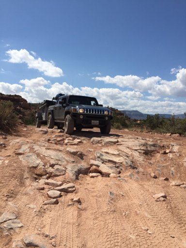
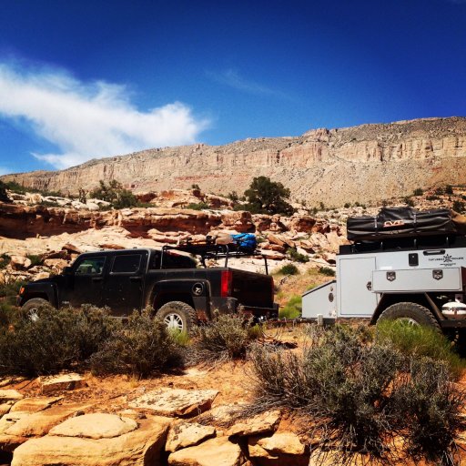
No lift kit or lockers on our H3T, 255/85R16 BFG KM2's, no winch. Carried shovel, ax, maxtrax (2), and a high-lift jack. 25gal fuel tank on truck, 3 5gal Scepter MFC's in bed of truck and 2 4gal Rotopax on trailer. 1 5gal water can just for vehicle.

We felt pretty good on being self-supported.

The truck has a dual band HAM radio that I filled for the minimal local repeaters and simplex frequencies for EXPO, hailing and NPS and BLM. We also have an InReach Explorer that we use to let family know we were doing fine and to ask for assistance if we have a catastrophic mechanical failure. We use the InReach and Gaia on an Ipod Mini for navigation, with a paper map and compass as a back up.

We carry a spare serpentine belt, upper an lower radiator hose, and assorted little fixums and fluids to hopefully take care of issues. Two spares (one on truck, one on trailer (trailer tires and rims match truck)), tire repair kit (plugs and patches, sidewall stitching stuff, and spoons), ratchet strap, compressor (with enough CFM to reseat a tire bead), spare wheel bearing hub for trailer (it's the pivot for the spare tire rack on the trailer), spare torsion arm for trailer.

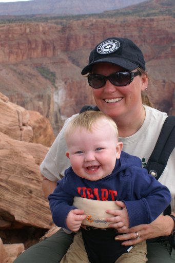
Medical stuff includes bumps, scrapes and bruises stuff, standard OTC meds for headache, fever and stomach issues, Benadryl and Epi pen for 11 month old (he's not allergic to anything but there are plenty of new things to come in contact with out there (we got his doctor to give us an RX for one), and standard trauma stuff including tourniquets.

Lessons learned.

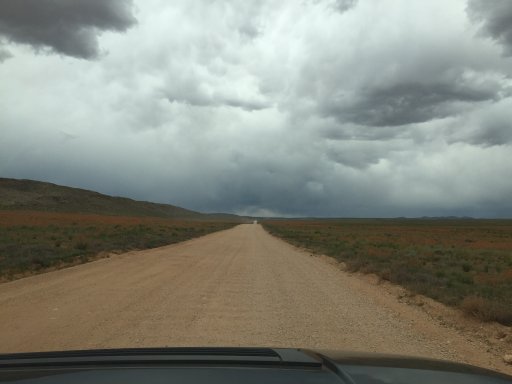
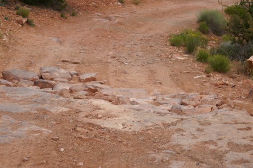
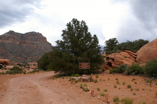
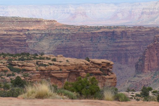
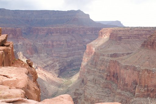
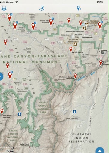
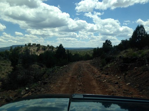
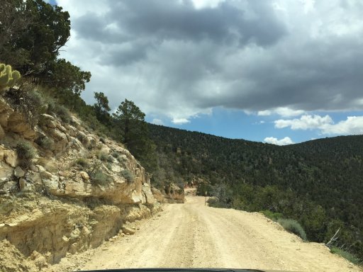
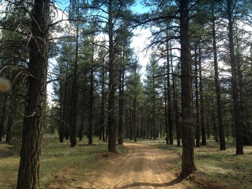
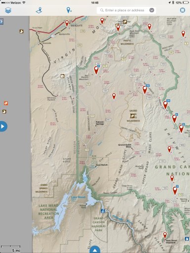
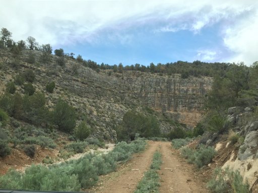
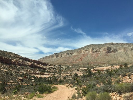
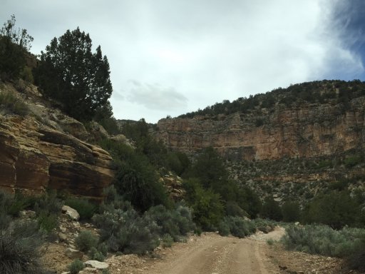
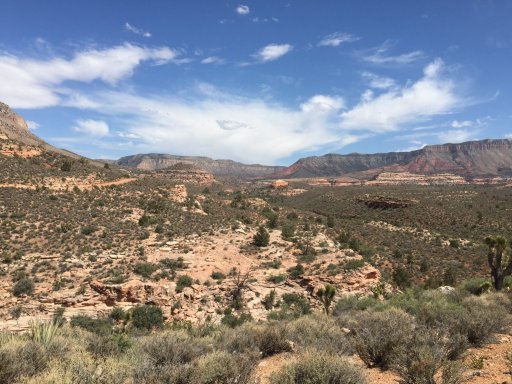
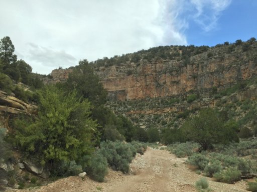
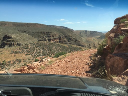
The BLM map legend has two indications of roads and trails for vehicle travel, just because you traveled on one type and it was a defined road with good travel time doesn't mean that the same type of road will afford you the same type of travel somewhere else (travel took longer in certain areas than I anticipated (1-2 MPH) instead of 10MPH)

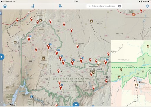
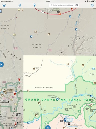
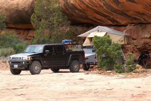
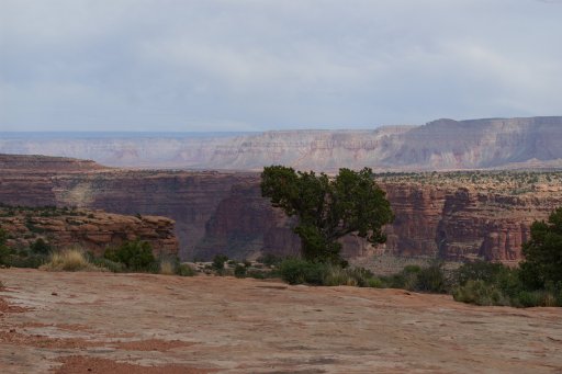
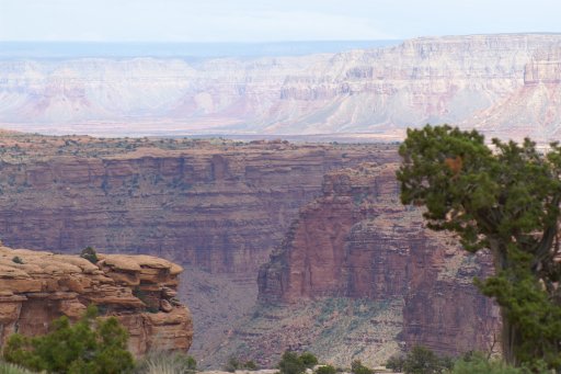
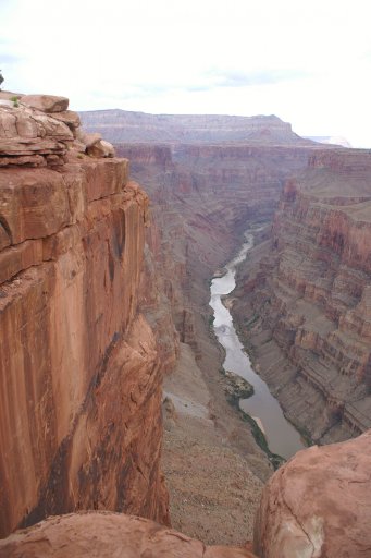
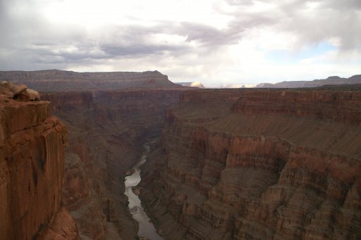
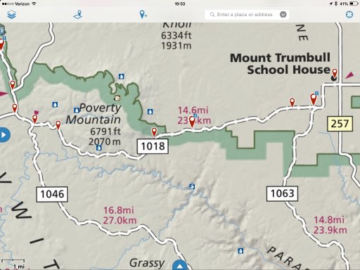
If we had another day it would have been better to camp near the Saw Mill area, it was a long day from Torroweep to Twin Point. On the same note, find a camp in the Hidden Valley area.

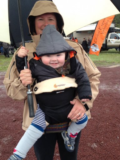
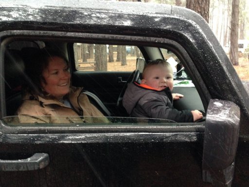
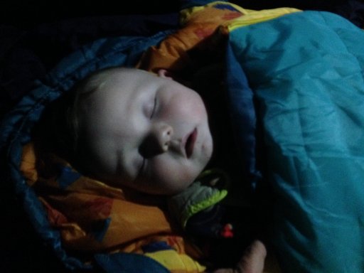
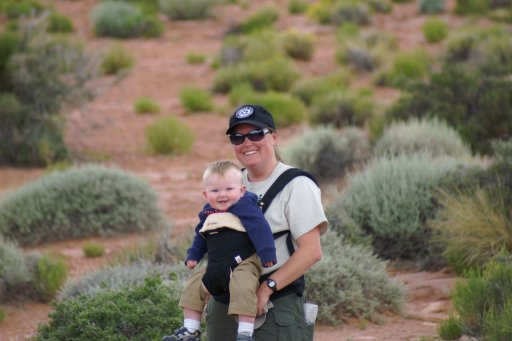
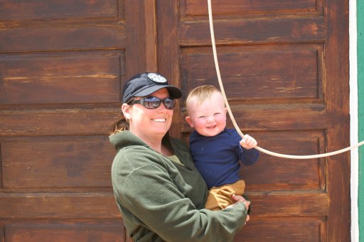
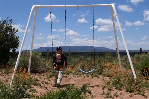
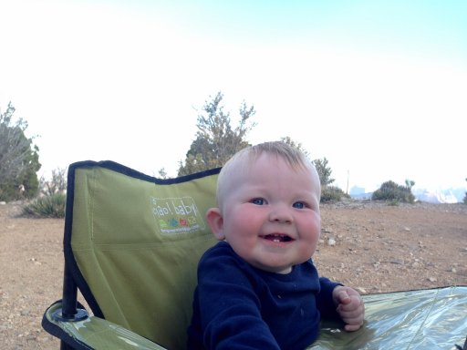
Everything takes longer with an 11 month old :wow

Kelty Woobie was a great sleeping bag for our son! Kept him plenty warm between us when temps dropped into low 30's at night.

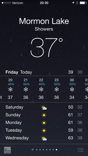
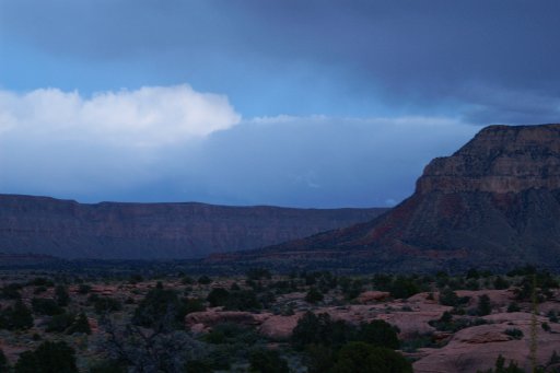
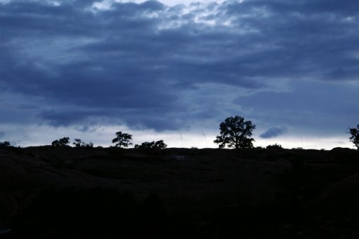
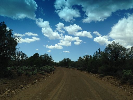
Everyone has their own opinion on weather, reports that the roads were wet were completely untrue, trust your interpretation of weather conditions.

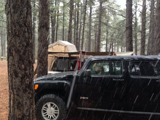
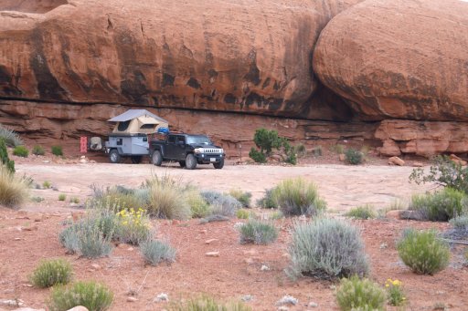
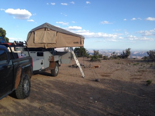
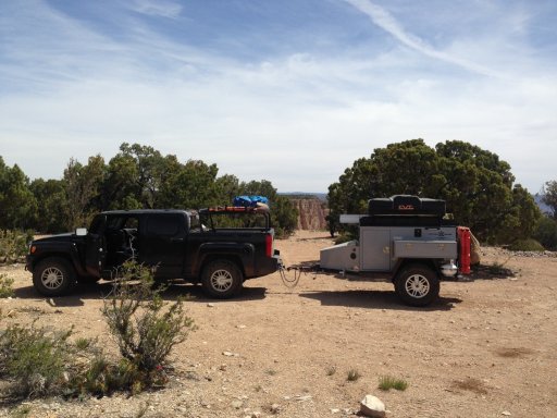
Turtleback pulled like a charm and provided an awesome travel platform! We need to create a fabric cover or net over top drawer in kitchen to stop food from being flung when trailer travels over rough terrain. Container Store bins for clothing in trailer made access and organization easy.

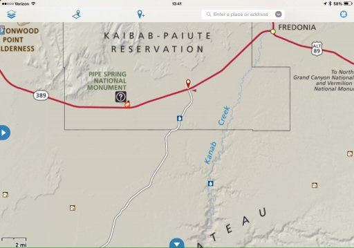
We topped our fuel tank off at Pipe Springs when we headed south to Torroweep, I put 5 gal in at Torroweep and 10 gal at Twin Point, kept the Rotopax in reserve and had a half tank when we reached Mesquite.

Thanks for reading and hope it helps inspire and plan!

Matt
 

1Louder

Rank VI
Launch Member

Member II

4,187
AZ
First Name
Chris
Last Name
K
Member #

1437

Ham/GMRS Callsign
K1LDR
I don't see any images. Just bad url links
 

1Louder

Rank VI
Launch Member

Member II

4,187
AZ
First Name
Chris
Last Name
K
Member #

1437

Ham/GMRS Callsign
K1LDR
iPad screenshot


Not sure if you are uploading photos or linking from a site like Flickr. I always link from an external photo hosting site.
 

1Louder

Rank VI
Launch Member

Member II

4,187
AZ
First Name
Chris
Last Name
K
Member #

1437

Ham/GMRS Callsign
K1LDR


Example from the app on my iPhone. I will check my Mac later today.
 
  • Like
Reactions: Matt92101