Which Paper Maps are Best???
- Thread starter dwb133
- Start date

Expedition Master I
- 8,095
- First Name
- Vance
- Last Name
- Ely
- Member #
-
28800
- Ham/GMRS Callsign
- WRNX949 is my GMRS, haven't taken my test yet but working on the HAM
- Service Branch
- USAF BRAT
yes always a great map book to have unser the seat, just in caseWe've always been fans of the Benchmark map books which, like the Delorme series, come one per state. Neither Delorme or Benchmark are real good at the close-in work but for 90%+ of mapping needs, they do the job.
Krycol08
Rank V

Enthusiast III
Here to say I like the Nat Geo maps for certain things particularly because they sync with Gaia so you have a digital copy too

Member I
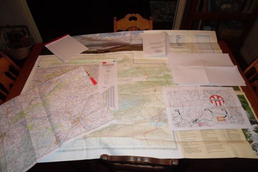
along with my navigation system, I use paper maps: Nat'l Forest Maps specific to Ranger Districts, Delorme Atlas & Gazetter, maps of the actual route (example) when the wife & I are running TAT or other backcountry routes to coincide with the other maps.
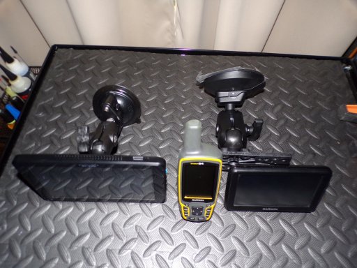
My navigation isn't nothing fancy Garmin MAP 64, Garmin Nuvi 50LM & Megellan TR7. I like the Garmin Nuvi 50LM because when the wife & I run the TAT GPS Kevin's micro SD Cards are programed TAT & other routes, so I can use that particular unit for TAT or other backcountry routes while the wife cross checking with paper maps. It works for us.


My navigation isn't nothing fancy Garmin MAP 64, Garmin Nuvi 50LM & Megellan TR7. I like the Garmin Nuvi 50LM because when the wife & I run the TAT GPS Kevin's micro SD Cards are programed TAT & other routes, so I can use that particular unit for TAT or other backcountry routes while the wife cross checking with paper maps. It works for us.


Local maps such as the ones at national/provincial/territorial/state parks usually provide better local information on the park, so we get these. For an overall paper map, used in early planning, and to show people where we've been and where we plan to go, we use ITMB maps.
Waterproof maps are no doubt good to have if you plan to be drenched on a long hike, however they are inconvenient if you like to annotate your paper map.
Waterproof maps are no doubt good to have if you plan to be drenched on a long hike, however they are inconvenient if you like to annotate your paper map.

Expedition Master III
- 2,735
- First Name
- jonathon
- Last Name
- Wiedmer
- Member #
-
47405
- Ham/GMRS Callsign
- WRYM477 GMRS
Definitely a fan of the Delorme Gazetteer map books although I wish they would spiral bind them. I keep one in the rig for whatever state(s) I will be in. The Butler maps, even though they are designed more for 2 wheelers, are awesome if they have one for where you will be running. GPS is nice and easy, but sitting around the camp studying a paper map just feels right! Plus the benefit to paper is having a large expanded view to catch a route you would otherwise not seen being zoomed out on the digital copy.

Member III
- 2,827
- First Name
- Joshua
- Last Name
- Downs
- Member #
-
20468
- Ham/GMRS Callsign
- KK6RBI / WQYH678
- Service Branch
- USMC 03-16, FIRE/EMS
I usually take time to check various state websites, many times they will send you free maps, and if you are traveling via interstate many welcome centers have free maps. They're not usually off-road oriented maps, but they can help you navigate on a macro scale. I'm not going to invest a lot in something that will spend the majority of the time in the map folder in the back seat pocket. Butler's BCD maps are about the only ones I've spent money on in recent years.
Nice maps, HOWEVER...sadly out of date. The NW India map doesn't even show the Main Delhi-Mumbai expressway!Here to say I like the Nat Geo maps for certain things particularly because they sync with Gaia so you have a digital copy too

Off-Road Ranger I
- 1,451
- First Name
- Allen
- Last Name
- Murray
- Member #
-
27152
- Ham/GMRS Callsign
- WRJY639


