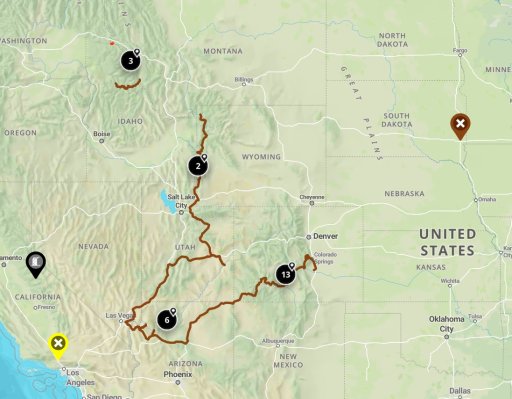
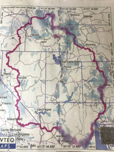
I found my overlook map which I printed out. Looks like I got something on it and smeared some ink. The southern smearing is the Mogollon Rim Trail, iirc. The upper portion in ID, Mt follows the Great Divide Mountain Bike Route. Much of that is fireroad and I follow it pretty much down thru, WY, CO, NM.
For me since I live in Calif I start in Barstow with a last fuel up and supplies then camp at Owl Canyon Campgrounds just outside of town. Then it weaves it's way to Trona Pinnacles, Death Valley, Gold Point, Tonopah, Berlin-Ichthyosaur State Park, Eastgate, Winnamucca, Black Rock Desert's High Rock Canyon. Owyhee Canyon, Magruder Corridor and connecting to the Great Divide Mountain Bike Route.
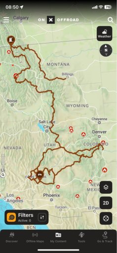
If you get on GE and check the route(I'm working on it) there are plenty of POI's and side trip options. My one caveat would be don't go alone thru Nevada, Who knows the conditions of the roads.