What system do you use to record your tracks (not what hardware/software)?

  • HTML tutorial

Etoimos

Rank V
Launch Member

Member III

2,779
Peyton, CO
First Name
Keith
Last Name
Upton
Member #

11810

I'm wondering what everyone's system is for recording Tracks and using them later. Do you start recording when you leave home and let it run until you return? Do you pause it overnight or make each day it's own track? Each trail or excursion?

On my recent Death Valley trip, I turned it on when I left home and paused it each night. When we had a mechanical issue that made us depart from the planned trip and we were messing around in town getting things fixed, I turned it of. Then, once back in the game, I turned it back on and paused it each night.

Back at home when I was working on my Tracks and photos, I found that while the two Tracks did a good job of showing our overall trip, they were next to useless to show day to day or trail to trail data.

So how does everyone handle this stuff?
 
  • Like
Reactions: HappyOurOverlanding

nickburt

Rank VII
Launch Member

Creator III

5,613
Wallasey, Wirral. UK
First Name
Nick
Last Name
Burt
Member #

2714

Because we run more than one navigation/gps system, I do both. Some record 24/7, but I stop and save at the end of each day, then restart straight away. Others are only used to record from start off in the morning until end of day.

I often get asked, and ask myself, why so many gps/nav aids on the go at once - simples, having taken part in many navigation challenges and cross country events, there's nothing worse than having to pull over and wait for a gps to pick up a signal, or having to drive somewhere off piste to get a signal, then track back. By having more than one on, at least one will be able to show my location, if nothing else. Even two apps running on the Ipad can end up in the situation where one has a signal (or more accurately, is making use of the signal) and the other isn't - it all depends on the stability of the app. It's also quite frustrating to watch one device have a perfect signal and another have none, or next to none, and they're within a few inches of each other.

As long as the device/software/application you're using records a gpx file, then it will contain a huge amount of data (lat, long, alt, speed, accel etc... etc...). The gpx file then needs to be imported into an application that can handle the data.

Doesn't really matter, because when not moving, especially over night, why use up memory space recording nothing much, except a big blob where you were parked. Remember, gps signals do dance around a bit, so when stationary, it will, sometimes, record a position some way from where your are actually parked. I've had overnight spikes that show me 100s of miles from my location, but it's usually only one rouge data point.

When using a gpx file to sort out a map of where we've been to share with others, or for geo-tagging photos in Lightroom etc..., I usually only use the files from the device that's been switched off over night, or if stationary for long periods. That way, the data file is a lot smaller and easier to work with.

The device that's been recording 24/7 can be used as a back up for detail, if the other has been corrupted, or (as I sometimes do) forgotten to be switched on first thing - nothing unusual to remember to switch in an hour into the day :tearsofjoy:
 
  • Like
Reactions: Road

Etoimos

Rank V
Launch Member

Member III

2,779
Peyton, CO
First Name
Keith
Last Name
Upton
Member #

11810

Thanks for the reply. I actually did have two running, my inReach (via the Earth Mate app on my phone) mounted in the Jeep and paused each night and Gaia on my phone on my person (also paused at night). I did not give this setup much thought until about a 3rd of the way into our trip when it donned on me that the resulting logs from both devices would give me pretty much the same data :frowning:

I like your process of stopping and immediately restarting your "24/7" device and I'll try and implement that with the inReach. That should give full coverage of the trip while still breaking it down into Day segments (how I tend to process my trips and reports).

I think with Gaia on a tablet in the Jeep, I could start and stop it based on segments during each day. If I can remember to do that, it would give me a backup of the overall data, but smaller Tracks and files to work with if needed. I can see this being helpful if I setup base camp and then go checkout different trails in the area.

And Gaia on my phone could be used to track hikes and excursions on foot.

That's all dependent on me remembering to start/stop them of course!
 
  • Like
Reactions: Road

nickburt

Rank VII
Launch Member

Creator III

5,613
Wallasey, Wirral. UK
First Name
Nick
Last Name
Burt
Member #

2714

Ha ha, my nemesis - remembering to start everything!!

A good one for saving daily is Motion X.

If you're using an Ipad, and/or Iphone, put all the apps you tend to use in one folder. that way, they're all in one place and you won't (shouldn't :smirkcat:) miss any.
 
  • Like
Reactions: MBroenkow

Etoimos

Rank V
Launch Member

Member III

2,779
Peyton, CO
First Name
Keith
Last Name
Upton
Member #

11810

I'm an Android guy, but when I had an iPhone I really liked Motion X. I wish they would port it over to Android.

I already have all of my "Jeep Apps" in a single folder, so at least I've got that part covered.
 

Road

Not into ranks, titles or points.
Launch Member

Advocate III

3,379
On the road in North America
First Name
Road
Last Name
Dude
Member #

6589

Good info in this thread; thanks for starting it, @Etoimos.

I forgot I had Motion X on my phone, because I use my iPad primarily now, and had not loaded it there yet. On my phone it was buried in my Navs folder and had gone unused for awhile.

I suspect this thread is going to grow into a really handy one for navigation techniques.
 
  • Like
Reactions: nickburt

Vantams

Rank V
Launch Member

Off-Road Ranger I

1,509
Plain City, Utah
First Name
Kory
Last Name
Tams
Member #

4688

Ham/GMRS Callsign
KI7UFV
A good way to organize day-by-day travel tracks is by color-coding! I don't know how many apps or systems offer this function but Backcountry Navigator let's you use literally a color prism to adjust.

So, what I'll do is start day one on Red and gradually work my way around the prism, modifying the color enough to be noticeable each day.

Downside is you'll just have to remember to stop and start recording the track each day.

Good stuff!!


Sent from my SM-G950U using Tapatalk
 
  • Like
Reactions: TeqPal and Road

Kent R

Executive Director
Staff member
Mod Team
Moderator
Member

Pathfinder III

5,200
El Dorado, Ca
First Name
Kent
Last Name
Reynolds
Member #

1632

Ham/GMRS Callsign
K6KNT
Service Branch
Retired Firefighter
I use the iPhone and & iPad but like most of you I forget to start the track in the morning. Thanks for starting this post I hope to learn something.
 

nickburt

Rank VII
Launch Member

Creator III

5,613
Wallasey, Wirral. UK
First Name
Nick
Last Name
Burt
Member #

2714

I have all the apps that get used while on a trip in one folder on the home pages of the Iphone and Ipad and still forget some or all of them .......

I'm going to put a sticker on the dash, right in front of me the says "trackers" - right next to the one that says "fridge" that's supposed to remind me to either switch off, or swap over power supplies for the fridge!!!

That'll be two things to forget to do ..........

but that's like to one at the top of the screen that has the heights of the rig on it for when I'm trying to get under car park barriers etc...... same problem, but with bigger results ......
 

1Louder

Rank VI
Launch Member

Member II

4,187
AZ
First Name
Chris
Last Name
K
Member #

1437

Ham/GMRS Callsign
K1LDR
I use the iPhone and & iPad but like most of you I forget to start the track in the morning. Thanks for starting this post I hope to learn something.
It just has to become a part of your routine. Kind of like checking Ham and CB.

I rarely pause my tracks because 90% of the time I FORGET to start them again and end up with a gap. The only reason to pause it to have a more accurate track time. I prefer to record them on my iPad because it is stationary. Sometimes I will record a backup track on my phone but it will include excursions out of the car on foot. Something most people don't need.

I create a track for each day. In Gaia the best way to keep things organized is create a folder. Then you can have all of your tracks and waypoints for your trip in the folder. These are then easy to share. Other apps support folders as well.

You can always merge the daily tracks into one file if you like with software like AZDE for the mac. Plenty of tools out there.
 

4wheelspulling

Rank VI
Launch Member

Member III

3,065
Chelan, WA.
First Name
Vance
Last Name
Myers
Member #

8452

Good ideas on this thread! I still am doing things the old way. Using paper maps and a highlighter, to mark my trips! Do have an old handheld GPS, that I want to start playing with and marking the start and stop coordinates on my maps and notebook of my travels. I know, boring, but that’s how I do it! Benz.
 
  • Like
Reactions: Road

HappyOurOverlanding

Rank VI
Launch Member

Member III

3,402
Verdi Nevada
Member #

9206

Ham/GMRS Callsign
KI7RAM
I'm wondering what everyone's system is for recording Tracks and using them later. Do you start recording when you leave home and let it run until you return? Do you pause it overnight or make each day it's own track? Each trail or excursion?

On my recent Death Valley trip, I turned it on when I left home and paused it each night. When we had a mechanical issue that made us depart from the planned trip and we were messing around in town getting things fixed, I turned it of. Then, once back in the game, I turned it back on and paused it each night.

Back at home when I was working on my Tracks and photos, I found that while the two Tracks did a good job of showing our overall trip, they were next to useless to show day to day or trail to trail data.

So how does everyone handle this stuff?
Besides recording the routes on a paper map, I am learning to use my tablet based app as we travel the DV area for a couple days. I use the pause feature at each camp stop then start it the next day. So far so good. I stopped using the InReach tracking since I didn't like how it transferred the route to the other app. I use it now for comms and emergencies.

Sent from my SM-G960U using OB Talk mobile app
 
  • Like
Reactions: Road

Etoimos

Rank V
Launch Member

Member III

2,779
Peyton, CO
First Name
Keith
Last Name
Upton
Member #

11810

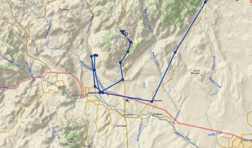
I'll have my inReach tracking here in about 2 hours and anyone can view where we are at on my inReach Map if you are interested in seeing this functionality of the inReach device. I'll track my trip from home down to the OB Colorado Meet & Greet camping trip and then the scenic route we take back home tomorrow.

Feel free to use the locate button on the left side. If you do, please post up on this thread or send me a PM with the time you did as I'd like to track some usage info on that page.
 

Kent R

Executive Director
Staff member
Mod Team
Moderator
Member

Pathfinder III

5,200
El Dorado, Ca
First Name
Kent
Last Name
Reynolds
Member #

1632

Ham/GMRS Callsign
K6KNT
Service Branch
Retired Firefighter
Started the locate at aprox. 0830 hrs.
 

TOMB

Local Expert Central Valley CA
Member
Member

Explorer I

3,575
Clovis Ca
First Name
Tom
Last Name
Butler
Member #

3129

Ham/GMRS Callsign
K6STB
Started locate at 19:47.


Sent from my iPad using OB Talk