
Alanymarce
Rank IV

Trail Mechanic III
This helps - I guess it's like a lot of laws around the world, not enforced until you do something inappropriate, at which point every infraction is enforced (or perhaps I'm out of date with the requirement).Lowrance made it easy to permanently mount their GPS. I really like using them out on the trails.
I live in CA and I've had my GPS sitting on the dash for more than a decade, and I've had my fair share of speeding tickets, and not once has an officer given me any flack over it. And it's not small, and I always have the bright white cover on the screen so I know it has been noticed. I wouldn't worry about it.
A question - if you have the GPS unit permanently mounted, how can you take it on a trail?
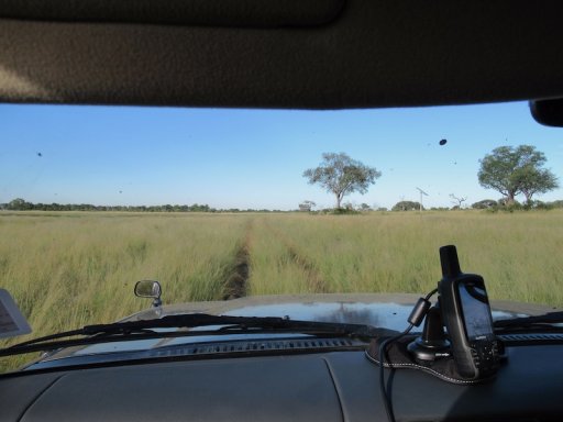
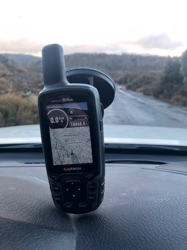
So, I found a couple of photos - the first is how we had the GPS unit set up in Africa - you can see the cable trailing over the dash. The unit was mounted on a Garmin "sandbag" support, which meant that it tended to slide about in more extreme conditions. The second is how it's set up now, on the modified GoPro mount - there's a permanent cable running inside the dash with a short lead which comes out below the windscreen - no loose cables. We have a separate cable for when we connect to the laptop for downloads etc. Much cleaner and more secure, while retaining the means to disconnect when
needed. Not very good photos, I'm afraid.