Member III
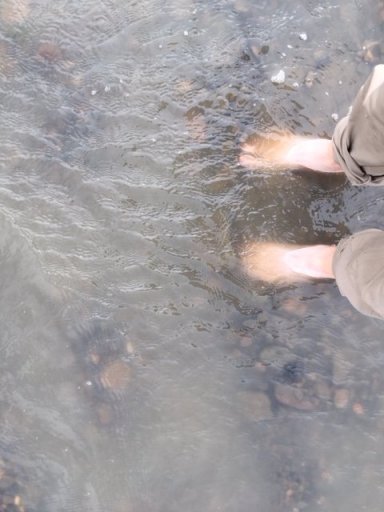
I'm knee deep in it. A LOT of Restore and Replace, with some mods: TruTracs Frt & Rr w/4.88 regear, 5-33" BGF KM3s, headers (to address a crossover pipe issue w/the 3VZE), mech oil press gauge, big 3 wiring upgrade, and some other interior & ext. lighting stuff. I hope I get done in time to properly View attachment 187879View attachment 187880break in the diffs before the trip, lol. Pics taken 18Feb21 (btw, that's just water on the floor. My garage gets a little storm surge action, hahaha)
Looking good! Glad you're not waiting till the last minute to get your vehicle prepped. That'll be a sweet Overlanding vehicle (not too big; not too small; should get half-way decent gas mileage, etc.). And with the TruTracs front & rear, you should be able to feel confident you can go anywhere.
I'm a huge fan of the TruTracs front & rear. My other Overlanding vehicle is a 1996 Dodge Ram 1500 4x4 (bought new, now with 232,000 miles) with gears changed from 3.55 to 4.10, 2" lift, 33" tires (285/75/16"), and TruTracs front & rear. It'll pretty much go anywhere (especially in the snow!) thanks to the TruTracs front & rear.


A few years ago my buddy bought a very-much used, high-mileage 1998 Jeep ZJ ($800 - "needed some work"), 4.0/auto, and we (mostly me) fixed it up for a little Overlanding trip. We put a 3.5" Iron Rock lift on it, 31/10.5/15") tires, changed out the 3.55 gears to 4.10 with TruTracs front & rear, and swapped out the factory rear Dana 35 axle for a "real" Dana 44 (not the ZJ aluminum center Dana 44A - we had a Dana 44 axle built for the Jeep from ECGS). He's still driving it.
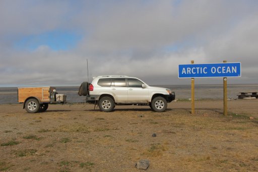
We took that Jeep (and my trailer) from Texas (where I was stationed at the time), straight up through Colorado, Wyoming, and Montana, and then crossed the border up to northern Canada to Dawson City, and then ran the Dempster Highway all the way to Inuvik (the road wasn't open to Tuk yet at that time). And then back home.
I'm a huge fan of the TruTracs front and rear. I think they're the perfect Overlanding combo for your axles. If anyone's out there running open diffs and is considering adding something to help with traction off-road, consider putting a TruTrac at least in the rear axle (if can only do one end, do the rear first). They are invisible on the road - you won't notice they're there (unlike the Detroit Locker in the back of my TJ which can be noisy, clunky, and is very noticeable on pavement).
And this also shows you don't need the newest and most expensive vehicle with huge tires to go overlanding and have a great time.


Last edited: