Road Trip 2019 - 56k KILLER

  • HTML tutorial

Ashton

Rank IV

Pathfinder I

1,212
Near the Rubicon
First Name
Hari
Last Name
See Above
The Mrs. and I have had a much despised and overly drawn out absence from the back roads and byways of this great country. We are usually good for a few road trips, and many weekend camping excursions into the mountains around us, but this last 8-10 month period has been focused on the (sometimes) battle called life. We have moved twice and have had a loved one pass away, we both excel at our jobs and both of our vocations were being bogged down by red tape and idiots, we seemingly hit every financial red light we could and getting any momentum on debt and the income sheet was challenging. The two powerful personalities that dwell in my woman and I have been pent up and stressed out and we could think of no better way to direct that tumultuous energy than with a ∩northodox overland adventure.

Our philosophy on overland travel is pretty much this: If it involves going places we haven't been, and we are in a vehicle, we are overlanding. Application of the K.I.S.S method of 'overlanding' has lead us on amazing adventures, some literally in our backyard. We have seen and experienced and gone to and fro. Both of us love being off the beaten path and if we can go a day without being around another human our spirits are at their happiest. Once the woman had accumulated the needed paid time off, and I had just about all I could handle of my business partners and staff, we took the opportunity to drive from California to New Mexico to get my child for the summer and to see my mother.

I make this short introduction post to warn you. I'm long winded and like to write. I enjoy researching the places I've been and sharing that learning with y'all. I really like geology, it rocks. I'm not as funny as I think I am, but I try anyway and I post a TON of pictures. With all that said, you have been warned. Continue on at your own risk.

Posts take a bit to build. Check back soon.
 

Ashton

Rank IV

Pathfinder I

1,212
Near the Rubicon
First Name
Hari
Last Name
See Above
The day of departure was like most other week days. My long time girlfriend, aka "wifey", wasn't going to be done with work until evening so we decided that we would set a leisurely pace for our southerly jaunt and make some short and easy to achieve goals. While she sold ice to eskimos (and the freezers to put them in) I packed up an ultra light load out for the trip. Through the years we have come to learn a couple of things about overlanding and what 'essentials' need to be packed for the types of terrain, environment and time periods we will be operating in. On this journey, I was certain of my route and felt confident that we could play around with the Googleometer and the finger in the wind to determine the path of most enjoyment. We were not going to stick to any one path, and I used the promise of potential rain in Nevada to set all sorts of possible way points to visit. We would attempt to skirt the southern portion of the weather front, and cross Nevada into Utah. The woman has never seen the wonders of the swell, the epic vistas, the geology or the red rocks of Utah so I really wanted her to get a chance to soak in the majestic beauty that is out there. From the Moab area we would drop down into the Four Corners to see the monument, also on her bucket list, and then beeline it down the west side of New Mexico to my home in the Gila River valley. All in all, a 1100 mile (give or take) journey that I've completed on my own adventures in an easy driving 2 days.

We set off around 1830, after eating a bit of food and finalizing our packing (minimal is best!) we said good bye to our fur babies and made haste for the comforting solitude of boondocking in remote places.


Our first days route would take us into some great BLM camping at the southern shore of Walker Lake. I have a million pictures of the mountains and vistas along I80 through Donner Pass, none of which I'll post here. Coming down the Eastern side of the Sierra into Reno, the dazzling lights of the Worlds Biggest Little City twinkled and beckoned, but we paid no heed. The real adventure would start tomorrow and our only goal was covering the few hundred miles to Walker Lake in less time than our Googleometer suggested. The route provided is one I've taken before and can be a little off putting, as you get off main roads to take farm roads just to end up back on the main road. You hop on a portion of an alternate route that says it's west, but you are going north and it gets really easy to get turned around in the dark without landmarks and familiar sights. I recommend it during the day as a meandering route, but if you just need to get to a free campsite for the night go through Fallon and down.


I pulled us into Twenty Mile Beach Campground at about midnight and even running our fog lights, the darkness was thick. Clouds in the sky has been pissing on us the entire way, off and on, and now they drown out what light the moon would have provided on this barren landscape. Walker Lake sits north of the town of Hawthrone and is a terminal lake, meaning it has no outlet. Once a part of ancient Lake Lahontan, that used to cover the Great Basin, it now sits dead and devoid with a ppm around 20,000. Any fishing that used to be done on this gorgeous expanse of water died off in the later part of last century and no fish have been reported since 2010. Fed by the Walker River, whose headwaters are in the Sierra, Walker Lake is considered a dead lake with even the heartiest species unable to survive its thick waters, which impacts all life that would use the lake for food or water. I had been here twice before, and I always wondered why I didn't see boats or people on the lake. The contrast of this amazing body of dead water in such a stark and beautiful landscape gives the place a feeling of reverence, like a giant cemetery. The campground is remote, not well identified on the road, and primitive (they do have pit toliets). There are other campgrounds around the lake in similar states of decay and abandon. Watch out on the SOUTH side of the lake (really, around the entire lake) as they used to test ordinance here and warning signs still stand to alert the few humans who do come here that live rounds may still be in the ground.


All that said, it sure does provide some gorgeous photo ops and a real sense of being human on this earth. We stayed long enough to enjoy the sunrise, dry out a bit from the rains and stretch ourselves out. Our ∩OV (that's ∩northodox overland vehicle) is a '16 Hyundai Tucson SE with a few factory bits. With the back seats folded down and the front seats scooted forward I can fit my 6'2" 215# self in the back to sleep. When you put my wifey in the back too it gets a little more cramped, but we were still able to sleep comfortably. I was impressed and thankful. Part of the justification to buy this vehicle was because of it's small size, MPG ability and the ability to go on adventures. Confirmation was a good way to start the day.


I had debated driving hwy 50 across NV and stopping at Bob Scott Campground while following the pony express trail (or is it the Wells Fargo trail.. I can never remember). Instead, I thought I would skirt weather that was forecasted in Austin, NV and cut across 95 and hwy 6 towards Utah. I took full advantage of our meandering attitude and turned that crossing of Nevada into a full days journey first heading south and then east, then north to end up at the same place I would have gotten to 5 hours sooner if I had stayed on hwy 50. Such is the nature of overlanding, eh?
 
Last edited:

Ashton

Rank IV

Pathfinder I

1,212
Near the Rubicon
First Name
Hari
Last Name
See Above
Our day 2 plans were pretty simple. See beautiful things, don't be afraid to get lost, and make our way into Utah. My beautiful co-pilot had left the planning of the itinerary and route up to me and, in my typical K.I.S.S methodology, I had little to no plan what-so-ever. I always find that in times of leisure it is much more fun to go with the flow and see what happens than it is to plan everything out. Work life is structured, building wealth and success is structured, so my "me" time is less so. I knew there were hot springs along the route and I had never explored to find them before. I made a deal with the woman: I will make sure you soak in hot springs on this day but you may not see the red rocks of Moab. Reluctantly and with the promise that we would go again someday and that it really is a tourist trap, she agreed to my on-the-fly planning. I won't give you an exact location, or coordinates, but many of you know this place undoubtedly... it is close to a town named after one of the first presidents... that's all I'm saying.


Hawthorne, Nevada is home to the U.S. Army Ammo Depot of the same name and is apparently the worlds largest. From the various vantage points in this valley, you can believe the statement as there are storage bunkers and facilities dotted all over the 226 sq. miles of the base. With 11,239 foot Mt. Grant presiding over the valley, Hawthorne and the surrounding Mineral County offer that classic barren beauty that I love about Nevada. Massive expanses of open space separated by ribbons of dramatic mountains and the beauty of it all. Being a philosophical man, in the classic sense, I would wonder what ancient beast raked the land with its gargantuan claws to create such landscapes. Hawthorne, the town, is sort of depressing. One of those unfortunate places that relies fully on the Army base with little to no other supporting industry. The quaint town feels like an old soul on its final breaths, holding on because it's to scared to let go. The people are friendly, and the experiences I've had passing through there are all good, but the feeling is pervasive.

We stopped to get some breakfast, and as always had the camera out for opportunities to snap memories. Dummy ordinance is on display all over town and the local McDonalds has a pretty good vantage point of Mt. Grant. Every other time through town that peak has been bare. We rolled through on May 30th and you can tell the mountain has a lot of fresh water still up there.


We caught this bad boy pulling in as we were leaving. The purveyors of this fine craft had obvious need for coffee and we didn't chit-chat them about their beautiful custom rig. I love running across these kinds of things on adventures. I always come away with new ideas, or new dreams and desires. I didn't see an OB sticker on there, though I didn't really look and I didn't have any cards on me to give them.


Bellies full of greasy grub, coffee and fruit juice, we headed out of Hawthorne towards Tonopah where we would junction to hwy 6 and away from the direction of Las Vegas. The weather I had been hoping to avoid lingered in patches, catching us with some showers but offering breaks for sun and an interesting effect on the landscapes around us. We stopped at times, just on the side of the road and sat there. As you can see traffic was VERY light on this route and we loved it. Another one of my enjoyments on these adventures is being so remote and so alone. Stretching out in the middle of the road for 20 minutes is just a perk of back road navigation.

The western U.S. had some pretty impressive winter rain and snow falls and the mountains, creeks, rivers and lakes were all full with their respective water state. We saw snow on the peaks clear into Utah, and stopped for respites at a few creeks that had been dry before. There were many places were standing water accumulated on the normally dry salt pans and what vegetation that was there was lush and green. If I had stopped long enough, or been quiet enough, I would have certainly seen the corresponding increase in wildlife in the area. I regret not taking more time to do that on this journey, the chances of it being like this the next time through are slim to none. As many of you know, this area of the country at the end of May is usually well into the dog days of summer and temps can easily push 100* F. Not so for us, luckily, and between the rain and never seeing a temperature above 90 we were happy campers.

Nevada is gorgeous. Live Vicarious my friends.


As we pounded pavement north on hwy 6 west towards Ely we ran into storms that impeded our ability to take good pictures. We hunkered down and made slower time as the rain conspired with traffic on a small two lane road to make for some harrowing experiences that required my utmost attention and brought out the small bit of irrational terror my wifey gets in times of high stress driving. I consider myself an able and apt pilot and I navigated my craft with confidence, though not through lack of focus and concentration.
 
Last edited:

Ashton

Rank IV

Pathfinder I

1,212
Near the Rubicon
First Name
Hari
Last Name
See Above
Heading west from Ely on 50/6, we pass one of the places I've really wanted to explore and yet, each time I get here, I falter and stick to pavement. Osceola, NV is an old mining ghost town with some stories of wicked big nuggets being found and all the juicy and gorey details those kinds of finds often create. The historical significance of the place is the two ditches that were dug in the 1850's to bring water to the mining operations there. The town lost it's steam when the minerals stopped being plentiful and the place was never rebuilt after it burned down in the 1950's. Today, there is apparently a ghost town down a dirt road and another road (to what degree it remains a road after the recent rain/snow) through the Sacramento Pass which reconnects with 50/6 on the other side of Windy Peak. Maps show all sorts of connectors over there, so undoubtedly it does so. My sense of adventure just needs to be stronger apparently. I have taken several pictures of the landscape of the area as viewed from the western side of the valley. It's amazing. You will just have to trust me I guess, since I can't find any pictures of it to load.

Western UT is a lot like Eastern NV and I hardly noticed a change in governmental oversight in the area until my Googleometer loudly welcomed me to the State of Utah. I had not been on portions of this route during my other trips down to New Mexico so I was excited to see what there was to see and to find the hot springs and a promise of a well deserved relax. At first the weather didn't look like it wanted to cooperate. The trend for snow covered peaks that we had seen in NV continued and indicated to us that the cool wet weather could continue.


Just inside UT we turned down State Rd 487 towards the Great Basin National Park Visitors Center. I have been meaning to explore the park more, and have never had the time or been in the area during the day. Today the former excuse kept me from it again and we zipped by and on to State Rd 21 towards Milford. Passing through here, you come across the remote ruins of a town called Frisco. We had not yet really turned off road to explore and my lovely co-pilot finally gave in to my incessant questioning "Ooooh, that looks like fun. I wonder what's down there?". Well, down this particular dirt path was some buildings and the charcoal beehive kilns of the old town of Frisco which shares a story and a time period with many such communities here in the west. The story of Frisco starts, unofficially, with one James Ryan and one Samuel Hawks,. These two discovered a silver ore vein in 1875, but feared it was a bust and sold the claim before ever working on it. That claim ended up producing 25,000 tons of ore in its lifetime and helped the area amass $60 million in silver, gold and other precious ores during it's brief heyday. Reports are that it was lawless, with brothels and bars galore. This feeds right into a classic western tale of the lone Sheriff sent to clean up a dusty, outlaw ridden town. He does so by the power of his six shooter and turns the lawless out on their asses. One of the fascinating things, to me, about traveling back roads in the wide open west is the amount of history you can interact with and walk through.


We climbed a small hill to test the capabilities of our center locking differential and AWD system, one of the other reasons we purchased this car was its off road gadgets and potential (locking center diff and downhill assist). On the stock street tires from the dealer she climbed the hill to the primitive camp site at the base of the charcoal kilns. People mistakenly think that Utah gets it's famous beehive logo from these buildings, which can be found at numerous old mining sites across the desert west. Regardless, they were largely intact, built from stone and mortar that revealed the pattern with which it was built as it crumbled apart. These kilns, a few buildings and the cemetery are all that remains of the once bustling, rawkus, wild west mining town. I had never seen these structures in person, so the saturating smell of burnt charcoal and the rough, flaky grit feel of the stone was very visceral to me. I couldn't see myself camping inside one, as others had, but I certainly would love it as a backdrop to a night of camping and some morning coffee at sunrise. We made note of it's location for future reference. These sites are open to the public and are protected on the National Registry of Historical Places. The rest of the mine is private property and is in some stage of active use. (Thanks to legendsofamerica.com for the read and the info)


We did our very small part to help keep these wonderful spaces clean and devoid of human garbage. We moved slowly through the dirt trails of the old ghost town, back to pavement and our goal of reaching the hot springs.
 
Last edited:

Ashton

Rank IV

Pathfinder I

1,212
Near the Rubicon
First Name
Hari
Last Name
See Above
Back on pavement, our capable vessel shot down hwy 21 into the cute little town of Beaver, UT for a refuel on both the rig and the humans on board. This town, like many small towns out west, had its come-upins in the mid 1800's as a river crossing on the California Trail (later called Mormon Rd). Today it sits at the junction of hwy 21 and Interstate 15, which was our northern route to Interstate 70 east. In 1856 it was finally settled by Mormon pioneers and was the first town in Utah to be electrified, according to Wikipedia. Apparently in 2006 it won an award for best tasting rural water, which it piggybacked into a 2010 award for Worlds Best Tasting Water. I ain't got no fancy learning, but it seems to me that these folks right here could be sitting on a gold mine of a commodity and at the very least should be used to make delicious spirits and ales. I saw no distilleries nor ale houses in town. I suppose being famous for a large beaver statue at the local truck stop will have to do for this post.


The promise of a relaxing soak in a natural hot spring that was free, developed and relatively easy to get to drove us the next 40 or so miles to the eastern portion of Fishlake National Forest. Just off the highway, through a small town, down a maze of dirt roads (we later found the more direct, easier route on the way out) is one of the most beautiful places I've ever seen. I could easily have stopped my daily travel for the day, parked the hyperdrive on ∩OV Firefly (as we had dubbed her) and knocked back a few cold ones and some of the ol' toby if it had not been for the group of local guys who showed up and took over the main pool literally seconds before we walked up to it. Our spirits only slightly dismayed, and all but given up on the hope of a naked soak, we enjoyed our time and took some snaps and made haste for the nights camping spot.


I will leave just a couple tantalizing clues about the area, so that if one seeks the location they may find it on their own. I have not had the opportunity to ask a local for directions, though if you find this well reviewed spot on your Googleometer, it will direct you through a maze of back roads (use satellite layer) to a single parking spot just below the pools. The main connector road is much easier to travel and comes right up to the pools with plenty of parking. You can tell the locals built this place, and it is a local place, so respect it and treat it well if you do visit it. Caution: if following the Googleometer path, you may pass by a place that 'Mystic'ally charges a fee for use of the relaxing, mineral rich waters that come bubbling out of the rocks around here. If you happen across the gate to this place, go left and continue on your way.


After our "soak", the cloud augmented light of the setting sun hastened our speed (or was it the 80mph speed limits in UT. WOOT!) and we took a very scenic and beautiful drive and just plain smashed it. Easily achievable goals be damned, I was moving with purpose. I made sure to point out all the features I could in the dimming light and to explain all the ones we couldn't see, but at 90mph in fading light I am not sure how much my lover really got to take in. I really do love the San Rafael Swell, the Capitol Reef and the surround areas. I'm a rock geek, in that I like them but know very little about them. This area has tons of rock and they span a time period that boggles my mind to think about. The San Rafael Swell is a huge 'bubble' in the earths crust created something like 60 million years ago. Since then, erosion has caused several different layers of that crust to be revealed along the surface of the earth, like rings of a tree. When you drive through the area, you can see these changes in the red and white sandstone, all completely able to be interacted with and experienced. Since the first time I drove I70 through Utah, it has always had the feel of an ancient place, like galactic civilizations interacted with each other here at this spot on our earth. I imagine the buttes and formations to be wreckage of battles and large mountains to be bases and motherships. I have an active imagination. Also there is little radio reception in this area so I'm often listening to audio books through here and one of my favorite genre is Sci-Fi... I guess it adds up.


I had intended to stay just outside of Moab, famous for it's dispersed camping and welcoming attitude towards "boondocking" (that last comment somewhat sarcastic), but I then resolved to drive all the way into Colorado to a spot I didn't know and only remembered a sign pointing to a direction off the highway that read "River Access". This would prove to be a good choice. We drove through UT as our light faded and as I turned down 191 towards Moab the clock on my dash was telling it was 2230 hours. I was already whooped and needing a nap but I pushed on. I made it through to Monticello where I turned left and headed for Colorado on hwy 491 and started to keep my eyes out for the small road sign that would point me in the direction of the undiscovered "River Access". I was tired and unsure and a bit weary of adventure at this point. Somewhere between Cahone and Pleasant View I eventually did see that river access sign and turned off onto one of the many well maintained farm roads that criss-cross this portion of farmland. A few turns (marked with signage) later we pulled into what appeared to be a BLM site and began to tuck in for the night. The time was 0200 and tired as we were the next morning, we were very pleasantly surprised when we woke up.
 
Last edited:
  • Like
Reactions: mjherron

Ashton

Rank IV

Pathfinder I

1,212
Near the Rubicon
First Name
Hari
Last Name
See Above
Arriving very early in the AM, I was able to track down the illusive "River Access" sign that I had remembered from my past travels down this route. This area of Colorado, the SW corner near Cortez, is a beautiful landscape of rolling fields of green crops in red soil. The huge blue skies contrast well and the only mountainous breaks in the horizon are stark and snow covered (at least this year). We had found our way down into a narrow valley where the Dolores River carves her way across the acres of farm land. There is a great bit of history here, some of which I'll repeat.


The area is on the western edge of the San Juan NF, in the Dolores River valley, on land that used to belong to a cattle ranching family named the Bradfields. Located at the upper end of the Lone Dome Recreation area, there are a bunch of campsites, day use sites and a boat launch (seasonal, for small craft) just up the road from the sign. Our resting area was to the right side of the road, with some toilets, but essentially a parking area. The road to the campground ($8 a day, toilets and seasonal water pumps, river access) is on the left of the road. We woke up early, stretched ourselves out and headed down the road to the campground. What a great spot on flat ground just beside the meandering Dolores River. I read somewhere that this river is interesting because it wanders 35 miles to go 12 miles on a map AND it cuts across rising terrain features (as opposed to flowing around them). I think I also read it creates a mini Grand Canyon further south on it's journey to join the Colorado river, carving 1000 foot deep canyons in the sandstones of Utah. At this point in the system we are upstream from McPhee Reservior and the fishing here is supposedly spectacular. I nearly checked in my man card, as I had forgotten all my rods and tackle at home (ultra-light is not always best) and I sat in front of prime fish habitat. Had us a little breakfast beside the river, where I drown my sorrows at my lack of preparation and manliness, then made for a Native American site I wanted to show my wifey.


Just down the road in Pleasant View you make a right turn at the bar with the tin signs hanging outside on the walls and head a handful of miles down more farm roads to the beautiful Lowry Pueblo. This ancient site was home to Native Puebloan cultures as far back as 1000ad. The site is part of the Valley of the Ancients National Monument and is located about 25 miles from Hovenweep National Monument. This pueblo is named for the homesteader who found the ruins on his land, though the history of the people who lived here before him stretches both in time and area. This site is one of many such pueblos that popped up around the rivers and streams of the Four Corners area (Chaco Canyon is probably the most famous of these). I've stopped at this place a few times and think its a wonderful pit stop. It's just enough off a back country road to be remote, but it does seem to have visitors every time I'm there. The bathrooms are nice, by pit toilet standards, and the day use campsites (no overnight camping allowed) are shaded and comfortable. The walking tour, complete with informational plaques, is well laid out and easy to do and you are able to go in and around the recreated and excavated ruins to get a much more visceral experience to your visit. The drive in and out of the monument is spectacular and epic in it's scale. Simplistic beauty at its best. We have taken pictures of both our dogs in this same spot, so we stopped to take pictures of ourselves to make a collage.


We took some time to walk around the interpretive trail and walk among the ruins. I enjoy this place and so did my lover, it being her first time here. We cooled down a bit in the inner part of the ruins that you can go into (though, it wasn't too hot this morning) and then took our snaps. On the way out to the car we grabbed a few sprigs of the lush white sage growing everywhere around the pueblo. I said a couple of prayers and made thanks to the spirits and we darted off for Cortez to get some much needed fuel for both human and machine. We were headed for a bucket list item that my wifey had wanted to see for years - the Four Corners Monument. Once again, I had been there before and was happy to play tour guide and pilot for majority of the trip.
 
Last edited:

gvb40

Rank II

Enthusiast III

473
San Anselmo Ca
First Name
Greg
Last Name
Vonbuchau
Back on pavement, our capable vessel shot down hwy 21 into the cute little town of Beaver, UT for a refuel on both the rig and the humans on board. This town, like many small towns out west, had its come-upins in the mid 1800's as a river crossing on the California Trail (later called Mormon Rd). Today it sits at the junction of hwy 21 and Interstate 15, which was our northern route to Interstate 70 east. In 1856 it was finally settled by Mormon pioneers and was the first town in Utah to be electrified, according to Wikipedia. Apparently in 2006 it won an award for best tasting rural water, which it piggybacked into a 2010 award for Worlds Best Tasting Water. I ain't got no fancy learning, but it seems to me that these folks right here could be sitting on a gold mine of a commodity and at the very least should be used to make delicious spirits and ales. I saw no distilleries nor ale houses in town. I suppose being famous for a large beaver statue at the local truck stop will have to do for this post.


The promise of a relaxing soak in a natural hot spring that was free, developed and relatively easy to get to drove us the next 40 or so miles to the eastern portion of Fishlake National Forest. Just off the highway, through a small town, down a maze of dirt roads (we later found the more direct, easier route on the way out) is one of the most beautiful places I've ever seen. I could easily have stopped my daily travel for the day, parked the hyperdrive on ∩OV Firefly (as we had dubbed her) and knocked back a few cold ones and some of the ol' toby if it had not been for the group of local guys who showed up and took over the main pool literally seconds before we walked up to it. Our spirits only slightly dismayed, and all but given up on the hope of a naked soak, we enjoyed our time and took some snaps and made haste for the nights camping spot.


I will leave just a couple tantalizing clues about the area, so that if one seeks the location they may find it on their own. I have not had the opportunity to ask a local for directions, though if you find this well reviewed spot on your Googleometer, it will direct you through a maze of back roads (use satellite layer) to a single parking spot just below the pools. The main connector road is much easier to travel and comes right up to the pools with plenty of parking. You can tell the locals built this place, and it is a local place, so respect it and treat it well if you do visit it. Caution: if following the Googleometer path, you may pass by a place that 'Mystic'ally charges a fee for use of the relaxing, mineral rich waters that come bubbling out of the rocks around here. If you happen across the gate to this place, go left and continue on your way.


After our "soak", the cloud augmented light of the setting sun hastened our speed (or was it the 80mph speed limits in UT. WOOT!) and we took a very scenic and beautiful drive and just plain smashed it. Easily achievable goals be damned, I was moving with purpose. I made sure to point out all the features I could in the dimming light and to explain all the ones we couldn't see, but at 90mph in fading light I am not sure how much my lover really got to take in. I really do love the San Rafael Swell, the Capitol Reef and the surround areas. I'm a rock geek, in that I like them but know very little about them. This area has tons of rock and they span a time period that boggles my mind to think about. The San Rafael Swell is a huge 'bubble' in the earths crust created something like 60 million years ago. Since then, erosion has caused several different layers of that crust to be revealed along the surface of the earth, like rings of a tree. When you drive through the area, you can see these changes in the red and white sandstone, all completely able to be interacted with and experienced. Since the first time I drove I70 through Utah, it has always had the feel of an ancient place, like galactic civilizations interacted with each other here at this spot on our earth. I imagine the buttes and formations to be wreckage of battles and large mountains to be bases and motherships. I have an active imagination. Also there is little radio reception in this area so I'm often listening to audio books through here and one of my favorite genre is Sci-Fi... I guess it adds up.


I had intended to stay just outside of Moab, famous for it's dispersed camping and welcoming attitude towards "boondocking" (that last comment somewhat sarcastic), but I then resolved to drive all the way into Colorado to a spot I didn't know and only remembered a sign pointing to a direction off the highway that read "River Access". This would prove to be a good choice. We drove through UT as our light faded and as I turned down 191 towards Moab the clock on my dash was telling it was 2230 hours. I was already whooped and needing a nap but I pushed on. I made it through to Monticello where I turned left and headed for Colorado on hwy 491 and started to keep my eyes out for the small road sign that would point me in the direction of the undiscovered "River Access". I was tired and unsure and a bit weary of adventure at this point. Somewhere between Cahone and Pleasant View I eventually did see that river access sign and turned off onto one of the many well maintained farm roads that criss-cross this portion of farmland. A few turns (marked with signage) later we pulled into what appeared to be a BLM site and began to tuck in for the night. The time was 0200 and tired as we were the next morning, we were very pleasantly surprised when we woke up.
Did you go up onto The Wedge in the Swell?
 

Ashton

Rank IV

Pathfinder I

1,212
Near the Rubicon
First Name
Hari
Last Name
See Above
Did you go up onto The Wedge in the Swell?
No sadly. Once again I drove through at high speed and only appreciated what I could see in the fading light. On my short list of wants is a week or two for exploring the whole Swell and Capitol Reef area. 99.9% of this trip is all pavement.
 
Last edited:

gvb40

Rank II

Enthusiast III

473
San Anselmo Ca
First Name
Greg
Last Name
Vonbuchau
No sadly. Once again I drove through at high speed and only appreciated what I could see in the fading light. On my short list of wants is a week or two for exploring the whole Swell and Capitol Reef area. 99.9% of this trip is all pavement.
Take Sinbad rd from hwy 70 It will take you through a beautiful little canyon past petroglyphs and on up to the Wedge Overlook.
I have been going there for over 30 years. It’s been modernized but still a wonderful place to spend a couple of nights. Turn left at the top and follow the road to the end. One camping spot with an incredible view of the little Grand Canyon with the San Rafael river winding through it.
 
  • Like
Reactions: Ashton

Ashton

Rank IV

Pathfinder I

1,212
Near the Rubicon
First Name
Hari
Last Name
See Above
Anyway! I enjoyed your writing. If you are in Nor Cal have you been over Henness Pass or taken the Bowman Lake rd into the lake
?
I haven't been through the pass, but the woman and I go to Bowman Lake regularly. So regularly, in fact, that I have the place tattoo'd on my arm :)
 

Ashton

Rank IV

Pathfinder I

1,212
Near the Rubicon
First Name
Hari
Last Name
See Above
Back in the days of old, when surveyors were out in the remote parts of our country doing what surveyors do, someone determined that the boundaries of 4 states should meet at one random point in the middle of the high desert of the southwest. I've asked around the Navajo community in Farmington (my childs family is Diné) and they don't really have a historically significant link to the specific area. Though, I'm sure there are people with fancy degrees who have done a lot of research on the subject that would disagree with me. The Native cultures of the area were not constrained to their current boundaries and there were people in the area long before States had lines on a map and there are much more geographically significant and logical places where these cultures would have held their most important events. I've heard one of the Native Utes (on the Utah side of the monument) say there once was a summer camp up here that was known for it's trading and spring ceremonies. Knowing what I know about the oral histories of Native cultures, ones that our white ancestors would have been privy too, I suspect parts of that are true but there has also been a bit of a ruse put on. I don't blame the Native cultures for this at all and find it rather amusing actually. That being said, this is a neat bit of geographical happenstance (or pre-planning) and the monument is a nice and completely out of the way place to stop. Every time I've been here it has been fairly busy with tourists and since it only costs 5 dollars a person to get in, it's worth the visit.


We took a little hike around the newly developed Dancing Horse Trail, which winds around from the right of the entrance to the monument to the top of a near by mesa, with commanding views of the surrounding landscape including the San Juan river. We were treated to a lovely ribbon of green and blue in this normally arid landscape from our perch on top of the ancient sandstone. I get mixed feelings in this place - the ancient history of it excites me, the sadness and suffering the people who live here is palatable, the views are awe inspiring, and there is that little part of me that applies a Giorgio Tsoukalos point of view to the whole place and sees nothing but the remnants of ancient aliens. I did go on some diatribe to my wifey about how I think the whole place was hit by some massive explosion, on a galactic scale, at some point eons ago and that's why there is a ring of dead and barren landscapes in this part of the country. She, even in her overactive imaginative state, wasn't buying it.


We took a few nice Google Globe pictures (a feature on our Pixel 3 phones) during our adventures but they don't upload well and post to forums. We had a nice one on the mesa here. I hope that technology becomes more integrated into forums and social media because the globe pictures are really cool and can build on the VR platforms I wish were more popular (we have the samsung one, love it). The new medium of 360 views, VR, Google globe is really exciting and I think will become more mainstream when people get more involved in the VR/AR words. Mark my words, in the next 10-12 years (or less) there will be much updated versions of Google Glass that incorporate AR/VR into your daily world. I could go down a rabbit hole with this until we get to the point of implantation of technology, but I digress.

After the hour or so spent walking around a relatively cool and windy monument (it's been 100+* F here this time of year, so 92* was enjoyable) we decided to make haste for home. My Googleometer said I had a 6 to 7 hour drive home, down the western backside of New Mexico, and I was determined to prove Google wrong.
 
Last edited:
  • Like
Reactions: Sparksalot

Ashton

Rank IV

Pathfinder I

1,212
Near the Rubicon
First Name
Hari
Last Name
See Above
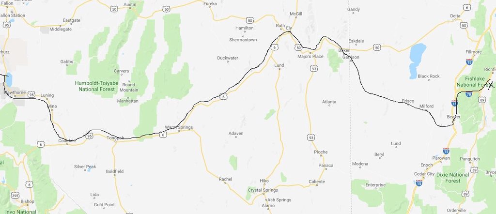
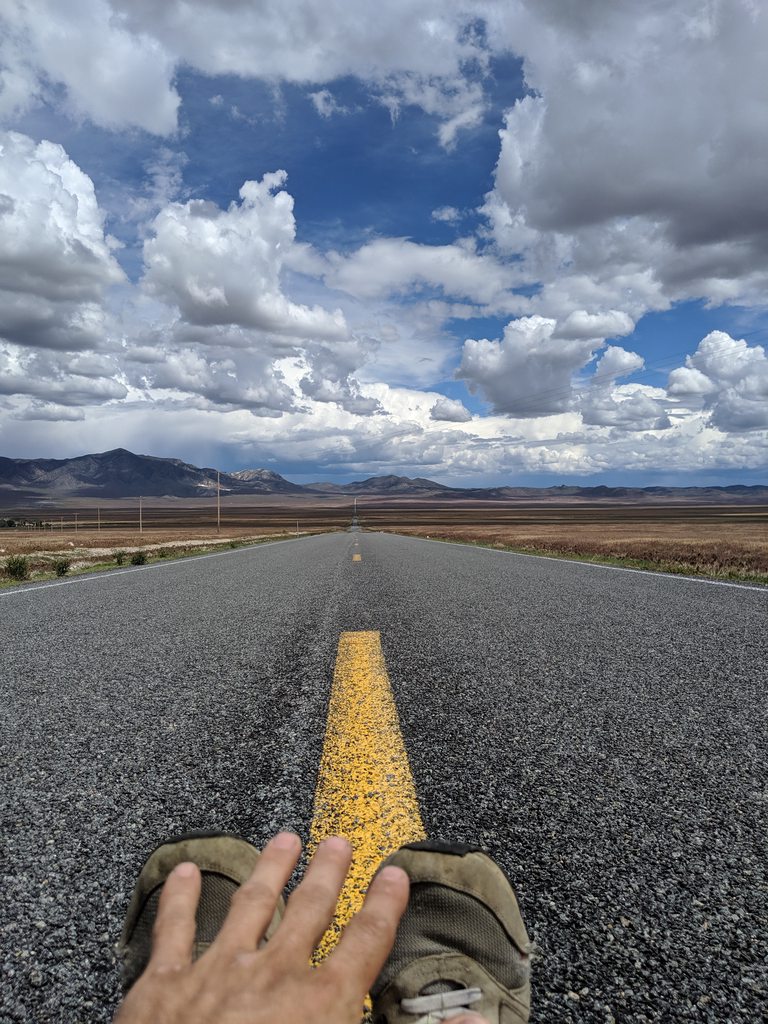
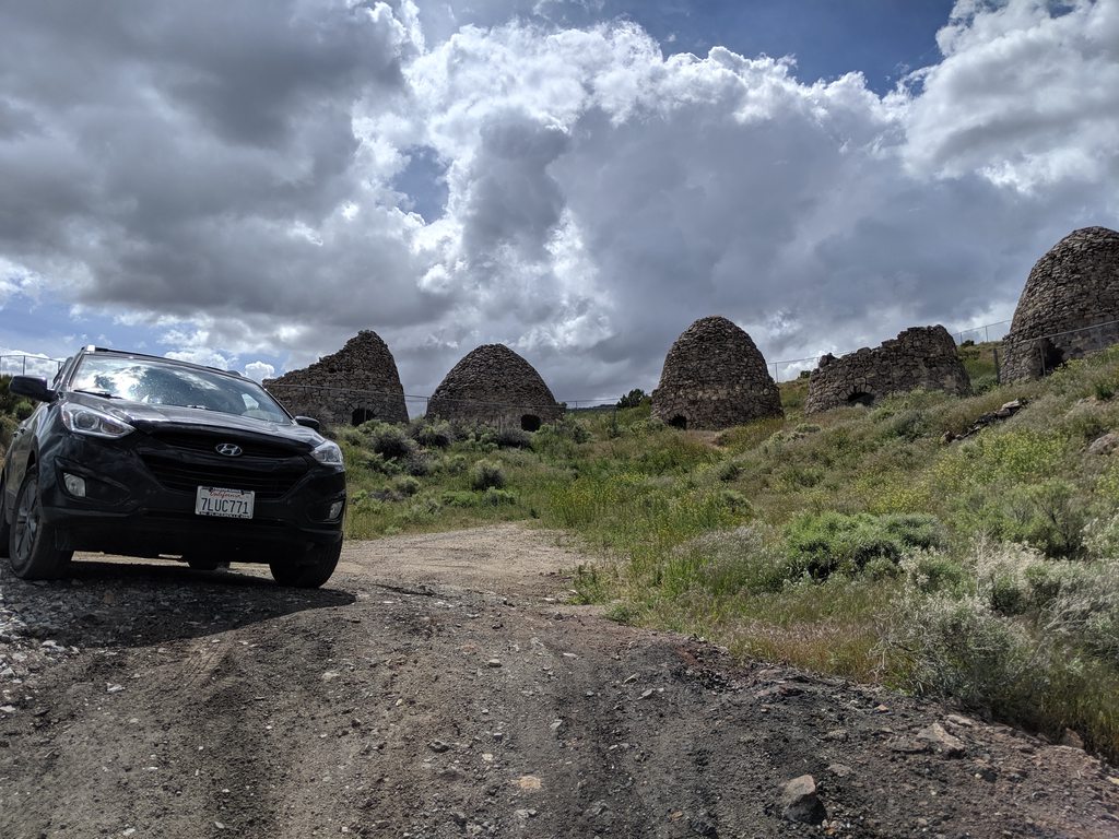
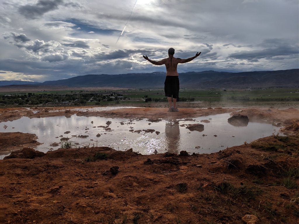
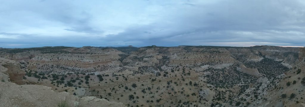
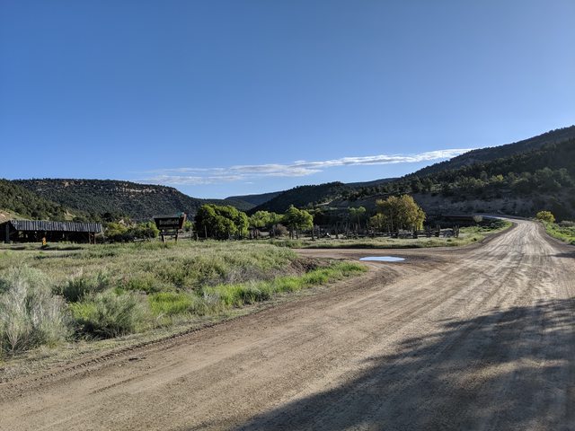
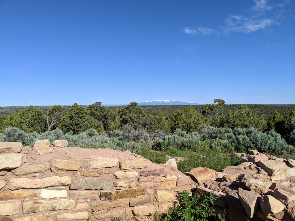
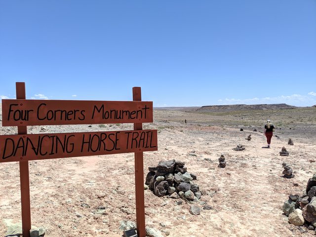
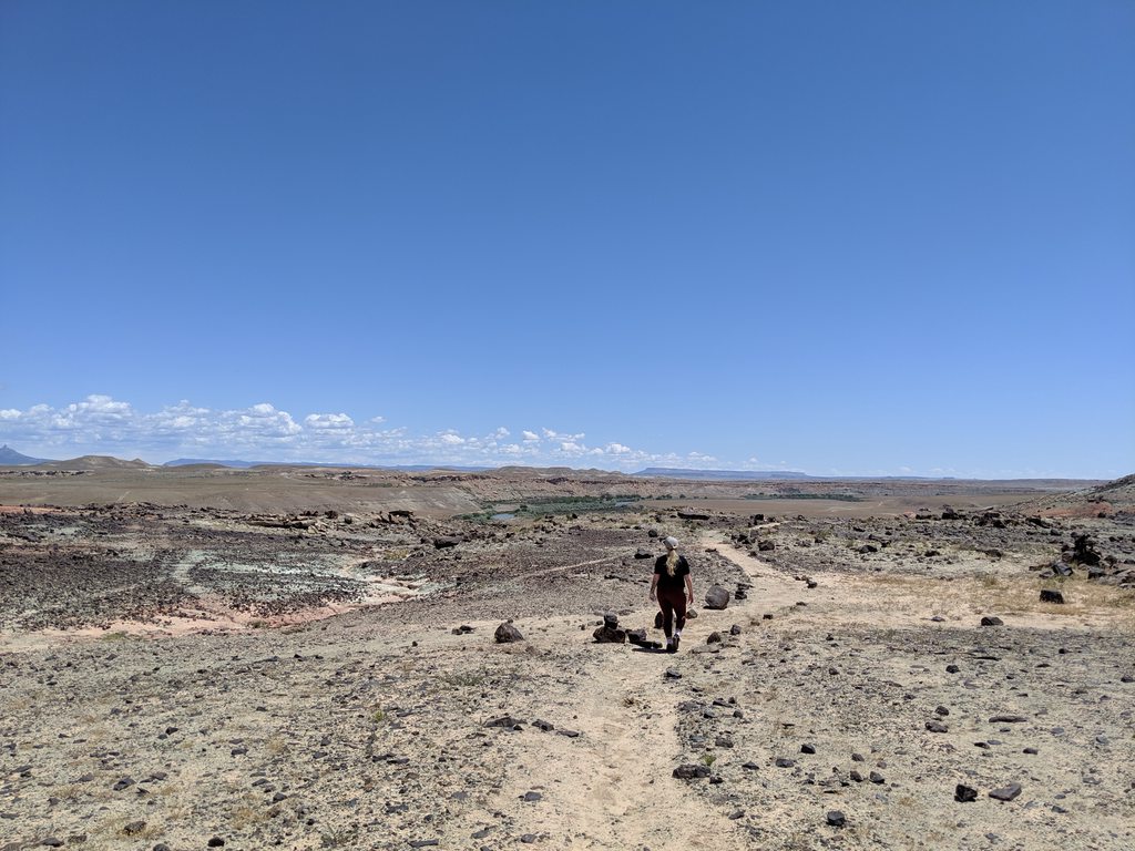
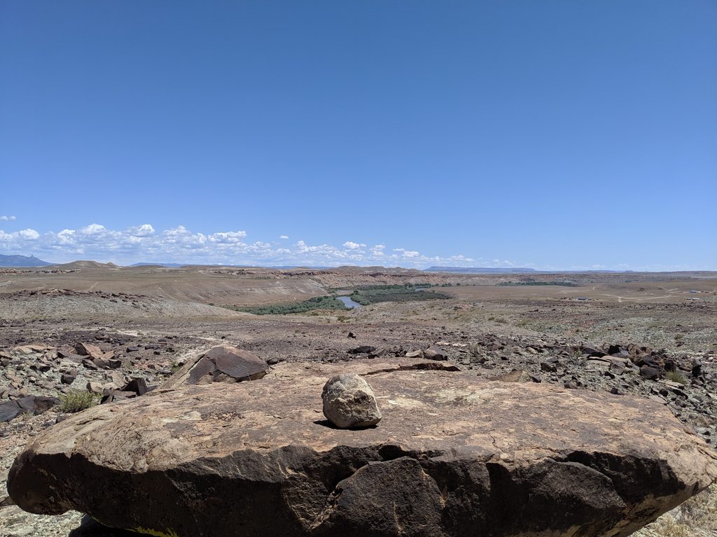
The last leg of our journey is the most familiar to me and therefore the least photographed. With the majority of the piloting duties, thus far, being under my belt I was happy to let my beautiful co-pilot take over so I could get some rest. The views from Teec Nos Pos (the monument) all the way to Gallup are mostly the same - huge expanses of land in a multitude of muted hues stretching right up to the light blue edge of a clear sky. There are a weathered mesas, table tops, canyons and mountains around and if we were allowed to explore the area, off-road, there would undoubtedly be a treasure of experiences. The landscape dominating Ship Rock (or Winged Rock as a Navajo man at the Four Corners Monument called it) is a 1500ft high remnant of the throat of an ancient Volcano and it dominates the view on this northern portion of todays journey. Before these modern history tribes of Native Americans called this place home, the ancient cultures of the Puebolans (or Anasazi) encompassed all these areas and had a settlement at the base of the rock.This is not one of the Navajo Sacred Mountains, though those can all be visited and climbed (on my short bucket list). VERY few people are given permission to travel overland on Native lands. There are a few trails with places to stay, made for tourists but the predominance of the land is for Natives only, so we didn't look to explore the surround areas. We shot past Ship Rock, drove about 120 miles through the north-west quadrant of New Mexico which the Navajo call home, and slipped into Zuni lands just south of Gallup and interstate 40.


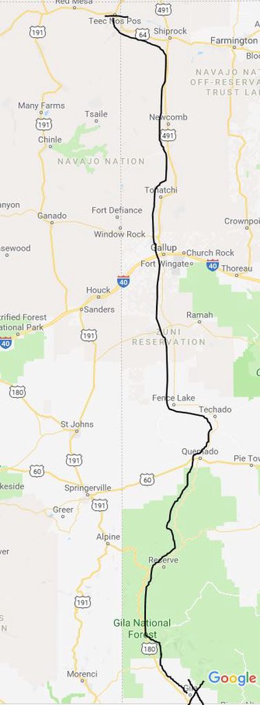
The land down here is much more lush with shrubs and grasses, and turns into a landscape of rolling hills and snaking valleys as the terrain climbs towards the massive amount of designated wilderness that dominates the south-west section of New Mexico. When you travel through the area it is easy to get caught up in these made up boundaries of tribes, please trust me that the roadside signage is not the eons old territorial designations. If one imagines the area on a grand scale and all the different topographies and environments, it's fun to get off on a tangent in the head about how life interacted... a imagined form of ancient people watching.


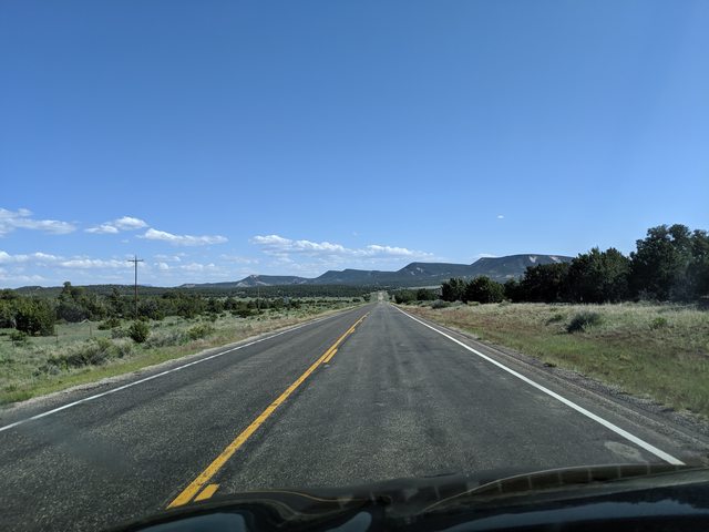
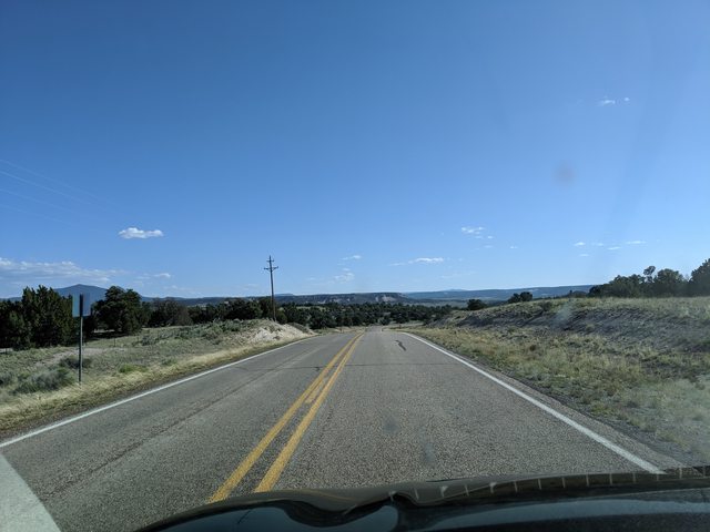
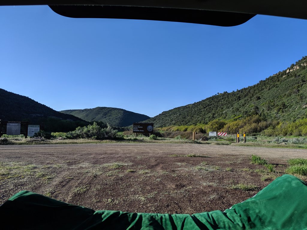
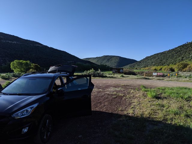
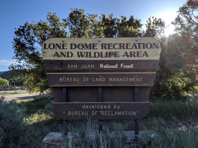
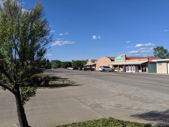
Coming down State rd 36 into Fence Lake is a pleasant drive, on a small back road with very little traffic. As with all small back roads on Reservations and small towns in NM, I would caution against going to far over the speed limit. Revenue for LE departments is limited here and, even though it is subsidized, they will gladly hand you a ticket for violations knowing good and well you won't come contest them. My wifey found this out on the trip home when she was pulled over going 3-4mph over the posted speed limit in the very small town of Glenwood, NM. Fence Lake is famous for being the home of the infamous Aggressive Christianity Missionary Training Corps (ACMTC for short). A copy and paste from Wikipedia seemed to be the best way to inform people:

The Aggressive Christianity Missions Training Corps (abbreviated ACMTC; also known as the Holy Tribal Nation, the Free Love Ministries, or the Life Force Team) is a Christian fundamentalist, Biblicist, theocratic-like cult. The ministry, founded in 1981 by James and Deborah Green (sometimes collectively referred to as the Generals; James is often called General James and sometimes Jim; Deborah is referred to as General Deborah, formerly Lila), still retains its military structure, partially based on the original pattern of the Salvation Army. In 2018, its leaders were sentenced to prolonged prison terms on charges of sexual abuse.[1] Moving from its starting location in Sacramento, California, it has now settled east of the rural town of Fence Lake, in Cibola County, New Mexico, 60 miles (97 km) south of Gallup.[2][3][4]

The organization has been classified as a hate group by the Southern Poverty Law Center.[5]
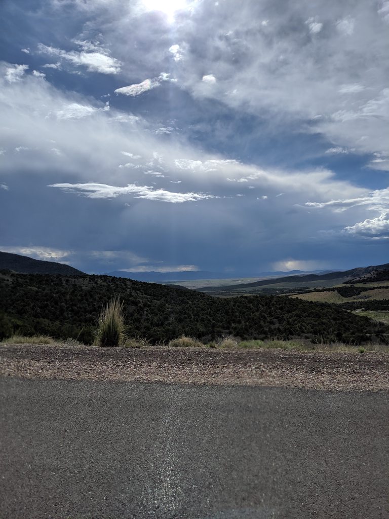
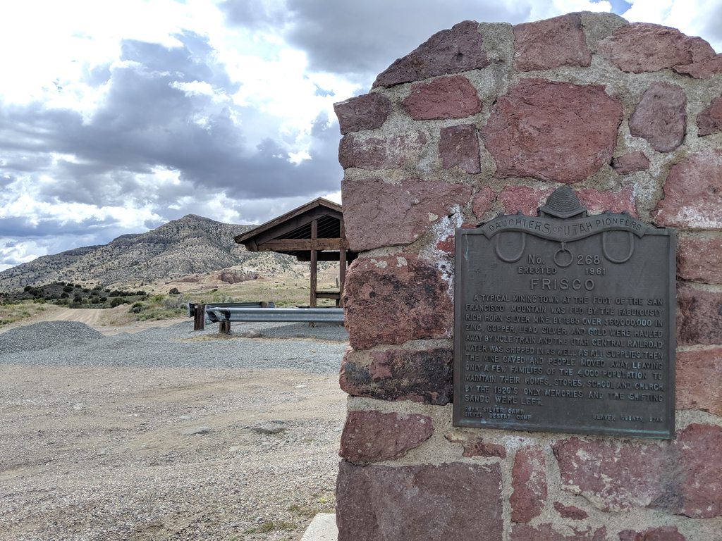
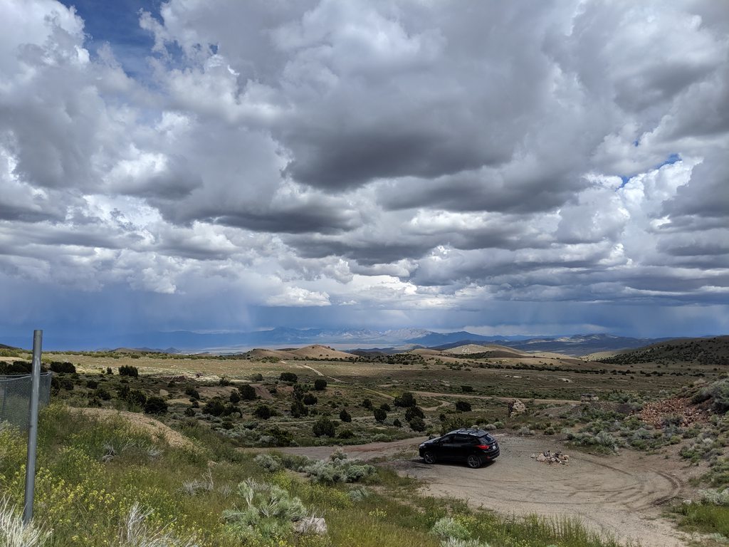
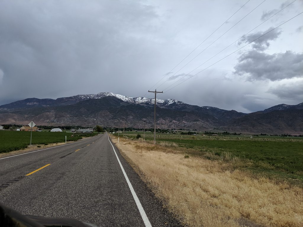
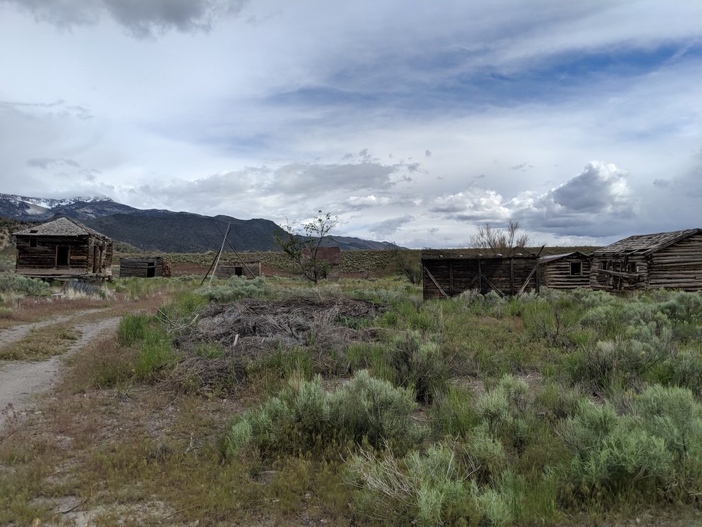
Climbing up the hills on the back side of the Mogollon and Black Range (which are the predominant ranges in the Aldo Leopold and Gila Wilderness areas), the lush green shrubs and grasses of the well watered plains give way to increasing pine, aspen, dogwood and cottonwood trees as well as increased severity of grade on the roads. This portion of the desert south-west was not missed in this seasons wet winter and the area shows it. I grew up in the region and there is a ton of ranching and farming that goes on here so rain is worth its weight in gold. I was happy in my soul to see the lush green forests and, while it needs some good management to prevent fires, the relative health of the forest. The joint wilderness areas and the surrounding National Forests are some of the Nations leaders in fire prevention through proper forest management. Us locals bitch them out a lot and hold them accountable (to unreasonable demands sometimes... *cough*Millennials*cough*) but credit where credit is due. The drive into the small town of Reserve is a beautiful one, with plenty of campgrounds and dirt avenues to explore. New Mexico is as rich as any of the other states with its diverse history and it is amazing the amount of history that all these places share with each other (well, probably not given the factors of old times...). What is now Reserve, NM was once called San Francisco Plaza (or Milligans Plaza) and was more a series of mining camps along the San Francisco River. The names Frisco, San Francisco and Francisco (in its various forms) come up a lot in these western United States. The influence of Mexican and Spanish culture is obvious.


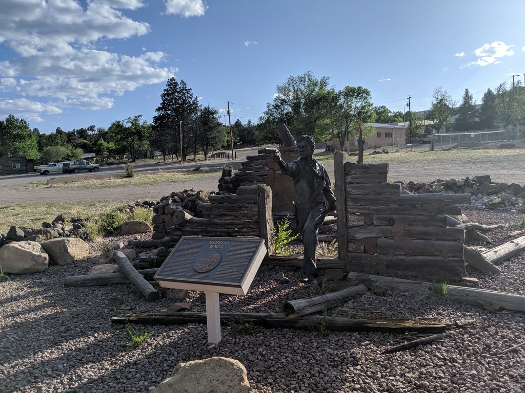
This statue commemorates an event that occurred here during the law-less times of the late 1800's when a 19 year old Elfego Baca came into town and cleaned things up, one way or another. Different stories exist on the matter but the jist is such: The residents of the area complained about the behaviors of local cowboys, most of whom belonged to one particular outfit owned by John Slaughter (another famous name in the area). When Baca came to town, he shot a few of the cowboys for good measure and then holed up in a adobe cabin when the cowboys buddies came looking for Baca. A shoot out ensued, the odds were greatly stacked against Baca, yet he lived on to bring justice to the area and served as a lawman and lawyer for the rest of his life. His story is a good one, no matter what side you take on the matter and it links to lots of great history in the area. A link to get your curiosity stirred is put below. Evidently Disney made a series about it, and fashioned some of the early Hispanic heros (and villians) after him.

Elfego Baca & The "Frisco War".

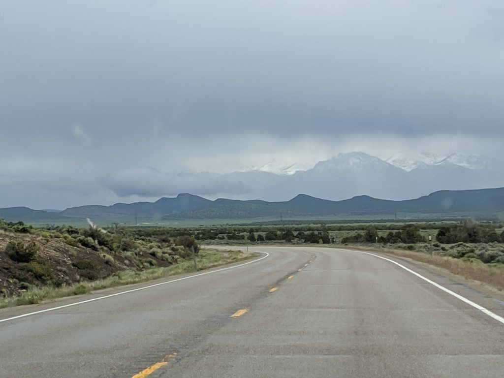
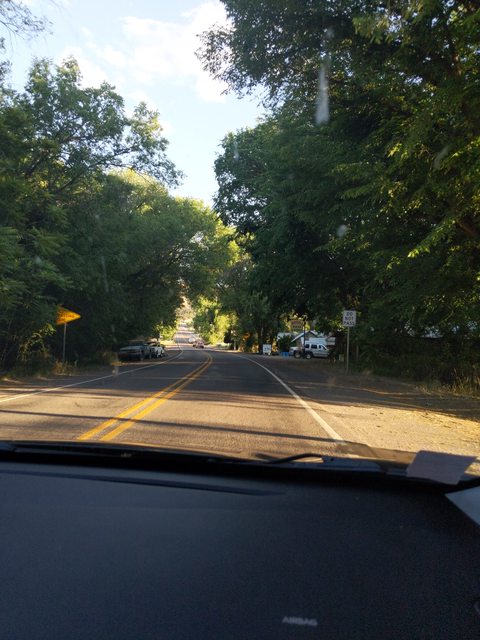
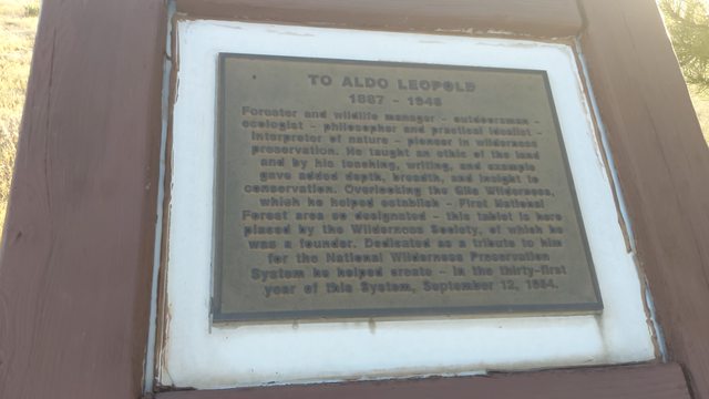
Reserve is tantalizingly close to my homestead in the Gila River valley, where my family has lived for a decade. My mother and my child, the latter having her summer holiday from school, were waiting for us to arrive and I felt the urge to get out of travel mode for a few hours before we would turn around the next morning and pound pavement home. I love this part of the world. I dream of it and when I close my eyes on a hard day I think of it to bring my mind to ease. As you come out of reserve and onto hwy 180 you wind down and through the small town of Glenwood, NM and the Catwalk National Recreation Trail. As part of a tour of the history and majestic beauty of the area, the Catwalk can't be missed. It is less than 3 miles round trip up a slot canyon (we don't call them that round here) where an old mine used to be. The area was built up in the 50's by the CCC (I walked the old Catwalk, I can attest, it was old) and was rebuilt in 2014 after it got washed away during post fire season flash flooding. We did not stop there this time, I was too close to home to stop and be a tourist. We passed through town and made our way up on to the western slope of the Continental Divide. We stopped at the Aldo Leopold Wilderness Lookout Point so I could show the wifey the Nations first designated wilderness.


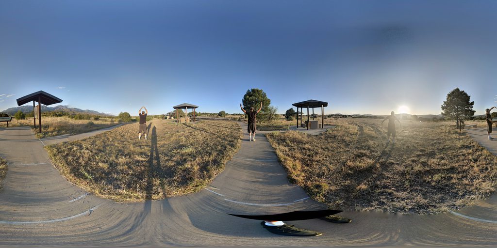
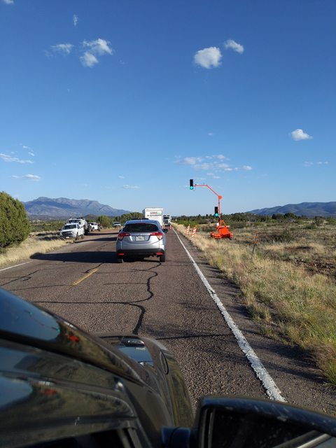
Those Google Globe (or whatever it's called) pictures don't come out great without the screen rotation. We obviously had a little fun with this one and , no, I did not sing the song. After a brief stretch and a few giggles at our childish behaviors, we jumped back on the road. The prevalence of street lights in this area is probably one in 150sq miles, so when we rolled up on this set up marking the start of a construction zone, I was amused enough to take a snap.


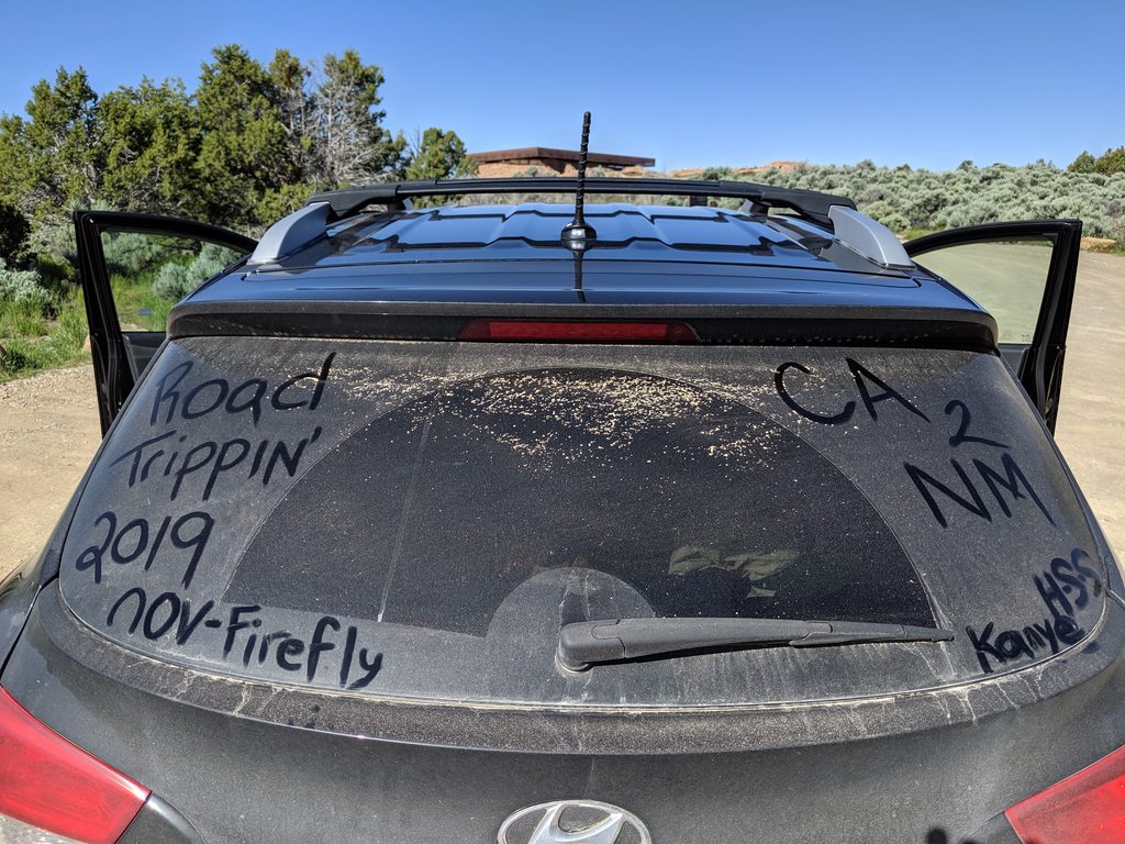
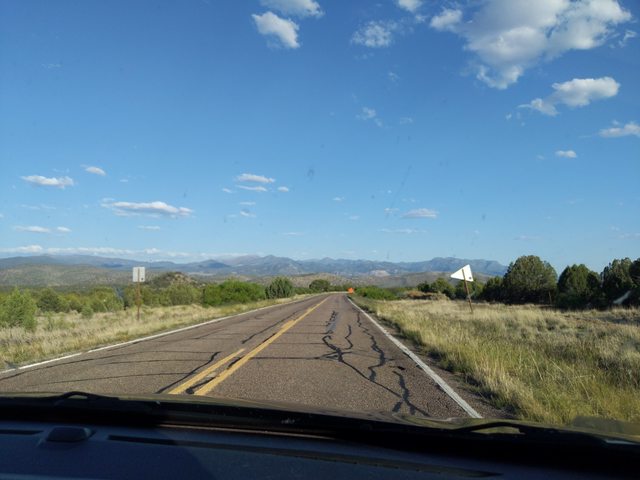
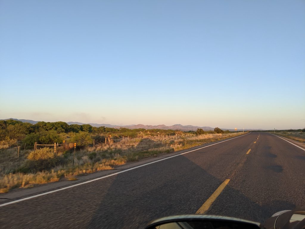
Just a bit further down the road, after the much needed zone of repaving, we set the hyperdrive cruise control on ∩OV FireFly at 65 mph and sauntered down the familiar hwy 180 that serves as the artery of civilization in these parts. Coming into Buckhorn - which is little more than a last chance shop (no gas here, that's in Cliff) where you can get beer, whiskey and the daily paper - I start to see the ribbon of cottonwoods to my left which serves as my indication that we are finally close to home. Some people hate the cottonwoods but I don't. They give us great shade in the summer and they remind me of home. Sure, they soak up a shit ton of water that could otherwise be used to irrigate or water herds. Water is literally worth dying over out here, the debates over it are passionate. Here, you can just make them out on the left hand side of the frame. Me trying to drive and take snaps on a camera phone is both stupid dangerous and a waste of time.


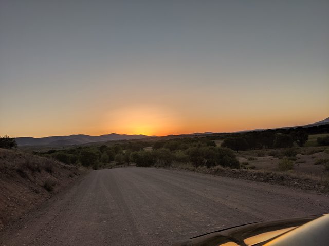
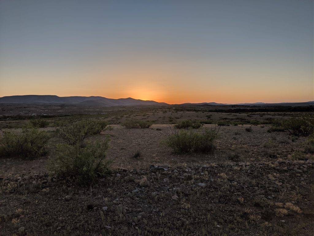
We neared sunset as I turned up the small road that runs on top of the Mesa that we live below. I used to be able to turn directly off of hwy 180 on to a short dirt road that went through a neighbors property, but they have since closed off access and now I go 'the long way'. I don't mind, it's one of my favorite views in all of the world. I have a billion pictures of this and every time I'm home I thank God for allowing me to witness the beauty of the area. I'm always in awe here and I tell my mother that until I get sick of the views we will always own land here. If you ever make it to this part of the world, I've got some dispersed camping on the top of the mesa above our land, it's spectacular for sunsets. This is the kind of place where you can watch the earth wobble over a span of time. The sun will set on the peaks during summer then slide steadily across that flat expanse you see, then back again. That kind of shit makes me feel like a really small and insignificant thing, in a good way. I love it.


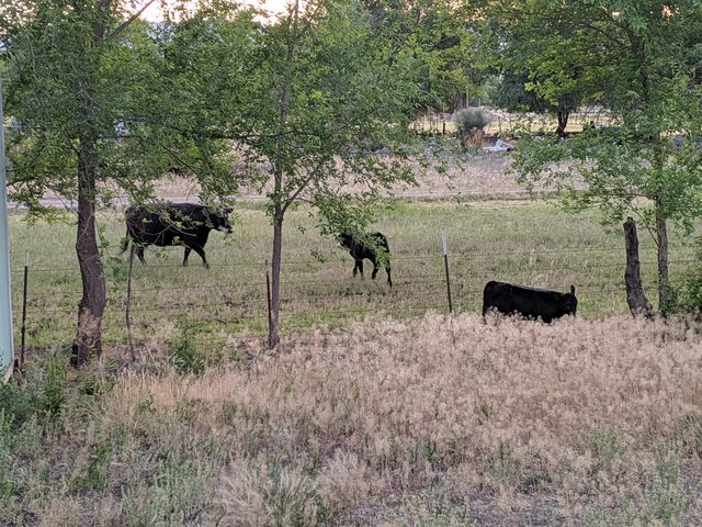
Pulling into the property was glorious. That had been a really long 2 days, it felt like, and I need a shower and a cold beer. I partook of both, chased some new born calf and his sister out of my yard and back into the neighbors feed lot and relished in the wonderfully soothing and happy energy of my family. A scenic and history filled 1100 miles was in the books and in a mere 12 hours, we would turn around and make the less interesting 1100 mile journey home. I'll post some more on that later.

 
Last edited:
  • Like
Reactions: Sparksalot