.
Honestly?
You don't need most of the high tech GPS devices that are out there to stay out of trouble,
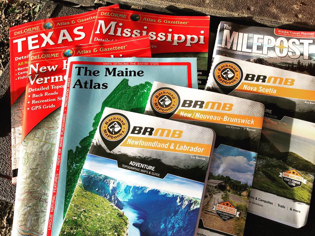
especially if already used to paper maps and your own directional instincts. I've been going on solo adventures all over the place for decades; way the hell back-country and off-pavement for weeks and months at a time and use my atlases, expanded Nat Geo maps, Delorme Atlas & Gazetteers, local topo maps, and hand out maps from parks and forest services.
Since you already know how to use paper maps and have a good directional sense, and if you possess even rudimentary skills with a compass, the rest can be just so much fluff. Nice to have, fun to use, and looks cool in your rig, to be sure, but not absolutely necessary.
I'm convinced that's why a lot of folks--certainly not all--get into larger GPS screens, complicated looking comms, and intricate mounting systems for it all; they want their dash to look more like a cockpit, and also see that everyone else is doing it, so think they need to, too. I did too, for a long time, then realized I was never using most of it.
For long distance and highway routing, I still use my old Garmin NUVI 760 dash mount GPS from fourteen years ago. Still works perfectly and has all my fav waypoints around No America. Surprisingly, if you keep these units updated, they have an astonishing amount of detail in regards to dirt and gravel roads.
For years I've tested myself while out adventuring. I'll start in the morning and check a Rand McNally or Delorme Atlas to set a basic end point; somewhere I want to end up that evening, and see which degree from north, or west, etc it is. Then I'll head out driving, using only the sky, sun, cloud movements and distant landmarks to keep me headed in the general direction.
All this said, however, because I am alone on almost all of my back country adventures, I do have a
Garmin Inreach for emergency satellite communication. I've had it for four years, and though I have never used it once, it's there should I get in a real bind without my van, eBike, or canoe to help me get out, or if I'm badly hurt and can't drive.
Here are two other posts about maps and such, both of which are part of much longer threads:
Which Paper Maps Are Best? -
Delorme, Backroad Map Books, etc
Orienteering By Hand:
Compass and Book info
and my own blog post about maps:
Easy to tell what I’m researching and thinking about as far as destinations when you see which map books I have out. The DeLorme Atlas & Gazetteer map books pretty much set the standard when they started publishing the Maine Atlas & Gazetteer In 1976. It was their first product, and I’m tickled...

roaddude.com
Good luck out here, and don't hesitate to go adventuring just because you don't have hi-tech gear.
.